Category Archives: Pacific Northwest

Yellow Aster Butte
My preparation for the 2021 Devils Dome Trek included a day hike up Yellow Aster Butte on 8/29/21 which provided good distance, elevation and beauty. I chose this hike because I never really got to experience the upper portion of the trail back in 2016 due to weather that was not cooperating.


My 2016 hike was later in Autumn and I had gotten a late start that day so I decided not to climb to the upper view with the weather uncertainty. Brook was with me in 2016 and the Autumn colors on that hike were indicative of the trail’s name.


I wanted to get the full Yellow Aster experience and I also needed the workout of 7+ miles and 2500′ vertical climb. A beautiful Day made for a great hike. It was a Sunday so I knew that I would be competing with other hikers for parking and trail space. Many hikers were coming down after spending the night. The trail starts out with many switchbacks giving you awesome views of Mt Baker.


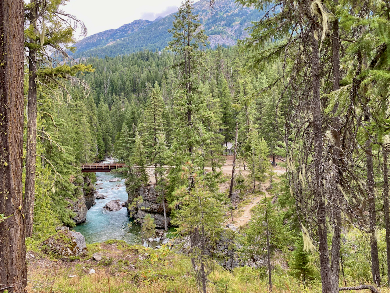
You can count on water from a mini glacier just before the final steep climbs.

The final climb, which is not really up to the Butte but to the peak just to the southeast of it is steep so your heart will be pumping. However, the reward of the 360 degree views are totally worth it.


I was fortunate that the wind was not an issue which made for an enjoyable lunch break at the top. These are the times when you really appreciate access to the mountains here in the North Cascades, I was totally ready for the Devils Dome Trek. The hike back down was predictable with anticipatory thoughts of Beer and Pizza from the North Fork Brewery in Deming on the road back to Bellingham.


Devils Dome Loop – Clockwise
I love multi-day backpacking loop treks and the Devils Dome Loop in the North Cascades turned out to be a jewel. I was a bit surprised to come across it only finding a few trip reports. The distance and vertical are very similar to the Timberline Trail but the the effort was far greater.


Most people approach the loop counterclockwise since the initial 4000′ climb is more moderate thanks to switchbacks. But I opted for the clockwise route to coordinate better with the North Cascades National Park permitting for the first night. My common backpacking partner, Bryce, was going to be challenged with getting there at a reasonable time on September 1st, so I opted for a campsite halfway along the East Bank Trail at Roland Creek. We did not hit the trail until 7 PM, so night hiking was required. One issue worth mentioning, especially when searching for your campsite in the dark, was that the campsite shows up on the typical topo maps as being south of the creek when, in fact, it is north of the creek. But it did turn out to be a good site for setting up in the dark.


We hiked about 6 miles to Devils Creek Landing on Ross Lake, where we had lunch and a rest before the big climb. The climb to Devils Dome, or at a minimum Bear Skull Cabin, was going to be the make or break for my body, which is why I had been putting in extra vertical training in recent weeks. Water is an issue, and the most dependable source supposedly would be found at Bear Skull Cabin, 4000′ up. We were told that there was a stream at about 3000′, so we only carried 2 quarts, which was adequate for our perfect cool weather climb.


However, 4000′ mostly straight up does kick your butt. Bryce and I slogged along and finally reached the cabin after a 6-hour climb. I believe I got all that I could from my body on this climb, so my training turned out to be totally justified. Now I understood why this loop is not more heavily traveled. The climb from the other direction is probably easier due to water and switchbacks, but 4000′ is a tough climb, especially for an old backpacker. We did have a nice campsite just off trail toward the cabin. The night was totally clear, with magnificent stars that I was too tired to enjoy.


The next day required another 1000′ climb up to Devils Dome which lived up to the hype for a fabulous 360 view of the North Cascades looking into Canada. The day was clear with some cloud cover moving in later, temperature at about 60 and no wind. This was as good as it could get.
Up till now we were also sharing the trail with the Pacific Northwest Trail, PNT, but that would end as we approached Devils Pass. Supposedly there is water on this 6 mile stretch but I don’t remember seeing any.


We were carrying enough water to make it to Granite Creek, which turned out to be our choice for a campsite after about an eight mile day. The trail over to Granite Creek was one of the most pleasant and beautiful stretches of hiking that I have ever experienced.


However, more campsite information would have been helpful. On the north side, there is a campsite about a quarter mile up a steep trail from the stream. We opted to go to the creek, assuming there would be campsites. Well, we only found one campsite barely large enough for two tents, which was just south of the creek as you enter the trees. This worked out fine since there were hardly any other backpackers on this loop. And we did keep commenting on this lack of traffic, especially on the long Labor Day Weekend. I guess the high vertical entry price to this loop keeps the crowds away.


Leaving Granite Creek hits you with a couple of tough 700+ ft climbs, the second being switchbacks up a fairly steep scree field.


These climbs were tough with legs that were worn out from the previous climb but were encouraged by fantastic views of Crater and Jack Mountain over beautiful valleys. The last climb was a bit precarious as you had to climb up a scree field with a few long switchbacks but also with a few really steep slippery sections. I think that I would rather be climbing here rather then descending.


We were again putting in about an 8 mile day planning to camp just before the final descent down to the Devils Park Trail which would take us back to our East Bank Trailhead parking lot.


We were again surprised that campsites were not more plentiful except for 2 to 3 miles up from the start of the descent. There was only one good campsite before the descent and it was fairly large but taken. Luckily the people there had scouted the area and found a hidden campsite a short distance behind theirs which turned out to be perfect for Bryce and I. The last day required us to descend down to Canyon Creek which was rather easy considering the number of switchbacks. This video captures my gratitude.
The long descent to the canyon floor.


At the crossing area over to the the Trailhead there is no longer a bridge, however, the stream ford is not to difficult. Plus there is a landslide just west of this crossing which forces you to ford the stream just to get around the landslide and back to the Devils Park Trail. Now you get to finish up the trek with a gentle 3+ mile hike along the stream.


Bryce and I agreed that the Devils Dome Loop is a special one, however, we would classify it as more technical or difficult. Our bodies were totally spent but it “Hurt So Good”. My advice, I originally planned to camp at Devils Creek on the 1st or second night to set up better for the long climb up to Devils Dome. One bummer for the trek was finding that thieves had stolen Bryce’s Catalytic Converter off his Toyota 4Runner.


Timberline Trail 2021

Yes, the Timberline Trail is the finest loop trail in America, and my fifth year in a row trekking around it was another epic adventure. The bottom line, though, is that this trail is tough, and my old body struggles to pull it off. Typically, after the tough second day, I really question why I do this. But the rewards are incredible, especially when the weather is so beautiful.
Rather different to start a summer backpacking trek by making your way through a crowd of skiers, but that is Mt. Hood. Starting out on July 11th in beautiful weather with no chance of rain for the entire trek. Joining me is Shannon “Snuffy” Leader, blogger of Must Hike Must Eat. I was to be joined that night by Bryce and Chris at Paradise Park. The hike up to Paradise Park is a good half-day warm-up, which is a bit out of the way but totally worth it. The trail is so easy over to the Zigzag Canyon overlook, but then it is down and up.

Down to the ZigZag and then the climb up to Paradise Park. It was a warm day and the black flies were out so we did pay our dues to get an excellent campsite at Paradise Park.

Some of the best flowers were displayed on the climb.


Hiking with “Snuffy” was a real treat to compare backpacking prowess and stories, but I had no interest in her culinary concoctions. That is what Shannon does; she validates really interesting wilderness trail meals, whereas I just try to consume my evening Mountain House meal. This colorful meal that she made was supposedly excellent.


Bryce and Chris joined us later in the evening in Paradise enjoying a great cloudless sunset together.

The second day after staying at Paradise Park requires a plunge into the Sandy River Canyon with the always exciting crossing of the Sandy. This year the challenge was medium, but mistakes could not be made.
The reward for crossing the Sandy is your visit to Ramona Falls. We got there a bit earlier then typical years so the sun was only at the top. But Ramona Falls is the best.
Just after Ramona Falls you have the option to take the high or the low trail to Bald Mountain. The high route has been devastated by a tree blowdown and is essentially closed but unfortunately Bryce and Chris forgot about that when they left us to accomplish their trek in 3 nights instead of 4. They completed the high route but paid a heavy price for their effort. There should have been a sign at the turnoff to the high trail, however, I believe that sign did not get placed until after we passed by.


This stretch of the Timberline is the toughest for me because of the 3000′ climb with no good water options. Every year this stretch tests my resolve and I contemplate why I do the Timberline. This year was as difficult as ever but as with every year I eventually make it to the great view at the top and the streams coming off McNeil Point. Our campsite in that area turned out to be excellent.


The next day’s goal is typically to cross the Eliot Canyon which this year we knew would be the greatest test. But this stretch of trail offers some of the most beautiful views of Mt Hood and surroundings. The burnt areas from the Dollar Lake Fire 10 years ago now seem to offer a unique contrast to the lush green slopes. The Cairn Basin shelter did take a hit from a blowdown tree.


The Eliot stream crossing has been a breeze in recent years thanks to a large log that spanned the water but that log has washed away along with a lot of the canyon wall to create a new treacherous crossing. However, the greatest danger in the Eliot Canyon is just getting down to the stream. The steep approaches to the stream present numerous loose boulder situations, but we experienced that last year.

This year we also got to experience one of the most forceful river crossing I have ever accomplished. The video is of a hiker from Michigan.
This year the option to just stay at Tilly Jane Campground seemed like a good idea since nobody else was there probably due to the mess that has been made by more tree blowdowns.


On this Northeast side of Hood you get to experience above treeline hiking which has become a favorite of mine.


The goal for the last night is typically to reach Newton Creek which has clear streams and good campsites. This year the Newton Creek crossing was a bit more challenging than usual. I do love the view of Gnarl Ridge from the Newton.

The final day offers many beautiful waterfalls before you enter the Mt Hood Meadows Ski Resort land.
Then down to the White River and the killer climb up to Timberline Lodge. The climb isn’t really that bad except that you are fairly exposed and pretty much spent from the previous 40 miles.


Thank goodness for visions of your post trek meal to carry you up the ridge of the White River Canyon. Once you see the lodge you know you can make it.


This year’s Timberline Trail again taught me a lot about my 67 year old body. Many times it “Hurt So Good”. I do believe I will return to the Timberline Trail next year, but maybe do it in 5 nights.

Trappist Abbey
I have been hiking the Trappist Abbey Trails for many years and again this week it is providing the necessary vertical workouts I need to get ready for my annual trek around Mt Hood.

The Abbey is about a 10 minute drive from home and it offers 900′ vertical over its various trails. The new sign (left) provides a much needed map with all of the Abbey rules. There were times when you could get lost on the property since trails were poorly maintained or marked. However, in the last year they have greatly improved the trails and signage. And this used to be my go to hike with Brook, but “No Dogs Allowed” now. Eliminating dogs is OK since the more prevalent use of vineyard cannons to keep the birds away also caused great anxiety for Brook. Now the focus is primarily for the exercise, but this is beautiful country that does refresh your soul.
Brook did love to hike Trappist Abbey in her youth.

At the Shrine 
Brook with Friend Phoenix 
Viewe from Shrine 
Beautiful Trails
Overall the changes implemented by the Abbey for trail management appears to be working. Plenty of hikers are enjoying the seclusion that for many years was only enjoyed by their monks. The main trail takes you up to the top of the ridge where you have a side trail over to a view of Mt Hood on a clear day. On the way up you have three offshoot trails that shorten the overall trek and let you manage how much vertical you want.

Plenty of deer 
Love the Trees 
Very lush vegetation 
And PNW Ferns
There are a number of great views of the valley along the trails.

Half Way Up or Down 
View at the lowest Point on the Trail
The Abbey provides nice parking at the trailhead which skirts their facilities. Not uncommon to have wildlife greet you at your car.

I hope you enjoyed this short post. I have been meaning to write about the Trappist Abbey Trails for many years. Our Lady of Guadalupe Trappist Abbey is a Trappist monastery located in Yamhill County, Oregon in the United States, north of Lafayette and about 30 miles southwest of Portland.

Early Season TDH Get-Away
I was itching for a backpacking Get-Away so when the temperatures started to rise with guaranteed clear skies I headed for my favorite overnight at Tom, Dick & Harry Mountain.

I have done this trek many times but never in April when there would definitely be snow, but I did underestimate how much snow there would be. Early on the trail the bridges filled to the rail with snow set the tone. The trail for the first two miles was essentially ice which created many difficulties especially for the hikers trying to get to Mirror Lake.

The upper trail to the top presented more serious challenges such as not sliding down hillsides and just finding the real trail. Once on the last leg to the top I realized I should have brought my snowshoes, but it was doable even though I was questioning my wisdom in scheduling this trek. I knew what the reward would be at the top but I was also starting to be concerned about how strong the winds were going to be.

The winds were strong and the snow was deep so this was going to be a whole new camping experience at my favorite spot. The winds were ripping up the mountain so I was able to set up camp with a nice view of Hood and still get shelter from the wind.


I quickly realized that I had not properly prepared for the snow or the wind so I had to improvise with some rope tie offs to nearby trees. Thankfully those rope ties did the job as the wind never let up throughout the night. It was amazingly beautiful as I have come to expect, however, the wind prevented any comfortable viewing of Mt Hood.

The saving grace for the evening was that the winds were also bringing in unusually warm air so being cold was not a concern. However, major wind gusts pummeling my tent all night did not allow for much sleep. Plus my air mattress was not holding air so I had to blow it up about every hour. It was still beautiful at sun up, but the winds were increasing in intensity.

By 7:00 am I had to break down the campsite to avoid being blown away. The winds were fierce so I had to take an alternate path behind the view area to get to the shelter of the forest.

The hike down was not easy but it was downhill so no complaints. Overall the the ultimate Get-Away that I had hoped for did not pan out, but it sure was another great Adventure.

Home Adventure Spa
I have not been in the wilderness since the Stevens Pass to Stehekin trek in August, so this post is mostly about how I followed through on my decision to get a Hot Tub. However, many other factors such as Covid, Massive fires and injuries contributed to why I remained relatively homebound for the rest of the season.

Upon return from the North Cascades I utilized our rotational week in Neskowin to allow my body to recover and to begin my investigation into the procurement of the perfect Hot Tub. I have always appreciated the hot tub experience but I have never really wanted to get my own. But now was the time, justified for therapeutic reasons was a good enough excuse. I started out with basic internet searches to get a feel for product and price. I knew that I wanted a relatively small tub since I did not see many hot tub parties in our future. Just give me a quality 2 or 3 seats with more jets then I would ever need. OK, I knew what I wanted but my inquiries were turning up an unexpected problem, availability. It appeared that our country has invested heavily in home upgrades to survive the pandemic. The Hot Tub business was booming with delivery options 6 to 12 months out. This was discouraging but also motivating, so I started talking with some of the larger Spa dealers around and settled on the purchase of a Dimension One Triad 36 from Spas of Oregon with an ETA about 3 months out. At least I was on the list and now I could focus on site prep.
I had a lot of fun designing where this tub would be located and how I would extend our deck out around it. I needed to put in a cement slab which is a fairly straightforward project guaranteeing some good exercise. The slab required me to dig up the sod in the rectangle area planned for the tub. This meant flat spade shovel work. What I discovered was how difficult it had become for my old body to jump up on this shovel for each initial dig.


This is where the injuries began, first to my left knee from digging then to my right elbow from lifting 60 lb bags of gravel and cement. These injuries were a real pain but they kind of added to the adventure. Next I had to fill this slab frame with cement. This is also when I got the call that my hot tub had come in 2 months early so the slab needed to be prepared ASAP. This is where having a strong son-in-law who was actually intrigued by the prospect of doing a project like this and owned a truck saved my butt. We decided to rent a 2 cu ft mixer to process 34 (60 lb) bags of Sakrete. It was a beautiful day which made for a wonderful family project.


My grandson had a great time watching and having our hand prints in the cement will be lifelong reminder for both of us.

Delivery was scheduled, however, various conflicts ended up having our hot tub installed on a Sunday evening as the sun was going down.

I had coordinated the installation of electricity a few weeks earlier and was very pleased when they were able to fit us in. I was not surprised to hear that hot tub electricity installations were dominating their schedule.

Oh boy, I filled the tub, followed the first time chemical treatment plans and thoroughly enjoyed this new hot tub. The D1 Triad 36 is basically a 2 person tub with a pump per side providing more jet strength then you would ever need. On the lounge side you are basically floating on jets. I believe that I can directly impact every muscle that I would ever want therapy for.

Now comes the fun part, building the deck and installing some low voltage lighting. I had spent many hours envisioning how this tub would be placed and accessed, many of those hours while hiking in the North Cascades. The plans were fine tuned and the building began. Unfortunately the cost of lumber is at an alltime high due to Covid work issues in the logging industry. I went with pressure treated lumber and was lucky to be able to buy what I needed at Lowes.

I will be adding other items to the installation such as a privacy screen and cabinet for towels. But for now the hot tub is in full use overlooking the farm under the open sky.

The overall cost of the project, Tub, Deck, Electricity & lighting will end up costing about $11,000.
This 4 month hiatus from the trail has been a different kind of adventure. Covid restrictions for my grandson’s daycare created the opportunity to watch my grandson two days a week, a priceless experience which has laid a relationship foundation for a lifetime. I was also able to lower my golf handicap from 20 to 16. But I am anxious to get back to the wilderness so I have blocked off low tide windows of opportunity for the winter months for the Lost Coast Trail. I just need a good weather window to match up and I’m on the Trail.

Stevens Pass to Stehekin
 I had completed my warm up treks and was ready for a new Adventure. I had not done Stevens Pass north on the PCT, but I had done Suiattle River access to Rainy Pass, so that first portion of the PCT Section K was at the top of my list. It is a long stretch of 107 miles and lots of vertical, oh well, no problem other then carrying enough food.
  I planned for 10ish days knowing that I don’t have an appetite on the trail which would allow me to stretch my provisions if needed. Weather was going to be excellent except that it was warmer than usual. My travel logistics were easy starting with spending a night in Chelan Lake State Park, leaving my car at Lady of the Lake long term parking, catching the free metro link bus to Wenatchee and then taking a Trailways bus to Stevens Pass. I was on the PCT going north by 3:00 pm on July 27th. However, this trek seemed more daunting then usual. I had not been solo for a number of treks and the distance was 30% longer then I had even taken on. My mind was telling me how nice it would be to be sitting on my deck drinking a beer and my legs were already telling me they were tired. This is always the challenge, to force yourself to just do it and after a few days you know it was the right call, because getting out there is what it is all about. Unfortunately key comfort factors were not in my favor. Temperatures were flirting with 80 degrees and the bugs must have just hatched. The positive was that water was not an issue and the wild flowers were good. So I was “On the Trail Again”.

First Night’s Campsite

Lake Valhalla
My goal for the first night was Lake Valhalla which push me a bit. I chose a campsite in a meadow where I discovered just how aggressive the mosquitoes and flies were going to be. But I was generally so tired at my campsites that I was content with escaping the bugs and getting to sleep. My goal for the second day would be Grizzly Peak thinking that the bugs would be better up high. This was only about 9 miles and not that much vertical, but it was hot.


My campsite plans for Grizzly Pass were fine except that the bugs were worse up high, so I did not hang out side much to enjoy the view.
The third day took me past Pear Lake which appears to be very popular due to alternative trail access options. I decided not to climb to Lake Sally Ann and opted for a night at Pass Creek which turned out to be much better with respect to the bugs. The goal for the next day was Indian Pass.


I was told about a great campsite by taking a trail from the Indian Pass sign. Yep, it was primo complete with a toilet, campsites in a thicket of trees next to a large meadow. However, the bugs were the worst yet. That night was kinda weird because a herd of deer bedded down around my tent. The next day would be about Red Pass.


Campsite plans were to deal with the ford of White Chuck Creek and camp on the north side. This ford complete with a buckled bridge and getting your feet wet was rather refreshing with a nice campsite reward.
The next climb would be Fire Creek Pass but I was wearing down so I opted to camp somewhere around Fire Creek. This section was a low milage day for enjoyment, bugs were not bad and the views were awesome. My body was wearing down since I had burned all of my easy fat and I needed to start eating more.


Fire Creek Pass was another beautiful event with plenty of snow, probably the most difficult of the trek.


On the way down I got the word that Milk Creek was an overgrown mess and that I could get water on either side. So my plan was to cross Milk Creek get water and find a campsite somewhere up the other side. The problem though was that for a mile before Milk Creek the overgrowth was so bad it was essentially bushwacking and the same was true on the north side. It was getting late in the afternoon, it was hot and the bugs were horrible as I tried to fight my way up from Milk Creek.


I was really getting tired so I was beginning to consider camping on the trail if I had to. It did not look good for finding flat ground for a campsite, but then I see a sign that says “Toilet”. Thank you God, I really needed to stop, there was no toilet but there were a couple of campsites. Now I needed to recover for the climb over Grassy Point the next day.


This was a tough day, the body was dead but I think the gorgeous scenery carried me over Grassy Point knowing that it was then down to the Suiattle River with one more huge climb to go.  It was around this part of the trek where I decided that I needed to finally put in a Hot Tub at our house. Thoughts of how I would install this tub provided a needed distraction for many days. I opted to camp next to Vista Creek and take on the Suiattle River crossing and climb the next day. Turned out to be a great campsite where I had my first fire.
At the major bridge over the Suiattle River I took a long break to recharge my body and iPhone. I had about a 3500′ climb ahead of me so I just wanted to knock off as many miles as I could before camping.
I ended up at the Skyline camping area where there was a large Forest Service work crew just setting up.

Suiattle Pass
Now the climb up and at least a little over Suiattle Pass. I was dragging but I made it to a nice campsite just over the pass complete with the most bugs of the trip.
It was Thursday August 6th and I had about 18 miles to go but it was mostly all downhill. I wanted to get close enough to High Bridge that I could catch the shuttle at noon on Friday. The hike down did have some more small climbs and the weather was changing to a light rain, plus I was running into more overgrown trail so I felt that camping at Swamp Creek 8 miles out from High Bridge would be fine. Plus I was soaked from the waist down due to the moisture off the overgrowth.


Almost to High Bridge
It was a nice last night on the trail even though it did rain off and on all night. But it was dry when I packed up for my final 8 “easy” miles to go. Not so easy as in some more up and downs with plenty of overgrown trail. The sight of High Bridge was so welcomed.
High Bridge
The normal Stehekin shuttle is not running this year, however, the Stehekin Valley Ranch is providing the service which gives you a hour layover at lunchtime to at the Ranch, just right for fueling up on a burger. I then stopped at the Stehekin Pastry Company where I had the best piece of Cherry Pie I think I have ever had.

I then set up camp in the National Park Lakeview Campground and proceeded to down a few brews from the store before it closed at 4:00 pm. The next morning I went back to the Bakery for breakfast and had a nice 2 mile walk back to get ready for my ferry ride back to Chelan.


Goodbye Stehekin
Overall a great trip, but it was also the most difficult trek I have ever completed and now 4 days later I am just starting to feel recovered.

Timberline Trail 2020
 I still believe that the 41 mile Timberline Trail around Mt Hood is the finest backpacking loop in America. It just has it all with adventure galore which is why it was the theme of a Podcast I did. This was my 4th year to take on the Timberline, which I use as my age/health meter, and I am pleased with how my old body held up this year. Bryce again joined me for this year’s trek, we failed on our attempt last year in mid June due to snow and weather.

Zig Zag Canyon
This year there was about as much snow but the trail was more navigable. Last year the beautiful portion was the first 2 days which served as a good memory for the wet weather that dominated the first 2 days this year.
Each year I think about going counter clockwise around Hood but each year my analysis of conditions steers me clockwise. Paradise Park is a great first night goal to warm up your hiking legs and prepare you for the grueling descent down to Ramona Falls and then back up the ridgeline to mid-mountain. This year’s trek started out with beautiful weather for the view from Paradise Park.


I had already decided that I wanted to checkout the most western campsite at Paradise Park located next to some tree cover. This turned out to be a fortuitous decision since a heavy wet fog moved in just as we had finished setting up camp.  The trees gave us some relief from the wet fog but by morning it didn’t really matter, everything was damp and we were set for hiking in a mist.


On the trail you quickly adapt to being cold and wet which actually serves as a great motivator for knocking off miles. The emerging Rhododendrons on the lower trail help as well.


Your first concern is making it across the Sandy river, this year we got advice to go up stream where there were a couple of small logs providing a dry crossing. By now it was essentially raining so passing through an empty Ramona Falls was not as inspiring, but Ramona Falls is still one of the most beautiful places on earth.

Now begins the most challenging part of the trek, climbing about 2400′ over 8 miles taking the upper route but cutting over before Bald Mountain.
I had hoped to go all the way to McNeil Point but the rain and low cloud cover nixed that option. We opted to camp at Glisan Creek because we saw a couple of spots that were relatively dry under the trees. Bryce was totally inspired to start a fire relying on his Air Force survival trainer expertise, I was impressed. As for me, I really got chilled after setting up my tent and needed to get in my sleeping bag to warm up. It was still raining and seemed to be getting colder. An hour later I emerged to Bryce’s fire ready for dinner. We went to sleep that night hoping for the rain to stop.


We awoke to blue skies with great anticipation to be warmed by the sun. The goal for the day was to get past Cloud Cap, maybe even go up to Cooper Spur, however, this next section was going to be physically challenging for our tired bodies.
We hiked over a lot of snow but unlike last year there had been plenty of people before us to set the trail.


Some of the stream crossings presented you with a decision to trust using the snow bridge, but no real danger.


This day was crystal clear giving us some of the best photos I have of the north side of Mt Hood.
The challenge for the day was crossing Eliot Creek and it was not about the creek crossing but instead about getting down to the creek. The water was running high probably from the previous day’s rain and the sunny day so it was not obvious where we would cross. There is a huge tree that provides an excellent bridge down from the trail entrance, however, you do not see that crossing option at first.


This is the canyon where the trail had to be rerouted in 2017 due to a slide. The 20 feet or so of drop off to the creek is a mixture of loose dirt, rocks and boulders. Getting from the trail entrance to the log bridge crossing was flat out dangerous. You could not trust any rock to step on and when a large rock started to slide you had be be extremely careful not to get dragged along with it. I don’t remember this descent to the stream ever being so loose, maybe it is just an early season issue. But somebody could get killed here, so I think it is time for some sort of a reinforced trail down to the stream. Now the climb up to Cloud Cap and all was good. As we climbed east from Cloud Cap our weary bodies enticed us to camp near the head of Tilly Jane Creek in a really nice sandy area.


We were able to dry everything out and enjoy a wonderful evening underneath Mt Hood.


Morning broke with more beautiful weather motivating us for our climb above treeline over high point which is one of my favorite areas.
 The weather was all over the place with sun and fog but it was a great temperature for the climb.


And then you descend down Gnarl Ridge to Newton Creek which presents a unique landscape of a really harsh existence for vegetation.


The Newton Creek campsites are excellent and within an easy distance to hike the following day, however, I thought that I remembered a spot near the upcoming waterfalls.


Unfortunately just after we left Newton Creek it started to rain and I was not finding those campsites so we ended up camping between Gemini and Voyager ski runs in Mount Hood Meadows Ski Area. The campsite worked out just fine and set us up for a relatively easy final day hike back to Timberline Lodge.
I do love hiking through Mt Hood Meadows Ski envisioning how I will ski down those runs next winter.
 Crossing the White River was more difficult then I remember, but it was a beautiful day.


The 1000′ climb up to the parking lot always seems tough but the motivation of your reward,  this year Halibut Fish & Chips, at the Barlow Trail Roadhouse, puts a hop in your step.
This years Timberline Trail Trek may have been the best yet. The still early season, unpredictable weather with pretty good awakening of flowers and no bugs made for a great Continuing Adventure.
- Previous Posts on the Timberline Trail around Mt Hood
- Timberline Trail Attempt in June 2019
- Timberline Trail September 2018
- Timberline Trail August 2017

Tahkenitch Dunes Loop
 It is March and a stretch of good weather was upon us so where could we get-away for a short backpacking trip. Oh yes, I remembered checking in with the Forest Service Office in Reedsport a few years back asking about backpacking in that area.
  They mentioned the Tahkenitch Dunes area but not with my dog between March 15th and September 15th. Well this meant that I needed to do this trail now, so on March 9th Brook and I set out for this new coastal backpacking overnighter. The weather was perfect and we were due for a full moon. It was a great trip. The overall loop is about 6 miles. The inland portion of the loop does take you through a really nice Sitka Spruce and Douglas Fur forest to a high point of about 400 ft. After 2.5 miles you cross a bridge at the north end of Three Mile Lake.
From the bridge it is about a quarter mile to the beach across the actual dunes.


Looking North at a Beautiful Stretch of Oregon Coast
Once on the beach it appeared we were alone, however, it was evident that vehicles could use the beach typically for fishing access. We hiked north looking for a good campsite. After setting up camp we prepared for some serious chillaxing. However, we were soon visited by a fairly unique recreational vehicle.


I have to admit both Brook and I were wondering who these folks were with a beach outfitted rig complete with a couple of Trump Flags. Brook and I did have a nice visit with these 2 fisherman who had caught some ocean perch. I stayed clear of any political discussions. As evening approached the cool breeze from the north was getting nippy, but the sunshine made it all good. Brook and I spent the rest of the evening enjoying our beach.
Brook had a great time playing with sticks.
And we were treated to a beautiful sunset.
Brook really enjoyed running on the sunset beach.
The full moon made for a great dimly lighted evening. I hung out in the tent until the sun rose to help dry everything out.


The second half of the loop took us up the beach until we cut back over to the actual Tahkenitch Dunes Trail.


We crossed the intersection for the Tahkenitch Creek Trail which looks like it would offer an even longer loop option. Overall this was an awesome overnight trip.

My Dog is Complicated
My dog Brook, @AussieBrook, and I just returned from a perfect backpacking overnighter to Tom, Dick & Harry Mountain. The weather was perfect thanks to a temperature inversion that kept the Portland area under a blanket of fog. This was important because I really needed to give Brook a positive backpacking experience since our early summer outings had soured her on the whole backpacking thing. You see, Brook, an Australian Shepard, is complicated. She is a typical Aussie in that she wants to herd, protect and keep me aware of everything.
She is 4 years old and has been backpacking with me for 3 seasons. The problem relates to how Brook will totally sacrifice her own comfort to ensure that I am protected. This translates to her only sleeping outside and typically finding a strategic vantage point from which to keep watch through the night.

Hiking out in a snow/rain storm 6/19
Frankly, I would rather she slept in the tent to help keep me warm, but I do appreciate her concern. However, as I mentioned, Brook is complicated. I have never had a dog that I needed to negotiate with. This year those negotiations centered around her deciding that she did not want to backpack with me. This objection relates first to the fact that she hates to ride in a car, I think this relates to her not having control of her environment. However, the real objection arose from our early season treks where she was the victim of some really bad weather. The photo above is from an overnighter to Ramona Falls in early June to investigate the Sandy River crossing in preparation for an upcoming Timberline Trail Trek with friends.

Morning at Eden
On that Timberline Trek Brook showed her disinterest in the overall trip but cooperated just fine until the weather deteriorated. After we got hit with a snow storm, Brook disappeared by positioning herself back up the trail letting us know that she was done. In this negotiation with her we agreed to end the trek. Back home when I was preparing to go on my Lofoten Norway adventure it was obvious that Brook wanted nothing to do with it. This was OK at the time because Brook was not invited to Norway or the later Colorado Trail treks, so essentially Brook got her wish and had the summer off from backpacking. Since returning home I have been looking for an opportunity to take Brook on a positive outing. I even purchased her a new winter jacket to help get her through those cold nights.
Well our recent overnighter to TDH mountain was all that I had asked for and better. From my perspective the view from TDH of Mt Hood and the many other mountains to the north is a backpackers treat.  Clear skies is a must but getting comfortable temperatures in November was more then I could have hoped for. We made it to our campsite around 4 pm and setup camp in preparation for darkness to hit early. As the sun went down it got really cold, probably got to 38 but the breeze was out of the west and it felt good. Brook ended up laying next to the tent close enough to be laying next to my legs. Again, I would have loved to have had her in the tent, but at least she was staying close. The first time I got up I could tell the temperature was rising, it felt great and I could tell that Brook was also happy with it. She hung out next to the tent until about 1 am which was a real positive. Overall she seemed very happy at sunrise and showed her appreciation with many kisses.
The morning was spectacular with an awesome view of Mt Hood. Brook had a wonderful time terrorizing the local squirrel population as I enjoyed a leisurely morning taking in the view.
I think Brook may be mellowing a bit in her objections to backpacking, but I will make sure that our next outing, probably next Spring will be a pleasant one for her.

However, I leave this trek with a concern. I do not think I have ever seen so little snow cover on Mt Hood.


These views of the south side of the mountain are from 110519 and 110818. The problem is not a lack of snowfall but more rapid melt-off due to higher temperatures.


