Category Archives: Hiking

Grand Canyon Boucher Trail
 My Grand Canyon Trek turned into the GC Boucher Trail Trek. Instead of 4 nights from Boucher to Bright Angel it ended up as 3 nights on the Boucher Trail. I had planned the trip based on my ability, however, I took on a backpacking partner who had difficulty and by the second day it was obvious we were not going to be able to keep our permit destinations. Hence, a GC Ranger modified our permit which basically turned us around. However, we did get 3 glorious nights on the Boucher Trail just above the Tonto Shelf.
The pre-trek plans went well. We got to the rim around noon, checked in at the Backcountry Information Center, took the Red Shuttle to Hermits Creek Trailhead and hit the trail around 2:30.

Hermits Creek Trail
Of course the first day started to dictate that we were not making the time we would need but I still had hope. The first night we ended up about a mile before Yuma Point with an excellent campsite and view of the Grand Canyon.


I was able to get water out of the potholes in the rocks. Weather was good but during the night the winds roared and based on the positioning of my tent I had an active night trying to keep my main tent pole from snapping. This is all part of backpacking, loss of sleep is only a minor problem. I did learn that cacti quills could penetrate hiking pants but I did enjoy the desert flora. The second day would now be tough if we were going to make it to Hermits Creek. The known challenges were the 2 black diamond descents that we would have to navigate. The tougher of the 2 descents at the Turpentine Canyon was truly a challenge, but I kind of liked it. Sure it was steep but it was no real problem unless you were not prepared.

My partner had a bad shoulder and some equipment problems which impacted his ability to make good time. It became obvious after this first descent that we were not going to make Hermits Creek. I opted to spend the night at White Butte to take advantage of the spectacular view.


Not only did we get the view but it was one of the most awesome star gazing nights I have ever experienced.

The next morning we met a GC Ranger who I worked with to salvage the trip, However, Hermits Creek was booked so we had to turn around. Thankfully the ranger allowed us another night before hiking out via the upper Hermits Creek Trail.
We spent our last night at the Yuma Point overlook taking in some nice sunset and sunrise views interspersed with rain and more wind during the night.
The hike out started out fine with the rain stopping around 8:00 am, however, the winds really picked up as we climbed out via Hermits Creek Trail.

Last morning in the Canyon
Near the top the winds were so strong we could hardly walk. The Hermits Creek to Boucher Trail is actually quite nice, however, it does have some scrambling.


The real value of this area is that nobody is there.
All in all it was a good trek with good immersion into the canyon, however, I will probably return someday to do my original plan.

Timely Documentary “Into the Canyon”
It is so timely during the Grand Canyon National Park’s Centennial Anniversary that the documentary, “Into The Canyon”, produced by the The Redford Center is now being shown on the National Geographic Channel.
In 2016 filmmaker/photographer Pete McBride and writer Kevin Fedarko set out on a 750-mile journey on foot through the entire length of the Grand Canyon. INTO THE CANYON is a story of extreme physical hardship that stretches the bonds of friendship and a meditation on the timeless beauty of this sacred place. It is an urgent warning about the environmental dangers that are placing one of America’s greatest monuments in peril and a cautionary tale for our complex relationship with the natural world.
 Timely as well because next week I will be backpacking on the South side of the Grand Canyon for 5 days to go from the Boucher Trail to Phantom Ranch and then out or up to the rim. But this documentary is more than just a trip log for the 750 mile trek through the Canyon from East to West. It is a great story about two friends who continue to take on adventures like this even if it means stretching their skills to the limit. Pete McBride is my kind of guy, no adventure is to large, while Kevin Fedarko provides the reality check and they end up complimenting each other for the good of the adventure. For backpackers the documentary is very realistic about the trouble you can get into. Thankfully for this team they have plenty of logistical support, but it is still realistic enough to be able to relate to their trials.
I am a Northwest backpacker where I primarily backpack up mountains. The Grand Canyon is about descending to the river. I first visited the Grand Canyon as a typical rim tourist last year. Even then I was not overly interested in taking it on as a backpacking trek. But as usual I watched a few videos and my interest was peaked. I started researching trails and connecting with forums to acquire the base information needed to commit to a trek which basically means I had to figure out where I would hike and camp daily so that I could submit a request for a permit. This was a bit challenging until a NP Ranger responded with some advice to allow me to select a trek route that a couple of old guys could accomplish.
The documentary takes on the Canyon from the extreme Northeast through to the end in the Southwest. My route reflects many of the challenges for which they encounter, however, I will be in a popular and somewhat supported section. It was great to see areas to the NE and SW of this main area for which I may very well need to return for future adventures. I like how they refer to the western section as the GodScape, however, as they progress west they also expose the over saturation of the helicopter tour business. The documentary also exposes the environmental concerns that have arisen from Uranium mining operations near the rim. I will have to deal with this by having to avoid acquiring water from certain uranium contaminated creeks.
Overall I highly recommend this documentary even if you are not a backpacker. The scenery is breathtaking and the message is important. And again I thoroughly enjoyed watching these guys make mistakes, because backpackers can relate.
I Am a Backpacker
I recently updated my Linkedin Profile which I have not visited for a few years. I added that I had joined the Board of Directors for an Augmented Reality Art Marketplace company. That triggered many responses from my contacts with congratulatory comments. This seemed a bit odd but that is how Linkedin works. It was rather fun trying to figure out who really initiated the comment vs which ones were automatically generated.  However, this got me thinking about how I might edit my occupational information to target a more representative audience for what I really do. I had listed that I am retired with many interests and activities. But what should really stand out is that I am a backpacker, a Serious Backpacker. And that realization prompted me to write this post.
I have been a backpacker for a long time but I have only ventured fully into the pursuit of backpacking for the last 4 years. What I mean by that is I have found that it’s something I enjoy so much that I want to do it like it’s my full-time job.
I went back and read the post I wrote before my first backpacking trek. It was titled Backpacking Tomorrow – Yes, and reading it brought back all of the excitement and anticipation that I felt on that day. I was starting a new job and I was not sure how it would turn out. I was also unsure about whether I could really commit to this job or would it continue to be a hobby. That was June of 2015 and I was 61, considered a bit young for retirement, so I was noncommittal about this career change. That first year of backpacking is documented in my book, A New Path.
In 2016 I did return to my previous career, committing to a year as an interim CIO in higher education which proved to be pivotal in my decision to officially retire in 2017. I wrote a post then expressing a more definite commitment to follow a career as a backpacker. In that post, What Retirement Means to Me, I had better formulated what a backpacking career might really mean. I referred to a post by Cam Honan, author of “The Hiking Life” entitled “A Natural Progression“ which is the best description I have ever read about why I am drawn to the wilderness. This is about the time that I transitioned my blog away from technology in higher education to become The Adventure Continues. And I formalized my life Philosophy in a post, Strong Finish, where I equate life to a basketball game.
Retirement became official for me 2 years ago and I was totally at peace with the decision to transition to a new career as a backpacker. Now this decision definitely puzzled various friends and family, but they kept quiet and let me give it a whirl. Sure I could have worked a few more years which would have given us additional financial security, but I knew it was time to move on. Backpacking would require excellent health and fitness which I knew I still had, but I also have some health liabilities. Both of my hips are made of Chrome-Cobalt and I have a history of back problems which motivates and requires me to stay physically fit. It was this concern about health that has been a recent issue and another stimulus to reflect with this post. Improper lifting combined with skiing resulted in a sore lower back which I do believe will be OK, but I take these scares very seriously.
I do enjoy watching the many strong young backpackers out on the trail. I was once one of them and I often wonder what if I hadn’t been lured into a professional career. Of course the desire for a family does influence those decisions, but I have no regrets. My professional career in technology which allowed me to be a part of the computer revolution has been a great adventure. Which is why “The Adventure Continues”.
Over the last couple of years when people ask what I do, I reply that I am retired and I do a lot of backpacking, and I typically get a look that solicits more information. I give them a few more details about backpacking but soon offer up that I am also helping Habitat for Humanity ReStore’s with online sales, or mention my involvement with some technology startups. On the ski bus last week a lady told me that her husband was a golfer and I gave her that questioning look and she reiterated that he is a golfer, that is what he does. Maybe that is when I realized that I am a backpacker, that is what I do, I am a Serious Backpacker, or my occupation is Backpacker. And I cherish every moment I have left in this career.
My simple definition for a Backpacker is “anyone capable and willing to carry what is needed to survive in the wilderness”. So what defines a Serious Backpacker? Experience is obviously a key so I suppose the many backpacking treks documented in my blog validate my experience. But it is really about the mental, physical and financial priority one places on backpacking throughout the year. Backpacking is seasonal at least for scheduling major treks, but as a serious backpacker I am always planning and doing research to amass significant resources in support of my profession. I’m always watching YouTube backpacking videos partly for entertainment but mostly for research to determine if a specific trek is worthy of my wish list. I have many affiliations with regional backpacking forums and I have cultivated numerous relationships with other serious backpackers. So yes, I am a backpacker.
This upcoming backpacking season is more representative of this commitment. I have been formulating a backpacking business plan made up of opportunities that I want accomplish. It is a wish list for my career which includes some items from my life’s bucket list. I have been eliminating the easier items and adding more aggressive ones. This is about expanding my comfort zone to take on treks that push me physically and mentally. I have realized that business expansion may require teaming up with other Serious Backpackers who could help facilitate and enhance the adventure. But I have also confirmed that finding other capable backpackers in my age group is a bit of a challenge.
 In 2 weeks I will be backpacking for 5 days in the Grand Canyon from the Boucher Trail to Phantom Ranch and out by way of Bright Angel. And I am doing it with, Judd, a recent backpacking acquaintance who I met on the Timberline Trail last year. I will do the Timberline Trail again in June and will make this trek an annual occurrence as a way to gauge my backpacking health. I will be checking off a trek that has been on my bucket list for a long time, the Lofoten Islands of Norway.

This story is more complicated which I will expand upon when I complete that trip report, but I plan on doing it with a Serious Backpacker from Switzerland who I have met online. That trek will be during the first 2 weeks of July. Then I figure that I will be in good enough shape to complete the season by doing the entire Colorado Trail with Brook of course.

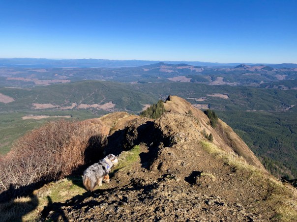
Saddle Mountain
 Another gem of a trail on the Oregon coast is Saddle Mountain. Located east of Seaside off Hwy 26, this is a must do hike if you are in shape for a 5 mile hike with about 1650′ of climb. It is a great trail, but it will kick your butt. I offered encouragement to many as I descended. Saddle Mountain is the highest point in this area of the Coast Range with sweeping 360-degree view from a 3,283-foot summit highlighting the Pacific Ocean, the Columbia River, and inland toward the Cascade Range. On this day I could even see the Olympic Peaks.
The trailhead is located at the camping area which appears to offer some really nice campsites. The trail’s first tenth of mile is paved but the climb is constant until you get to the false summit. You start getting views to the south and then west. And the beauty increases as you climb. The trail is well maintained with extensive effort to prevent the natural erosion problems. Much of the trail is covered with link fencing.


Near the bottom and toward the top there are house sized boulders that offer unique appearances from sculpture or vegetation covering.


You eventually leave the protection of the forest and if wind is happening you do get hit with it. Brook seemed to like it.


You come to the first peak or false summit which offers a imposing view of the final climb. Brook says let’s go.
The final climb is no more difficult than much of the lower section, but your anticipation and exhaustion get your heart really pumping. I did appreciate the occasional hand rails especially at the top.
Looking southwest from the saddle you see the timber harvest and the basalt walls that weave around the mountain.
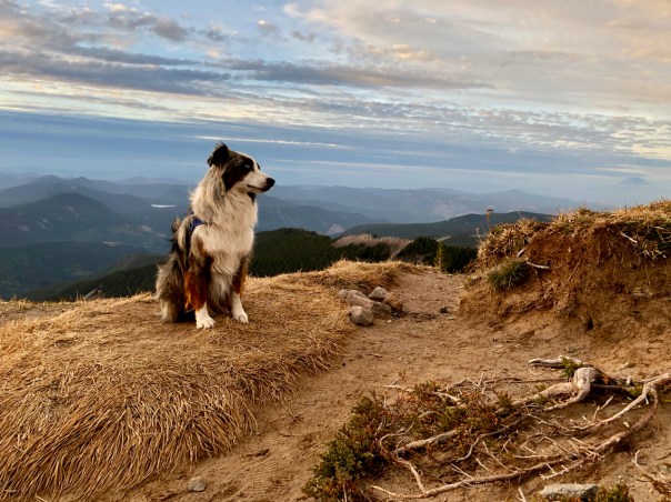
Once on the top Brook agreed to pose for a photo but she enjoyed her own exploration much more.
In the above photo notice the Columbia River to the north. As you can see it was a beautiful day and the wind was not that bad with the 50 degree temperature, in January. In the distance behind Brook to the east you can see from right to left Mt Adams, St Helens, Goat Rocks and Rainier. Of course Mt Hood was out there as well.
We hung out for a while enjoying the fabulous view.  On the descent we came to the early turnoff to Humbug Point about a quarter mile from the trailhead. Today the trail up to Humbug Point was the most vegetated with ferns and moss. The final climb is very steep but rock steps and a cable rail help.


The real value of Humbug Point is the view back to Saddle Mountain.

The Adventure Continues

Neahkahnie Mountain
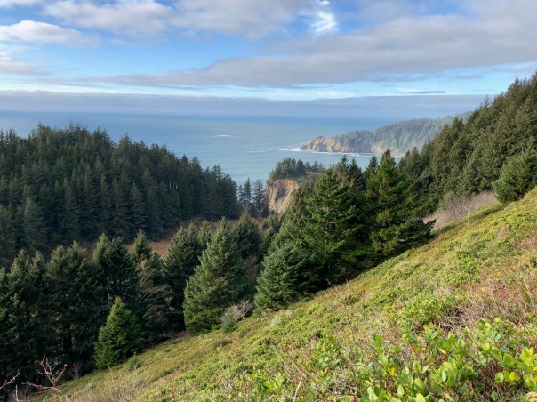
 I have lived near the coast of Oregon for 14 years and have never visited the Neahkahnie Mountain which is a part of the Oswald West State Park.
  I took the hike from the North with the trailhead starting at a parking lot pullout on Highway 101 just North of Manzanita. The trail begins on the east side of the highway and is pretty much an uphill trail. The first section of open meadow of switchbacks offers great views of the coastal cliffs at Cape Falcon. Overall the trail is of moderate difficulty, however, you are constantly navigating slippery roots.
 Once you leave the initial meadow you enter into the a beautiful coastal forest.
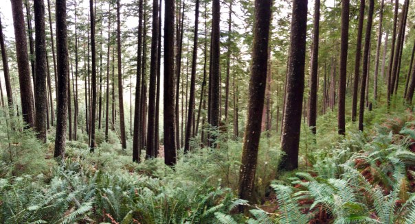
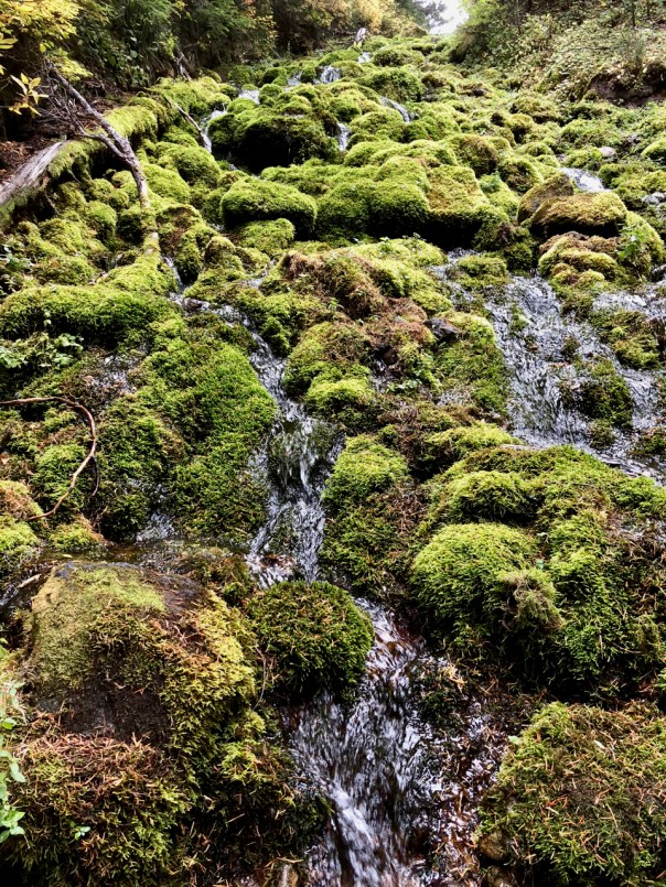
Once into the forest you enjoy a magical rainforest.


Once you approach the Neahkahnie View area it can be confusing about which path actually leads to the top. The easiest route actually wraps around the back side where you still need to climb a fairly steep rock face. Once at the top the view South is fabulous.


Why Backpack?
 How does an old retired guy end up becoming a backpacker, and why? This passion is not a common pursuit for any age. The older I get the more lonely I find myself in the pursuit of my favorite activity. Lonely is not a bad thing, solitude is actually a huge part of my backpacking pursuit. I just find myself wanting to share my passion with others of similar age and experience. I do love seeing so many young people exploring the backcountry even if it does make the pursuit of solitude that much more difficult. I think it would be great to still have those backpacking friends from my youth, but life intervenes.
I learned how to survive in the wilderness as a young man while living in Colorado. Then, backpacking was more about conquering the wilderness, proving that I could go to these remote beautiful places. And I am so thankful that I did, but life intervenes. Yes, family, job and many other hurdles replace that freedom for a period of time. When freedom returned, backpacking again emerged as a passion, but now with wisdom and some restraint. So the Why? Can be answered by the passion, but How does this happen?
Backpacking is physically demanding and can definitely be uncomfortable which is why most all of my friends do not share this passion with me. Sure, everyone wants to be on those mountaintops but reality does not allow that for most. I believe that getting in shape in order to pursue serious backpacking would be extremely difficult at my age, which is why I am so thankful that I have stayed in shape. This was not really an option. I have inherited a bad back and I have paid the price for not maintaining strength to protect against throwing my back out. So I have pursued exercise throughout my life primarily seeking out games to fulfill the goal. Basketball was my mainstay, however, a lifetime playing roundball rewarded me with both my hips needing to be replaced and that was the end of basketball. Because of the hips I could not participate in any exercise that created lateral stress, however, hiking only creates forward stress. Luckily I have found that backpacking physically agrees with my chrome cobalt hips.
 Without fitness getting in the way, the question becomes, “why would you want to place yourself in such uncomfortable situations”. And this is the real challenge. Committing to a backpacking trip when the comforts of home are so appealing is the greatest hurdle. The pressure to stay in shape especially in old age is a significant motivator, however, it is the reward of the adventure that drives you to the trail. Of course the process gets easier and your experience tends to help you overcome most unnecessary hardships. But it is the defiance of old age that may be the ultimate driver. Experiencing the beauty of true wilderness for as long as possible is the ultimate motivator.
The reality for everyone is not knowing when your body will finally give out. For me I have to always be concerned about my hips, but that unknown is a motivator as well. Do it while you still can. That is why I am placing the more difficult adventures at the head of the bucket list. The Adventure Continues.

Henline Mountain with Snow

Beginning
Retirement means you can go on a hike when conditions are optimum, which is what I did today Dec. 3 going up Henline Mountain Trail #3352. For some reason we have many days of sunshine beginning here in Oregon so I decided to touch winter by way of Henline Mountain. I really did not expect there to be much snow but I found a good fresh covering.

No Snow
The route is about a 5 mile round trip with a 2220′ vertical. Not an easy hike, you are basically climbing at a fairly steep grade all the way and then coming back down does a toll on your knees.
But this hike was a great workout which should help get me ready for skiing. On this day there was no snow at the start however, soon you could tell that there was plenty of snow up on the trees. Some of this snow was coming down as I ascended, but more was coming down as I descended the mountain. I noticed a great overlook site about a mile up which I figured I might use for a break on the way down.


At about this point the snow pack on the trail was becoming real and then the final mile the snow did make the hike a bit more challenging. Brook loved it though.


The sky was blue and the contrast with the trees and snow was stunning. There were a set of foot prints from the previous day but it was obvious that this trail is not heavily used. I had the mountain to myself. The final approach to the lookout spot is even steeper and with the snow depth increasing this was kind of fun.
Once at the top you have a 360 vista with Mt Jefferson prominent to the East. However, it was probably about 30 degrees with a slight breeze so it was a bit cold.
We took out photos, ate some lunch and headed down. 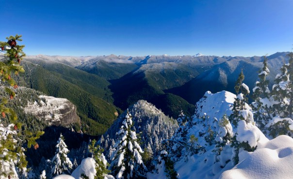 While I was at the top a lot of snow must have fallen off of those trees because the snow on the trail was much more pronounced.
In fact the snow falling from the various tree branched made for some serious snow dogging. Brook got hit once on her back by a large drop and it totally freaked her out. Once we got back to that overlook below snow line we took some time to enjoy the scenery.


Actually spent a t least an hour just soaking up the sun and enjoying the view. What better place to spend an afternoon.


We did get on the trail in time to get back to the car at sundown. The dirt portion of the road in was in OK shape.
Just returned to climb Henline again on June 11th, 2019. The dirt road sucks again. Here are some summertime photos.

TDH from New Mirror Lake TH
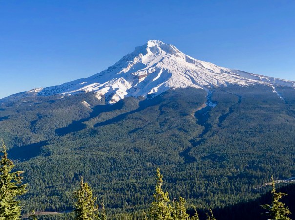 Brook and I had a great trip up to Tom, Dick & Harry Mountain in the Spring so I wanted to experience it in the Fall. We waited for optimum weather for our return.
  What we did not realize was that there is now a new Trailhead serving Mirror Lake and TDH. Initially I assumed I had missed the turnoff, but then found the new Trailhead located at the west end of the Ski Bowl parking lot, and it is nice. Not only will this provide adequate parking but a much safer access and departure for cars.
  The new trail that eventually connects with the old trail is paved for the first .2 miles down to the first of 9 new cedar bridges.
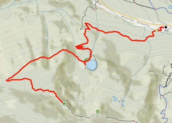
Map from new Trailhead
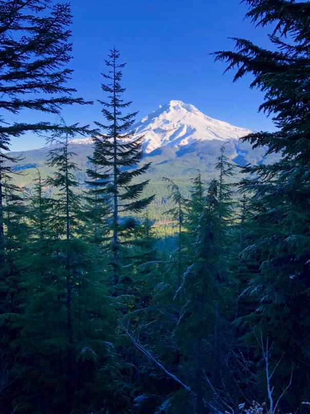
The day was partly cloudy but the clouds were hiding all the important objects such as the sun and Mt Hood. The hike up to Mirror Lake is now 2 miles and it is a super highway of trails. Many improvements which will handle far greater crowds of hikers. I do hope that they put restrictions on that traffic around Mirror Lake. I did not get the classic mirror photo of Mt Hood behind Mirror Lake on my way up but here it is from my return.

Mt Hood from Mirror Lake
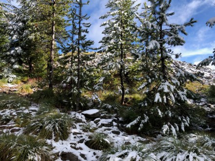
The climb up to TDH introduced a small amount of snow which created a nuisance of slippery rocks.
Approaching the View Summit
But it also added to the beauty. It was about 40 degrees with a forecast for east winds later. Once at the top we waited for the clouds to reveal the prize of Mt Hood, but views of the TDH Mountain and the valley with clouds was still fabulous.

Tom, Dick & Harry Mountain
There is one great campsite just past the primary view area but I scouted the entire ridge hoping for something better, but no there is only one prime site. I cleared away the few inches of snow and setup camp. It was a bit depressing knowing that it would start getting dark around 5 pm and that was when Mt Hood started to reveal herself.
The end of the day did bring an impressive view of Mt Hood and the valley, but it was also getting cold, as in it would get down to about 25 degrees and the east winds started in the early evening.
Brook never sleeps in my tent but I felt like tonight would be different with the deep wind chill cold. Plus I would have enjoyed her contribution of body heat to the tent. But no, she slept outside all night. Once in my sleeping bag I was acceptably warm even after discovering that my patched air mattress would not hold air, but thankfully I had my ZLite foam pad. Morning broke with fabulous views of Mt Hood and the valley under clear skies, and a bitterly cold wind.  The views justified the cold night but not enough to hang around and freeze. The hike down was very pleasant.
View about 1/2 mile up from Mirror Lake

McNeil Point at Mt Hood
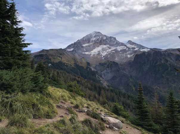
 Why did it take me so long to get to McNeil Point. I don’t think a campsite next to Mt Hood can get any better. Yes, I have hiked past the trail to McNeil Point a number of times, each time saying that I should go check it out, only to rationalize that I have to move on. Well finally I planned a trip specifically for McNeil Point, and when you have the luxury of choosing how and when you tend to end up with one of those awesome experiences. As a backpacker in the Pacific Northwest, October signals that you better make the most of any good days left for high country packing. McNeil Point was the perfect choice and to do it on a weekday is probably the only way I would have been able to get a spot to park at the Top Spur Trailhead.

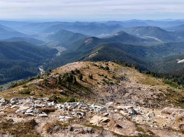
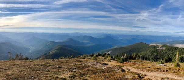
View from Bald Mountain
This was the first time I have used the Top Spur Trailhead and yes the parking area is small, but the access and road conditions are great by forest road standards. The overall hike to McNeil Point is about 5 miles and 2000′ vertical but it is an excellent trail with only a moderate incline. The hike is broken up into nice chunks with the first required option taking the loop around Bald Mountain. Again, why have I not taken that little detour when I was doing the Timberline Trail. You take in the view and then use the Cutoff Trail to get back over to clockwise Timberline Trail.
Now you get to climb a ridge trail for a little over a mile up to the next gorgeous view of McNeil Point next to Mt Hood. This was my previous Mt Hood view highlight from my Timberline Trail trips.
First view of McNeil Point
Back into the forest where the ground foliage autumn colors are starting turn. Shortly after this view you have the choice to take the  short but steeper trail up to McNeil Point. I decided against that option not since the other route is so nice and relatively easy. This section over to the McNeil Point trail is the area where Brook got lost on my Timberline Trail trip a month ago. I think she remembered it. She has definitely stayed much closer to me since. It was afternoon so I was mostly meeting day hikers coming down. It is always interesting to observe their response to telling them that you plan on camping at McNeil. Some think you are crazy and some are totally envious.
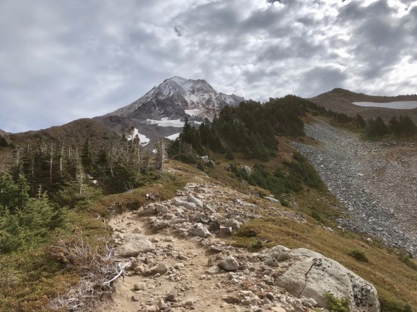 So on up to McNeil Point on a beautiful trail up a ridge line and then cutting over to an option to the shelter or up above.
View from above the McNeil Pt Shelter
I arrived around 3 pm and spent about an hour hiking up and down the ridge above the shelter looking for the optimum campsite. The wind was going to be a factor so I was looking for wind shelter but I also wanted a view of the mountain.


I settled on a spot not to far above the shelter which gave me the mountain view along with a good valley view. There are a number of sites with rock walls and I do believe the wind break helped a lot throughout the windy night. The next few hours I just enjoyed how fabulous this view was.


There were a number of bird flyovers that highlighted the view.
The wind was on and off but each time it came I feared it would escalate, but it never did.
 Actually the wind probably kept the temperature a few degrees warmer. It only got down to about 30 F during the night. I was hopeful for a great sunset but it was nice that it ended quickly because I was freezing outside of my tent waiting for it.

I did not sleep that well probably due a bit to the altitude, 6200′, or the noise the wind made flapping my tent. But overall it was a good night and as usual Brook slept out in the open making sure I was safe. Knowing that she would do this I gave her a serving of beef stroganoff on top of her dog food to make sure she had plenty of fuel to keep herself warm through the night.
 Morning came and Brook was good to go. On the way back I captured the mini Ramona Falls in its full glory.
Brook was unusually friendly on the way out in greeting the few day hikers heading up to McNeil, but she was a tired pup.


Timberline Trail Revisited 2018
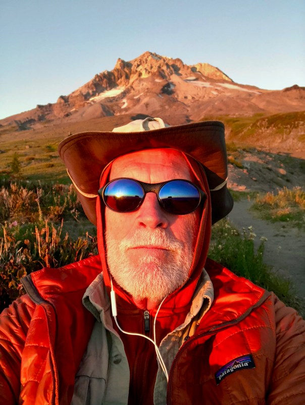
It has been a smokey backpacking year so when we got a break of clean air, @AussieBrook and I decided to go for a proven great trip, so back to do the Timberline Trail around Mt Hood. Here is comparison photo of Mt Hood 3 weeks prior to this trip.


I got to Timberline around 1:30 on Labor Day 9/3/18 and it took me about a half hour to find a place to park.


This must have been the final day of summer for so many people. But it was a beautiful day and my goal was only to make it to Paradise Park hoping to take in an awesome sunset that night. I got a prime campsite with only a few other campers in the area.


 And the sunset was awesome.
The next day was going to be the tough one. From Paradise Park down to the Sandy which did not turn out to be a difficult crossing. Then over to Ramona Falls


and then up the Ridge finally camping near the Mazama Trail. You need to remember how long that ridge climb is before you get to water. I was beat and ended up going to sleep around 7:00 pm. Brook came by camp to eat her dinner around midnight but she was not around at sun break like she normally is. I didn’t think much about her being away since it probably had to do with her not wanting to wear her backpack, but she was still missing when I got all packed up and ready to go around 8:30. So I got a lot more serious about searching for her. Calling out her name and asking other backpackers if then had seen her, but no luck. OK, I’m starting to get worried. Brook would not run off so my fears led me to think about Brook having a wild animal encounter or getting into some other type of trouble. By 9:30 I was ready to starting hiking back the way we had come but just then a couple showed me a note that they had found on the trail stating that Brook had joined their group and they were headed to Cloud Cap. My heart relaxed and as I turned to head toward Cloud Cap, there she was sitting in the trail.  After a joyful reunion we returned to the goal of hiking around Mt Hood. There was more to the story. Thanks to a voicemail and meeting the people who Brook hooked up with, I started to piece together what happened. She had met the folks the day before so felt comfortable trying to herd them up the trail. She must have been having so much fun herding these humans that she forgot about me. Well, from the timeline it appears that once she realized her mistake it took her over an hour to find me. Needless to say she did not venture far from the campsites on the remaining mornings.
My goal for the 3rd day was to get somewhere near Cloud Cap which we mostly did with a nice secluded campsite at the bottom of a rock slide.


I think once you make it past Cloud Cap on a clockwise loop hike you have passed most of the difficult water crossings. None were very difficult for me, but Brook did take a swim after slipping off a narrow log crossing. She hates to get wet and she got totally dunked, which did help with her need for a bath. The climb over the high point seems like it should be more difficult than it is, however, it really isn’t that far and the grade of the climb is minimal. As usual the hike along the Eastern side of the mountain presented us with strong winds which were actually much appreciated since it would have been a bit hot without the breeze. My goal for the last night was a campsite on the West side of Newton Creek.


We joined many other campers so I had to inform them about how Brook would feel obligated to protect them all. Turns out she made the rounds to visit all the campers but was all business about it. It was here where I met the people who Brook hooked up with so they were extremely happy to see that Brook had found her master. Others on the trail knew that an Australian Shepard had been lost so we got lots of inquiries as to whether Brook was the lost dog. The bar tender at Charlie’s in Government Camp even knew about Brook being lost.
The final hike out on my fifth day was very pleasant even with that brutal climb up to Timberline from the White River. Some of the best waterfalls occur prior to Mt Hood Meadows, plus I love hiking through ski terrain that I know will look a whole lot different come winter.


For the second year it was the anticipation of a Burger and Beer at Charlie’s that helped me make it up that final ridge. Timberline is definitely one of the finest multi-day loop trails in America.


