Category Archives: Backpacking
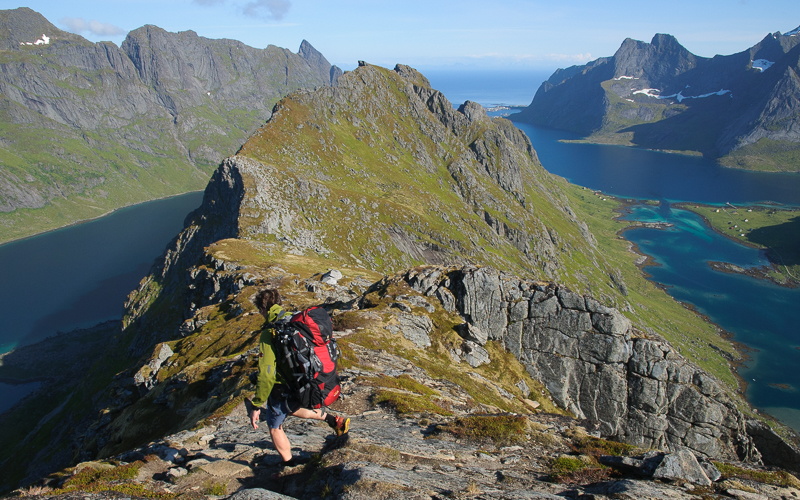
Matmora Summit – Lofoten Islands
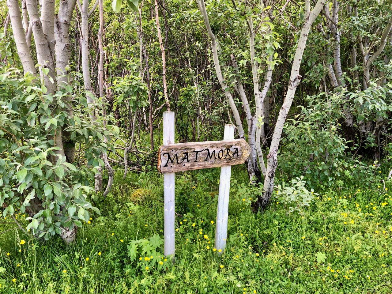 Our first segment or day corresponded to the Great Crossing’s first day which was to cross over Matmora Mountain from Delp to Sandsletta. We did have to add a few km due to hiking to the Delp Trailhead from Laukvika but the trail was well marked and my Lofoten Adventure had begun. I quickly realized that the trail tended toward difficult since it essentially went straight up, no concept of switchbacks in Norway. Soon we were greeted by the local free range sheep who had deposited many poop landmines along the trail.


The trail started out in a steep climb up to about 400 m where the first summit flattened out with fantastic views to the South, West and North.


A large cairn marked this first plateau where we signed the log book. The trail then stretched out over ridges and shoulders before the final accent to Matmora.


At the summit we got our first 360 view out over Austvågøya Island. Overall the weather was excellent but we did need to pull out our backpack covers for a short rain storm.


The trail down was steep but dependable and the lower areas were drier then we expected.

The hike to Sandsletta was not bad at all.

Backpacking the Lofoten Islands

I can’t believe I did it. Many years ago I saw photos of this amazingly beautiful place called the Lofoten Islands in Norway. I then found a website that talked more to the backpacking opportunities. Then an opportunity arose to join a group that was to backpack the Long Crossing of Lofoten, but that fell apart. However, out of the process I did hook up with another senior backpacker from Switzerland who was interested in taking on this Long Crossing so the commitment was made. My earlier post Outside My Comfort Zone detailed some of the hopes and fears I had leading up to the actual adventure. In this post I will give an overview of the entire journey and then add specific trip reports for the various 1-2 day treks that comprised the overall adventure.

My Luggage
The adventure really began when travel commenced. In fact, I was probably most concerned about the travel. The three flights from Portland, OR to Oslo, Norway did not go as I would have hoped. My glitch occurred when my backpack did not make the connection in London to Oslo. In Oslo after diagnosing the problem I felt good about my backpack catching up to me that evening so that I would be fine for my flight the next morning to Bodø and then on to the Lofoten’s via ferry. That assumption was based on how lost baggage is handled in the US, but this was Saturday night in Oslo and nobody was actually concerned about my lost bag. So on Sunday morning when I realized that the process was not going to deliver me my backpack in time for my flight, I decided to find my backpack myself. I believed that my pack was on a late flight from London but no confirmation had been issued. The airport started waking up around 6:00 am but nobody could let me into the International baggage claim area until 8:00. My flight was at 9:30. Once I finally was able to speak with a baggage claim representative I was running out of time and they were not motivated to help, instead it was easier for them to assure me that my bag would be sent to me. Of course that was not going to work for my wilderness address on the Lofoten Islands.

Lofotens from my Ferry
So I resorted to serious begging and was finally able to motivate a handler to go search for my backpack. Thankfully, they did find my pack and I was just able to make my flight to Bodø and then catch the ferry to Svolvær. A lot of stress, but all part of the adventure.
I met up with my new backpacking partner, Jakob, Sunday night June 30th and we set forth our plans to hitch hike to the beginning trailhead at Delp. Hitchhiking didn’t really work, but we met a kayaking group who were headed in the right direction. We then got lucky where they let us off by catching a ride from a Swiss freelance writer who was working his way through the islands.

View Waking Up in Laudvika
However, the weather was not cooperating so we decide to rent a cabin in the town of Laukvika and start the trek on Tuesday. We were basically trying to follow the stages laid out in what was referred to as the Great Crossing of Lofoten.
Stage 1 was a hike from the hamlet of Delp to the hamlet of Sandsletta over Matmora mountain. This would be about 15 km and 1000 m vertical with the high point at 766 m (2546′). The trail was rated medium/difficult. The day’s trek was great, some rain and some sun and amazing views. This trek helped to define what hiking would be like in the Lofotens. Difficult typically meant more difficult than a trail in the US. And if the listing was medium/difficult then it meant half of the trail was difficult.

View from Matmora Summit
It was difficult because the trails are laid out for the shortest path, as in, straight up a mountain, the concept of trail switchbacks does not exist. Unfortunately Jakob developed a problem with his foot on this first day and the injury would influence his participation throughout the rest of the Crossing. After spending a night in Sandsletta Jakob decided to seek medical advice in Svolvær and I set out to conquer stage 2 by myself.

Leaving Sandsletta with Matmora Behind
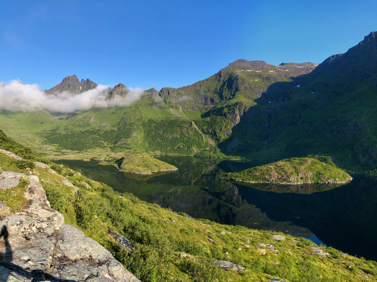
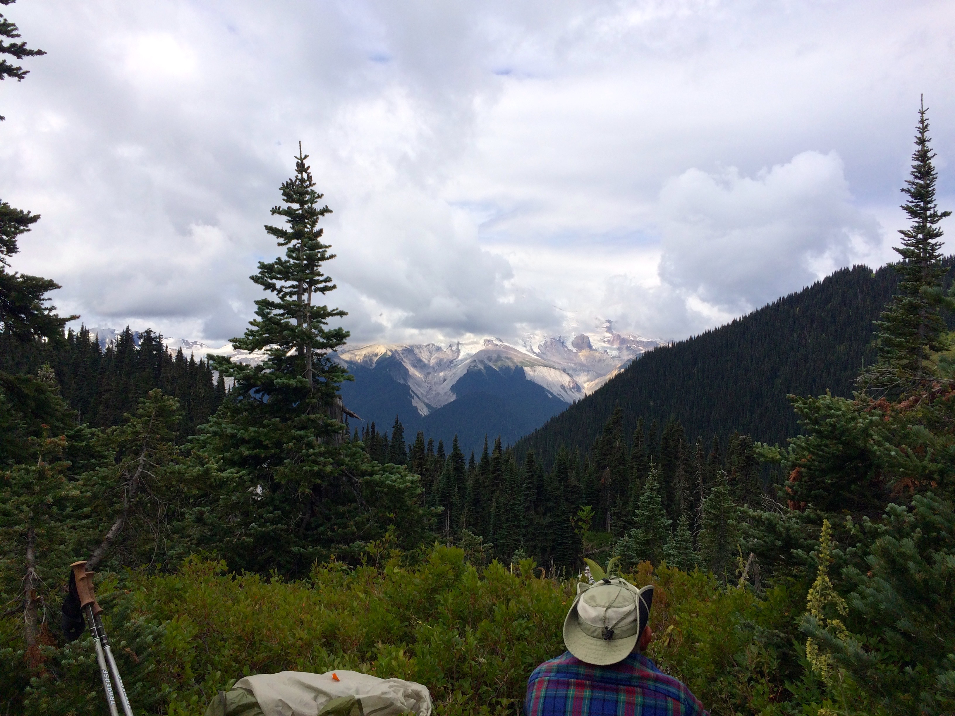
Stage 2 Haugen to Svolvær takes you from one side of the island of Austvågøya to the other over a snowy mountain pass. I was not concerned about taking on this segment alone, however, I did borrow, Jakob’s Garmin which could utilize a GPX file. Unfortunately his Garmin was starting to whack out which did cause me trail confusion. The weather was good and the trail was decent but the scenery was stunning which totally motivated my tiring body.

Navigating by Ice Lake over to Svolvær
Hiking in the Lofoten’s is a lot about avoiding muddy wet trail sections which probably contributed to what could have been a very serious tumble that I took on my descent into Svolvær. A misstep caused me to take a couple of somersaults ending up without anything broken except my trekking pole. The backs of my hands were scraped and bleeding, but a couple of Norwegian hikers, Nina & Erik, happened by to help me compose and bandage myself. Now I was a bit more concerned about my ability to backpack in the Lofotens, plus I was hitting that second day exhaustion. Thank God, Jakob decided to rent a car and was able to pick me up at the end of the trail. We regrouped in Svolvaer to plan out the next few segments. Jakob needed a few more days to rest his foot so I decided to head out on my own again.
Vikjorda/Lake Store Krenggårsvatnet Trip Report
Campsite near Storvatnet
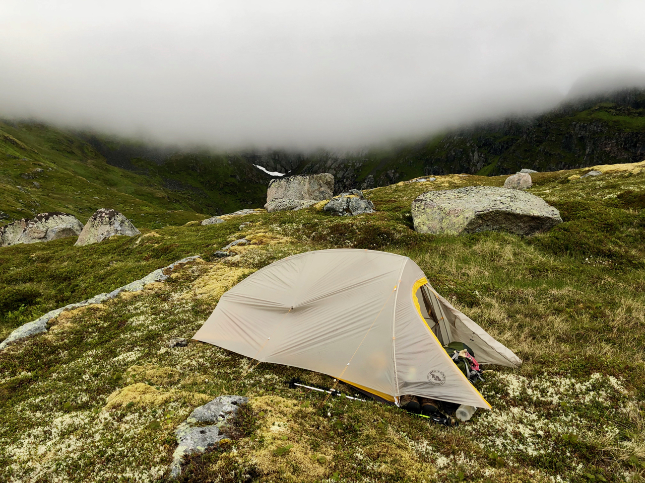
We decided I should skip segment 3 which entailed way too much road hiking so Jakob drove me to the start of Segment 4 Vikjorda which would connect with Lake Store Krenggarsvatnet and on to Leknes. This segment was referred to as a mountain crossing connecting with a more tame segment 5. I was planning on taking 3 days to complete these 2 segments so I felt good about the progress I made on the first day. However, this was a strange trail because it stated that there was no trail to get you to a ridge and that was accurate. It was critical to have a GPX route to follow. I found a good campsite which would set me up to go over the mountains the next day since the clouds were not going to allow that on this day. All seemed good the next morning when the clouds lifted but that changed quickly as I neared the peak of Dalstuva. I was only a 50 m from the first highpoint but a cloud was totally blinding me.

Too Dangerous to Continue
Combining poor visibility with a very narrow ridge to navigate, not to mention a steep descent on the back side I succumbed to fear and wisdom and decided to turn around. I ended up back on the lightly used highway 815 hoping to hitch a ride to Leknes. I finally got a hitch after walking about 6 km and was eventually able to meet up with Jakob in Leknes on that Friday afternoon.

On the Trail to Justadtinden near Leknes
Jakob was feeling up for an easy hike out of Leknes so we headed to Justadtinden for an overnight. We did not intend to go all the way to the summit so this simple trek worked out well with a great view and time to come out before rain was due on the next day. As the weather deteriorated the next day we did our reconnaissance work to plan for our next 2 day segment. We did explore the trail options around Nusfjord but were not impressed with what we found or were told about. However, we did manage to give a number or rides to very grateful backpackers on that rainy day.
Selfjord Bay to Horseid Beach Trip Report
We decided to spend the night in Remsberg and then modify Segment 9 by going from Selfjord Bay to the Lofoten’s most remote Horseid Beach and then return. We were entering our second week and the weather forecast was finally cooperating. We had also totally abandoned the idea of completing the Great Crossing at least as it was laid out. Instead we used it as a guide to hit the most impressive hiking areas of the Lofoten’s typically by choosing 2-3 day routes and this next trek was definitely a highlight.
We got an early start with the goal to go from Selfjord Bay over to Horseid Beach for the night. The climb over the pass was tough but the beach reward was worth it. We ended up camping on an ocean overlook with an opportunity to view the midnight sun. The location was magical and my hours of private time on the rocks the next morning totally validated why I wanted to explore the Lofoten Islands. We spent the second night on the mountain saddle before descending back down to Selfjord Bay.


To the Summit of Munkebu Trip Report
Coming out on the third day allowed us time to drive to our next trek which was to be summiting Munkebu which offered one of the most spectacular 360 views of the islands. We ventured down to Sørvågen where we headed up to the Munkebu Summit trail. We decided to camp at about 250 m and then summit the peak the following day with day packs. This worked out well for the 766 m (2510′) summit on this popular trail which did not disappoint us.

Greg & Jakob on Munkebu
The view was fantastic. We had some chats with other hikers on top and I believe this was the first place that I ran into others from the US. We hiked back down to our campsite for a relaxing evening.
Andstabben Above Lake Ågvatnet Trip Report
After hiking out the next day we ventured down to Å to take on the Andstabben hike. Unfortunately we did not have a GPX file for this hike and we never did find the trail up and over the mountain so we settled on camping above Lake Ågvatnet.
Lake Ågvatnet
The following day we relaxed in the village of Å by renting a cabin and having a great meal at Maren Anna.

Village of Å
This brought a close to our Great Crossing of Lofoten. I took the Moskenes Ferry to Bodø where I wanted to do some backpacking but the weather did not cooperate. There were definitely some excellent backpacking options on the coast north of Bodø where I was able to do some hiking on my last day before catching my flight to Oslo. However, I did squeeze in a day of golf above the arctic circle at Bodø Golf Park. I then spent 3 days visiting Oslo where I totally enjoyed that energetic city.

Timberline TR Attempt June 2019
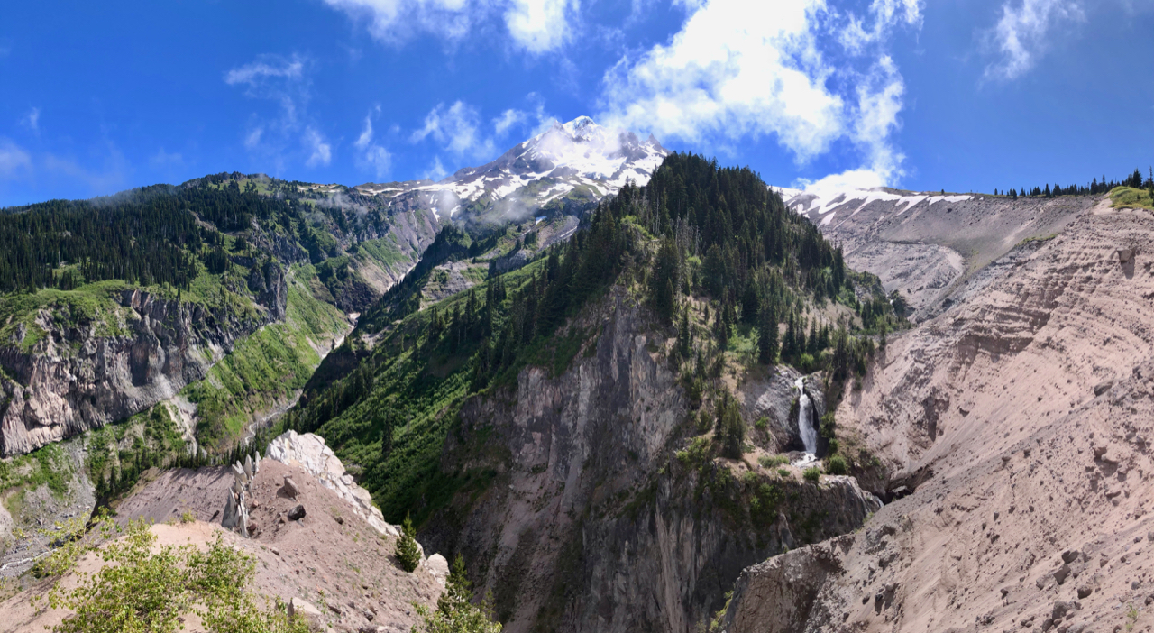
The goal was to complete Timberline Trail loop for the 3rd year in a row, but Snow and Weather dictated a different outcome. Scheduling this year required that I attempt the Timberline Trail on June 17th. Yes, a bit early but I knew there would be rewards of clear skies and few people. 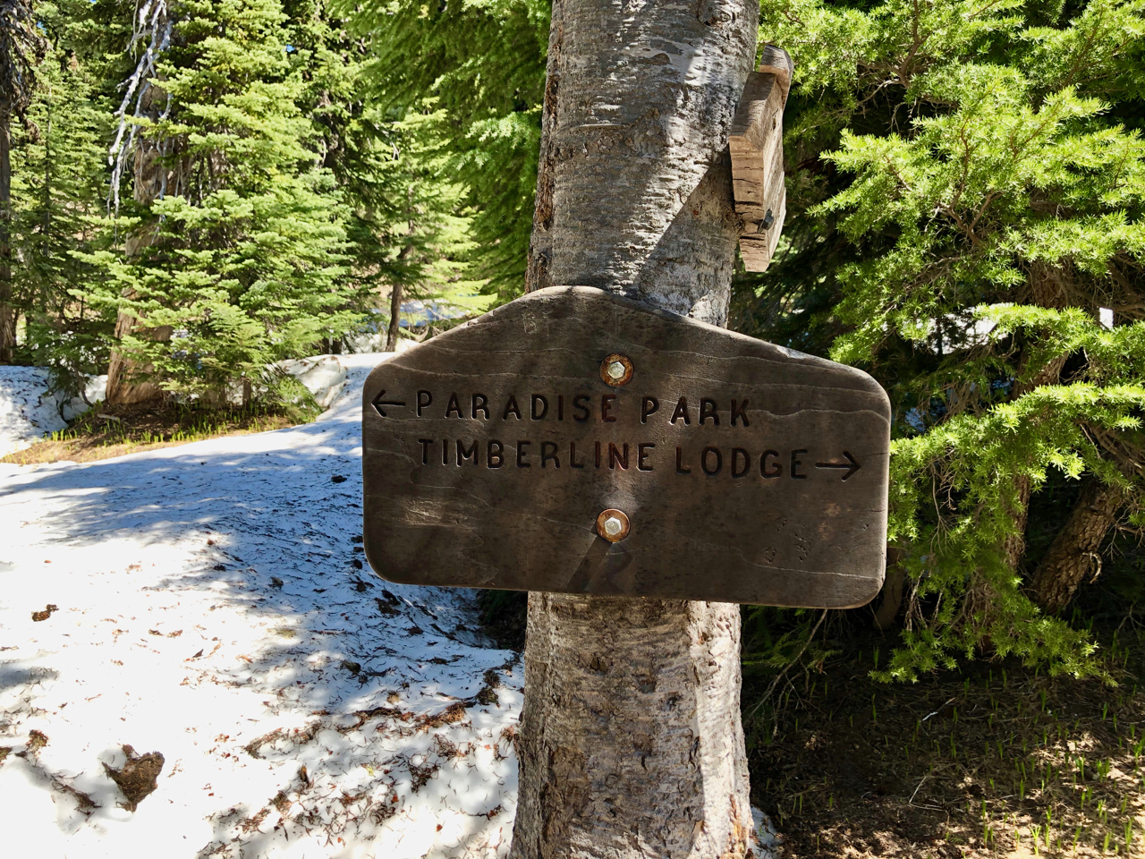 However, I did not think the snow depth on the Northeast side would create such a problem. Combine that with a snow storm that emerged from the gorge when we would have been crossing the high point and we had to adjust to a Top Spur extraction. Overall it was an Epic Adventure because I have never seen the views so clear and brilliant, rhododendrons blooming and nobody on the trail.


This is my annual trek to evaluate how old my body feels and I am very pleased with the results. My main concern for completing the loop was the severity of the river crossing, but they were totally acceptable.


I can’t believe I didn’t worry more about the snowpack on the northside. It wasn’t that you could hike over the snow, it was how it created severe inclines over what was the trail and then it engulfed the trail. We made it to the Wy’East area clockwise from Timberline Lodge before we determined that we had to abort. Of course we had already met 3 backpackers who had turned around. I do think we could have made it if it wasn’t for the weather. All week the forecast just kept getting worse with the prediction of snow. And the forecast turned out to be more than accurate which made for a tough night at Eden Park and the hike out to Top Spur.


Knowing that the best weather was at the beginning I decided to do my traditional clockwise route from the lodge and boy am I glad we did. Paradise Park was amazingly beauty and it looked like we may have been one of the first to spend the night up there.


We almost got a great sunset but the sun hitting Hood at the different intensities is just as good. Unfortunately we did have fairly high winds at our Split Rock campsite and then we got a couple of hours of rain starting at sun up.
The weather cleared to give us a perfect hike down to the Sandy with the most amazingly clear views of the Sandy River headwaters up to Mt Hood.


The river crossing was challenging but we did not have to get very wet.
Of course Ramona Falls was glorious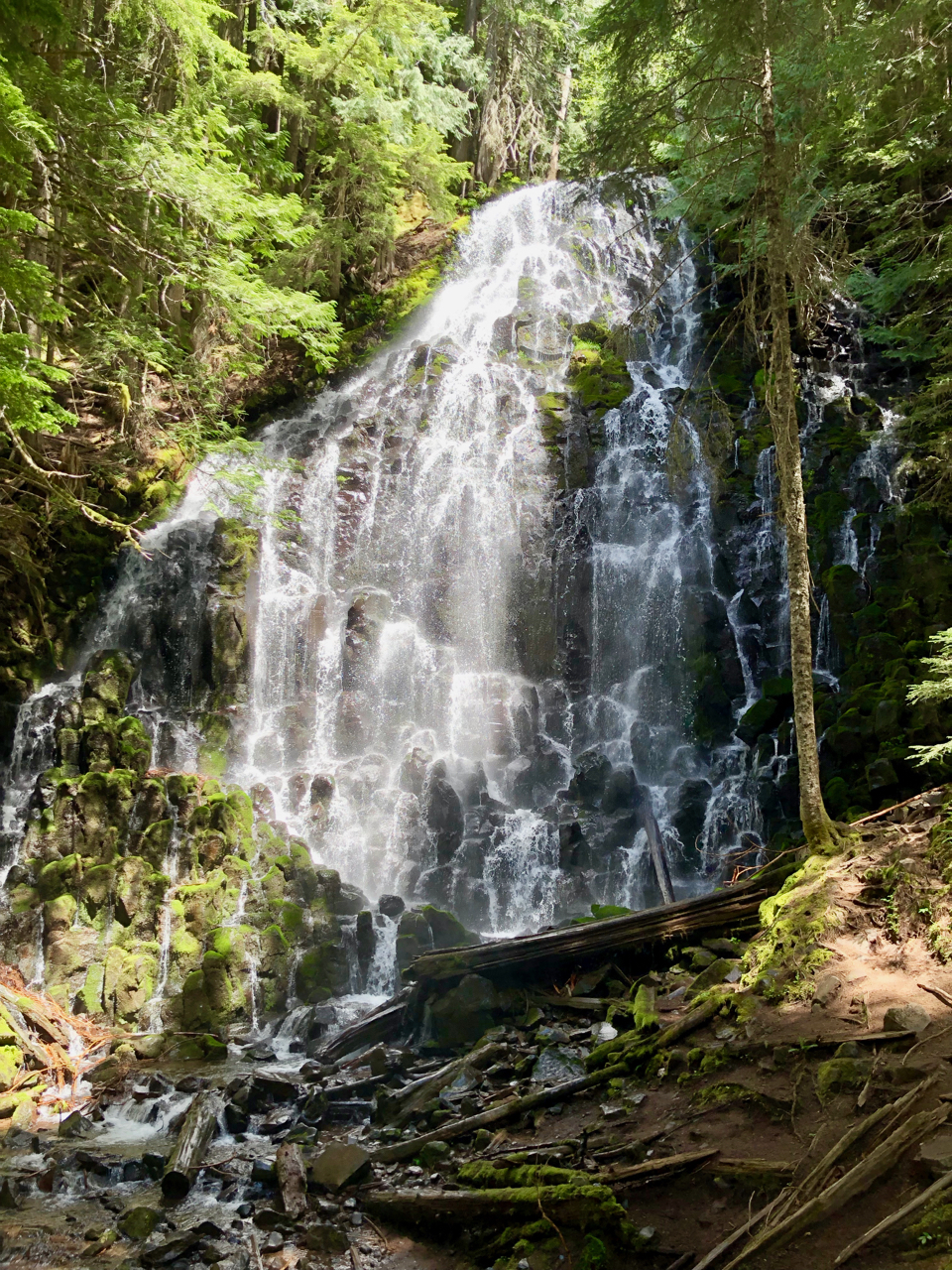 and the hike up to Top Spur junction was hard since we took the lower Muddy Fork route where one from our party exiting to the Ramona Falls TH. As I mentioned the flowers we exceptional.
The second night we camped at Bald Mountain with a perfect night for sleep. Climbing up toward McNeil we were treated to a beautiful view of Hood, but fog and clouds were forming.


This is when the snow pack got higher than I expected. Not a real problem until about Eden Park where it became more treacherous and difficult to find the trail.


The rest of the way over to Wy’East only got more difficult, but it was still beautiful because the storm was forming to the north and Hood was backed by blue skies. Wy’East was the decision point because you have cell reception there and we had to coordinate for someone to extract us. We decided on Top Spur for the following day hoping that maybe we could get to McNeil Point.


But no, the weather started to deteriorate and we were happy to camp at Eden Park. The snow started to fall at 2 am and it was a cold wet mess for the rest of the trip out. This trek did provide some inspiration for my post about how complicated my dog Brook is: My Dog is Complicated
Previous Timberline Trail Reports
- Timberline Trail September 2018
- Timberline Trail August 2017

What is Backpacking Really about?
It is common to be asked why do I backpack. And there are many times on the trail, typically early in a season, when I ask myself the same question. My family doesn’t get it, most of my friends just think I am nuts, but many do appreciate that I let them share in the adventures. I think we all have dreamed of what we would like to be doing if we had a choice.

For me those dreams were born when I was a young man Backpacking Colorado. I remember my last evening in Steamboat Springs before I was to move to the SF Bay Area to start my career with Hewlett-Packard. See Post AM San Francisco. I sat on a hill with my dog, Rusty, overlooking the town and ski area and said goodbye to a great life, but I think in my heart I also knew that I would return to that life. That was my Second Quarter, I was confirming my passion as I prepared to pay my dues.
Yes, wilderness backpacking is not for most, but it is for me. When I am in these fantastically beautiful places I think about all the billions of people who are not, who can’t even dream of such beauty. That is when I confirm my passion. We only have so much time on this amazing planet and I want to maximize every minute that is left. You know it isn’t just about the adventure, it is also about the health. It feels good to be in decent shape. I’m 65 and the body does tell me that it is getting old. But to feel healthy is also a beautiful thing.
I am about to kickoff another epic backpacking season, and I am so excited. What gets you excited? Next week I do my annual trek around Mt Hood with a couple of good friends. But then I am off to Norway’s Lofoten Islands and then the Colorado Trail. This is my dream come true. The Adventure Continues

Ramona Falls Loop from Top Spur TH
I have passed by Ramona Falls many times since it is on the PCT and it is an easy day hike from the Ramona Falls Trailhead. But this trip was from the Top Spur Trailhead which offers a great loop option with Trail #600 the high route and the PCT #2000 low route. 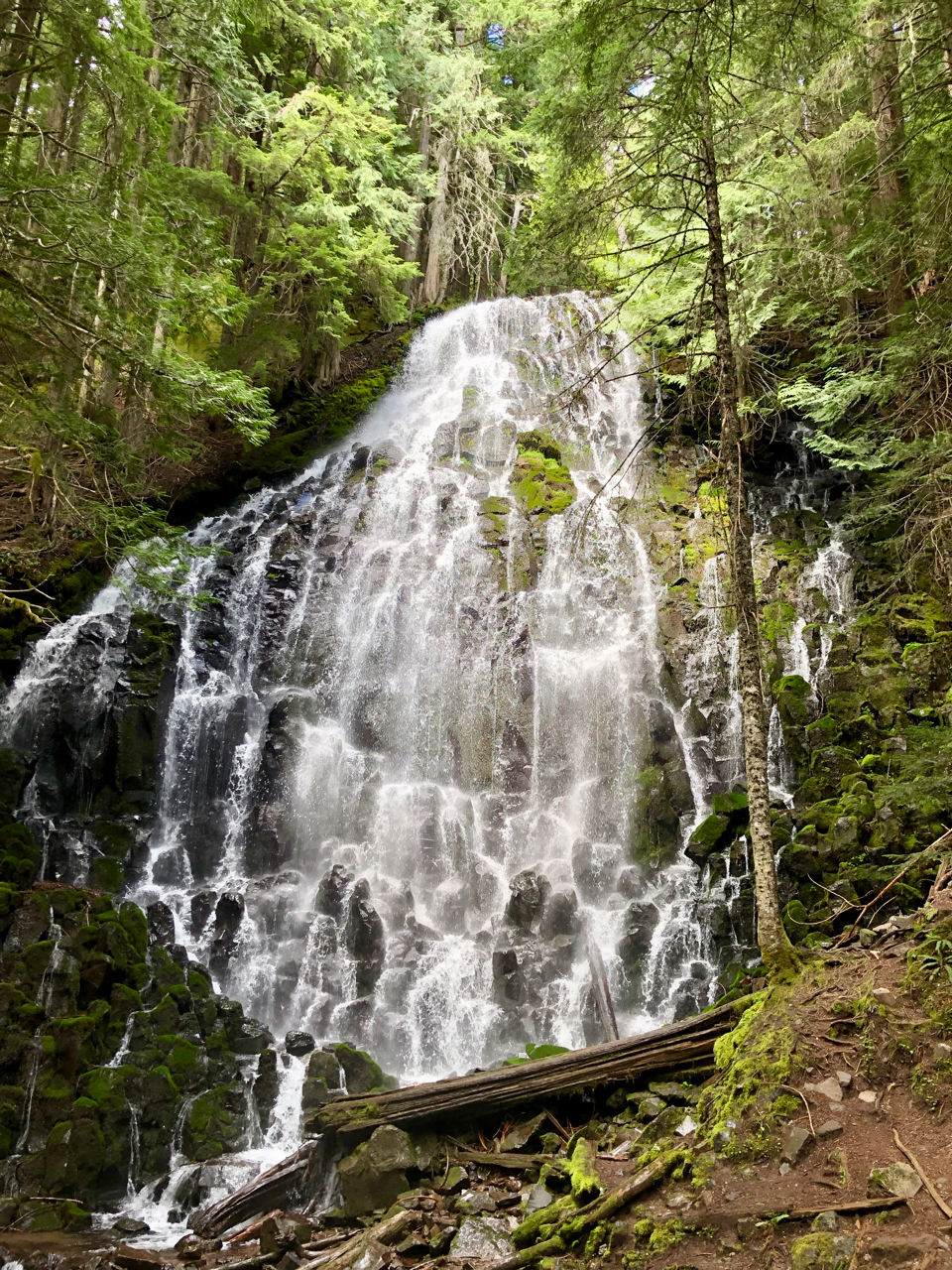 My motivation for this trip was primarily to checkout the Muddy Fork and Sandy river crossings in preparation for an upcoming Timberline Trail Trek. From this snippet of reconnaissance I do feel that the Timberline Trail should be fine. I also was OK with probably being able to enjoy Ramona Falls all by myself which did happen. Unfortunately I took a chance on the weather for this Thursday-Friday trek which called for scattered showers and possibility of snow on Friday. Well the showers started out scattered but ended up continuous, and yes on the hike out it did snow. Not fun but it is all part of the deal for a backpacker.
The hike over to Ramona Falls was rather nice even though Mt Hood was mostly hidden in a cloud.


The view from Bald Mountain was unique as usual and crossing the Muddy Fork was a bit of a challenge. I found a safe rock jump about 30 yards up from the normal trail crossing.
Overall this Trail 600 over to Ramona Falls is a great trail.  The Trillium and many other flowers are coming out and the Rhododendron’s are starting to bloom as you near the falls.


And of course Ramona Falls was bursting with flow and beauty.
I camped over by the abandoned ranger cabin which provides a nice view of the Sandy Canyon.
I did hike over to the Sandy and determined that it is crossable, however, it may entail wading across by a couple of logs that will help to stabilize you.


Overall this portion of the Sandy looked fairly normal and ready for Timberline Trail crossings. 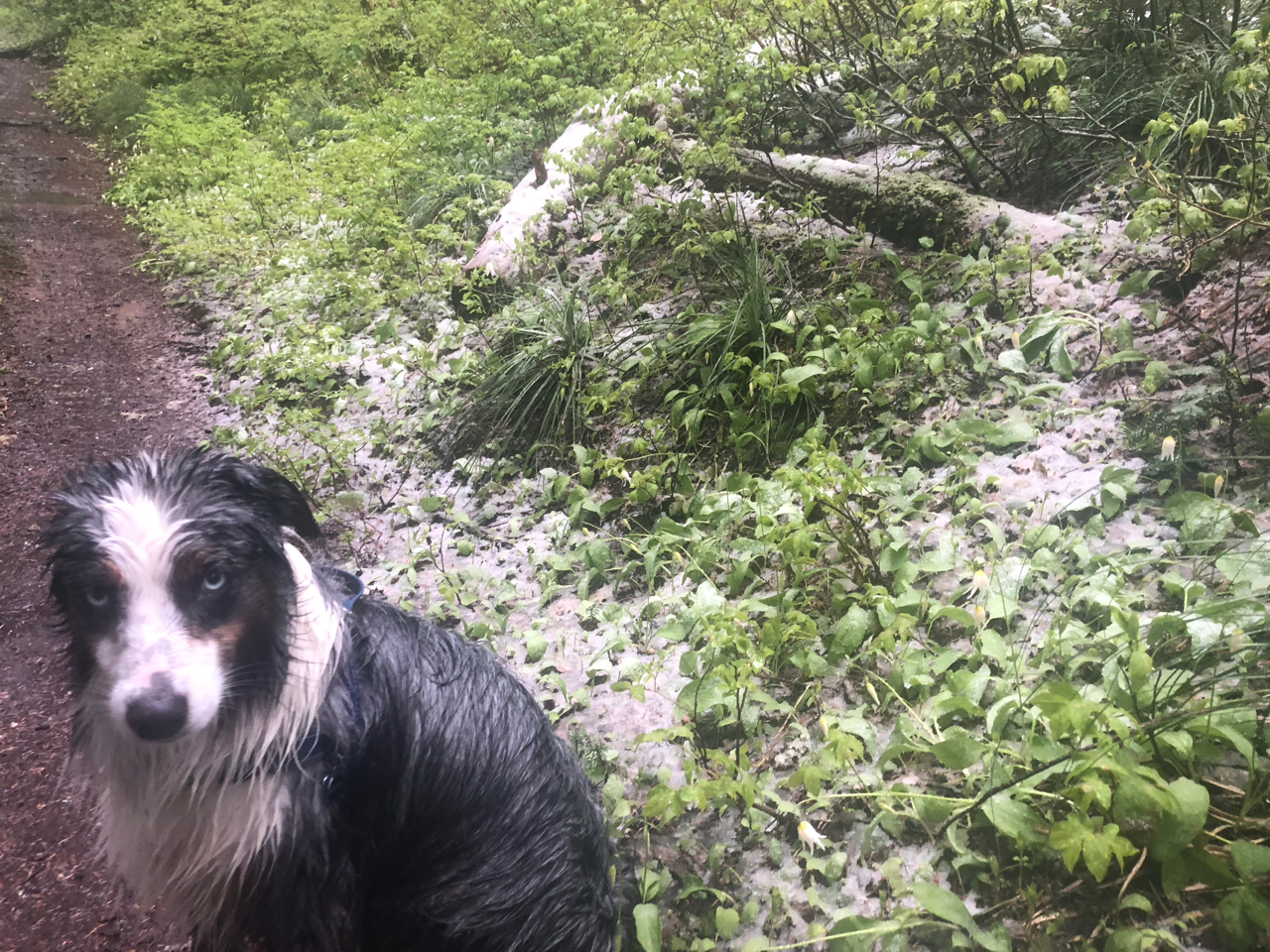 The trip was going great until the showers started to show up. So I basically was forced to stay in the tent after about 7:00 pm. And it rained most of the night and turned into a steady rain by morning. Bummer for Brook who does not like to sleep in the tent, so she got soaked and did not complain a bit even though she must have been freezing. But in her strange Aussie way she probably cherished the opportunity to protect her master. If I was her, I would have slept near one of the large trees that were offering cover, but she slept next to the tent.
Breaking camp in the rain is messy, but it is what it is. You pack everything up which is mostly wet making your pack a lot heavier than it should be. 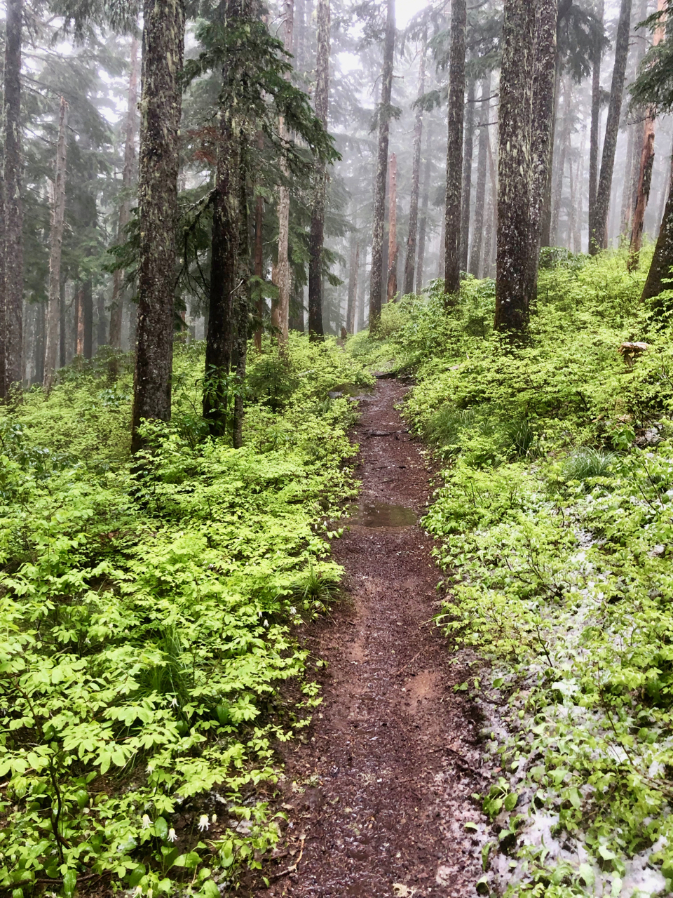 Then hiking out is just as messy, you are wet and cold but in a weird way I kind of like it. I reflect back on my Lost Coast Trek and realize how much worse it could be. The snow falling on the hike out was a bit ridiculous.

BayOcean Spit
I finally backpacked the Bayocean Spit that is known as “the town that fell into the sea“. After researching the history of Bayocean I was amazed that I camped in solitude on ground that once hosted a significant resort community in the early 1900s. Bayocean is a small stretch of land that forms one wall of Tillamook Bay which I have neglected for many years as a backpacking option. The Bayocean trailhead offers a large parking lot which mostly accommodates day hikers. What I found was one of the most beautiful coastal backpacking option available on the Central Coast.
The name defines the the route either on the bay side or the ocean side. I started out on the ocean side mostly by accident but had no issues with the ease on walking on the wet sand. As 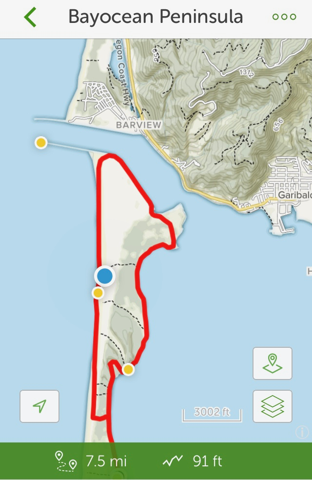 I checked the map I realized that trails were coming off the bayside trail and I was not sure if these trails connected to the ocean or ended up on the various hilltops. However, I did find that the trails connected and were very well marked. I decided to hike to the furthest trail cutover and look for a good campsite. Hiking in the bayside tide was low but beautiful.
 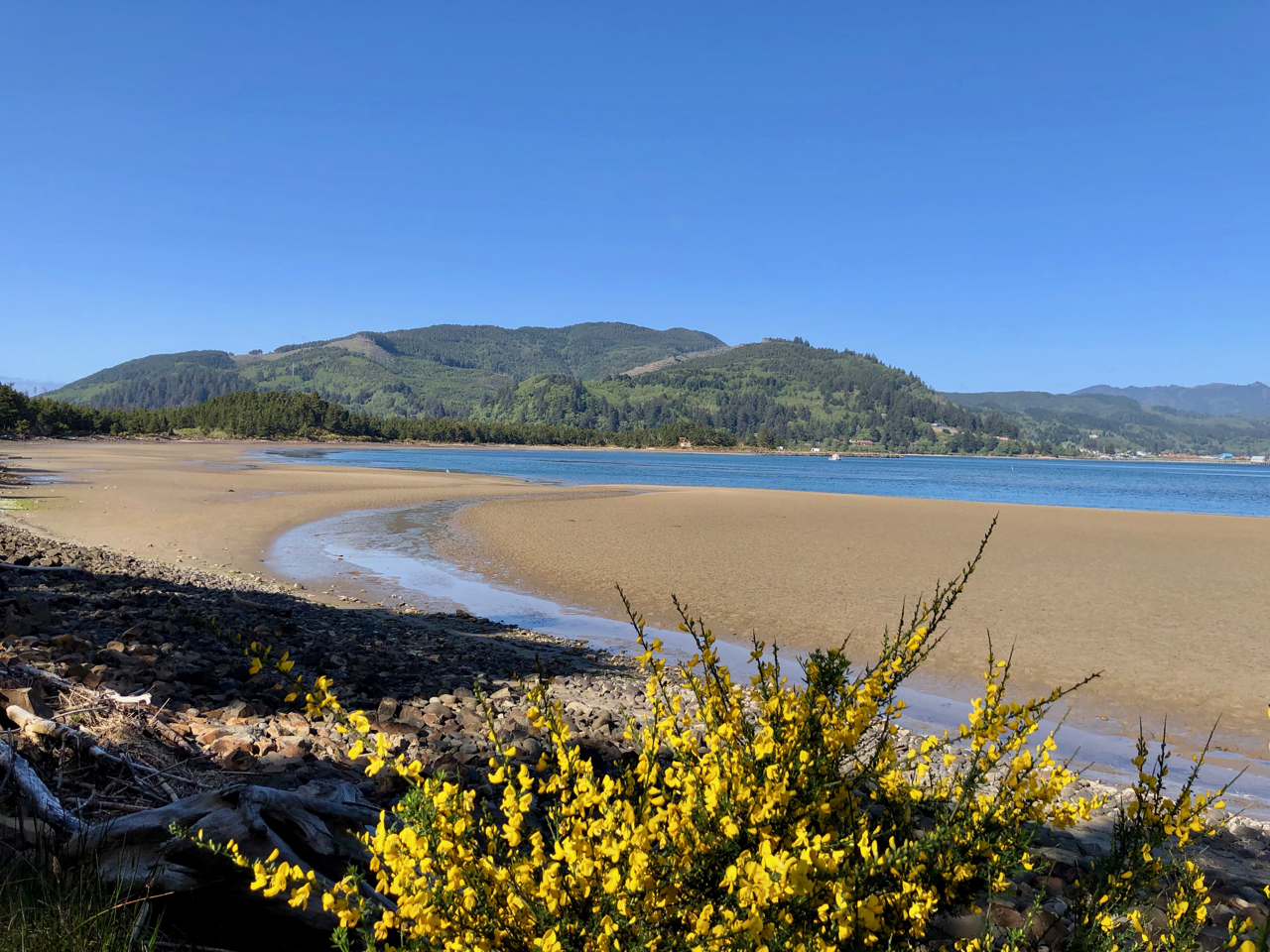 What I found at my destination was an awesome sand dune beach with many great campsite options. This was ridiculously nice. The weather was perfect and I was the only person here on a little slice of land surrounded by many coastal communities.
 I setup camp and Brook and I settled in for a beautiful evening waiting for a possible sunset. Brook had plenty of fun chasing sticks and digging in the sand.
This video captures some of the experience showing Cape Mears in the distance.
Sunset was not going to be great due to the distant offshore cloud bank, but it was still pretty amazing.
Temperature got down to 45 making for a great night for sleep. Brook slept out in the grass and looked wet and sandy in the morning.  We took our time hiking out. I checked out the other trails knowing that I will definitely backpack this spit again. I even found some fresh water which would probably only be available in Spring or Fall. Each time I ventured back out to the beach I had to snap more beach photos.
The tide was up on my hike out which made for beautiful bay side photos.


Scotch Broom dominates the fauna of the start of the spit but it probably provides good soil stability and it is rather attractive.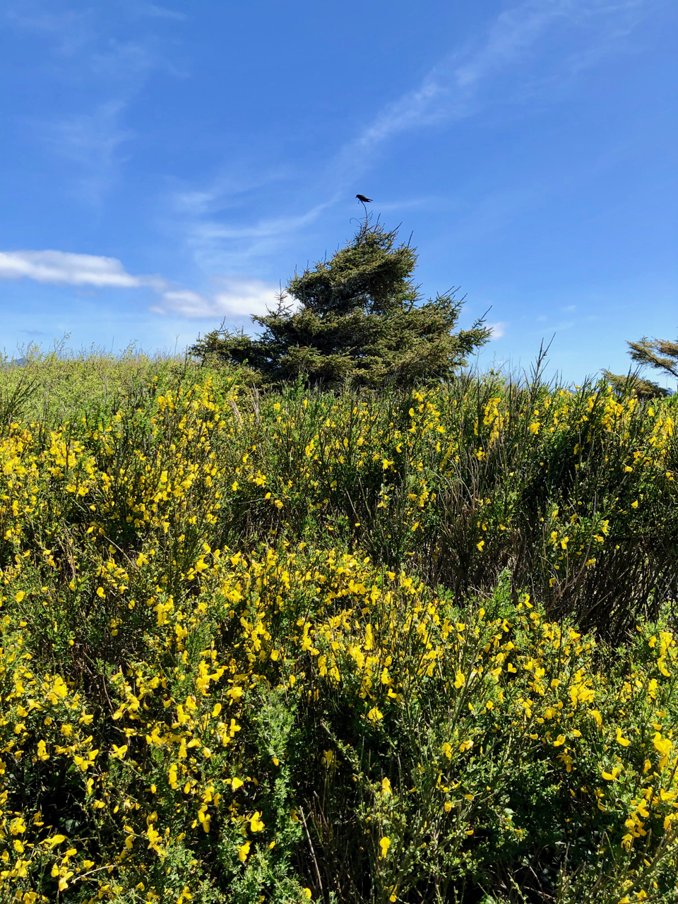
The overall loop is 7 plus miles long and for not having much vertical I still got a really good workout.
Outside my Comfort Zone
 What would be considered a “bucket list” item for me has been the desire to backpack the Lofoten Islands Norway. I saw a photo such as this which caused me to find out where this place was. Somewhere in Norway, OK, referred to as an archipelago, interesting. Then it must have been a video such as this that gave me the full perspective of the Lofoten Islands.
I became a member of the Rando-Lofoten website. Then in late 2018 I received an invitation to join a guided group of up to 20 people for “The Great Crossing of the Lofoten Islands” from north to south. It did not take me long to determine that I could do this. This opportunity dealt with my concern about logistics associated with such a backpacking trek in a land I did not know. There were some administrative details relating to backpacking acumen and liability waivers taken care of in early January. Everything looked good, however, in late January the leader had to back out due to health concerns and the trip fell apart.
The disappointing news was beyond changing my commitment to backpack the Lofoten Islands. The trip organizer allowed all interested participants to communicate with each other to explore possibilities for further collaboration. It turned out that my dream matched up well with a backpacker of similar age from Switzerland. So we plan to meet on July 1st in Svolvaer and will head up to the start of the first segment at the hamlet of Delp. Needless to say I am really looking forward to stepping out of my Western US comfort zone to backpack in one of the most beautiful places on earth. This is above the arctic circle which will mean 24 hours of sunlight. Travel will include 4 flights and a ferry ride each way. But I have given myself up to 16 days in the islands with a few days reserved for Oslo. The Adventure Continues
Checkout these 360 panoramic photos from throughout the Islands.

Great PNW Multi-day Backpacking Loops
I have been putting together an annual multi-day backpacking loop trek for my friends for the last 8 years. The goal was to find a 4 or 5 day trek of moderate difficulty based on a loop to simplify travel logistics.
The first trek was through the Sisters Wilderness in 2011 and during each trek we would ask other backpackers what they thought was another great loop option. This advice truly led us to discover and confirm the finest multi-day backpacking loop treks in the Pacific Northwest. Since I have answered this question for other backpackers through the years I decided to create post to highlight these loop treks. The order presented is based on the order in which I discovered these treks. Please feel free to share your similar favorite loops.
Three Sisters Wilderness
Husband Peak coming down Separation Creek
There is a 50 mile loop that encircles the 3 Sister Peaks, however, I selected an approximate 35 mile route that starts from the Lava Lake Trailhead and cuts through between the Middle and South Sister peaks. This was my first multi-day trek for which I named the post “No Pain No Gain“, reflective of efforts and rewards of backpacking. The route adhered to the 4 to 5 day goal while adding the challenge of being up close to the Sisters. I would recommend the clockwise route with attention paid to water availability on the first day. Camp Lake through to the Chambers Lakes typically presents the challenge of climbing through snow but you need to experience the view from up there. You have to time this trek to allow for the snow crossing while also taking in a maximum floral display without too many bugs. The east section which is the PCT takes you through lush forests into lava fields. Passing through the restricted Obsidian area is not a problem, however, you want to time your climb over Opie Dilldock pass during the cool part of the day. The Mattieu Lakes near the start and finish offer good rest options. You could also consider doing this loop from the Pole Creek Trailhead.
Eagle Cap Wilderness

Glacier Lake – Eagle Cap
The Eagle Cap Wilderness was enticing, however, piecing together a loop was not as obvious. I settled on using the Two Pan Trailhead to enter via the Minam Lake Trail and returning via the East Fork Lostine Trail while taking in all of the options provided by the Lakes Basin area. This loop requires crossing the 8548′ Carper pass to settle around Mirror or Moccasin Lakes. Here you have the option of expanding the loop up and over Glacier pass through Horseshoe Lake to Douglas Lake. Or you could just base from the basin area and do a few day hikes to fill your trek. Either way you must experience Glacier Lake. The lakes here are deep and can provide some good fishing. You come out completing the loop via the East Fork Lostine Trail with a shrinking awesome view of Eagle Cap.
Goat Rocks Wilderness

Valley below Goat Lake
Goat Rocks should end up on everyones list, however, with that popularity come the weekend crowds. The loop option is fairly defined with a starting point at the Berry Patch or Snowgrass Flats Trailheads. It could be treated as a 2 day loop, which is why you include spur hikes north & south on the PCT. Whether you go up Snowgrass or Goat Ridge Trails you will be doing the bulk of the climb and you typically will deal with the worst of the mosquitos and black flies. I like the Snowgrass Trail to the Bypass Trail over to the PCT. Once on the PCT portion of Goat Rocks you have access to Cispus Pass south or Old Snowy north which is worthy of a few nights. Then head over to the Lilly Basin Trail which takes you to the Goat Lake area. The lake is generally iced over, however, the campsite options around there provide an awesome view of the valley and Mt Adams. You may want to hike up to Hawkeye Point and you should be treated to herds of mountain goats above Goat Lake. Your hike out via the Goat Ridge Trail is essentially downhill.
Spider Gap Buck Creek Loop
The Glacier Peak Wilderness provides a classic 36 mile backpacking loop that takes you up a glacier to Spider Gap past the Lyman Lakes then over Cloudy and Suiattle Pass by Fortress Mountain and over to Buck Creek Pass and Liberty Cap. This trek is probably the most true loop and it may be the most challenging especially getting up to Spider Gap. You start at the Phelps Creek Trailhead and head up the Phelps Creek Trail as far as you can in preparation for the climb up the Spider Gap Glacier. Camping near the Lyman Lakes sets you up for the next climb to Cloudy Pass and then around to Suiattle Pass where you get your first glimpse of Glacier Peak. If time and energy allow you should consider including a visit to Image Lake along Miners Ridge. As you work your way around to Buck Creek Pass, Glacier Peak is positioned prominently to the west. Find a campsite with a view of Glacier and take a hike over to Liberty Cap. The final hike out is relatively easy from there.
Timberline Trail Around Mt Hood

Mt Hood
This is a great loop trail around Mt. Hood with views many other mountains. I have decided to do this loop every year because it is so perfect and it provides me with a gauge for my overall health. The TT is approximately 40 miles with a number of potentially challenging stream crossings. The elevation low point is near Ramona Falls at about 3300′ with a high point on the east side at 7350′. There are many choices for a starting point with the most common being at Timberline Lodge. Clockwise is the more common route from the lodge on the PCT which takes you by the Zig Zag Canyon where you should consider detouring up to Paradise Park for an evening. Crossing the Sandy river may be the most challenging before you take in Ramona Falls. The PCT offers you a couple of options, I like the one up toward Yocum Ridge over to Bald Mountain before you head up the Timberline Trail toward McNeil Point. On the north side you cross through some old burns but the beauty is everywhere. Once past the Cloud Cap TH you climb to above tree-line typically crossing many snow fields. Copper Spur is a side trip option and then you work your way down to Gnarl Ridge. All of this area is arid and treeless. Cross Newton creek, pass some waterfalls and head through Mt Hood Meadows Ski Area. The final push is to cross the White River and then climb back up to Timberline Lodge. This final climb can be challenging due to the sandy trail and exposure.
My Annual Timberline Trail Trip Reports: 2017 2018 2019 2020 2021
I hope these backpacking loops help you find that perfect trek.
A recent loop that I have just completed does deserve mention, however, it is more difficult than my top 5. It is the Devils Dome Loop in the North Cascades of Washington.
I will also throw in another option which is partially a loop, The Wild Rouge Loop diverges from the primary Rouge River Trail up to Hanging Rock.
I am moving to Grand Junction, CO, where I have targeted the Four Pass Loop in the Maroon Bells – Snowmass Wilderness to potentially replace my Timberline Trail Loop Annual Trek.

Grand Canyon Boucher Trail
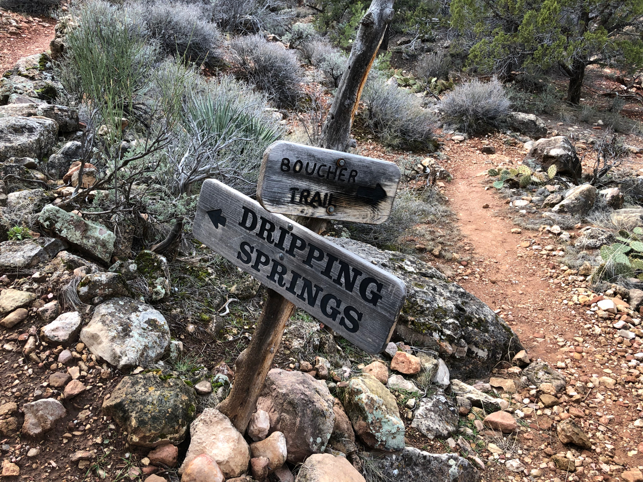 My Grand Canyon Trek turned into the GC Boucher Trail Trek. Instead of 4 nights from Boucher to Bright Angel it ended up as 3 nights on the Boucher Trail. I had planned the trip based on my ability, however, I took on a backpacking partner who had difficulty and by the second day it was obvious we were not going to be able to keep our permit destinations. Hence, a GC Ranger modified our permit which basically turned us around. However, we did get 3 glorious nights on the Boucher Trail just above the Tonto Shelf.
The pre-trek plans went well. We got to the rim around noon, checked in at the Backcountry Information Center, took the Red Shuttle to Hermits Creek Trailhead and hit the trail around 2:30.
Hermits Creek Trail
Of course the first day started to dictate that we were not making the time we would need but I still had hope. The first night we ended up about a mile before Yuma Point with an excellent campsite and view of the Grand Canyon.


I was able to get water out of the potholes in the rocks. Weather was good but during the night the winds roared and based on the positioning of my tent I had an active night trying to keep my main tent pole from snapping. This is all part of backpacking, loss of sleep is only a minor problem. I did learn that cacti quills could penetrate hiking pants but I did enjoy the desert flora. The second day would now be tough if we were going to make it to Hermits Creek. The known challenges were the 2 black diamond descents that we would have to navigate. The tougher of the 2 descents at the Turpentine Canyon was truly a challenge, but I kind of liked it. Sure it was steep but it was no real problem unless you were not prepared.

My partner had a bad shoulder and some equipment problems which impacted his ability to make good time. It became obvious after this first descent that we were not going to make Hermits Creek. I opted to spend the night at White Butte to take advantage of the spectacular view.


Not only did we get the view but it was one of the most awesome star gazing nights I have ever experienced.

The next morning we met a GC Ranger who I worked with to salvage the trip, However, Hermits Creek was booked so we had to turn around. Thankfully the ranger allowed us another night before hiking out via the upper Hermits Creek Trail.
We spent our last night at the Yuma Point overlook taking in some nice sunset and sunrise views interspersed with rain and more wind during the night.
The hike out started out fine with the rain stopping around 8:00 am, however, the winds really picked up as we climbed out via Hermits Creek Trail.

Last morning in the Canyon
Near the top the winds were so strong we could hardly walk. The Hermits Creek to Boucher Trail is actually quite nice, however, it does have some scrambling.


The real value of this area is that nobody is there.
All in all it was a good trek with good immersion into the canyon, however, I will probably return someday to do my original plan.

Timely Documentary “Into the Canyon”
It is so timely during the Grand Canyon National Park’s Centennial Anniversary that the documentary, “Into The Canyon”, produced by the The Redford Center is now being shown on the National Geographic Channel.
In 2016 filmmaker/photographer Pete McBride and writer Kevin Fedarko set out on a 750-mile journey on foot through the entire length of the Grand Canyon. INTO THE CANYON is a story of extreme physical hardship that stretches the bonds of friendship and a meditation on the timeless beauty of this sacred place. It is an urgent warning about the environmental dangers that are placing one of America’s greatest monuments in peril and a cautionary tale for our complex relationship with the natural world.
 Timely as well because next week I will be backpacking on the South side of the Grand Canyon for 5 days to go from the Boucher Trail to Phantom Ranch and then out or up to the rim. But this documentary is more than just a trip log for the 750 mile trek through the Canyon from East to West. It is a great story about two friends who continue to take on adventures like this even if it means stretching their skills to the limit. Pete McBride is my kind of guy, no adventure is to large, while Kevin Fedarko provides the reality check and they end up complimenting each other for the good of the adventure. For backpackers the documentary is very realistic about the trouble you can get into. Thankfully for this team they have plenty of logistical support, but it is still realistic enough to be able to relate to their trials.
I am a Northwest backpacker where I primarily backpack up mountains. The Grand Canyon is about descending to the river. I first visited the Grand Canyon as a typical rim tourist last year. Even then I was not overly interested in taking it on as a backpacking trek. But as usual I watched a few videos and my interest was peaked. I started researching trails and connecting with forums to acquire the base information needed to commit to a trek which basically means I had to figure out where I would hike and camp daily so that I could submit a request for a permit. This was a bit challenging until a NP Ranger responded with some advice to allow me to select a trek route that a couple of old guys could accomplish.
The documentary takes on the Canyon from the extreme Northeast through to the end in the Southwest. My route reflects many of the challenges for which they encounter, however, I will be in a popular and somewhat supported section. It was great to see areas to the NE and SW of this main area for which I may very well need to return for future adventures. I like how they refer to the western section as the GodScape, however, as they progress west they also expose the over saturation of the helicopter tour business. The documentary also exposes the environmental concerns that have arisen from Uranium mining operations near the rim. I will have to deal with this by having to avoid acquiring water from certain uranium contaminated creeks.
Overall I highly recommend this documentary even if you are not a backpacker. The scenery is breathtaking and the message is important. And again I thoroughly enjoyed watching these guys make mistakes, because backpackers can relate.


