Category Archives: Pacific Northwest

Smokey Goat Rocks
If I had not experienced Goat Rocks in perfect conditions 4 years ago I would have been more then satisfied with my recent visit, however, the smoke, heat and bugs did detract a bit from the overall experience. We were originally going to enter Goat Rocks from the north doing a loop by Lost Lake with a return on Trail 61 at Tieton Pass.

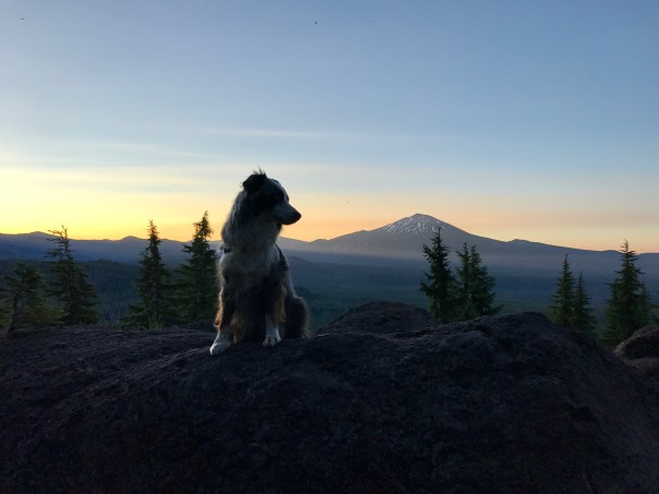
Old Smokey from Goat Ridge
However, the Miriam Fire was too much of a risk so we entered from the Berry Patch Trailhead via Goat Ridge and out by way of Snowgrass Flats. I would recommend the reverse direction entering on the Snowgrass Flats side since the climb is more gradual.
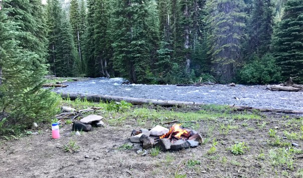
We got a late start so we were looking for a place to camp as we approached Jordan Basin but we needed to find water which first comes available as you leave the trees. The climb on a very hot Tuesday afternoon with many bugs was a bit of a challenge.
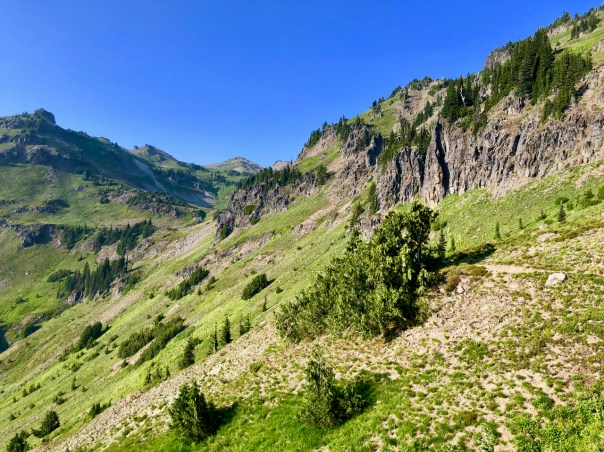
Approaching Jordan Basin on the Goat Ridge Trail
Camping on Goat Ridge turned out to be really nice with the view down the valley with a smoke laced sunset.


We knew what campsite we wanted near Goat Lake so the relatively short hike over on Wednesday would give us a good shot at getting the spot below Goat Lake next to the water fall. 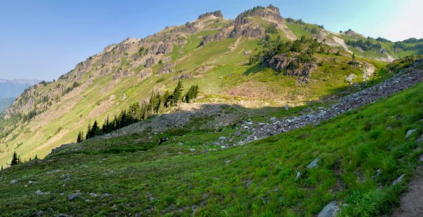 Actually the Jordan Basin offers a number of great campsites as well as good options above toward Hawkeye Point.
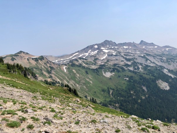
Old Smokey From near Hawkeye Point
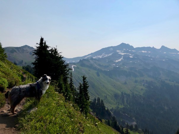
Brook @AussieBrook was in heaven taking care of her herd of humans.
Coming over the pass to Trail 86 we realized that smoke was going to keep us from the fabulous views of Mt. Adams.
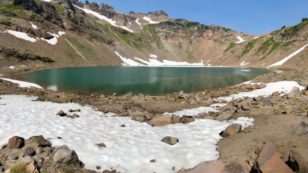
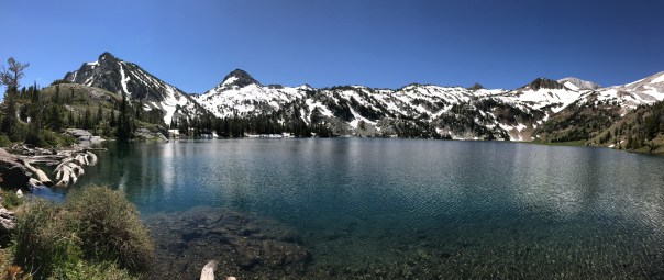
A Pan of Goat Lake
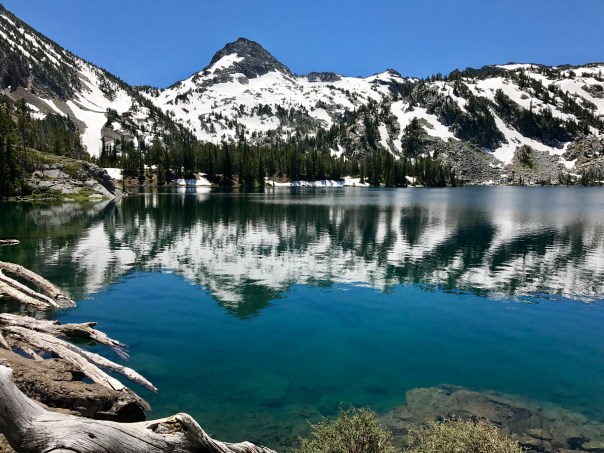
Goat Lake still had some ice which ensures that the water is as cold as it can get.


From our campsite the view down the Goat River Valley should be topped with a view of Mt. Adams.

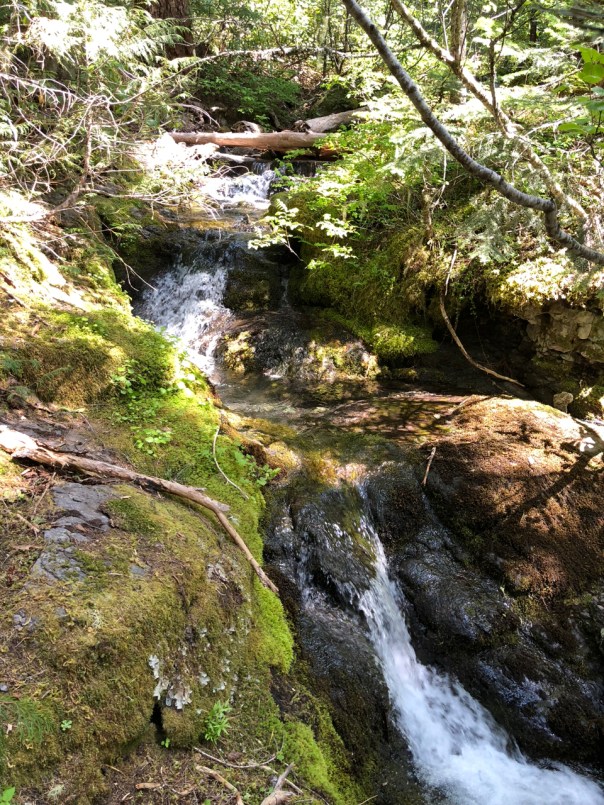
Last Snow Bridge
It was still a fabulous view and the stream to water fall offered a cool little canyon to help fight the heat. Wednesday evening we were treated to a good view of about 20 mountain goats above us.

Good to see the Mountain Goats
We ended up staying at this campsite for 2 nights as we use the days for day hikes to Hawkeye Point and over to the PCT. Actually we were planning on going to Old Smokey, however, the smoke was really bad on Thursday so we turned around at the PCT junction at the bypass trail. We were planning on camping Friday over toward Cispus Pass but again the smoke, heat and bugs convinced us to just cut the trip short and hike out on Friday.  The morning sunrise was sprinkled with sunbeams through the smoke. The hike out was essentially all down hill with a ridiculous number of flies bouncing off our bodies.
 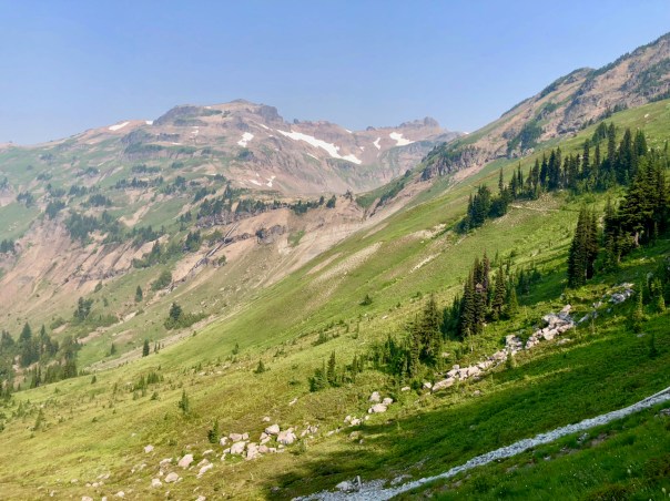 We did feel sorry for the many backpackers coming into the Goat Rocks area on Friday since the area was already full of people.

Last view of Goat Lake Basin
Hopefully they got a little rain from the front that was coming in, maybe it would even clean out the air for that exception view.

Suiattle River TH to Rainy Pass
Another one of those trips that I was denied in the past due to unforeseen events, in this case the Blakenship fire in 2015 that closed the PCT.

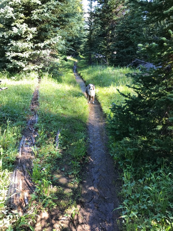
Suiattle River Trail
So I return to take it on starting at the Suiattle River Trailhead with Rainy Pass as the destination about 58 miles with a stop in Stehekin where a couple of buddies will join me. This trip was made possible thanks to a good friend who gave me a ride from Rainy Pass where I left my car to the Suiattle River TH. I had been on the Suiattle River Trail a couple of times with a great trip to Image Lake, so the first part of this trip was all prep for the climb over Suiattle Pass and on to Rainy Pass.
@AussieBrook and I got to the trailhead late Saturday June 30th but was still able to make it to Canyon Creek for the first night. It rained most of the day, but I was sparred from the rain for most of the hike.

Suiattle River Trail Slide
I was impressed with the work done to allow passage through a recent tree slide that blocked the trail. Overall the Suiattle River Trail is one of the finest in Washington.
The goal for Sunday was to get close to Suiattle Pass to prepare for the crossing the following day.

PCT Closure Sign from 2015
I ended up camping at Miners Creek PCT mile 2549. It was a damp day but again I was sparred from getting wet. Once I got on the PCT I started to encounter the first of the SOBO hikers. At my eventual campsite I met a young man who had been a HS Math Teacher but was now going to hike to Mexico. Unfortunately he had just come off a tough night where he had to make camp on a tuft of snow on Suiattle Pass due to a headache and darkness. I will give that young man a 50% chance of completing the PCT. From these hikers I did learn that there was a lot of snow on Suiattle Pass but at least I should be able to follow their footsteps. I was thinking a mile of so of snow. It was a bummer to wakeup to rain knowing that I would be hiking through snow. After I began my decent north from the pass into the Agnes River drainage I met other hikers who alerted me to the additional 4 miles of snow ahead.

Campsite Morning Sun
Overall it was about 5 miles of snow with occasional trail breaks. The snow was soft and footing was treacherous, I went down many times. But what a joyous day of rain, wind and snow. And to finish off the day I got to ford a cold stream. I ended up camping at a great established campsite at PCT mile 2557. Checkout this video of Brook scratching her butt. We were fairly soaked but the skies did clear and we woke to relatively dry sunny conditions.
I was so glad that I had started a day early then I originally planned since now I had the option to go to Stehekin on the 4th in preparation to meet my buddies on the 5th.


Plus this stretch along the South Fork of the Agnes was all down hill so we had an easy day except for a treacherous ford at PCT mile 2559.  Normally I might put on my crocs for a river ford but this river was roaring and my boots were already wet so I just sloughed my way through. Unfortunately, this river was flowing a bit too strong for my 35 lb dog, Brook. She got fairly nervous as I crossed first to leave my pack in order to come back to lead her. Nope, the current was too strong so I ended up carrying her across. From here on the sun was shining and we started to dry out. Ended up at a nice campsite PCT mile 2564.
Brook was in heaven chasing the many squirrels up trees that were far enough apart to prevent their easy escape.


She tormented the squirrels all waking hours that evening and the following morning.


July 4th we hiked to High Bridge enjoying huckleberries and then catching a ride with a park worker and hit the Stehekin Bakery for lunch.  The weather was superb so we thoroughly enjoyed our 24 hrs of rest. I wanted to go to the Ranch for dinner, however, they couldn’t really accommodate Brook. We ended up camping in the Lakeview campground with a Mountain House meal of Beef Stew before hanging out on the deck drinking beer with the many SOBO backpackers.

Lake Chelan
Also a big thank you to the store manager who was extremely accommodating for all and sold bottle of beer for $2.50.
July 5th my friends; Bob and Pete, arrived on the Lady Express boat at 11:00 am and I made them deal with the National Park campsite permitting for our remaining nights on the PCT portion of the trail inside the NP boundary up to Rainy Pass. We hit the trail in the heat of the afternoon which turned out to be the hottest day of the trip.


We only went about 5 miles to Bridge Creek Camp but with it being uphill it was a good workout.
The following day was again a climb but a beautiful lunch stop at the confluence of Bridge and Maple Creek offered a trip highlight.
We camped that night at Six Mile PCT mile 2583. We had some short rain periods to deal with along with more hungry mosquitoes but we woke up ready to finish the trip on Saturday 7th.


The final stretch offered many scenic views along with a number of interesting stream crossings. Since I had to take my buddies to their car in Chelan, I took the opportunity to stop at the Washington Pass Overlook to take in the American Alps.


Bull of the Woods
My first backpacking trip that I took when I moved to Oregon in 2004 was on the Dickey Creek Trail.  I think I found it in a book of hiking trails. It was good but I never got high enough to discover the vista views that are abundant in the Bull of the Woods Wilderness. The ridges that surround the Fire Lookout Tower offer great views. So it was time for a short backpacking trip and the Bull of the Woods area caught my interest.
  Surprisingly I was not finding that many good trip reports but it did look like the Pansy Lake Trailhead would be a good bet to launch. It appeared that I had a number of loop options but those diminished as I discovered the trails that were not being maintained. I discovered that the Mother Lode fire in 2011 severely impacted the area keeping me from venturing further south. So I adjusted my trip to camp the first night at Lake Lenore and then evaluate if there was more to see for a second night. Link to FS Map with my Route
Hiking to Lake Lenore was a fairly difficult 4.7 mile trek with plenty of vertical and some snow to navigate. The trail was in good condition except for snow on the drop down to the Lake Lenore Trail. There is a nice overlook just after Pansy Lake which worked out well for a lunch break. After that you would occasionally get great views of Mt Jefferson. Once you got to the junction for the Bull of the Woods Trail and the the Mother Lode Trail #558 you got your first view of Mt Hood.


Continuing on to the drop down to the Dickey Creek Trail junction for the Lake Lenore Trail, I had to navigate a fair amount of snow but nothing difficult.


I was planning on camping at the Lake Lenore, however, that whole area below the last ridge was burned from the Mother Lode Fire.


I decided to camp on the ridge which turned out to be just beautiful, but I needed water so I had to hike down to the lake. This hike for water was quite a task as the trail was almost nonexistent on a very steep grade probably due to the fire damage. The forest floor is recovering with small plants but it has a long way to go before trees reappear. Camping on the ridge is a nice option, however, very little flat area for a tent.
Mosquitos are an issue in the Bull of the Woods which is another reason why you may want to camp on high ground where you have a bit of a breeze. But I also love to camp high up with a view and this one gave you the Oregon Cascades.  The next day was focused on visiting the Fire Lookout Tower with the option for another night but the options for this area really lean towards a single night trip. The hike back to the fire lookout tower is mostly a return to join the Bull of the Woods Trail.
  The tower was perfectly located to provide a view of any fire activity from the Sisters to Mt Hood. It is appreciated that the tower is protected in the National Historic Lookout Register. I was the only human at the tower so I thoroughly enjoyed just hanging out taking in the view for a few hours. I took many photos and as with my previous night’s campsite there is fairly good cell service here which I believe is received from Mt Hood. With the cell connection I was able to do a live video on facebook to let all my friends back in the midwest get a taste of the wilderness.


I thought about camping another night but it was early afternoon meaning I needed to accomplish more. I considered another spot down the Bull of the Woods Trail but ended up deciding to head for home by way of cut over trail to the Pansy Lake Trail.
Stream near Pansy Lake Trailhead
Here are some flower memories.


This trail did have a number of downed trees but none were a problem to climb over. Back to the car and ready for the drive out on NF roads that are in great condition.
Here is a nice post about the History surrounding the Bull of the Woods Fire Lookout By Cheryl Hill, Board Member, Trailkeepers of Oregon

Publishing a Photo Book

A high school classmate of mine, Susan Clark, proposed to me that I should create a Photo Book of some of my backpacking pictures. Susan put together a template which made it much easier for me to jump in and it has been a lot of fun working with her on this project. The goal was to produce a Photo Book focusing on the images and use enough space to tell the story. The story took on a bit of a motivational message as to why I backpack drawing from my Strong Finish post. So we have ended up with about a 30 page Photo Book with enough story to help one understand where the photos are from and a bit about some of the unique reasons why I was there. And I will admit that I am very pleased with how it turned out thanks to the power and flexibility of Apple’s Pages word processing program. It mostly takes place in 2015 ending with a very dangerous trip I survived on the Lost Coast Trail of Northern California.
At this time I am not sure how many books I will print or exactly what size the book should be, but cost is steering it toward an 8.5×11 landscape for about $25. If you want to buy a book feel free to influence me on how many books to print by sending me an email: ghsmith76@gmail.com.
The book draws images from many of my blog posts such as: Three Sisters, Eagle Cap, Goat Rocks, Three Sisters PCT, Timberline to Gorge, Spider Gap, Stevens to Snoqualmie Pass, West Coast Trail, Jefferson Park, Paradise Park, Elk Mountain and The Lost Coast Trail.
* UPDATE * I have received the Second Proof Book on better paper and I like it. So it looks like we have a book to sell. The book costs me $30 and I figure I can send ti to you for $5 so the cost will be $35.


* UPDATE * Alright, my book is available for purchase at amazon for your Kindle or Kindle App. It was very interesting going through the process of publishing a book using Amazon Kindle Direct. All the work was done in creating the book for print. I was then able to use that file to create the Kindle eBook. The price range allowed by Amazon was $2.99-9.99, so I made it 2.99. Then it was interesting to see how they handle the royalties. They pitch the fact that they offer 70% royalties, but that also means that they take 15 cents per MB of download and my book is like 150 MB so it would cost me $21 per book to get 70% royalty. So of course I chose the 35% royalty option. Obviously this type of fee structure does not favor a photo book. Not that I cared about the royalty, but interesting to learn this industry. The important thing is that the book is easily accessed and the photos will look best on a digital display.
Amazon Kindle Link: “A New Path: Finding My Passion in America’s Wilderness“
I do hope that you enjoy this book. Join me in the journey around the Pacific Northwest. The book may look best if viewed on a Computer or a Tablet.

Assuming all of this process continues to be positive I would bet that there will be at least one more book highlighting my backpacking adventures with my Australian Shepard backpacking buddy, Brook @AussieBrook.

Rogue River Trail from Grave Creek

When the backpacking stars align you have to go. Got back from a nice trip to Arizona with a Grand Canyon visit highlight to realize that the weather was perfect for a Southern Oregon backpacking trip on the Rogue River. Since I did the Wild Rogue Wilderness Loop a couple of years ago I was looking at the East end of the Rogue River Trail. I thought about starting at Marial and hiking up river, but the thought of that 2 hour drive on a terrible road with Brook convinced me to just start at the Grave Creek end and hike until I felt like turning around. We ended up turning around at Kelsey Creek at 14.3 miles. Overall a very leisurely 4 day 3 night 29 mile trip in perfect weather. However, the ticks were bad but not much poison oak on this part of the trail.
We got started at about 2:00 pm and ended up 7.1 miles at Slate Slide. The Rogue River Trail is in great shape and the frequent views of the river valley are as good as it gets.


All by ourselves next to the river was perfect for Brook not to feel like she needed to watch the trail. We found a washed up rubber soccer ball that Brook played with all night. One bummer though was not appreciating how sharp the slate was until I punctured my REI blowup seat cushion. We slept in until the sun dried out our tent, got on the trail by 11:00.
 The second day again brought perfect weather and trail conditions. I knew we were about to descend in elevation just before getting to the Meadows Creek area so I decided to camp at a clear area above the trail at about 13 miles behind a very old Madrone Tree. I had decided that we would head back up river the next day due to concerns about ticks.
I setup camp and then took the daypack to hike on to Kelsey Creek. I was impressed with the Meadows Creek area for great camp sites. Tonight’s campsite was more in the trees above the trail so I had some issues with Brook wanting to monitor trail traffic, but she is all bark. I think we may have stumbled upon a relatively undiscovered old cabin foundation near our site.


Above was a larger clearing where a stream looked like it was diverted to multiple channels for irrigation. The old cabin had a fireplace foundation and the outline of a wall foundation. We found an old stovepipe and various other metal items. It was kind of cool envisioning what it must have been like living there.


The next morning we hit the trail by 9:00 am enjoying another perfect day, maybe even a little warm. 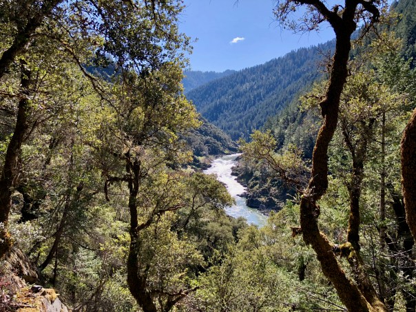 We stopped at Slate Slide again so Brook could play with her rubber soccer ball. While there a number of rafters pulled in to take advantage of the eddy’s to cast a fishing line with good results.
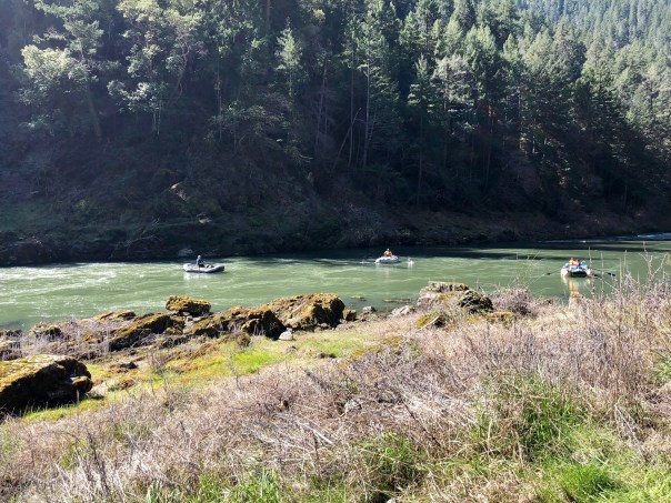
My plan was to camp at Whiskey Creek, but I spotted a cool looking river site at Doe Creek so we traversed down to setup camp. This area turned out to be primo and we selected a nice area on grass near the river. A couple of women with a dog from Bend shared the upper part of the river area.


We settled in around 2:30 and took advantage of a beautiful warm afternoon to relax. Ducks were competing for river space, fish were jumping and a bald eagle was buzzing us. It doesn’t get any better then this.


Brook was exceptionally photogenic since she was extremely relaxed.


After a good meal we continued relaxing until the sun went down and the temps dropped. It was so nice I took a lot of videos to attempt to capture the experience. The moon was almost full so I left the fly off my tent to enjoy it. It was interesting watching Brook totally case the perimeter after I went into the tent. She is very committed to her role as protector. The dew turned out to be very heavy so I had to put the tent fly on around 1:00 am.


Morning was beautiful with early sun to dry things out. We checked out the historic cabin at Whiskey Creek, it was impressive. Overall this was an excellent backpacking trip.


North Fork Smith River
The Olympics were over and Brook and I needed to get into the wilderness so the window of good weather on Feb 26-27 looked like our chance for a getaway.

View from BLM Rd 28 where I got stuck in the snow.
I had read the few other posts which started at Kentucky Falls to understand that the roads to this area were confusing, but Google seemed to know how to get me there. Yes, and of course No, The Google route tried to take me over the mountain on BLM Road 28 but the snow storm the previous night put an end to that option. It was a beautiful view where I got stuck in the new wet snow and I did have cell service for the possibility of a rescue, but I was not to be embarrassed by this misfortune. I put on my chains and dug out the snow with my window scraper to eventually b able to turn around. My only suggestion for the route to either the NF Smith Trailhead or Kentucky Falls from the East would be to go by way of Mapleton, OR.
 I finally arrived at the trailhead and set out on trail by 2:00 pm. It is supposedly only 6.5 miles to the lower Kentucky Falls which was my intended destination. The trail is nice, seems like you hike on moss most of the way. The scenery here is your typical coastal mountain rain forest which gives you every hue of green and brown. This trail must have been waiting for the Forest Service to build the two new bridges across the Smith because I had not found much information on this route. All was good, late February and Brook and were on the Trail Again.


The first new bridge at about 1.7 miles was impressive and much appreciated. Once crossing over to the other side you climb and are presented with some great views of the river valley.
At about mile 3.5 you get to the second new bridge.

Second New Bridge
Shortly there after you are presented with an important fork in the trail. The seemly main trail to the right heads down to the river where I aborted due to river flooding. You get pretty twisted around so I thought I was heading up river. So when I came back to the fork and headed up the other trail thinking it was some optional route I was actually back on the trail I wanted.


I was using the Forest Service map but I was not reading it correctly because in my mind the trail to Kentucky Falls was impassable. So I followed this correct trail to about mile 5.0 looking for a campsite. The terrain is steep and the trail was getting more precarious but I think it was probably fine if I had known where I was. It had been a tough day, but I sure am disappointed in my getting confused. Anyways, it was raining and getting late so I turned around and ended up finding a campsite back below the second bridge at about mile 3.2.

Oh well, I will definitely have to go back to finish this trip to Kentucky Falls. It did stop raining but everything was wet and temp was about 35. Plus I was a bit tired.  Brook and I settled in and I was asleep by 8:30. One of the best sleeping nights I have had on the trail. Brook decided she needed to sleep outside. Morning broke to clear skies.
  We got back to the car by about 10:30 and I decided we should try to drive up to Kentucky Falls. And guess what, we got stuck again in the same heavy wet snow. Overall this was a failure with regard to reaching intended destinations, however, I have gained a good understanding of the area and I’m very impressed with the potential for other hikes because the terrain is fabulous.

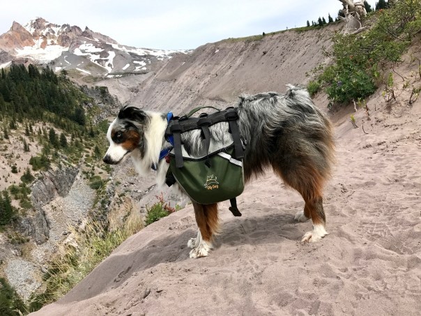
Timberline Trail

Starting out at Timberline Lodge
Everything came together for the perfect backpacking trip around Mt. Hood. The previous week was about heat and smoke from various forest fires burning in the state, but then the winds shifted to blow the smoke to the east, temperatures dropped and the stage was set for backpacking the Timberline Trail in perfect weather. Brook and I hit the trail mid morning and who do we see at the registration box,

Randy “Rebo” Berton
Randy “Rebo” Berton. I got to spend some trail time with Randy who was headed to a PCT Meetup at Bridge of the Gods.
I didn’t give much thought to the track the Timberline Trail would lead me on, but what did catch me off guard was that by starting out from the Timberline Lodge you basically hike downhill for the first day as you head to Ramona Falls.
Above Little Zigzag Canyon
This downhill did test my knees a bit which is something that I have never had to worry about before.

Map with Campsites
Hiking below Paradise Park we had to navigate a number of fallen trees, but nothing too difficult.

Sandy River Crossing
We ended up camping at the clear stream just before the Sandy River crossing which I would cross the next day. The Sandy turned out to be the most challenging of the many water crossings. I wasn’t sure how Brook would navigate it so I went ahead and waded so not to influence her into walking the narrow tree bridge. Brook now makes her own decisions on how to cross streams and she decided to wade the first part of the Sandy. I was fairly impressed with her since the current was trying to sweep her under the tree and she really doesn’t like to get wet.
A short distance after the Sandy you are rewarded with Ramona Falls, one of the most unique and beautiful cascading waterfalls I have ever seen.

Ramona Falls

Bridge at Ramona Falls
At Ramona Falls you have 3 trails to choose from which all take you to where the Timberline Trail leaves the PCT. We chose the actual Timberline Trail which does add .4 miles but it was worth it. I have done the Muddy Fork route and it would be shorter but with more elevation change. Overall though, we were looking at a day of climbing which felt good on the knees but really kicked our butts. This stretch is extremely beautiful with an abundance of lush vegetation and stunning views of Mt. Hood. I was hoping to get to the Vista Ridge Trail area, but Brook and I opted for our own private view of the mountains to the north just before the McNeil Point Trail.


Here is an assortment of photos from this section of the Timberline Trail.
Tragedy did strike just after setting up our tent when I was trying to take a little nap. Brook was in the tent when she saw a chipmunk that needed her attention. I unzipped the tent door and out she ran, but pushed off from my air mattress and punctured it with her claw. A major bummer as I realized that I was going to sleep on the hard earth for the next two nights.


However, the views of Mt Adams, Rainier and St. Helens with a sunset and sunrise were stunning.
Day three would include many miles through the aftermath of the 2011 Dollar Lake fire and then past Cloud Cap on to High Point. Another tough day with many challenging water crossings, but so worth it.


The extent of the fire was large but selective offering a unique contrast of dead trees supporting a ground cover of mostly wild flowers. The big concern for this section is the Eliot Creek crossing which I admit to not researching completely. The new trail takes you down to a more stable crossing area but I did not want to add the decent and climb so I hiked far enough on the old trail to see that the old trail was far too dangerous especially for Brook. So from the Eliot Stream low point below Cloud Cap the climb to High Point near 7300 ft was daunting.


The trail options from the Cloud Cap Trailhead are exceptional.  Before hitting the total exposed trail I took a break to refresh my feet in a beautiful stream. I was not sure I would make it to High Point but knew there would be water just before so I climbed light. I really enjoyed the new above tree line terrain, although Brook prefers more shade, but she did have snow to cool off on. A big help was a strong cool breeze that helped push us up to High Point. There were plenty of small snow melt streams all the way up. My goal was a protected campsite just beyond High Point.
  This campsite at about 7300 ft with Mt. Hood behind was perfect. Some hardy scrub trees to offer protection which turned out to be really important that evening.


The views of Mt Jefferson to the south offered a unique observation of cloud formations fed by the various forest fires.
The winds picked up and noisily shook the tent which was detrimental for sleep and scared Brook from wanting to be in the tent. However, it was strange, that it got warmer throughout the night. Going out for a break at 2:00 am was “Way Cool” with the warm wind and the a moonless star filled sky.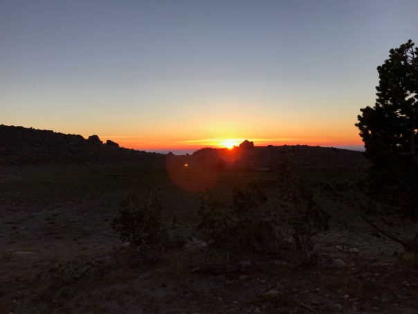 Luckily I woke up for a nice sunrise. Now I was ready for the last 10 miles which started out by dropping from the sky to Gnarl Ridge through Mt Hood Meadows and on to the White River Canyon.


Climbing 1100 ft to Timberline Lodge was going to be tough since my body was telling me that it was spent.


This is when I pulled out my earbuds and let my music playlist get me to the end. A beer and burger at Charlie’s in Government Camp was such a great reward. Overall, I highly recommend the Timberline Trail.

Three Sisters Wilderness on the PCT
I was looking for a 3 or 4 day trip when a friend living in Bend, OR, offered to provide logistical support, so I took him up on providing me a shuttle from the Lava Lake Trailhead at McKenzie Pass to the Elk Lake Trailhead south of the Sisters Wilderness. This would be an excellent 30+ mile trip which had special significance since it would be the completion of the PCT Segment E that I aborted back in 2015 due to the heat.
Brook with Sunrise over Mt Bachelor
I hit the trail late afternoon on Thursday and made it to the top of Koosah Mountain for an evening with a fabulous view and an army of mosquitoes. Waking up to those mosquitoes did cause me to question why I had decided to venture into the Sisters Wilderness at this time.

Mirror Lake
However, I also realized that the lakes region south of the Sisters is a perfect mosquito breeding ground, so it did get better as I progressed north. I also ran into more snow as I got closer to the Sisters. Snow was not a detriment but rather refreshing. It was also a bit early for great flower presentations, however, there was plenty of color.
I camped the second night at Hinton Creek which provided a beautiful view of the Middle Sister and meadows for Brook to monitor wildlife activity. She also had a lot of fun playing in the snow around our campsite.


The next day we would hike through Obsidian Limited Entry Area where I knew I might want to soak my feet in the headwaters of the Obsidian Falls stream.


I took my time progressing through the area enjoying the scenery. I had a feeling I would camp the next night at Sawyer Bar and it turned out to be better then I had remembered it.

Brook at Sawyer Bar
A perfect campsite between forest and lava, plus the mosquitoes were not a problem.
The last day offered up the climb over Olie Dilldock Pass which is a unique experience hiking over lava fields.


Always best to do this pass during the cooler portion of the day. In the heat it can be referenced more to this quote from Ted Ricks “I looked back down over the lava cinder river below us with heat rising off of it…and thought of Dante leading Aeneas out of Hell…”. The views of lava rock sculpture and the distant mountains: Washington, Three Finger Jack, Jefferson and Hood make it one of the highlights of the trip. Once over the pass it is an easy hike to the Lava Lake Trailhead passing by the Matthieu lakes. There was a nice “Trail Angel” couple celebrating their 29th wedding anniversary at the campground prepared to serve the PCT through hikers. Unfortunately very few through hikers had made it this far north yet.

West Fork Wallowa River Trail – Ice Lake
I knew heading into the Eagle Cap Wilderness from the Wallowa Lake Trailhead that I may not be able to access my desired objectives but the unknown is just as alluring.

Ice Lake
I got a late start after dropping my wife off at the Fishtrap Writers Conference ending up where the trail to Ice Lake splits from the West Fork Wallowa River Trail.

Brook is not sure about this
I bought a new REI lightweight day pack which I have found is a great way to take on those offshoot trails which typically include a lot of vertical. The climb to Ice Lake is a good steady 2500 foot vertical, so kind of nice for Brook and I not to be carrying our backpacks. This hike is primo, hillside meadows, roaring streams, waterfalls and great views. The reward is a majestic lake in a high mountain bowl.
Ice Lake Reflections
The climb to Ice Lake is packed with photo opportunities, here is a sampling.
Unfortunately about half way up the trail I realized that a blister was birthing on my left heel. No problem, I would stop and put a slab of moleskin on it. Oh crap, I did not transfer my first aid kit to my day pack. This is a moment when a backpacker knows that they have screwed up. I knew that I was gonna pay for my error with a bad exposed blister for the rest of my trip. Oh well, I would be able to deal with it for the rest of the trip thanks to moleskin, but the price would eventually have to be paid.
 My campsite at the base of the Ice Lake trail was great, next to a stream with plenty of wood for a fire and nice benches to enjoy it from. Brook enjoyed keeping the chipmunk and squirrel population under control. Four cute fawns ran through the camp not realizing that they probably shouldn’t be doing that. Thankfully, Brook does not feel the need to chase the larger wildlife.
For the second half of the trip was I was hoping to get to the Lakes Basin, camp at Mirror Lake, even though I knew it would be iced over. I would then do another day hike to the many lakes in the area and then come out after 4 nights in the Wallowa’s.

Six Mile Meadow
Unfortunately the bridge is gone for the stream crossing at 6 Mile Meadow and the trees jammed together would not allow for Brook to safely cross. I talked with a USFS trail crew who confirmed the risk of that crossing and another that you would have to wade through at waist level. So we opted to head for Frazer Lake even though we knew it was also covered by snow.
Trail to Frazier Lake
The trail was not good. Half of it was really a stream and there were many downed trees to crawl over of under. We got to about a mile from Frazier Lake and decided to abort back to a great stream side camps site at the crossing to the 7 Mile Horse Camp.
Sweet Campsite
This actually turned out to be perfect with another great fire right next to a wider babbling stream. Plus the USFS trail crew followed us and took care of all the downed trees, so our return trip was much easier. The hiking options had run out and my raw bloody heel under the moleskin was motivating me to return to Wallowa Lake a day early. The hike out was uneventful and the a little painful, but I had plenty of rewards especially knowing that access was going to be restricted by the heavy snowpack. Brook and I spent a few days in Joseph and Enterprise with a couple of visits to Terminal Gravity for food and IPAs.

Image Lake via Suiattle River Trail

I finally made it to Image Lake and boy was it worth it. On my Spider Gap Loop trip in 2015 we tried to get to Image Lake but had to turn back. After climbing the last 1400 ft from Miner’s Ridge on this trip I would say we made the right decision to backoff back in 2015. But I needed to get to Image Lake partly for fulfillment and partly to push the body into backpacking shape since this was my last weekend in the North Cascades before retirement the following friday. The trip is 32 miles with 4800 vertical with most of the vertical, 3300 ft, from the river trail. I planned on 3 days but I was not sure how it would play out.
The hike into the Canyon Creek campground was a possible first night destination, however, all campsites were taken thanks to a fairly large PCTA work crew. So I hit the PCT going North and saw that there would be a few campsites before the Image Lake Trail.
Shortly after Canyon Creek Brook and I were attacked by “Max” a combination Shepherd and Wolf. All I heard was “No Max” and around the bend comes Max in full charge. Brook got between my legs and held her ground but Max was only about attack. A serious fight broke out at my feet and I believe Brook realized she was not going to win. I heard a dog cry and then Brook took off running for her life with Max in pursuit. I think Brook chomped on some part of Max’s body which freed her for the get-away. Well Max’s owner chased after Max and I followed calling for Brook. Running with a full pack at my age is not what I should have been doing, but my dog was in trouble. After about a quarter mile Max was contained and I headed up the trail looking for Brook. I found her to be safe and injury free. Wow, I did not really say anything to Max’s owner because he knew how bad this was. He said that it was good that Max was tired. I was thinking it was good Brook is so fast. Overall, this was probably a good learning experience for Brook, to know that anything can happen and it is best to stay close to the Human you want to protect. Brook’s trail etiquette is almost perfect, but people don’t always understand how Aussies want to check them out.
Back to the trail with the temperatures rising to about 80 which was taking a toll on my body.  I would have loved to have been able to climb to Image Lake for the overnight view, but I was beat. Luckily there was a sweet campsite just before the trail to Image Lake. I decided to camp there and go to Image Lake the next day with my new lightweight day pack that I just bought at REI. This was the first time in a while that I have camped in a forest setting with lodgepole type trees with not a lot of distracting sound such as you would get from a rushing stream.
  The evening turned out to be wonderful listening to the wildlife and watching Brook try to stalk all of the local chipmunks. The sun setting between the trees was a whole different kind of beautiful sunset. I even took a selfie.


But I was tired and thanks to splurging by bringing my Therm-a-rest air mattress, I slept like a log. I did not use my fly which did offer some star gazing. Brook started out in the tent but she knew she needed to be outside to properly protect us. I did not try to influence her otherwise even though it was pitch black out.
Sunday morning and it is time to climb to Image Lake.
First Glimpse of Glacier Peak
I knocked off about 2000 ft to Miner’s Ridge as the temperature was again pushing 80.

Second Glimpse of Glacier Peak
The last 1300 ft nearly did me in, but I saved enough energy to properly explore not only Image Lake but the Miner’s Ridge Lookout Tower at 6210 ft. I was the only human up there and it was an amazingly beautiful day. This is why we backpack. The view of Glacier Peak is the highlight, the pan at the top gives you the full perspective.

The Suiattle River Drainage was also breathtaking
There was only snow at the top and Brook was loving it. Here Brook wants to go after a marmot on the other side of the lake.
The rest of the photos will speak for themselves.
Descending back to my campsite nearly did me in, thank goodness it was downhill. But on this second night I was really beat, no appetite either, but a serious thirst that I needed to quench. I put the fly on earlier and decided to leave it which allowed me to just sleep on top of my bag all night. Brook woke me at 5:00 am and I felt good so we hit the trail by 6:30 am. The hike back was uneventful but I continued to realize that my body was benefitting from this extreme exercise. I am writing this post because I am too tired to do anything else. I am going to sleep good tonight. I think I am ready for retirement.


