Category Archives: Hiking
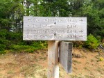
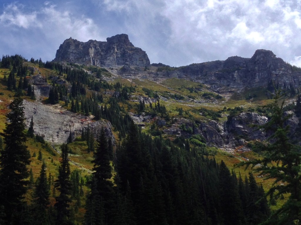
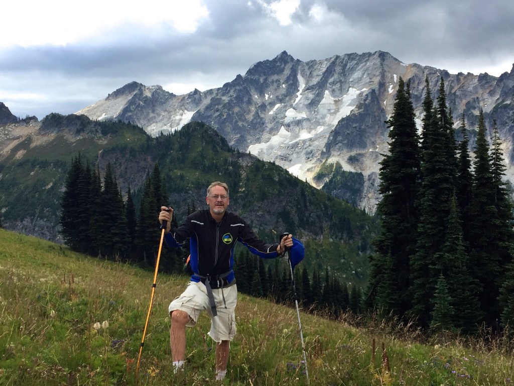
Scott Paul Loop under Mt. Baker
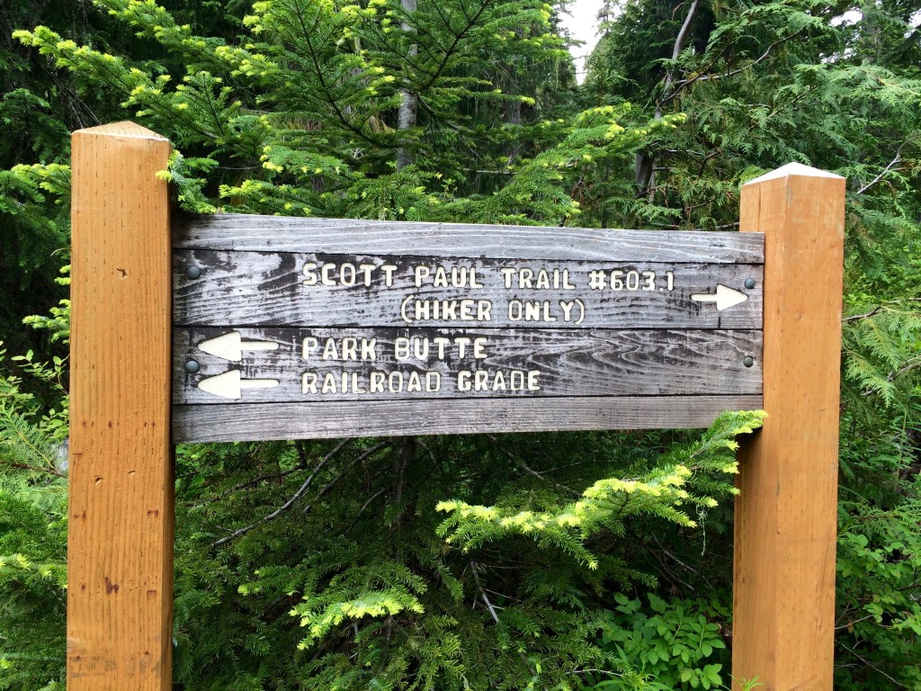
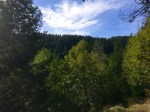
Brook and I took in our first North Cascades backpacking trip this last weekend from our new home in Bellingham, WA. I have received a lot of suggestions for my first outing but I ended up choosing a trip that looked like it would be below the snow line and give me a good challenge. The choice was the Scott Paul Trail and I am very pleased with the outcome. I also want to mention that the Forest Service facilities were impressive and the gravel road to the trailhead was actually pretty smooth. I’m definitely looking forward to a season of backpacking in the North Cascades.
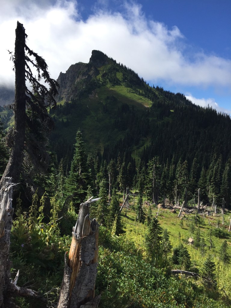
I took the advice of one of the trip reports to take on the loop counter-clockwise and I can confirm that is the way to take on the Scott Paul. The 2000 ft climb to 5200 ft is much easier on the western approach. The descent via the eastern side was a more effective route to navigate the more prominent mud patches.

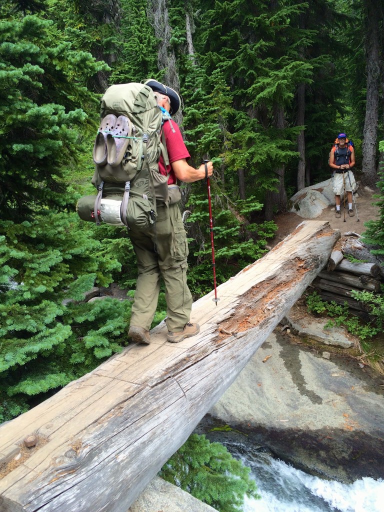
The first bridge was temporary aluminum ladder style that worked well for Brook and I.
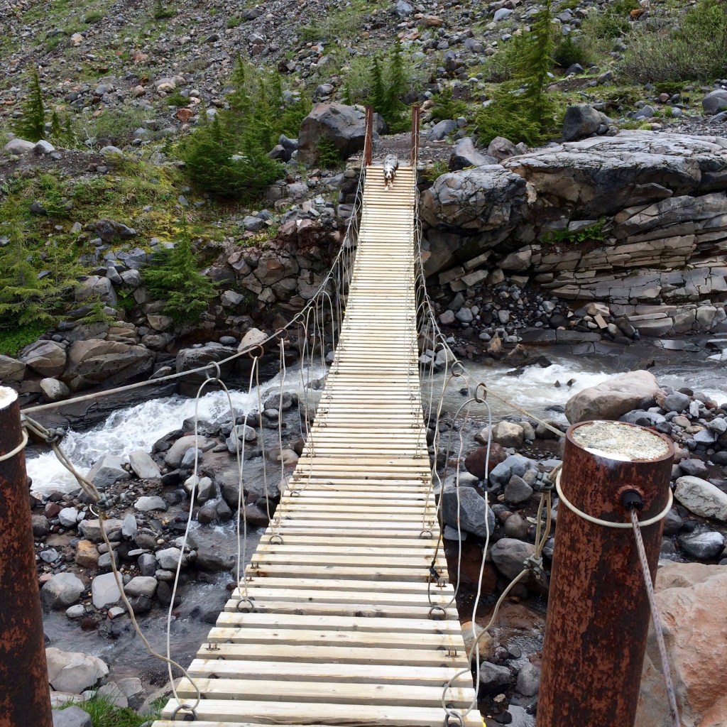
However, the second wood plank suspension bridge was impossible for my 9 month old pup. This was a bit scary as I could not find an effective location for her to cross at the stream so I ended up carrying her. This was a bit of a risk with the swaying bridge which if it started swinging I could have lost Brook. We went very slow and she was extremely trusting, but I was definitely nervous.
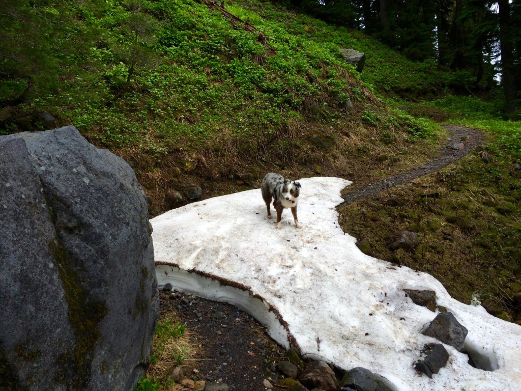
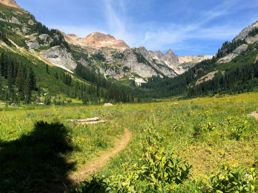
We were now encountering good patches of snow and Brook was in puppy heaven. Below is the video compilation of her excitement.
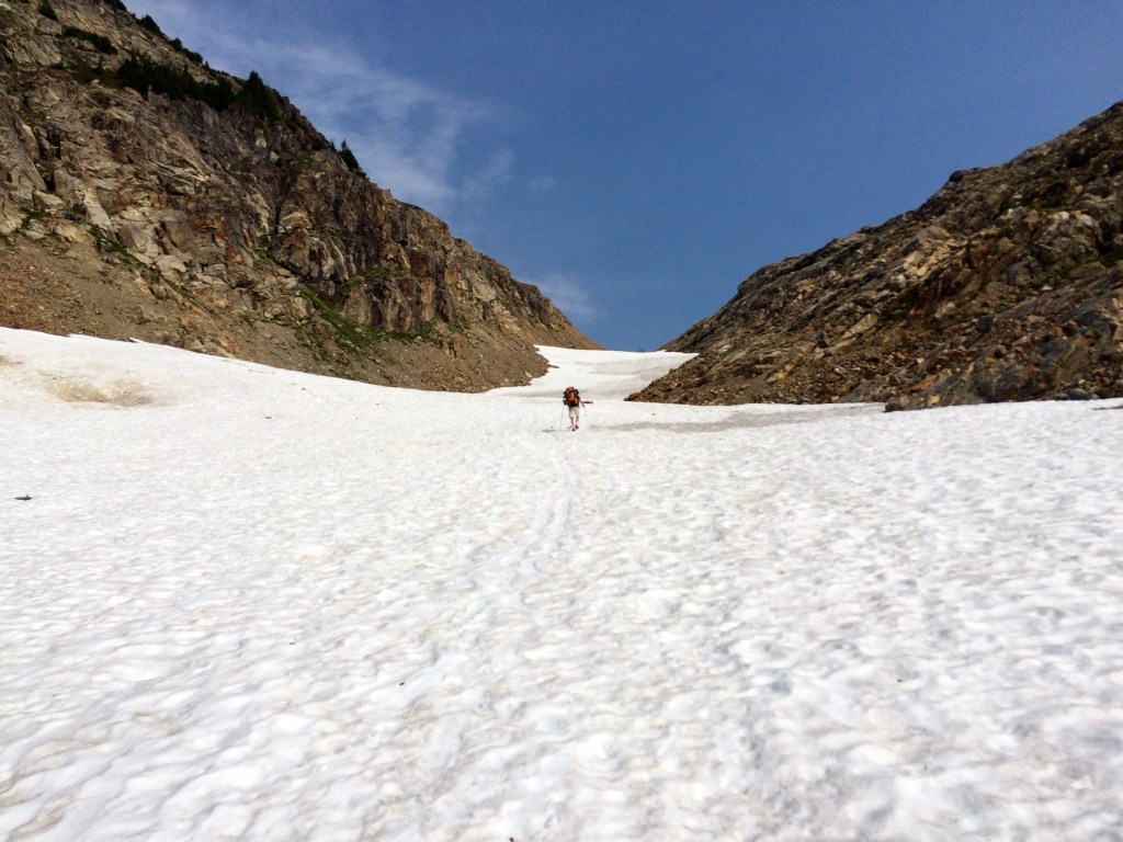
The weather had cooperated and it was time to find a campsite which turned out to be a bit of a challenge.
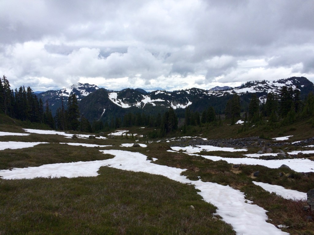
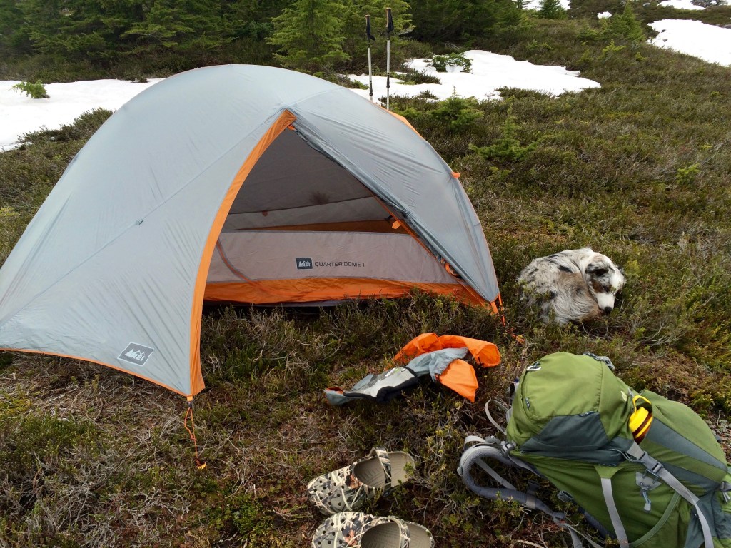
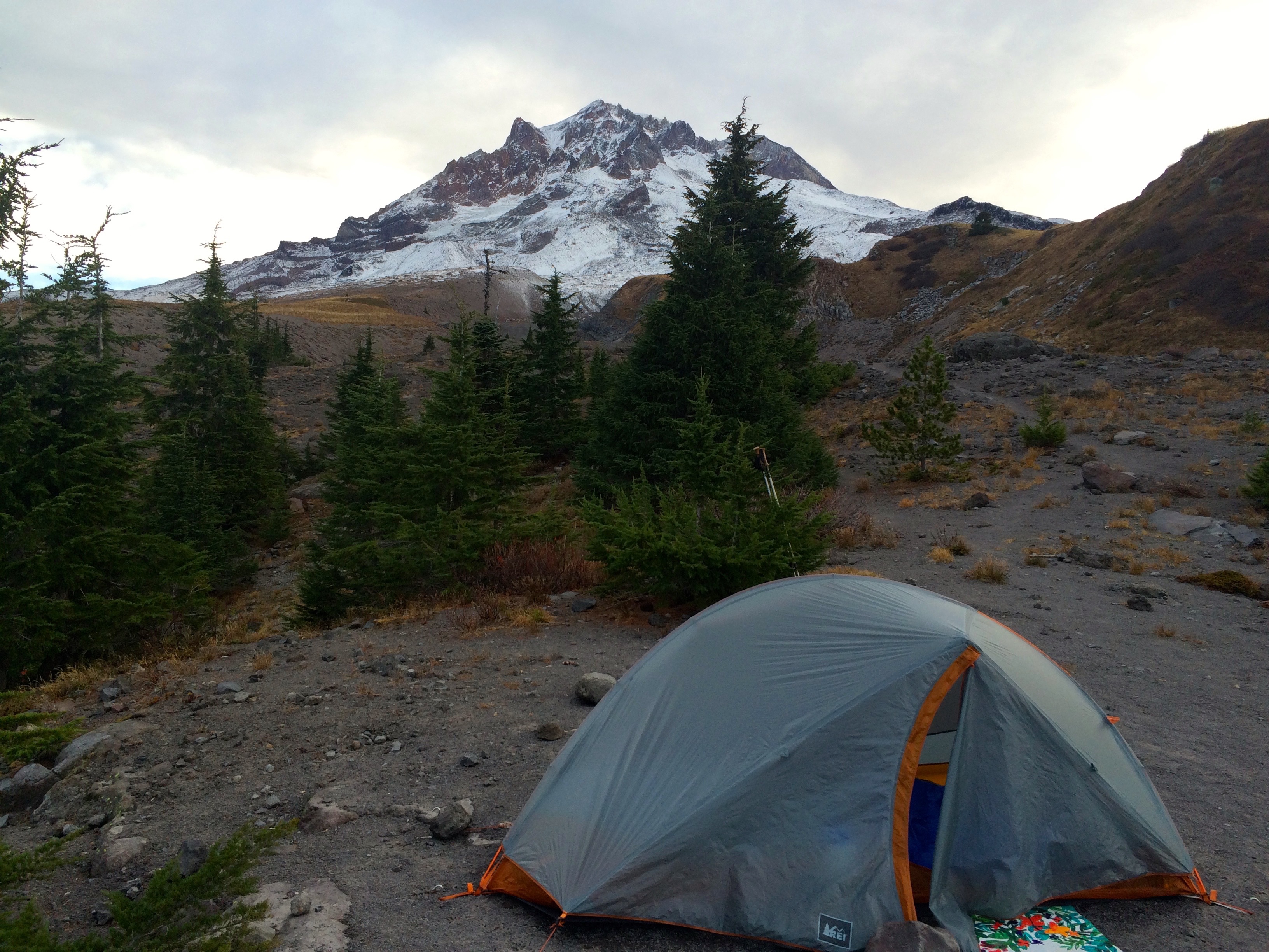
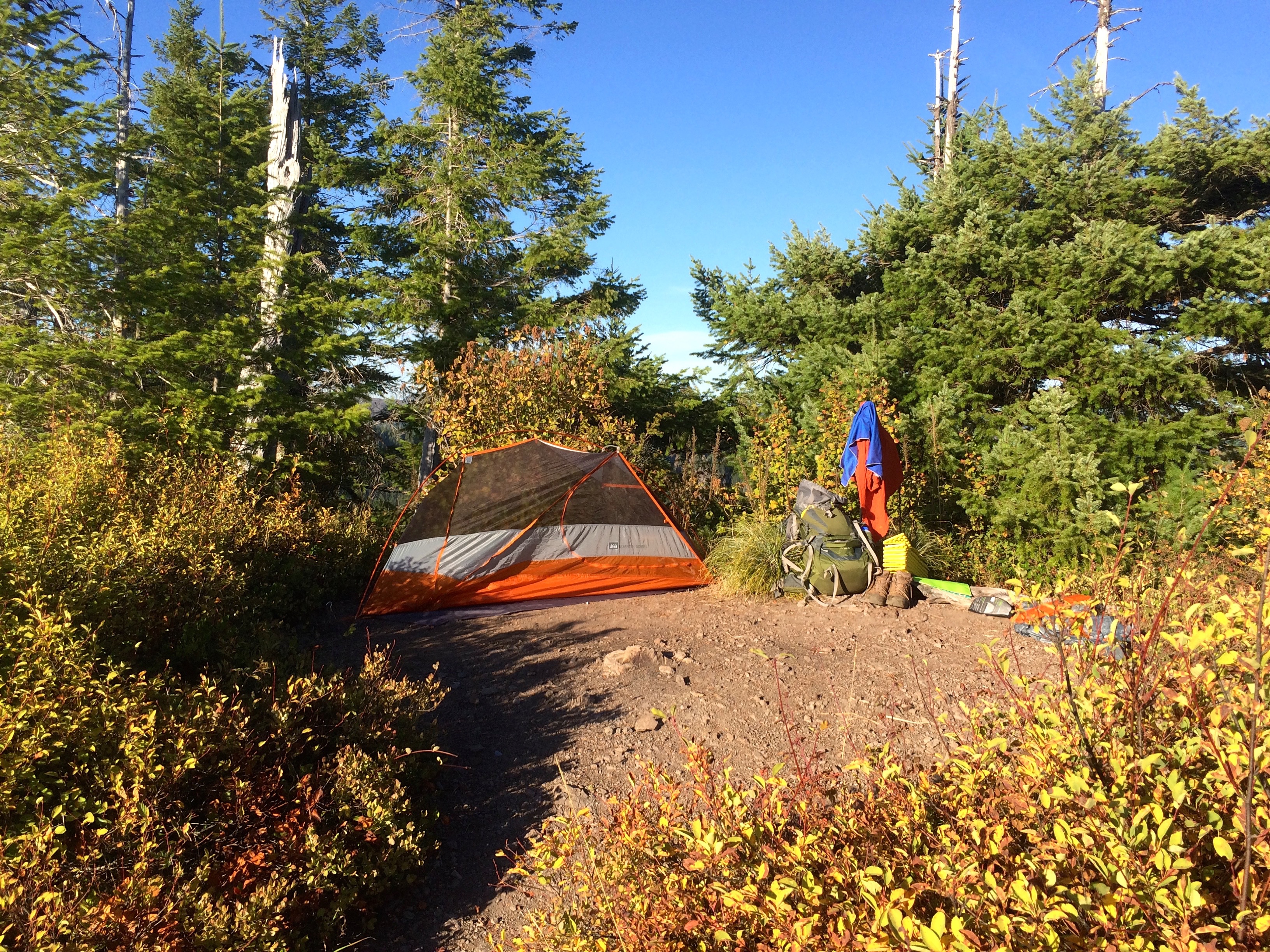
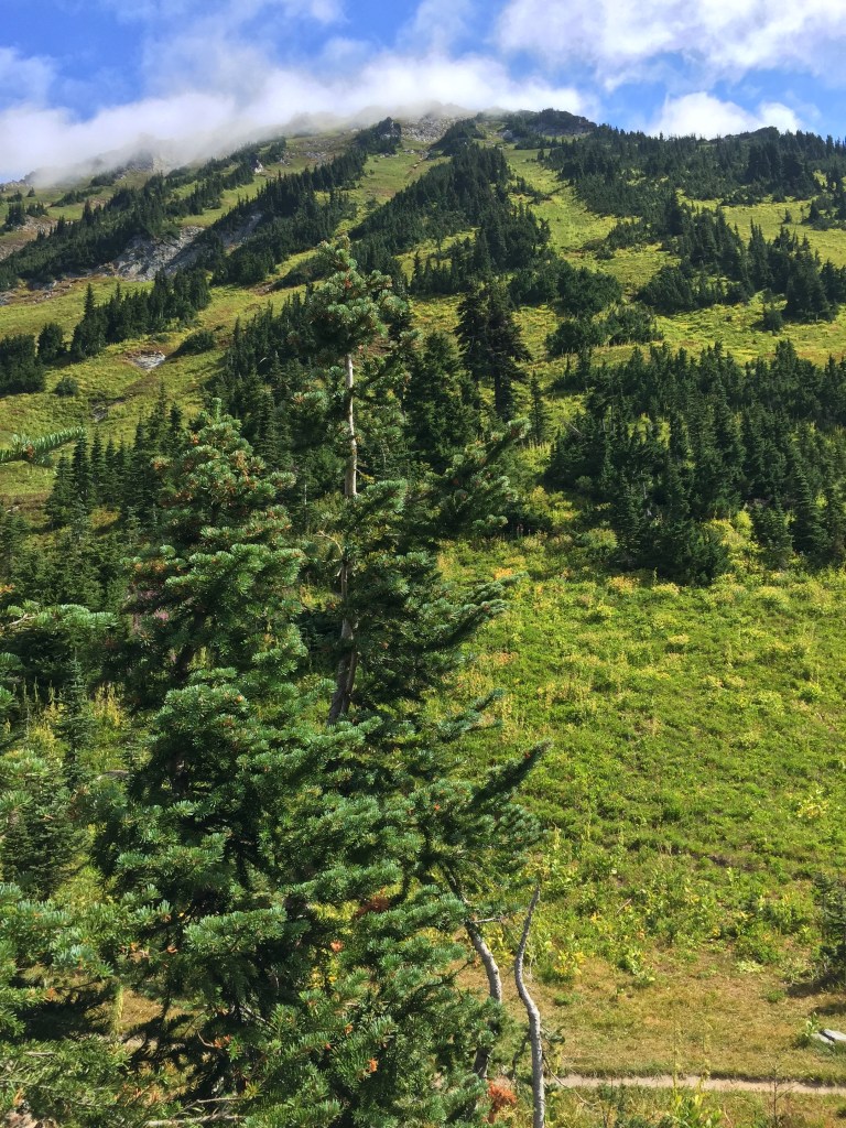
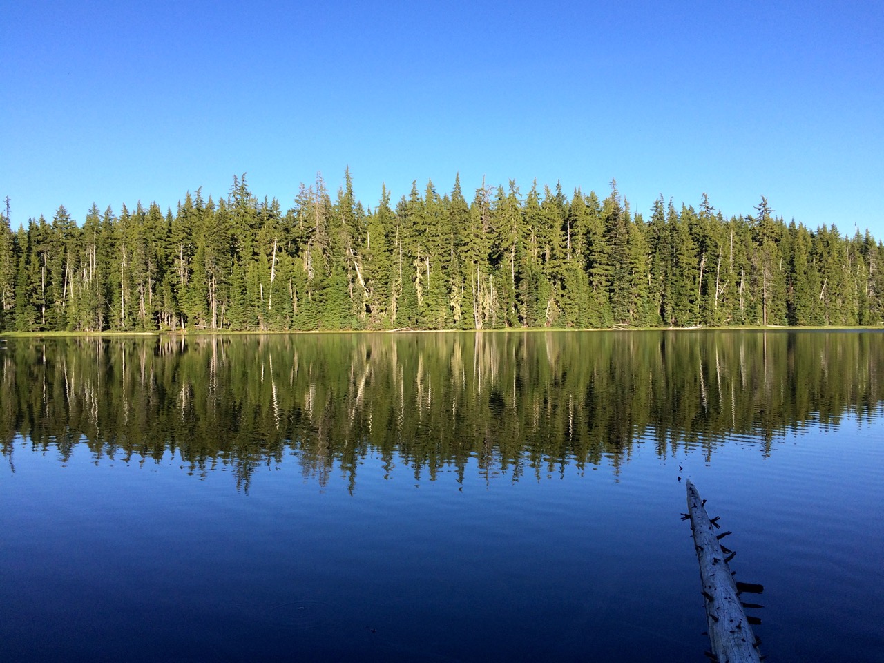
Above treeline on the slopes below Mt. Baker there were no level pieces of ground. Finally I spotted some patches below trail that might support a tent as well as offer the ultimate view of the Cascade range to the south. I would recommend this campsite option as it was the only place I found at Coordinates 48.72, -121.82. The campsite was fabulous with the ultimate bedroom window.
Brook was loving this but was also a bit intimidated by real wilderness. In fact she did not know what to make of the Marmots whistling.
After a quick nap,
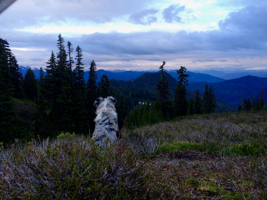
she had to give in to her Aussie instinct to protect her master by sitting in front of the tent panning the terrain around in all directions. She was grateful that I let her sleep in the tent so she could retire from lookout duty. It was a great evening taking in the view and staying just warm enough for a good night sleep.
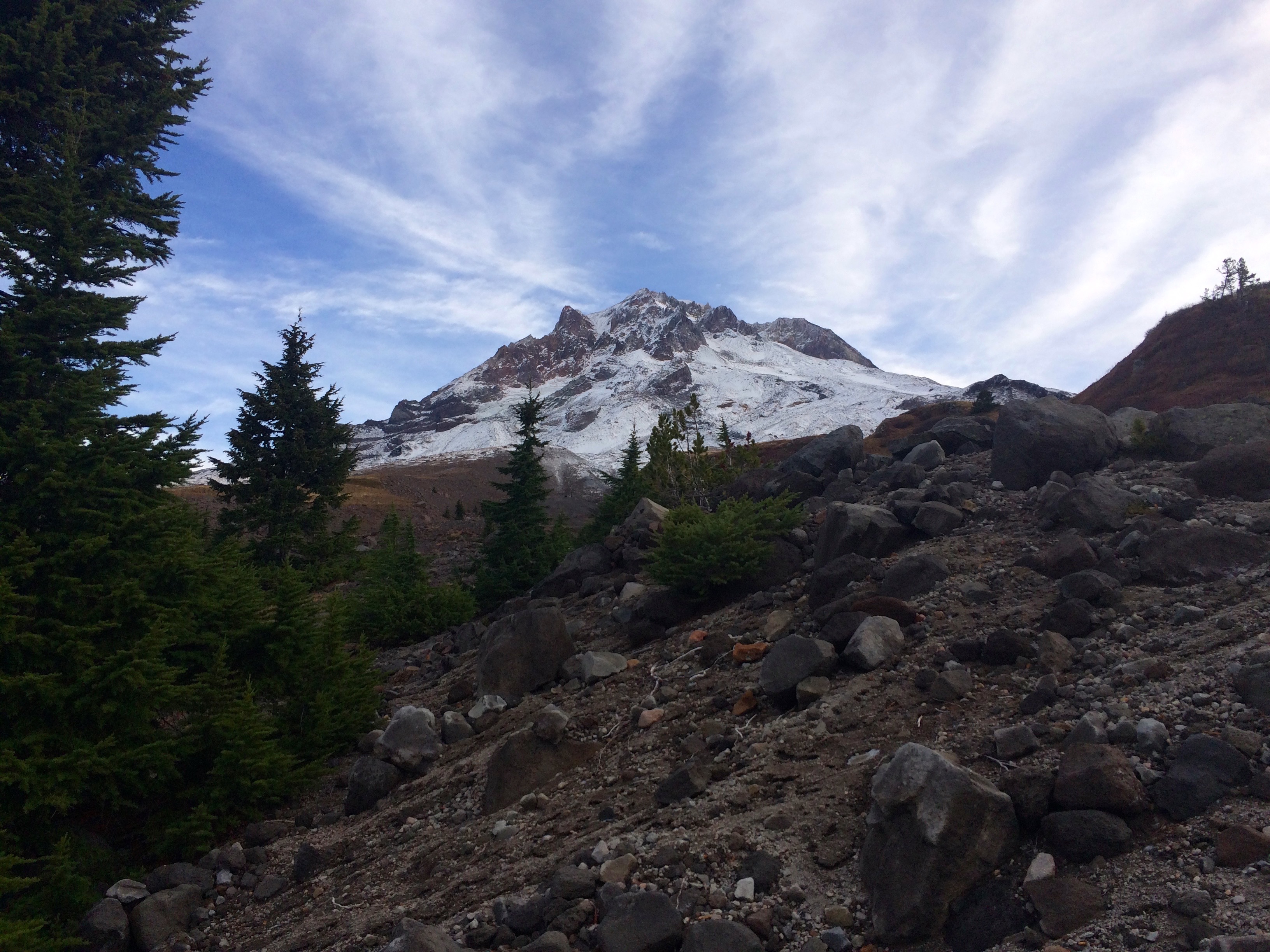
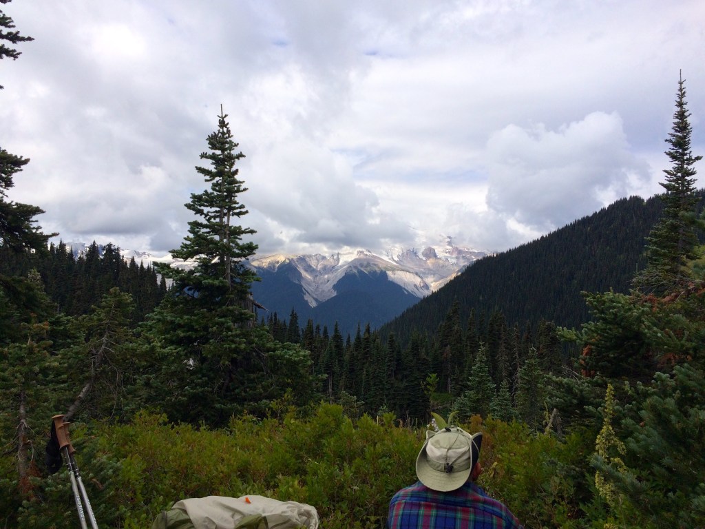
Mt. Baker’s presence was felt but we never got a great look at it. The morning brought beautiful fog and another difficult stream crossing where I ended up carrying Brook over. All in all it was an extremely successful introduction to the North Cascades.

Wild Rogue Loop
News Flash: “Wild Rogue Loop” selected as one of the Best New Trails in the US by Outside Magazine.
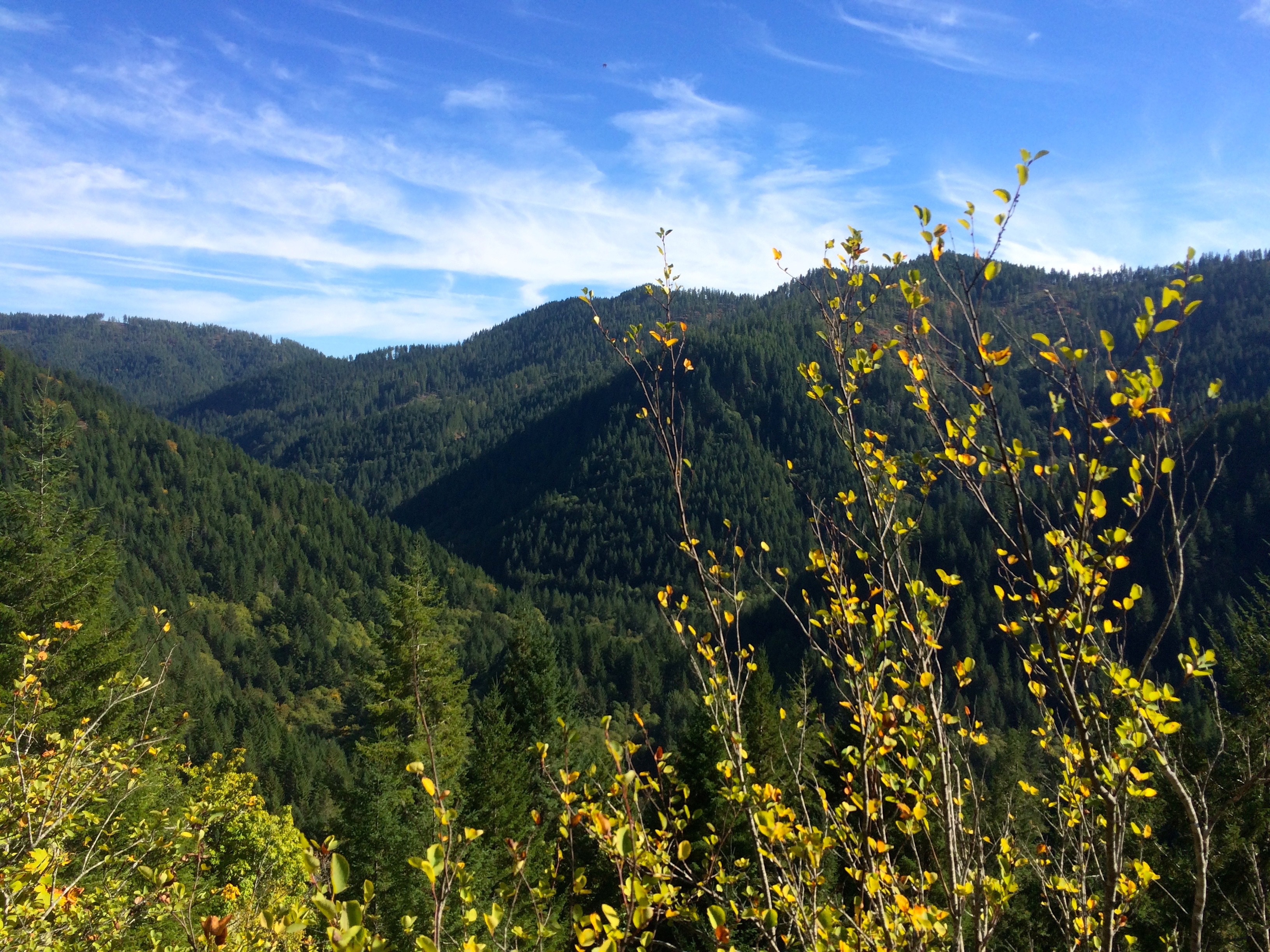
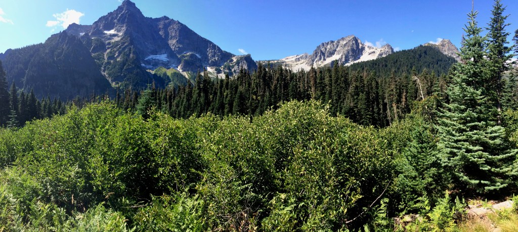
My backpacking companion had a few weeks off at the beginning of May and I’m still retired until June so we searched for a challenging early season backpacking trip.  Looking for a loop with good temps, flowers and minimal bugs led us to find this refurbished Wild Rogue Loop in Southern Oregon. Last year the Siskiyou Mountain Club with help from grants rejuvenated the 25 mile Rogue River Loop which is a conglomeration of the Rogue River Siskiyou National Forest’s Mule Creek Trail 1159, Panther Ridge Trail 1253, Clay Hill Trail 1160A, and the Rogue River Trail 1160. This was necessary because of the damage done by the 2005 Blossom Fire after allowing the forest to heal for 10 years. The combined trail is one of the best in Oregon. The evidence of fire is minimal, the terrain is challenging and the scenic rewards are stunning.
Once this loop was chosen for our Spring outing, gathering trail details was more challenging, but critical feedback on the trailheads, poison oak and ticks was helpful.

USFS Livestock Pasture near Foster Bar
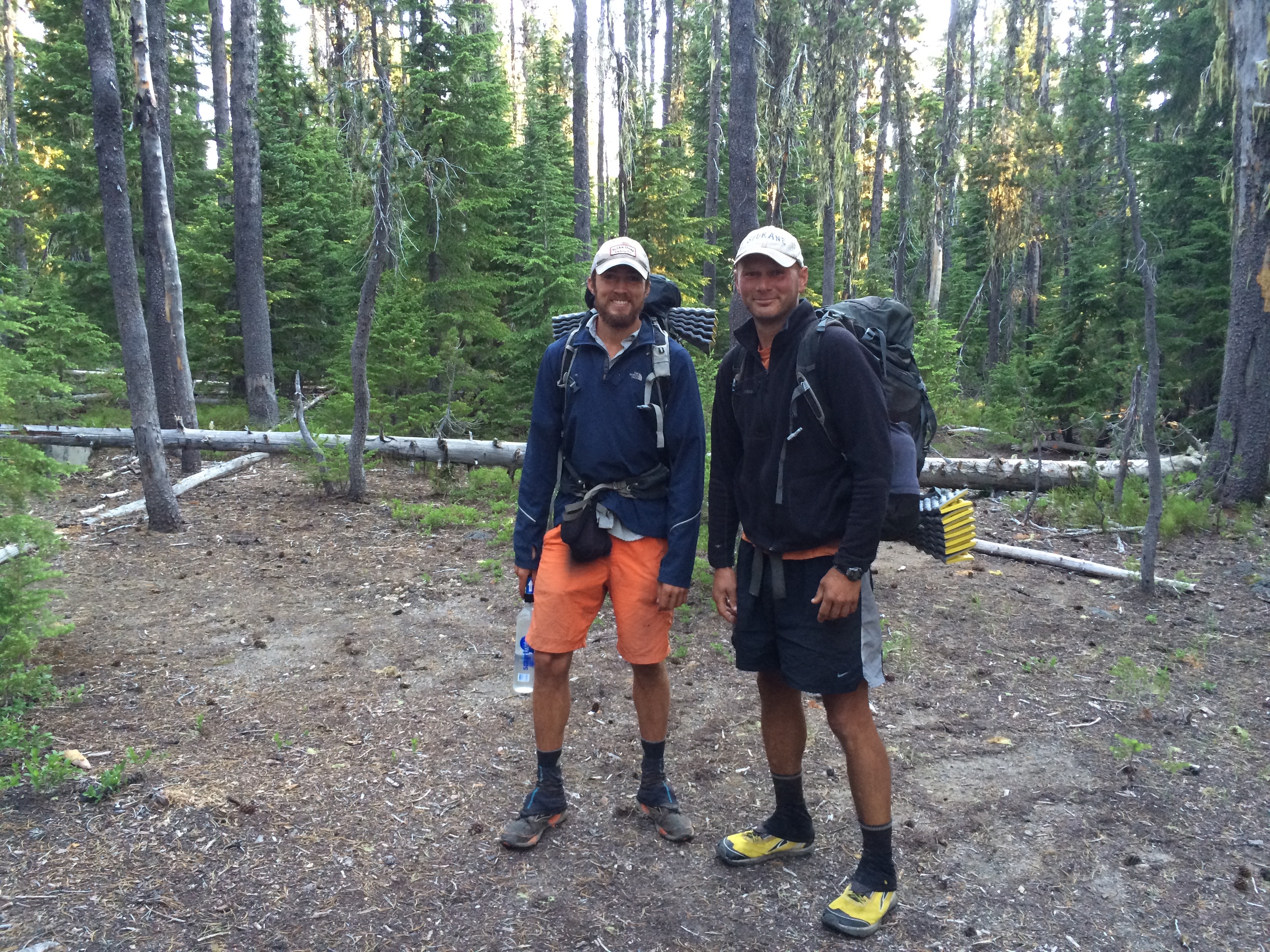
I decided to use the Foster Bar Rogue River Trailhead, which happens to be the West end of the 40 mile Rogue River Trail. This entry was down river a bit further than I expected but access and facilities were good and taking in more of the Rogue River was a plus. Overall I think we stretched our trip into about a 40 mile hike. We completed the trip in three and a half days but probably should have stretched that to 4+. We could have used more information on campsite options.
We set out toward the beginning of the loop heading up the Rogue River on Sunday May 1st. A beautiful day that pushed temps up into the 80s. The trail is cut out of the North bank or wall of the canyon presenting you with moderate difficulty and plenty of river vistas.


The waterfall at Flora Dell would be wonderful for a cool dip.  Obviously water is no issue, however, you rely on tributaries since direct access to the Rogue was generally not easy. On this beautiful Sunday we passed many backpackers, hikers and runners heading down river. However, we never encountered another human for the remainder of the trip.
  I will confirm that poison oak is plentiful until you get above 2000 feet. And yes, I had to deal with a number of ticks, humans can handle this, but I would not take a dog.
We decided to take the shortcut at Brushy Bar over Devil’s Backbone, a decision we questioned after comparing the added vertical to the shorter distance. Camping along the Rogue is primarily geared for the boaters but the camping area at Blossom Creek was perfect for our first night. Complete with a Bear Box and access to the Rogue for some fishing, it was excellent.


We definitely pushed ourselves on this first day but all was good. The second day took us through Marial to the Tucker Flat Trailhead in order to head up the West Fork of Mule Creek.


From our GPS PDF Map on Avenza it was obvious that water sources could be scarce as we climbed toward the top of the Mule Creek Trail.

Hanging Rock from Below
It appeared that the site marked Camp Hope would be the most likely for water but there were 2 other streams just before there still flowing. The first is where we interrupted a black bear but he scurried off into the forest. Unfortunately the trail in this area does not offer great campsites so we pretty much camped on the trail. A thunderstorm accelerated our efforts to set up camp. Again we probably pushed ourselves a bit more then we would have liked on a warm day climbing 2500 ft.
The next day was focused on experiencing Hanging Rock, and it was all that I had hoped it would be.

Greg on Hanging Rock
I would rank it as one of the Top 10 scenic locations in Oregon.

Pan from Hanging Rock

Where Hanging Rock Photos are taken
After lunch on the Rock we had the Panther Ridge Trail to cover and then a decision about how far down the Clay Hill trail we could make before our energy gave out. The 4.25 mile 3000 foot descent back down to the Rogue to complete the loop is tough on old knees.


About half way down we found just enough flat ground to setup our tents just before the rains opened up for the evening. This was another tough day since we had to carry extra water knowing that there would be no more available before we needed to stop.

Rogue River Valley from Clay Hill Trail
 The fourth and final day presented essentially a downhill hike back to our car but it was another 9 miles with plenty of climbs for two old guys with tired bodies. Hiking the same segment on the Rogue River Trail was entirely different in the opposite direction. Overall this was a perfect time to do the loop.
The wildflowers were plentiful, bugs were still sleepy and temperatures were moderate.

Raising a Backpacking Buddy
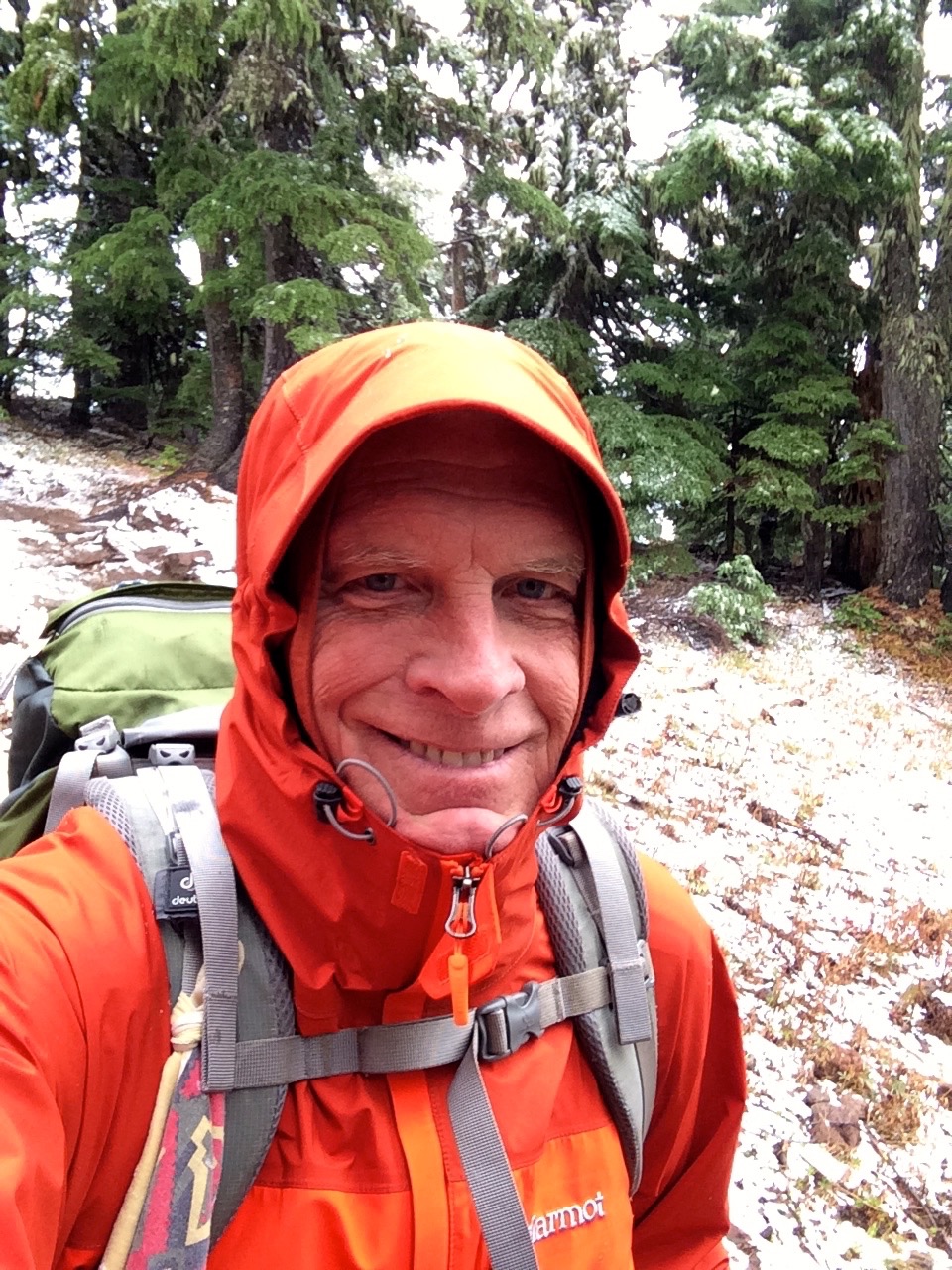
Puppy Brook is growing up and I took her on her first backpacking trip this week. She did great and I’ll share some of that in a bit. But any baby growing into adulthood is an incredible experience. Sure it is a lot of work but also a rewarding experience. Brook is our 3rd Australian Shepherd so it is interesting to compare but also helpful to know what the breed tends toward. An Aussie is primarily interested in serving her master which historically has meant herding their flocks of animals. So raising an Aussie does mean that you break them of that herding instinct especially with the neighborhood kids. Aussies will learn whatever you want them to, but their independence is also very important. Right now I am tempering Brook’s need to be the protector with the social requirement for her to be friendly. This is the critical artistry of parenting a pet.

Riding out a Thunderstorm
Our backpacking trip was a simple overnight on the Opal Creek Trail near the north fork of the Santiam River east of Salem, OR. This is an easy hike highlighted with typical Oregon majesty. Brook’s trail etiquette continued to be outstanding, but that is really built from her Aussie traits. I was really wondering about canine backpacking issues like staying on the trail, crossing narrow tree truck bridges and ignoring forest wildlife. And of course the critical test for how she would handle sleeping in the forest. An additional test of how she would handle a thunderstorm greeted us first as we barely got the tent setup before the storm hit. I was not real happy with how I had to rush the setup of the t ent, but it provided shelter in the nick of time. Brook immediately had to decide whether going into this tent was acceptable but quickly realized it was fairly cool hanging out with her master in such a confined space. This may have turned out to be the most valuable lesson most of us dog owners deal with. How does your dog deal with thunderstorms. Most of my previous dogs have gone berserk during a storm. However, during this storm Brook was so happy hanging out with me in the tent that she had no reason to fear the loud thunder. I may finally have a dog that can deal with thunderstorms. Awe yes, but then there will be the fireworks test someday soon.
The overall backpacking experience was perfect. Brook initially did not want to cross narrow log bridges. She was nervous about all bridges but if they had rails on both sides she could handle it. She does seem a bit reluctant to explore streams, I kept telling Brook that the best drink is from those babbling brooks. She did want to sleep in the tent but that worked out OK since she did not get overly dirty or wet. She would go out into the night for a drink and things but she did not waste much time staying away from the tent. In the morning she did get a bit spooked by all the birds serenading us, but that was quickly forgotten when she discovered how much fun it was to run up and down all the little trails around the campsite.
The major problem Brook is still dealing with is riding in a car. She does not prefer to do this, however, she does not have a choice in this matter. This trip was extremely valuable lesson for her, even with the throwing up in the car. She will be able to handle car travel, but I don’t think she will ever desire it.
April 30 I will be backpacking the Wild Rogue Loop in southern Oregon. Unfortunately Brook will not be accompanying me due to the presence of poison oak and ticks in the area.
Introducing our New Aussie, Brook

Brook
At the end of my Timberline to Cascade Locks backpacking segment I was crushed by the news that my beloved dog, Abby, had died unexpectedly. Abby was 12+ and not able to backpack with me any longer, but losing her at a time when I was experiencing a dream that she should have been sharing with me was tough. My wife and I knew we would find a new dog when we felt the time was right. Well this post is dedicated to introducing you to our new dog, Brook, another Australian Shepard who is destined to be my new backpacking buddy.
Brook came from Gearhart Aussies on the Oregon Coast about a month and we have survived puppy training. Plenty of accidents have been cleaned up and not to much chewing damage has occurred.

Broncos Fan
There is a period of time with the new puppy where your lives are not yours. You have to cater to the needs of the puppy at the expense of your own desires. However, you know it is short-lived especially when dealing with the intelligence that comes with the Australian Shepard breed.
Brook is a Blue Merle Aussie with piecing blue eyes. Her color scheme is beautiful with perfect marking of the reddish fur. She has already shown her commitment to being a Broncos fan during last weekend’s AFC Championship. Now we will prepare for the Super Bowl.
We will also hit the trail soon to expose Brook to the discipline needed for backpacking. I like her disposition of displaying initial caution with strangers or unusual activity, however, she quickly evaluates the situation and reacts appropriately.
My wife works in a hospital and would like for Brook to possibly accompany her as a comfort dog for her patients. I think Brook will be perfect for this duty. But the primary job for Brook will be to provide companionship for us, function as a watchdog and allow us to love her unconditionally for the rest of her life. A Dog’s life is so tough.
Here is a video recap of the Gales Creek Hike in Tillamook State Forest.

I Lost to the Lost Coast
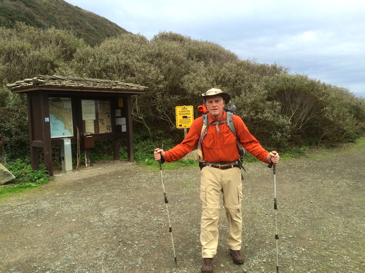
Ready for the Lost Coast
I headed into my Lost Coast Trail backpacking trip during the first week of December 2015 confident that I would accomplish my goal to hike from Mattole Trailhead to Shelter Cove and return. I knew it was going to rain a couple of days, but the forecast called for 10 mph winds. I also knew I had some bad timing for when the low tides occurred during the first part of the week. But I did not dig deep enough into this data to be properly prepared for what was ahead.
The drive down to northern California through the Redwoods was great, my car loves roads like the Redwood Highway. I visited the BLM office in Arcata first thing Monday morning to get my waterproof map, so with that map also on my iPhone equipped to use GPS, I was well prepared for navigation.
The low tide on Monday was not going to allow me to get past the first high tide hazard stretch so I had a leisurely hike past a herd of cattle to end up camping next to the Punta Gorda Lighthouse. It was a beautiful evening as I overlooked a beach full of seals.

Low tide on Tuesday was at 9:33 am at 3.2 feet, so I entered the beginning of this 4 mile stretch before 9:00 am. Based on most reports I had read this stretch was not going to be a problem even if you were a few hours on either side of low tide. Unfortunately, I did not consider the actual height of the low tide. The trek through this segment was tough even without navigating the dangerous rock points of which there are about 5 that are really challenging. Some you can climb up and over, but the rocks were really slippery probably due to the higher then normal waves preceding the approaching storm. So I worked my butt off hiking over the beds of football size boulders. As I neared the last few hazard spots it seemed like it was far more dangerous than it should have been.

Then the last point before Spanish Flat nearly did me in. It was a point where you had to go between a large rock as the waves were crashing, however, it was all under water. As I tried to see around the corner to determine what I was up against I caught a full face on wave that nearly pulled me into the ocean. At that point I couldn’t worry about waiting for the best wave timing so I jumped into waist deep water and made it around. I was soaked but relieved to have survived.

Spanish Flat
I stopped at Spanish Flat, put on dry clothes and checked the tide tables to discover that the low tides that I was experiencing were the highest low tides of the year. That explained things, but now I was concerned about the next day’s stretch of tide hazardous coast with another 3.2 foot low tide, not to mention my concern about coming back from Shelter Cove.


I decided to camp at a nice beach fortress just below Spanish Ridge. The winds were gaining strength which was good for drying out but it was also a bit foreboding knowing that rain was on the way. Yep, the rain started at sundown and the wind just kept getting stronger. It was time to reevaluate whether I should press on to Shelter Cove.
I knew it was going to rain all day so I decided to stay put through Wednesday with plans to head back to Mattole by hiking up the Spanish Ridge Trail over to the Cooksie Spur Trail on Thursday. This was a nice campsite and I was able to get out a few times during rain breaks. This video will give you an idea about how I spent Wednesday.
I was up before sunrise Thursday morning with my backpack ready to go, just needed to take down the tent. I was so happy that it had not been raining for a few hours and the tent was dry. Unfortunately all hell broke loose at sunrise. The rain and the wind hit what I would call typhoon force. My line holding my tent fly broke, my tent stakes were being uprooted, water was rushing in so I had to go. Taking down a tent in gale force winds is challenging but I captured everything, but somehow lost my reading glasses. Of course I was instantly soaked but my Marmot Gore-Tex jacket was taking care of me.

Climb to Spanish Ridge Trail
I decided to go straight up the side of Spanish Ridge and intersect with the trail which worked out fine thanks to the map I had with GPS location on my iPhone. The wind was blowing from the south so it was mostly going to be at my back.
My goal was to climb the 2400 foot vertical of the Spanish Ridge Trail and then take the Cooksie Spur Trail over to Cooksie Creek since I would need water.  Well halfway up the climb (see blue dot on map) I was realizing that this wind was a real problem. As it whipped up the slopes it must have gained even more power, so much so that I was barely able to stand up. Then I really got hit, actually blown off my feet, and I was a 250 lb object. I was totally exposed at this point, no trees or large rocks to shelter behind, so I laid face down next to a small rock that gave my head a little relief. I was pinned down about 45 minutes with the wind occasionally lifting me when it hit between my body and backpack. Oh yes, and the rain was as hard as you could imagine. So here I am face down trying not to be blown off the mountain and I’m getting cold. The night before I had listened to a chapter in Lawton Grinter’s book “I Hike” about his experience with hypothermia, so I knew that the shivering, loss of feeling in my hands and feet and the desire to burrow were typical of hypothermia. What was a bit fascinating from being in this predicament was getting a taste of what it may be like to face the real possibility of death so my conversation with God was with great urgency.
Of course the human spirit doesn’t just give up, I had to do something because my current situation was hopeless. I fought to stand which was really hard because my legs were not working as I would have liked. Something told me that I needed to climb out of this, however, I had no way of knowing what was ahead, but my GPS map at least assured me that I was on track. I walked with my back to the wind using my trekking poles as braces to counter the force and I made it to an area where a small cornice offered some relief from the heavy wind. At this point I knew I had to warm up so I pulled out a wool shirt to add a layer under my rain jacket. Buttoning that shirt with my cold fingers was far more challenging than I could have imagined. However, this accomplishment seemed to give me new motivation to press on at all costs. And pressing on was brutal. There were a few sections where the wind was at my back so I used it to essentially fly up the mountain, however, coming to a stop was never pretty. Then my backpack cover blew loose but was still attached to my backpack creating a spinnaker type sail that dragged me for 20 feet. In between my attempts to move forward I spent more time on my face trying to regroup. Overall it took me about 3 hours to travel about a mile through the really bad section of the ridge.

Beginning of Cooksie Ridge
Of course I did finally make it to the top and when I got off the Spanish Ridge Trail and onto the much calmer Cooksie Spur Trail I was singing praise to God for allowing me to live. From the looks of the map I knew that the Cooksie Trail was also going to present an exposed ridgeline so I opted for the best tree sheltered spot to pitch my tent with the goal to get into my sleeping bag and warm up. That evening was not great but compared to the effort to get there it was wonderful. I was very content to make it through the night with just 13 ounces of water. I had dry clothes, mostly wool, so I did eventually warm up.


The forecast for Friday was sunshine which held true, so I set out with the need to get to Cooksie Creek for water. I also decided that I had had enough of the Lost Coast and I really wanted to hike back to my car with dreams of a good meal and warm bed. But the hike out Friday turned out to be a lot tougher than I expected. Thank God for my GPS map locator since finding the trail to the creek was rather confusing. For some reason I thought that the trail was going to follow the creek back to the coast, but as I kept examining my map I realized I must cross the creek and then climb 650 feet and another 2 miles just to get back to the coast.
 Well of course the creek was swollen from all the rain so crossing it created some anxiety trying to crawl over trees and fight the current. Unfortunately I lost my backpack rain cover as I was crawling over a log for part of the crossing. I was really bummed about the simple climb because my legs were dead tired, but the weather was great and the motivation to end this trip lifted my effort. This was a typical view as I returned to the coast.
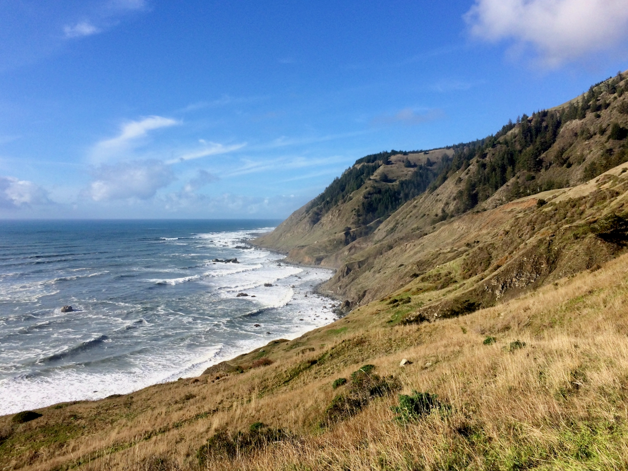 The first beach segment on this final coastal leg required navigating a few difficult points but it was at the (high) low tide. Surprisingly I ran into a single woman just entering this difficult stretch and it was an hour after low tide. I warned her that she might want to reconsider trying to make it to Spanish Flat, and I’m not sure what she decided. The rest of the hike out was not dangerous but it was exhausting.

Walking on loose sand with tired legs was tough, but the motivation was strong and the sunset was beautiful.
When I finally got to my car at sundown (long day) I was met with yet another disappointment. I noticed that my gas cover was ripped open and then I noticed that all of my windshield wiper blades had been stolen. This was just so rude. Luckily I intentionally had less than half a tank which probably meant they didn’t get any gas. However, if it had been raining that would have been one dangerous drive back to Ferndale. I did get to Ferndale and I had possibly the greatest NY Strip Steak ever and a much needed warm bed.
Note: I returned 4 years later in February of 2020 to Conquer the Lost Coast Trail
I visited the LCT again in February of 2021 and have plans to return again in February of 2022.
I was able to reenact my 2015 route in 2022 with perfect weather. Here is the comparison

A Night in Paradise Park
It had been 3 weeks since I last escaped to the wilderness so I just had to take advantage of the two day good weather forecast.
Timberline Ready for Winter
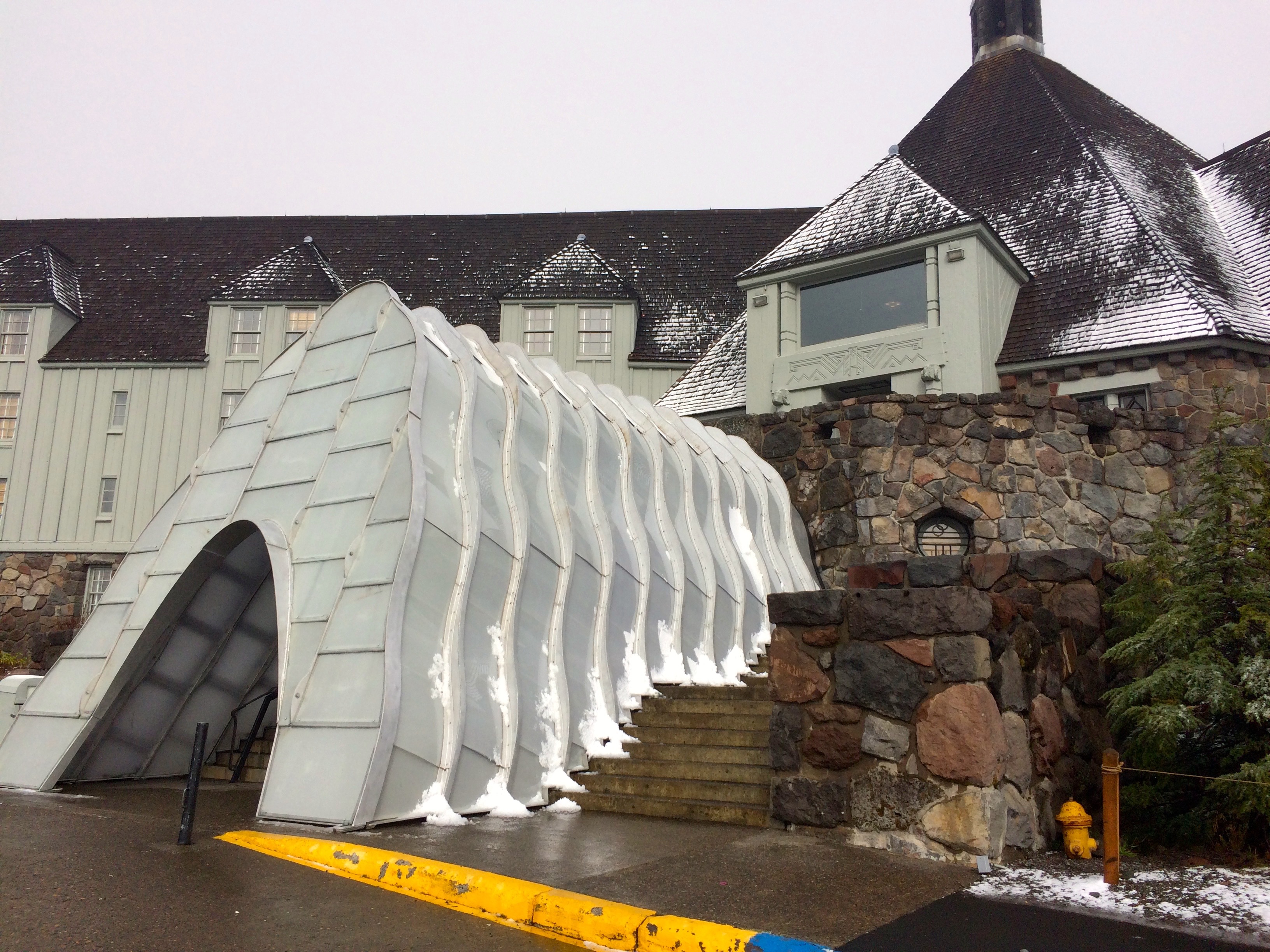
I initially tried to select another outing in the Tillamook State Forest since my last trip to Elk Mountain had been so rewarding, but something drew me to higher elevation. What about Mt. Hood, even if it may have gotten some fresh snow. Perfect, I had wanted to check out Paradise Park ever since my PCT segment that took me past the trail loop back in July. From Timberline Lodge it is about 5 miles to where I would want to camp. The Timberline webcams showed melting snow. The forecast called for a clear but cold night so let’s do it.
Cold Start
I packed my warmer bag and my perma-rest air mattress along with adequate warm cloths which turned out to provide sufficient comfort as the temperature may have hit a cold of 30 degrees. After a lunch buffet and IPA at Timberline I was off.
The typical day hike distance to the Zig Zag Canyon overlook and below offered a before and after shot showing just how much the weather changed from the trek in and next day return.


The trail takes you down to the bottom of the canyon and then you get to climb back up, but it went very well with a fresh body.
Autumn Color
I was a little slower on the return trip as I was feeling some tired muscles. Hiking in late October does not provide the lush foliage but it was just as interesting seeing the mountain prepare for its winter blanket. I arrived at Paradise Park around 4:30 pm.

Setting Up Camp
I scouted the terrain quickly selecting a campsite with a view and accepting the consequences of a cold wind. The October evening was playing out way to fast. I had to enjoy the view but I also needed to setup camp.

Deer Family Visitors
Then a family of deer, 4 doe and a young buck strolled by. They stood near looking at me as if to say, “what are you doing here”.
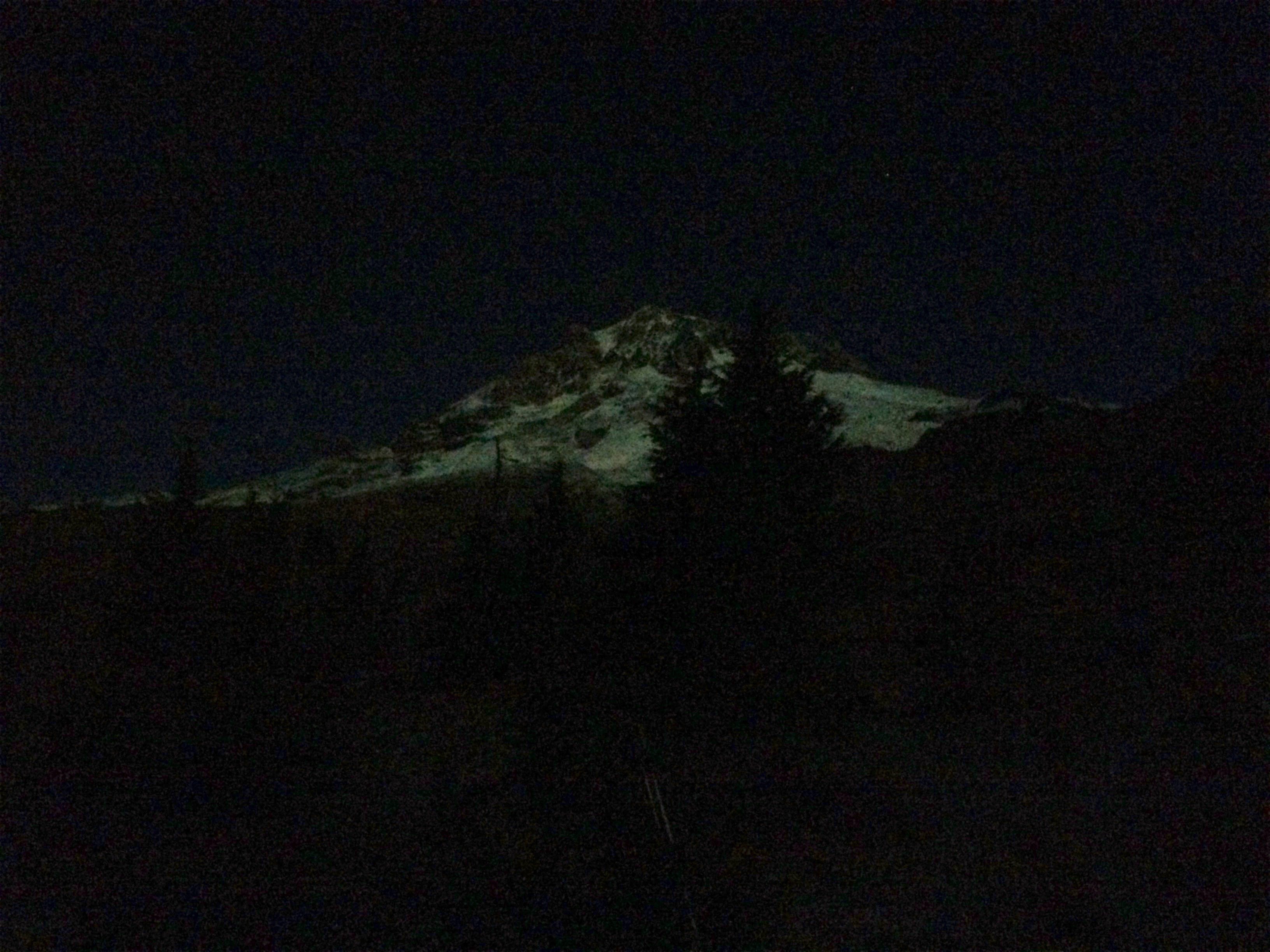
Back to the view, which was highlighted by the clouds opening to a valley exploding with sun rays. I had no idea what lay behind me as Mt. Hood was engulfed in a cloud. However, the hopes for a glorious sunset were high, but the temperature was dropping rapidly. The sunset did turn out to be unique but it was not photogenic due to the light sky above. The cold drove me into the tent where it seemed like I might be in for an uncomfortable evening.


It turned out to be just fine after I closed my air vents and put on a second pair of socks. It seemed like it was coldest at about 10 pm and then the wind shifted from the east. I wanted to enjoy the almost super moon rising over Mt. Hood but it was just too cold.
Mt Hood in Moonlight
When I got up around 3 am it was awesome, a bit warmer and the moonlight exposing a clear Mt. Hood was gorgeous.
Good Morning
Morning brought a reluctance to leave the warmth of the sleeping bag even though the sunrise potential with a clear Mt. Hood was high. I quickly took it in and then slept in until 8ish. The sun was quickly providing welcome warmth allowing for a pleasant coffee and hot chocolate wakeup.
Joys of JetBoil
I hung around most of the morning enjoying the view from Paradise.
The hike back offered numerous views of Mt. Hood and Jefferson which I cherished via my many stops for rest.
Mt Hood’s Glory
The impulse backpacking escape turned out to be perfect.

Mt. Jefferson
Return to Timberline Lodge
I am so grateful to be able to take advantage of God’s gift to us.

Mountain Top Experience
My backpacking choices just seem to get better and better. The weather October 5th was exceptional and I did not have any commitments for the start of the week so why not find a local backpacking trip. This one was stimulated when I stopped by the Tillamook State Forest Visitors Center and asked a forest ranger for a backpacking recommendation. I think the ranger knew I was serious because she gave me advice about trails that stated they were not for backpacking. Well the Elk and King Mountain summits caught my eye because they created a nice loop option for a day in day out quick trip.

Radically steep trail
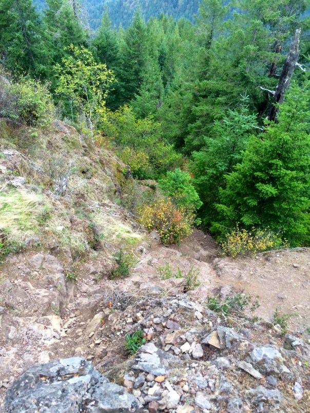
I chose Elk Mountain because it appeared to be a relatively short but challenging hike to the summit which I could pull off with an afternoon start. It was 1.5 miles and a 1900 ft climb, which of course had to translate into a steep trail. I found a blog post at crystaltrulove.wordpress.com that was valuable for helping me understand the false summit confusion, but even though I was warned of the difficulty of the steep trail, I assumed it would be a quick way to knock off 1900 ft.
Views of Wilson River Valley along the Trail
Well that 1.5 miles felt more like 5 and it took me about 3 hours to summit. The recommendation that this is not a back-packable hike would be accurate. But Oh what a reward at the top.
This trail has been adopted by the Mazamas for which I applaud their work in helping to make this trail available.

Summit Sign & Log Book
At the summit I signed the log book which the Mazamas have provided. This mountain top consisted of about 700 sq ft of land with maybe enough space for 20 people and one campsite.
Elk Mountain Summit Campsite
I had it all to myself and the evening was shaping up for a good sunset. This was too good to be true when you consider what would be the nicest front porch view you could have for an evening. Again, the weather was perfect with very little breeze so I setup camp and had dinner as I watched the sun set over King Mountain.
The gallery of photos below gives you a feel for the sunset and the coming prize of the starry night. There was no moon and you are far enough away from the Portland metro area lights to have excellent star viewing.


This was definitely a no fly on your tent night.
The experience got even better with the sunrise.


I jumped out of the sleeping bag to take photos and kept the camera close as I had my coffee.
I knew that the back side of Elk Mountain also offered up some radical vertical which is even more difficult going down, but it was not as extensive as the climb up.
-
- Decent to Elk Creek Trail
-
- Wilson River Valley
What did surprise me was the 2 mile segment to the Kings Mountain Trail that inserted more summit climbs and more awesome views of the valley. Another pleasant surprise was how beautiful the final 4.8 miles of the Elk Creek Trail turned out to be.

This was truly a Mountain Top Experience.
Spider Gap Buck Creek Loop

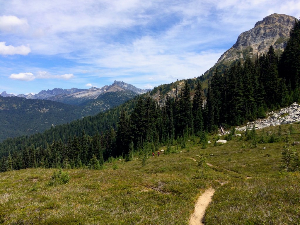
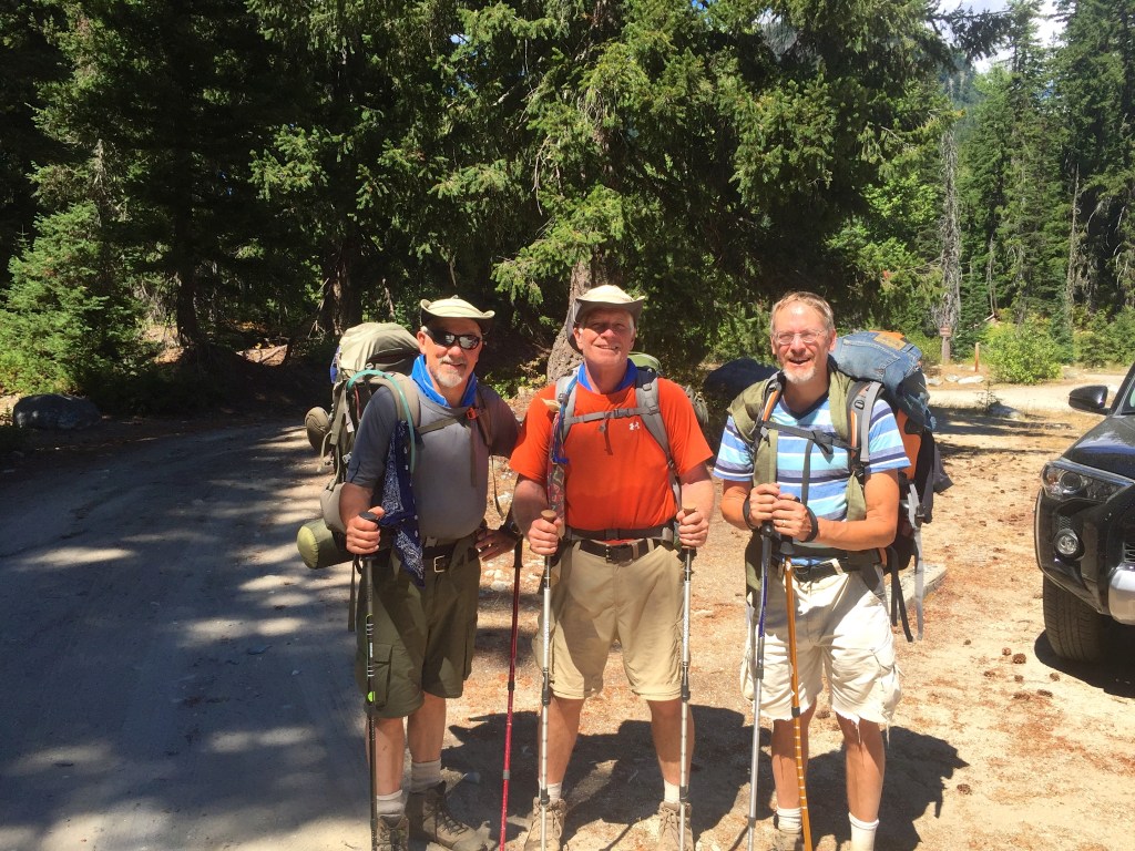
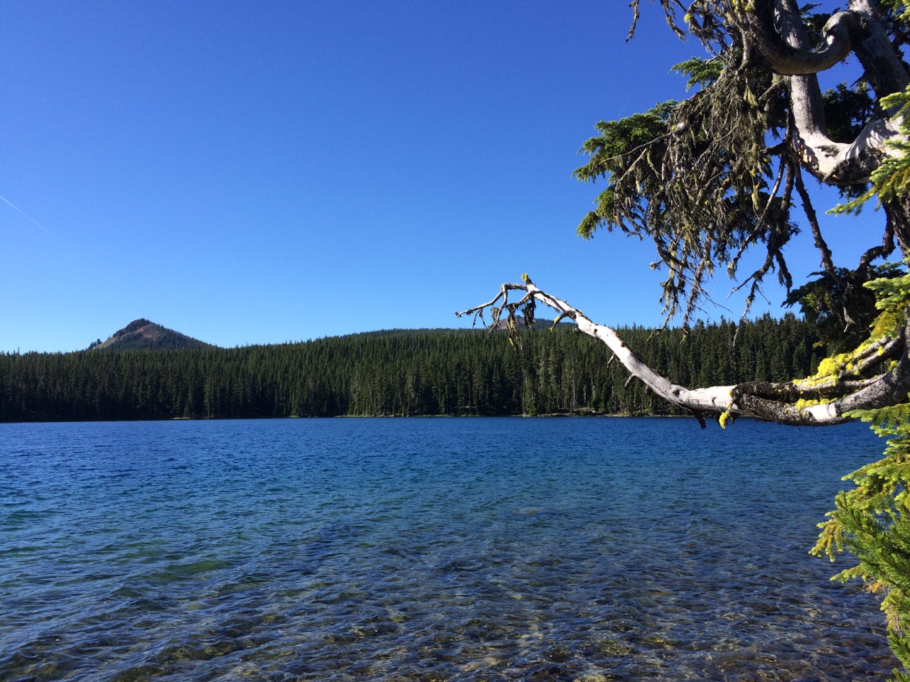
I am sorry for being a bit late on posting about our Spider Gap Buck Creek Loop trip, Aug 1-6. As expected this 36 mile loop with 8000′ vertical was amazing and lived up to our high expectations.
Every year I do a loop like this with friends and when we have asked other backpackers what they believe to be the best loop, Spider Gap Buck Creek tends to be the winner. And it is truly an awesome loop complete with incredible vistas, challenging climbs and unique topography.
We decided to take the counterclockwise route beginning with the Spider Meadow Phelps Creek trail. The meadow was beautiful but it was obvious that we had missed the high flower point by a few weeks.
Taking it easy the first day we planned for the Spider Gap climb which is broken into an initial 1000 ft climb on a fairly rugged rock trail and then another 1000 ft climb on up the snow field. The reward at the top was worth the climb.
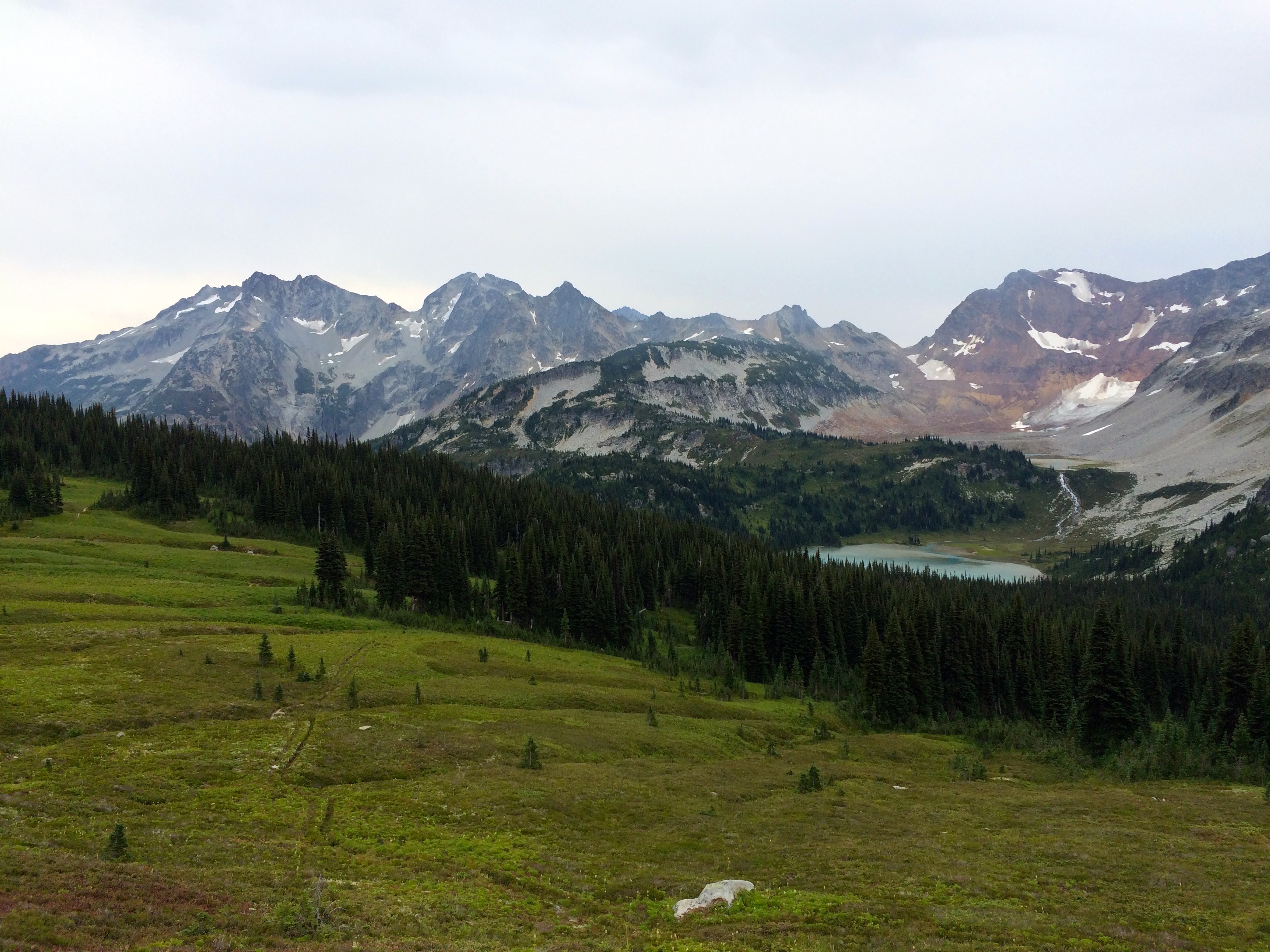
The view into the Lyman Lakes Valley and Glacier was highlighted by rugged terrain which turned out to offer up a bit of a scare to us. We made the mistake of assuming the trail to the east would eventually wind down to the valley. Wrong, so I advised that we backtrack and go down the snow field. Unfortunately, Bob, who hates to backtrack decided to take the short cut down the mountain slope. This was not communicated well and we ended up getting separated from Bob.

The outcome of this turned into a nervous search for Bob who did eventually turn up to relieve our fears after he had a bit of a hair raising descent down the side of the mountain ending up further down the valley. Our concern stemmed from the dangerous loose rock navigation that could easily result in a slide or a fall. But all was well and we settled in between the Lyman Lakes.

Old Backpakers 
Lyman Lakes Campsite
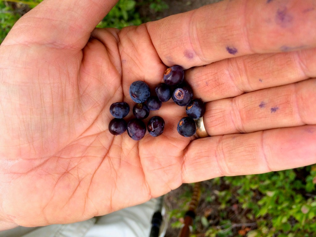
The following day took us over Cloudy Pass which lived up to its name. This is also about the time we began enjoying an over abundance of blueberries and huckleberries. We had a fun log stream crossing below Lyman Lakes. Again we kept losing Bob because he couldn’t resist stopping and eating the berries.

This is when we first saw the fires which have wreaked havoc with the PCT Trail closure. At this time the big fires over at Lake Chelan had not blown up yet. As we climbed over the pass we got to speak with many of the local Whistle Pig population.
This was also when we discovered that the detour to Stehekin was no longer an option for the PCT’ers. We went about half way to Image Lake and turned around figuring that the weather was not going to present us with enough reward. After talking to others who went over I think it was the right decision.
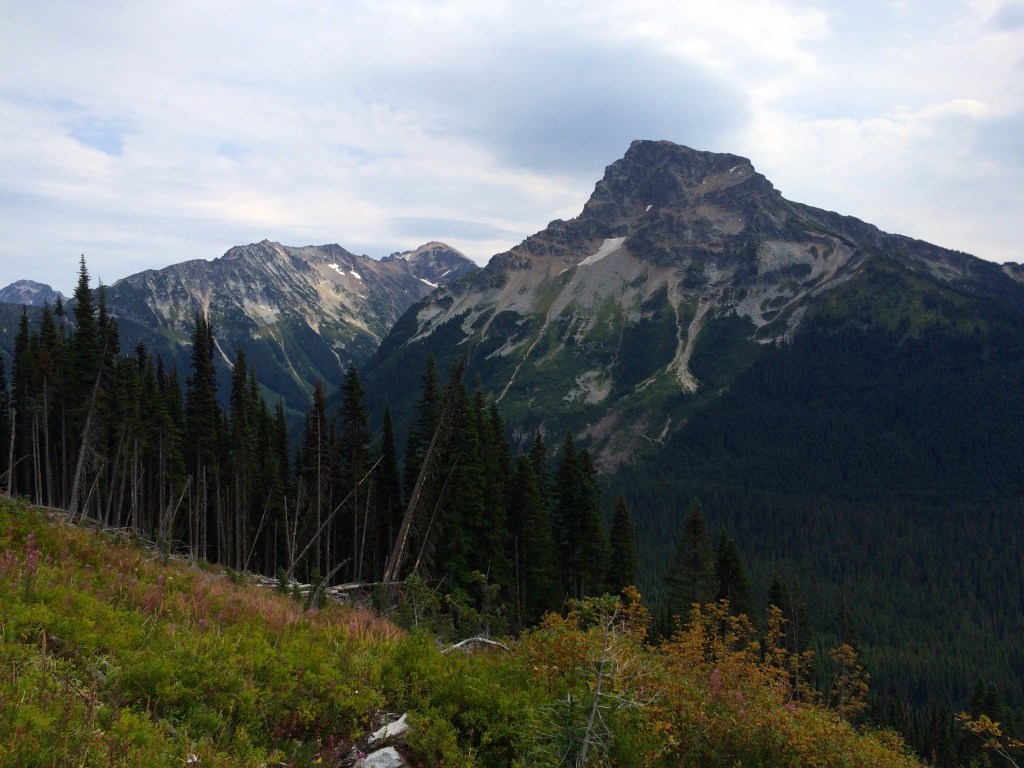
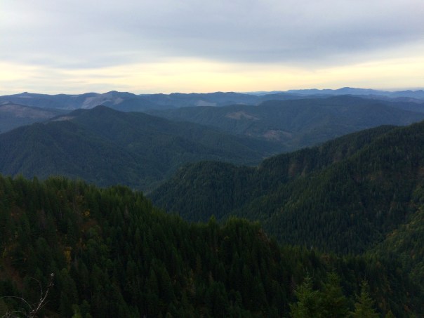
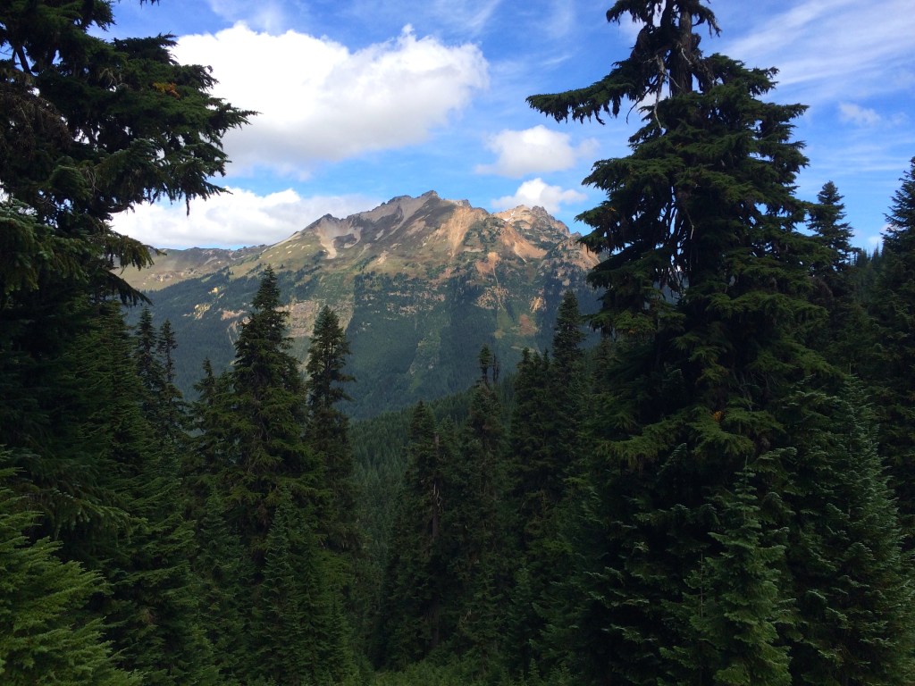
Fortress Mountain 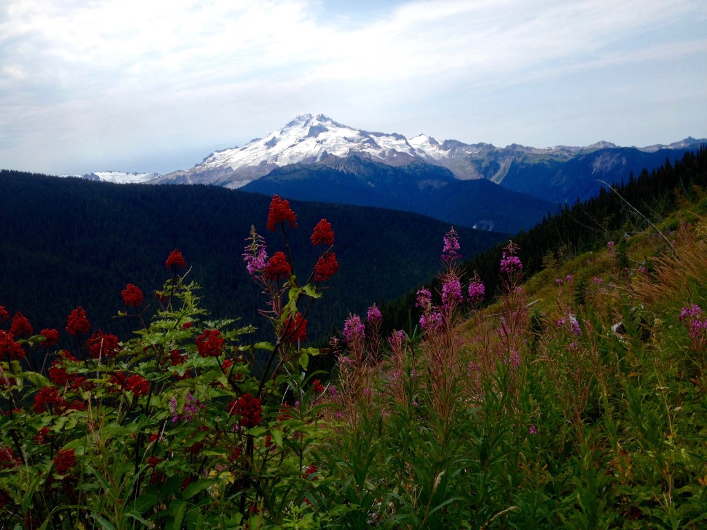
Glacier Peak

We had hoped to hike over to Image Lake which is a 2.4 miles. We went about a mile and decided we didn’t really need to go all the way. The views of Glacier Peak were excellent from where we were. (I did finally get to Image Lake and yes it is awesome) We camped across from Fortress Mountain. This was the Suiattle Pass Junction area where the PCT closure was spelled out.
We continued on with our loop up to Buck Creek Pass knowing that we would have time for a side hike. We setup camp at the top of the pass while the weather still looked good and we decided to do the Liberty Cap trail.

I highly recommend this route which offers fabulous views of Glacier Peak.
Well the weather started to change once we got up on Liberty Cap which caused us some concern but also offered beauty in the cloud formations.


We got back to camp just in time to avoid the rain.
The next morning it was still miserable on the pass but we could see that there was sun in the valley on our route back to the Trinity Trailhead. The annual backpacking loop trip with friends was again a great success, however, this year I was set to continue on for a few more weeks.
My original plan was to get my resupply and go from Stevens Pass to Canada, however, the fires forced a change to that strategy. So I decided to go from Stevens Pass to Snoqualmie Pass for my next segment.

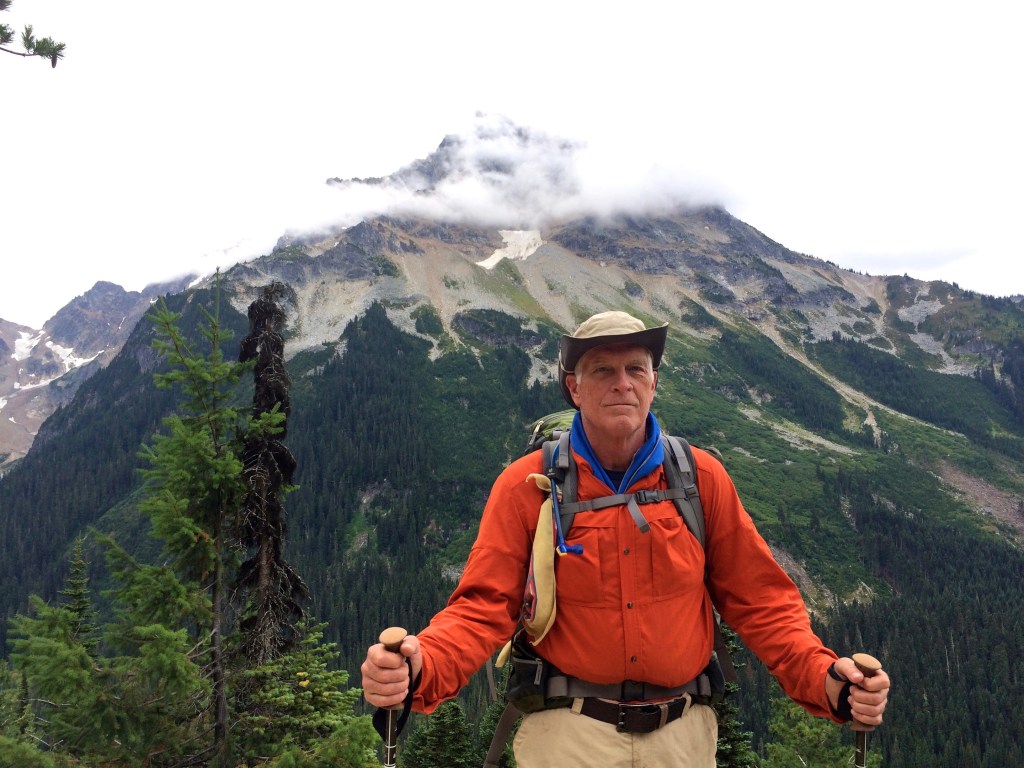
Timberline to Cascade Locks
My second Oregon PCT segment was excellent, the weather was what you would expect and the scenery was as good as it gets.

Abby
Unfortunately when it ended and I returned to the cellular world at the Eagle Creek Trailhead I found out that my beloved old backpacking canine companion, Abby, had died the night before. It was good that I had another 2.5 miles before I got to Cascade Locks, I needed the time to shed tears and reflect on our years together. I am so glad that we got to travel back to Oregon together. Australian Shepherds are incredible dogs and Abby was one of the best.
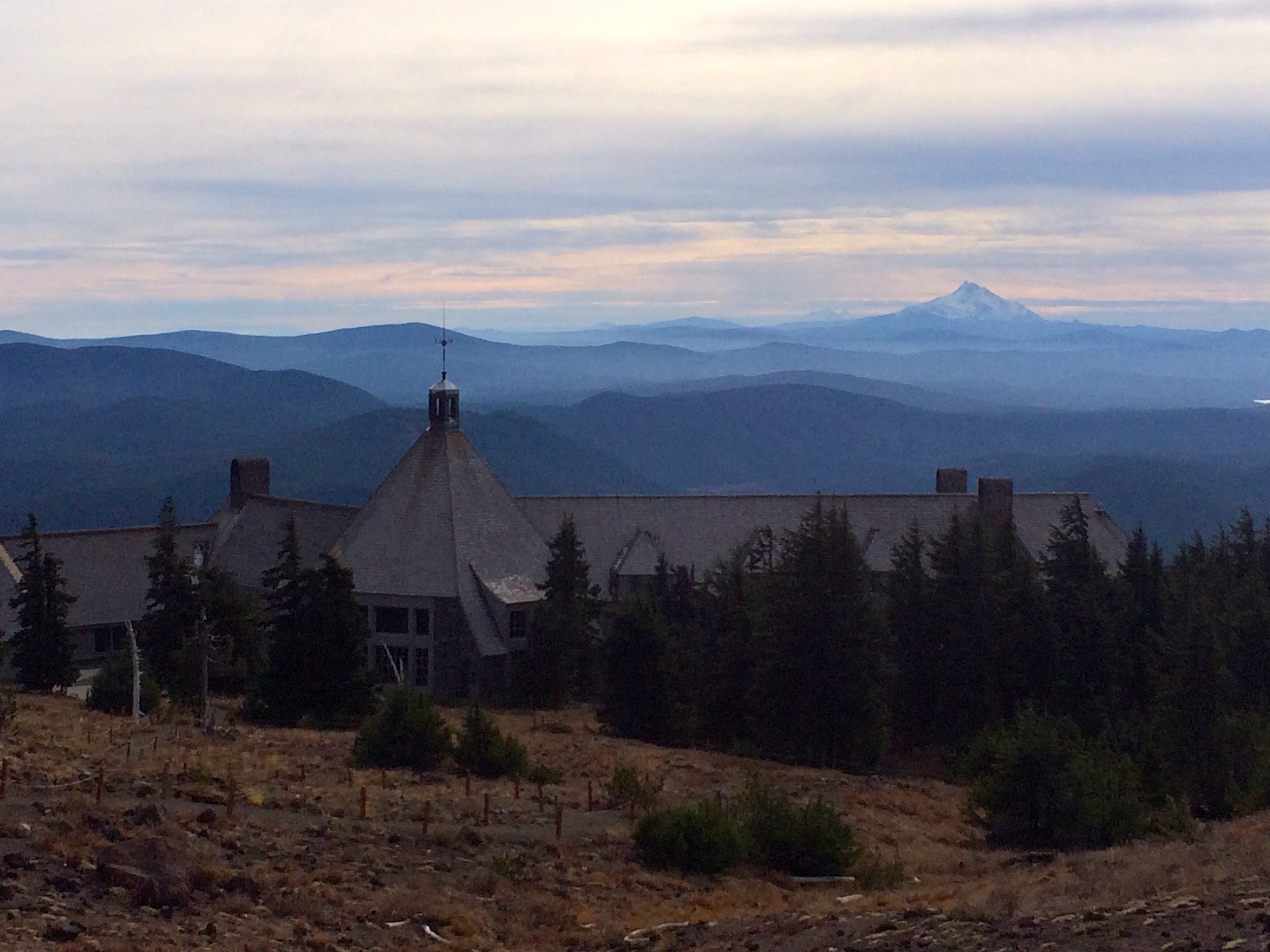
 Back to the Hood to Gorge review. My wife and I spent the night before I departed at Timberline Lodge. Weather was perfect as were the IPAs we consumed in the adirondack chairs observing Mt. Hood. We could see Mt. Jefferson to the South initially but the view faded away into a smoky haze from the fires in southern Oregon.

Early Views of Hood
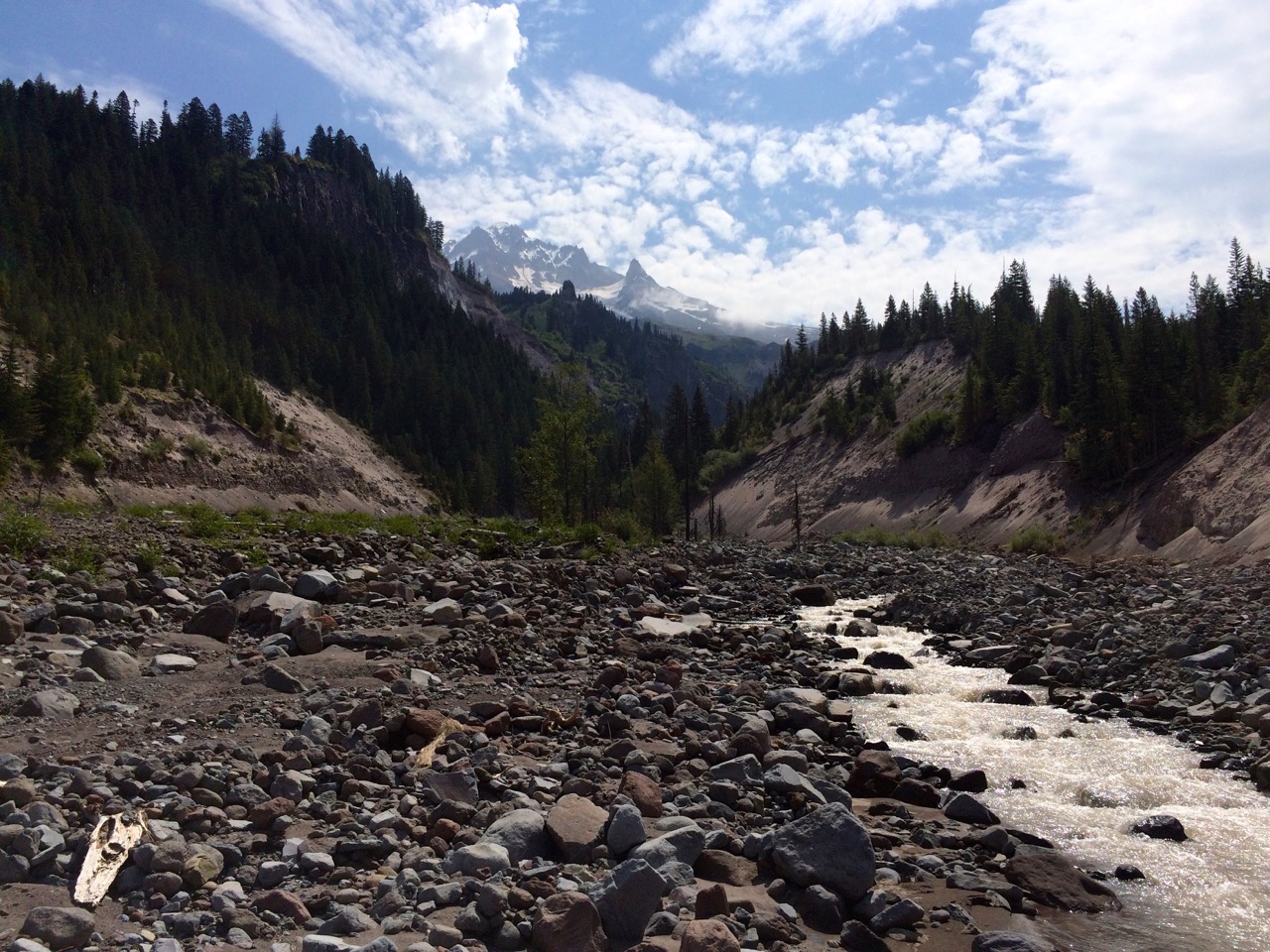
I departed on July 9th in beautiful weather with no deadlines, just a destination. The PCT from Timberline takes you into the Paradise Park area which is all about majestic views of Mt. Hood. You feel very small underneath the mountain. An afternoon thunder storm brought needed moisture but also motivated me to seek a campsite. A heavy fog moved in which essentially equated to rain all night long.  The following day offered more amazing Paradise Park views. This is fairly rugged trail that skirts the many snow melt streams from Hood. The main goal was to have a relaxing lunch at Ramona Falls, however, crossing the headwaters of the Sandy river to get there always presents a challenge.

Sandy Crossing
So when I came out of the forest to greet the Sandy it was obvious that I was not crossing that high volume stream at this PCT designated trail point. When looking for a crossing you head upstream and look for perfectly positioned rocks or hopefully a log assisted crossing.
Mt. Hood from Sandy
I found the log/stick crossing that had been thrown together, and although it was a bit scary it turned out to be more then adequate. The reward for the challenging stream crossing is a glorious view of Mt. Hood.

Ramona Falls
Then on to the ultimate reward of Ramona Falls and I was not disappointed. The sunlight through the trees creates unique highlights of this cascading waterfall.
I needed to put in a few more miles so taking the PCT Ramona Falls alternate trail to the Muddy Fork Junction was a perfect climax to my second day.  However, crossing fast flowing stream on a couple of logs was interesting. But more interesting to watch were a couple of endurance runners cross the stream on foot.
The next day, Saturday, was a bit dreary weather wise, but that was OK since it kept down the day hiker population. It was a tough day for distance and vertical, 10 miles of 3000 ft up and about 1500 down. When I passed Lolo Pass I was thinking about putting a long sleeve shirt on which made me wonder about the 4 teenagers who were heading up to Bald Mtn. in shorts and tank tops.

Mt. Hood and Lost Lake from Buck Peak
Sunday ushered in a lifting fog which made for an eerie beautiful trail. The body felt good as I was knocking off more vertical before the inevitable drop. I had passed Devil’s Pulpit and Preachers Peak so I was in the mood for a wilderness church setting. About 10:00 am I noticed a side trail which lead to Buck Peak. The trail was OK but narrow and overgrown enough to mean that condensation from the vegetation was going to be soaking. But I sensed its call and a half mile up I was rewarded with His majestic throne’s view of Mt. Hood and Lost Lake. The church service was excellent.
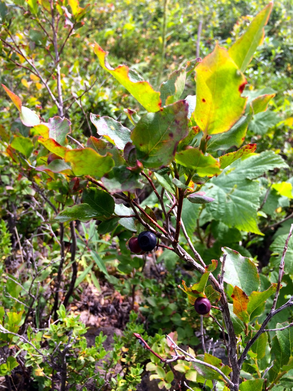
Ripe Huckelberries
The trail began the inevitable elevation decline to the gorge and with it came an abundance of ripe berries. I had a wonderful afternoon taking my time enjoying the spectacular view of the Eagle Creek canyon and eating plenty of ripe Huckleberries. After arriving at the Indian Springs abandoned campground I opted to continue on another 3 miles to Wahtum Lake. Definitely the right call as the lake campsite was beautiful and the trail there and then on to rejoin the Eagle Creek alternate PCT trail was a more gradual vertical decline complete with beautiful lush waterfall strewn scenery. Oh yes, and plenty of Thimbleberries, a tasty relative of the raspberry.
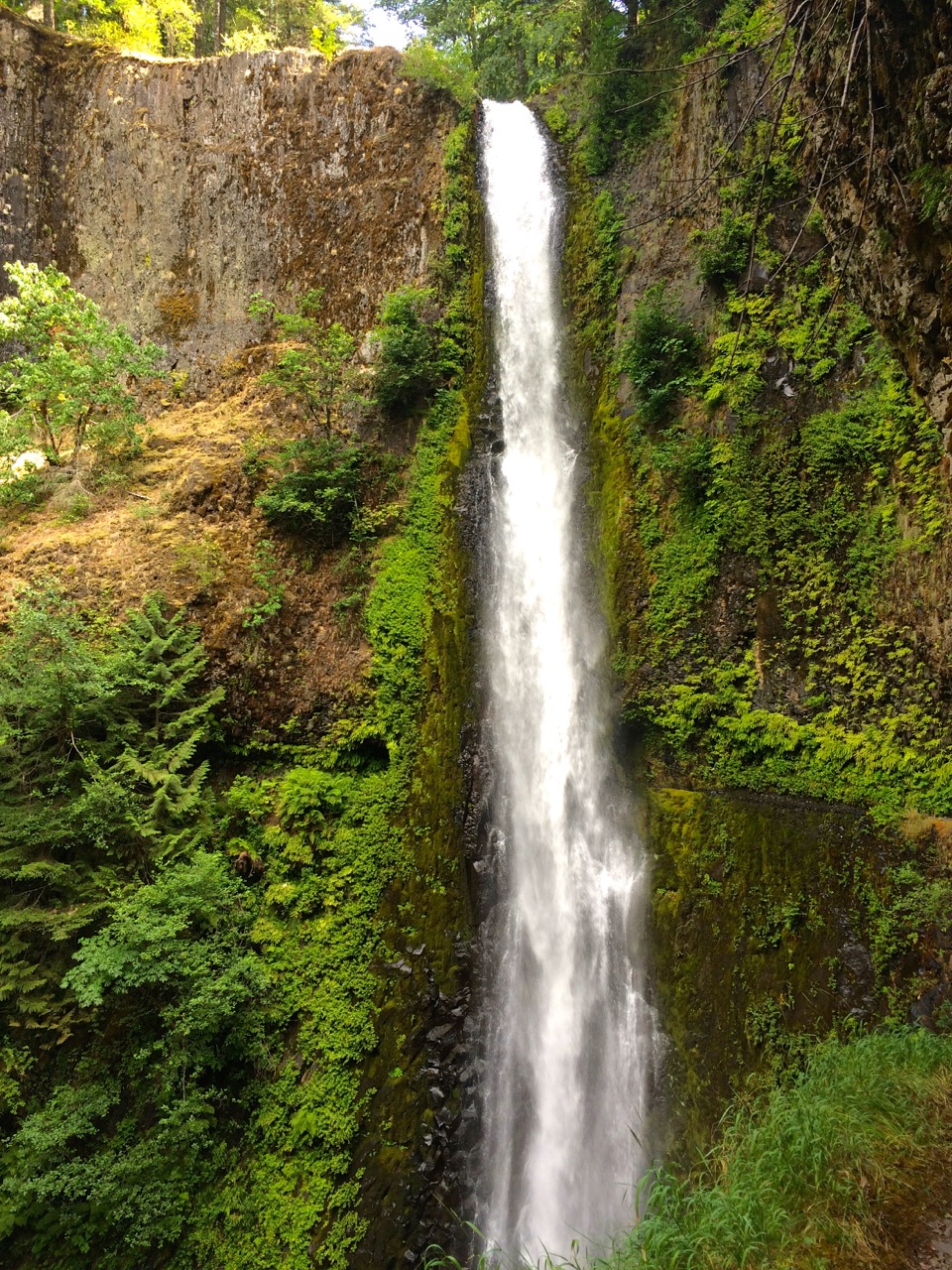
Tunnel Falls
I knew I was in for a treat from the Eagle Creek canyon trail but little did I know how amazing it would be. My daughter and I hiked up this trail about 10 years ago but stopped short of the really great landmarks.  So the ultimate goal is Tunnel Falls, which totally lives up to the hype. Actually the entire Eagle Creek Trail is awesome with many serious waterfalls, good swimming holes, precarious cliff carved trail and great campsites. But Tunnel Falls, Wow.
I knew that my trip would end the next day so I kept looking for the ultimate campsite, but I was getting tired.

Last Night Campsite
Thankfully I kept seeking a better site and ended up with a primo campsite just below 4-Mile Bridge next to this 30+ foot waterfall, Skoonichuk Falls. But it made for a perfect last night on the trail where I was spared the heartbreak of knowing what was happening at the time with my dog, Abby.

Bridge of The Gods
The final day took me past High Bridge and Punchbowl Falls, plus greeting about a hundred, mostly day hikers, many with the goal to make it the 6 miles to Tunnel Falls. After receiving the news about Abby I hiked the Columbia River Highway State Trail up to Cascade Locks which provides a very nice view of Bridge of The Gods over to Washington. My wife and daughter were at the PCT Trailhead park by the bridge waiting for me. It was a gorgeous day for a burger and beer as we mourned the loss of our family dog.
Backpacking Lessons Learned
My first segment on the PCT taught me a lot, but the most important was that you cannot beat the heat. My goal was Willamette Pass to McKenzie Pass, about 80 miles in 9 days. I aborted after 6 days and about 50 miles after 2 days of 90+ degree heat with thunderstorm humidity did me in. The other lesson taken away was to keep your destination schedule open, since you never know what will affect that schedule.
OK, now for a quick update on what I did accomplish. Remember, I am 61 years old, healthy, but not really in great shape and I have been living at low altitude.
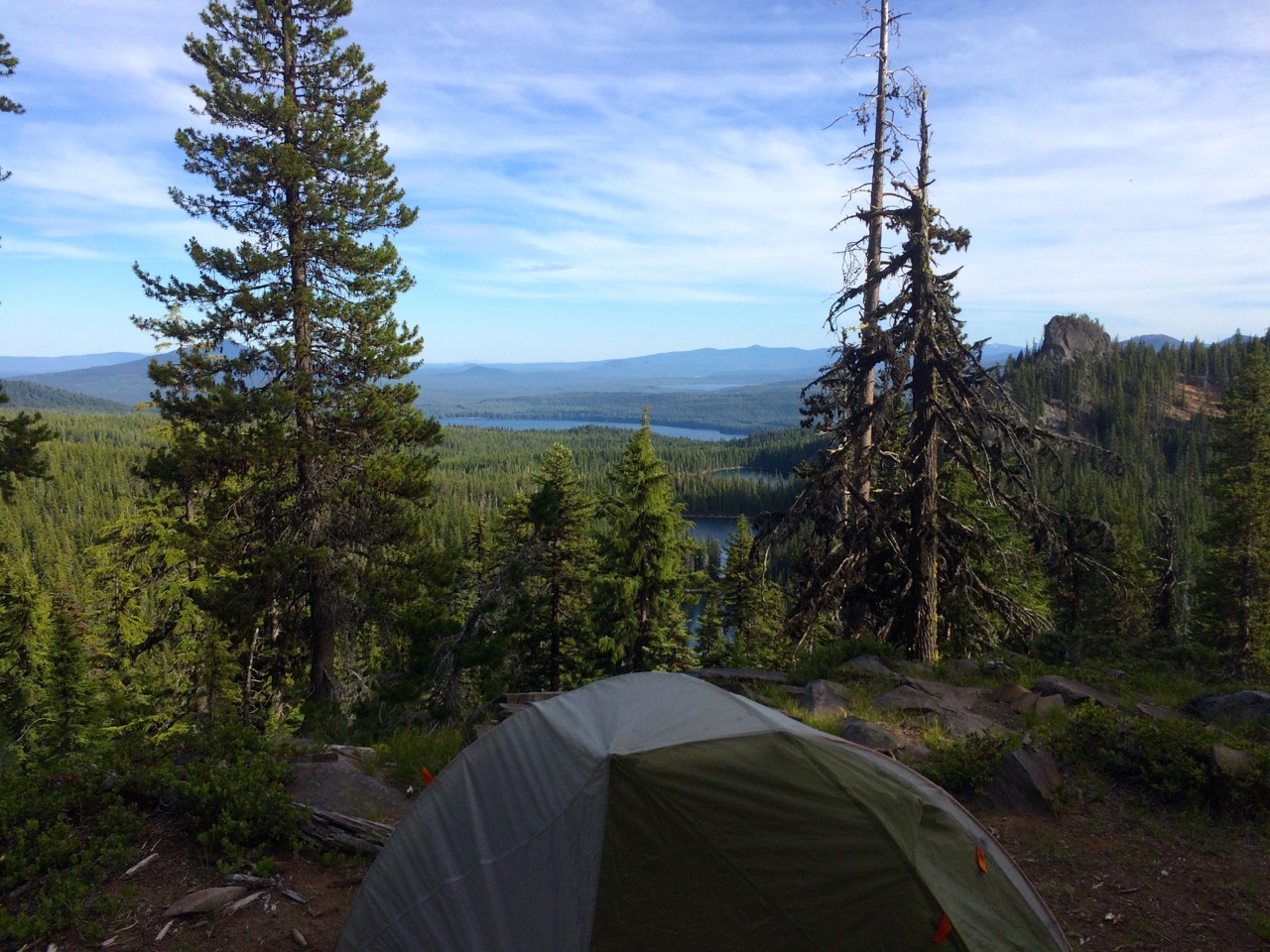
First Campsite Overlooking Rosary Lakes
I started off in the afternoon figuring I just needed to get a few miles under my belt to loosen up. I ended up going 5 miles and climbing 1200 vertical to end up at a fabulous overlook campsite. I felt great and was so pumped to be transitioning into this new wilderness mindset.
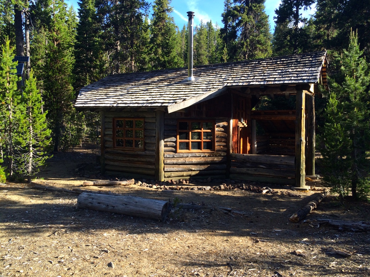
Winter Ski Cabin
The second day I enjoyed the comfort of a really nice winter ski cabin to escape the mosquitos and reorganize a bit. I determined that I would camp at the top of the next climb which meant I had to pack more water which I secured at Bobby Lake. I put in 9 miles and more good vertical and the body was responding well. Also to my surprise I had cellular service (maybe from Waldo Lake), although sporadic, but it did allow me to let the world know I was doing OK.
Carlton Lake
Mosquito Survival Net
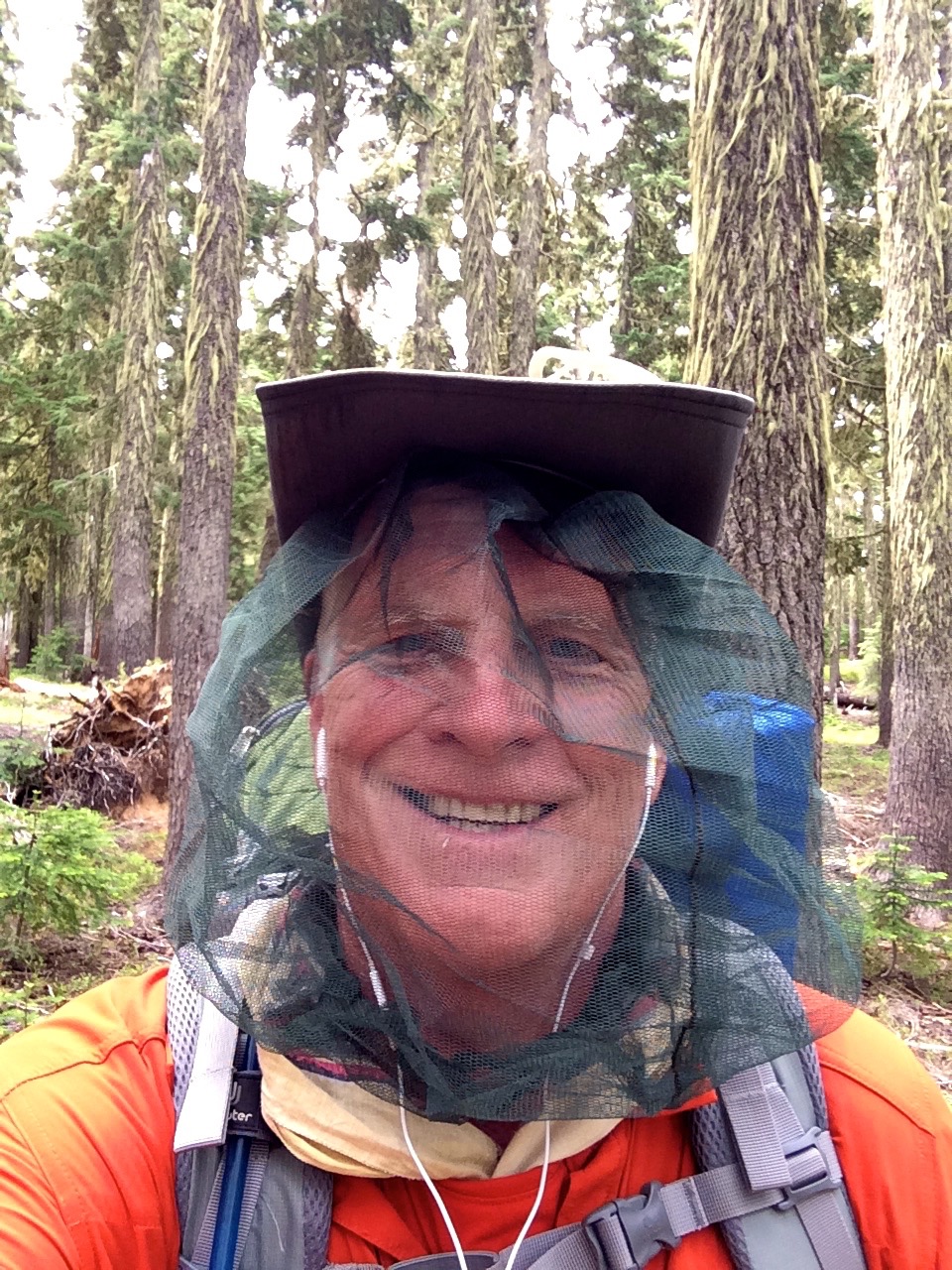
The third day felt good, I get up early to take advantage of early morning coolness which allows you to wear longs sleeves to combat the mosquitos, but that is nothing new, just inconvenient.
Trail Maintenance Team
I knocked off a number of miles and stopped at Carlton Lake to filter water and cleanup a bit. The mosquitos were getting worse and the breeze off the lake was a a welcome relief.
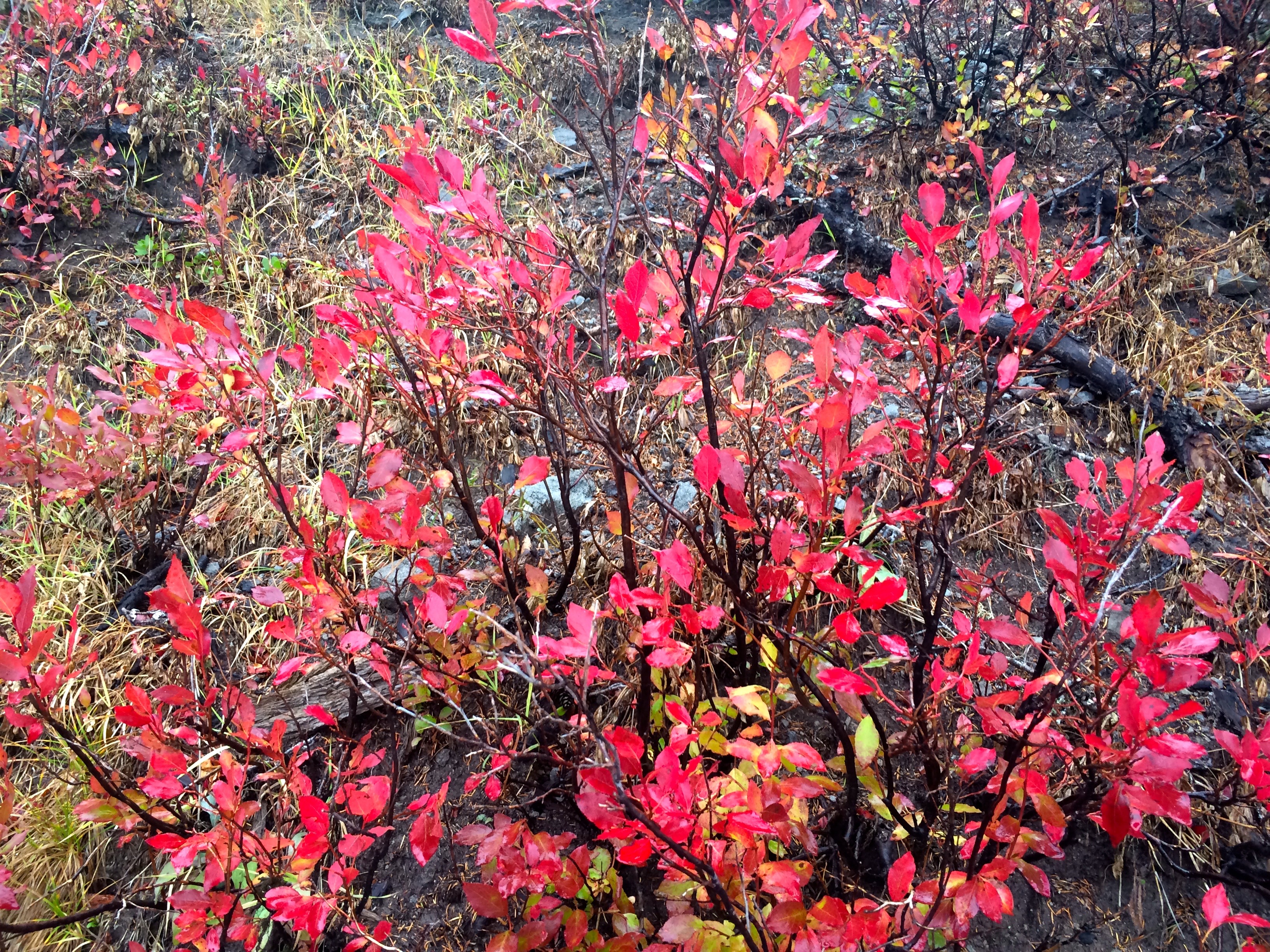
I was feeling good so a set a goal of another 9 mile day to get to Taylor Lake. Along the way I thanked a trail maintenance team for the work they do and travelled through maybe a 10 year old fire area.
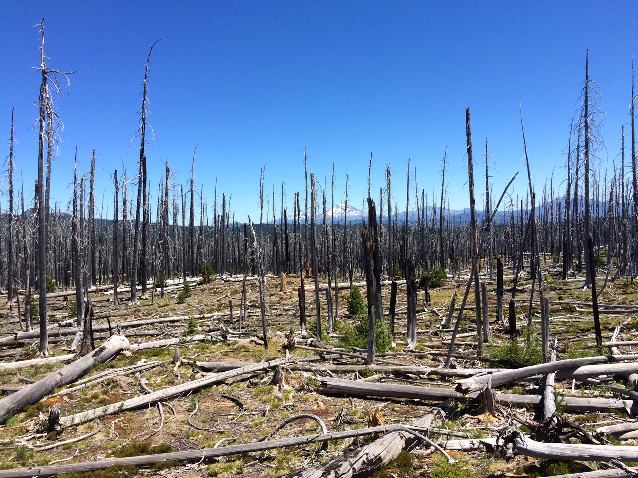
Fire Burn Area
Peaceful Taylor Lake
I got to my campsite early afternoon and took advantage of relaxing by Taylor Lake enjoying the mosquito less breeze. This was the first time I realized I had pushed my body to about max, but I could tell that I was able to refresh it with rest.
Around dinner time I was joined by a couple of PCT through hikers, trail names: Ranger and Bubba Gump, which made for good conversation as I compared my PCT adventure to theirs. They may have been one of the first through hikers to reach this far north, however, they skipped the Sierras to avoid the late winter storm.
Ranger and Bubba Gump
They did plan to return to do the JMT.
Next day I watched the young buck through hikers leave me in the dust I again felt strong and very satisfied with how my body was responding. However, the temperature was rising and all was about to change. I pushed myself this day for 10 miles and ended up at a campsite totally depleted of energy as the heat was taking a toll on me that I still believed I could plow through. That night we had a thunderstorm which did little to reduce the temperature but it did raise the humidity. The overcast morning made for a warmer and more intense mosquito start to the day. After my initial few miles of enthusiastic trekking my body started rebelling. I was sweating a lot which I think I was replenishing with liquids, but the heat toll was greater then that. I had hoped to put in 12 miles and make it to Elk Lake Resort. However, as my body began to fail, symptoms of heat exhaustion setting in, I made the decision to stop at Dumbbell lake only half way but my only good camp option.
Therma Rest Float
Anyways, wisdom was setting in and I knew I had to back off due to the heat and this lake looked ideal for the swimming potential. So I made camp before noon and focused the afternoon on body recovery. Floating around the lake on my Therma Rest Pad provided a wonderful way to cool down and great relaxation. However, I was now challenged to make my designated destination pickup at Lava Lake Trailhead. Unfortunately, it was still hot and more storm clouds added to the humidity.
The only remaining option which would allow me to complete the planned segment would be to put in 10 miles and summit Koosah Mountain with a difficult 1200 vertical or bailout with a 6 mile mostly downhill trail to Elk Lake Resort.

End of my Trail
Well about 4 miles into the effort it was obvious that heat exhaustion was not going to allow me to accomplish the needed goal so Elk Lake it was.
Actually aborting in this way made for a fairly interesting adventure in figuring out how to get home. I hitchhiked from Elk Lake, something I have not done for 40 years. The couple that gave me a ride dropped me off at the Cascade Lake Brewery in Bend, OR. I was able to connect with an old GEOAID colleague who gave me a bed for the night. Then I took a bus shuttle to Gresham, OR, where I caught the MAX light rail train to Hillsboro. All in all, it was a wonderful first phase of the adventure. Backpacking is tough, but the rewards of experiencing God’s earthly beauty justify the effort. I’m ready to hit the trail again in a week after this heat wave subsides.


