Category Archives: Adventure

My Dog is Complicated
My dog Brook, @AussieBrook, and I just returned from a perfect backpacking overnighter to Tom, Dick & Harry Mountain. The weather was perfect thanks to a temperature inversion that kept the Portland area under a blanket of fog. This was important because I really needed to give Brook a positive backpacking experience since our early summer outings had soured her on the whole backpacking thing. You see, Brook, an Australian Shepard, is complicated. She is a typical Aussie in that she wants to herd, protect and keep me aware of everything.
She is 4 years old and has been backpacking with me for 3 seasons. The problem relates to how Brook will totally sacrifice her own comfort to ensure that I am protected. This translates to her only sleeping outside and typically finding a strategic vantage point from which to keep watch through the night.

Hiking out in a snow/rain storm 6/19
Frankly, I would rather she slept in the tent to help keep me warm, but I do appreciate her concern. However, as I mentioned, Brook is complicated. I have never had a dog that I needed to negotiate with. This year those negotiations centered around her deciding that she did not want to backpack with me. This objection relates first to the fact that she hates to ride in a car, I think this relates to her not having control of her environment. However, the real objection arose from our early season treks where she was the victim of some really bad weather. The photo above is from an overnighter to Ramona Falls in early June to investigate the Sandy River crossing in preparation for an upcoming Timberline Trail Trek with friends.

Morning at Eden
On that Timberline Trek Brook showed her disinterest in the overall trip but cooperated just fine until the weather deteriorated. After we got hit with a snow storm, Brook disappeared by positioning herself back up the trail letting us know that she was done. In this negotiation with her we agreed to end the trek. Back home when I was preparing to go on my Lofoten Norway adventure it was obvious that Brook wanted nothing to do with it. This was OK at the time because Brook was not invited to Norway or the later Colorado Trail treks, so essentially Brook got her wish and had the summer off from backpacking. Since returning home I have been looking for an opportunity to take Brook on a positive outing. I even purchased her a new winter jacket to help get her through those cold nights.
Well our recent overnighter to TDH mountain was all that I had asked for and better. From my perspective the view from TDH of Mt Hood and the many other mountains to the north is a backpackers treat.  Clear skies is a must but getting comfortable temperatures in November was more then I could have hoped for. We made it to our campsite around 4 pm and setup camp in preparation for darkness to hit early. As the sun went down it got really cold, probably got to 38 but the breeze was out of the west and it felt good. Brook ended up laying next to the tent close enough to be laying next to my legs. Again, I would have loved to have had her in the tent, but at least she was staying close. The first time I got up I could tell the temperature was rising, it felt great and I could tell that Brook was also happy with it. She hung out next to the tent until about 1 am which was a real positive. Overall she seemed very happy at sunrise and showed her appreciation with many kisses.
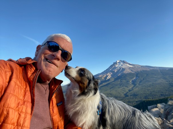
The morning was spectacular with an awesome view of Mt Hood. Brook had a wonderful time terrorizing the local squirrel population as I enjoyed a leisurely morning taking in the view.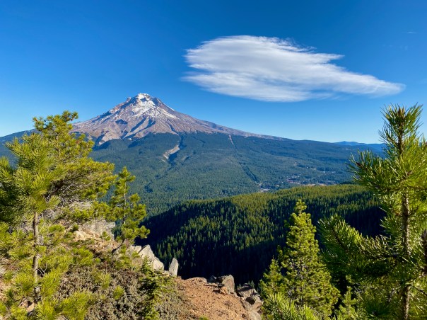
I think Brook may be mellowing a bit in her objections to backpacking, but I will make sure that our next outing, probably next Spring will be a pleasant one for her.

However, I leave this trek with a concern. I do not think I have ever seen so little snow cover on Mt Hood.


These views of the south side of the mountain are from 110519 and 110818. The problem is not a lack of snowfall but more rapid melt-off due to higher temperatures.
Summer of 73, Indy 500 and Secretariat
Historical Posts representing Adventure Continues: Second Quarter
It is May 1973 and I am finishing up my first year of college. The Vietnam War is winding down and Watergate is ramping up. The Second Quarter is faintly calling me to seek my passion. However, I’m still going through the motions to pursue the passion that was typically prescribed to a midwestern kid with an aptitude for Science and Math. I should become a doctor, own a big house and become a member of the Country Club. That “Dream” appeared to be alive and well after earning a 3.7 GPA for my freshman year at Indiana University in a premed curriculum.
The month of May for Hoosiers is mostly about the Indy 500, however, attention is also given to the Kentucky Derby, won that year in record setting time by a horse named Secretariat. Secretariat then won the the Preakness later in May which stimulated talk of the first Triple Crown of horse racing in 25 years. But the Indy 500 was the big show and I was fortunate enough to be invited to attend via a friend’s access to a press pass which got us into the track the night before the race. This was an unbelievably fortunate opportunity for a couple of 19 year olds. That night before the race was surreal. We strolled through Gasoline Alley, kissed the bricks at the finish line and gazed out over the raucous crowd partying outside the track. I know that we spent the night inside the track but I don’t actually remember any sleep. We did not have a ticket so we positioned ourselves at an excellent view point in the infield of the first turn.
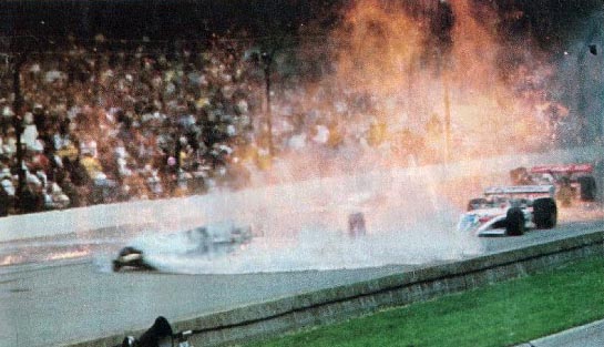
Rain was the big issue holding up the start of the race for many hours but finally it was about to begin. This was so exciting because it was the first time that I had ever been to the actual race. I had never even seen the race live, you see, if you lived in Indiana you could only listen to the the race on the radio. The pace laps were complete and the roar of the start of the race was deafening until the sound of crashing cars and smoke rising from the end of the straightaway took over my anticipated moment. A terrible mishap had occurred during the start, single cars passed by us and then I so vividly remember seeing a wheel roll all the way around the first turn. It started raining soon thereafter, there would be no race on that Memorial Day May 28th, 1973. In fact rain only allowed for an abbreviated 133 lap race to be completed 2 days later ending after the fatal crash of Swede Savage.
We Hoosiers transitioned out of the somber mood of the deadliest Indy 500 May ever as we started out summer. I got a job working at the Purdue University Agronomy Farm doing something special to alfalfa plants for some professor’s research. My best friend, Rick, and I umpired little league games or were playing basketball in the evenings. I was in-between serious girl friends so dates were not happening a lot. It was a great summer in Lafayette, IN. On June 9th Secretariat did win the Triple Crown by Winning the Belmont Stakes in stunning dominance. Rick was more in tune to horse racing but it was I who pushed that we should go up to Chicago on June 30th to see Secretariat run in the Arlington Invitational.

A road trip to Arlington Park was a fairly big effort for 19 year old boys who would have to borrow a parent’s car, luckily our 3rd amigo, Pager, had a car, a 63 Chevy Biscayne, and he was up for the adventure. As usual I was the one who worked out most of the logistics. We did a pretty good job navigating our way to the park for a full day of horse racing. Rick knew a bit about betting the horses since his father had taken him to the track a few times, but this was all new to me. Pager was commissioned by a neighbor to place the lucky number bets of 4-7 and 7-4 on the Daily Double.
So the number 4 or 7 horse had to win the first 2 races. We had a winner in the first race but our horse in the second race named “Go Father Go” was a bit of a long shot. Well what a thrill we had cheering “Go Father Go” to victory in that second race meaning we had a Daily Double Ticket worth $600. So here are 3 young men looking at $600 and greed won out. We decided to keep the money and tell Pager’s friend that we did not get to the track in time to place the bet. We were actually very fortunate to have gotten there in time so we rationalized that we deserved the money. We all felt a bit guilty about this, but oh what day we would have with some real money to play with.

We did not increase our winnings but we did not lose it all either. The opportunity to see Secretariat run was awesome. Secretariat was challenged by only 3 horses so the betting was on Secretariat or any of the other 3 to win. Secretariat won in an impressive performance and paid $2.10 on a $2.00 bet. I bet $20 on Secretariat and won a buck. It had been a great day at the race track and now we had plans to find a good restaurant on the way home. We were feeling quite bold as we strategized how we should order a drink with our meal. The problem for us was that we had no clue what drink we should order. Pager only knew of a drink named “Manhattan” so that is what we would order. We figured that if we flashed a $100 bill they would think we were old enough to drink. I can only imagine how stupid we must have looked as we tried to be cool ordering our dinner and by the way we would all like a Manhattan as well. Well the restaurant really didn’t care so we all got to experience our first mixed drink and then boast to each other all the way home how well we handled ourselves.
Summer ended and we all went back to our college lives. But something was different, I was starting to truly think about my future. The concept of adventure was creeping into my decision process. When I pictured myself as a doctor I saw a stable career serving a community of patients for the rest of my life. But that did not translate as adventure to me. I would not classify the Indy 500 or the trip to Chicago as great adventures, but I do think that I gained confidence in knowing that adventures were out there and that I wanted to experience them.
Next Post: Leaving Indiana 76
Ending my college time at Indiana University in 1976 highlighted by the Hoosier Basketball NCAA Championship and then I was off to Colorado as a Presbyterian Missionary and having the all to real experience of the Big Thompson Flood.

Wild Rogue Loop
News Flash: “Wild Rogue Loop” selected as one of the Best New Trails in the US by Outside Magazine.
My backpacking companion had a few weeks off at the beginning of May and I’m still retired until June so we searched for a challenging early season backpacking trip.  Looking for a loop with good temps, flowers and minimal bugs led us to find this refurbished Wild Rogue Loop in Southern Oregon. Last year the Siskiyou Mountain Club with help from grants rejuvenated the 25 mile Rogue River Loop which is a conglomeration of the Rogue River Siskiyou National Forest’s Mule Creek Trail 1159, Panther Ridge Trail 1253, Clay Hill Trail 1160A, and the Rogue River Trail 1160. This was necessary because of the damage done by the 2005 Blossom Fire after allowing the forest to heal for 10 years. The combined trail is one of the best in Oregon. The evidence of fire is minimal, the terrain is challenging and the scenic rewards are stunning.
Once this loop was chosen for our Spring outing, gathering trail details was more challenging, but critical feedback on the trailheads, poison oak and ticks was helpful.

USFS Livestock Pasture near Foster Bar
I decided to use the Foster Bar Rogue River Trailhead, which happens to be the West end of the 40 mile Rogue River Trail. This entry was down river a bit further than I expected but access and facilities were good and taking in more of the Rogue River was a plus. Overall I think we stretched our trip into about a 40 mile hike. We completed the trip in three and a half days but probably should have stretched that to 4+. We could have used more information on campsite options.
We set out toward the beginning of the loop heading up the Rogue River on Sunday May 1st. A beautiful day that pushed temps up into the 80s. The trail is cut out of the North bank or wall of the canyon presenting you with moderate difficulty and plenty of river vistas.


The waterfall at Flora Dell would be wonderful for a cool dip.  Obviously water is no issue, however, you rely on tributaries since direct access to the Rogue was generally not easy. On this beautiful Sunday we passed many backpackers, hikers and runners heading down river. However, we never encountered another human for the remainder of the trip.
  I will confirm that poison oak is plentiful until you get above 2000 feet. And yes, I had to deal with a number of ticks, humans can handle this, but I would not take a dog.
We decided to take the shortcut at Brushy Bar over Devil’s Backbone, a decision we questioned after comparing the added vertical to the shorter distance. Camping along the Rogue is primarily geared for the boaters but the camping area at Blossom Creek was perfect for our first night. Complete with a Bear Box and access to the Rogue for some fishing, it was excellent.


We definitely pushed ourselves on this first day but all was good. The second day took us through Marial to the Tucker Flat Trailhead in order to head up the West Fork of Mule Creek.


From our GPS PDF Map on Avenza it was obvious that water sources could be scarce as we climbed toward the top of the Mule Creek Trail.

Hanging Rock from Below
It appeared that the site marked Camp Hope would be the most likely for water but there were 2 other streams just before there still flowing. The first is where we interrupted a black bear but he scurried off into the forest. Unfortunately the trail in this area does not offer great campsites so we pretty much camped on the trail. A thunderstorm accelerated our efforts to set up camp. Again we probably pushed ourselves a bit more then we would have liked on a warm day climbing 2500 ft.
The next day was focused on experiencing Hanging Rock, and it was all that I had hoped it would be.

Greg on Hanging Rock
I would rank it as one of the Top 10 scenic locations in Oregon.

Pan from Hanging Rock

Where Hanging Rock Photos are taken
After lunch on the Rock we had the Panther Ridge Trail to cover and then a decision about how far down the Clay Hill trail we could make before our energy gave out. The 4.25 mile 3000 foot descent back down to the Rogue to complete the loop is tough on old knees.


About half way down we found just enough flat ground to setup our tents just before the rains opened up for the evening. This was another tough day since we had to carry extra water knowing that there would be no more available before we needed to stop.

Rogue River Valley from Clay Hill Trail
 The fourth and final day presented essentially a downhill hike back to our car but it was another 9 miles with plenty of climbs for two old guys with tired bodies. Hiking the same segment on the Rogue River Trail was entirely different in the opposite direction. Overall this was a perfect time to do the loop.
The wildflowers were plentiful, bugs were still sleepy and temperatures were moderate.

I Lost to the Lost Coast
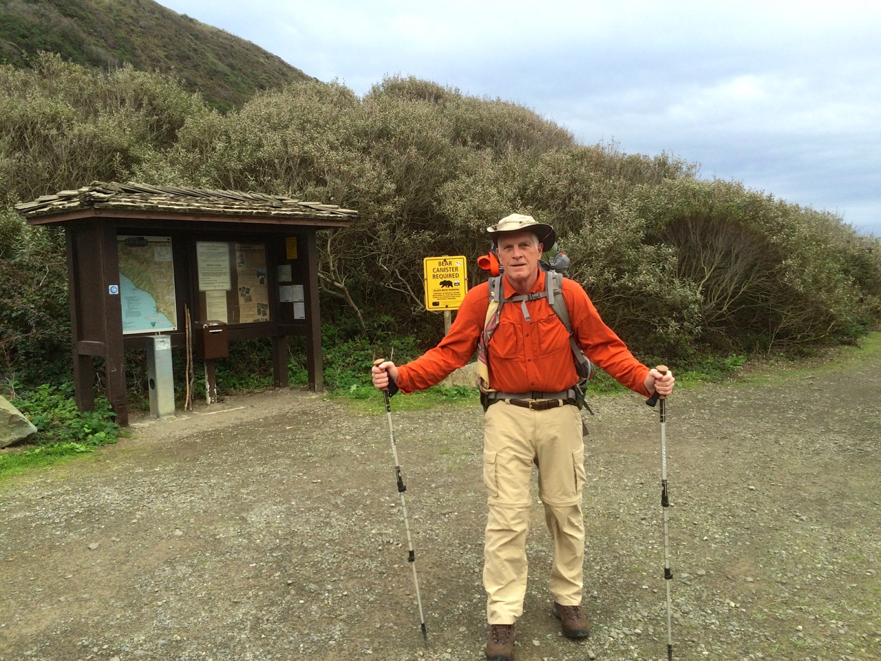
Ready for the Lost Coast
I headed into my Lost Coast Trail backpacking trip during the first week of December 2015 confident that I would accomplish my goal to hike from Mattole Trailhead to Shelter Cove and return. I knew it was going to rain a couple of days, but the forecast called for 10 mph winds. I also knew I had some bad timing for when the low tides occurred during the first part of the week. But I did not dig deep enough into this data to be properly prepared for what was ahead.
The drive down to northern California through the Redwoods was great, my car loves roads like the Redwood Highway. I visited the BLM office in Arcata first thing Monday morning to get my waterproof map, so with that map also on my iPhone equipped to use GPS, I was well prepared for navigation.
The low tide on Monday was not going to allow me to get past the first high tide hazard stretch so I had a leisurely hike past a herd of cattle to end up camping next to the Punta Gorda Lighthouse. It was a beautiful evening as I overlooked a beach full of seals.

Low tide on Tuesday was at 9:33 am at 3.2 feet, so I entered the beginning of this 4 mile stretch before 9:00 am. Based on most reports I had read this stretch was not going to be a problem even if you were a few hours on either side of low tide. Unfortunately, I did not consider the actual height of the low tide. The trek through this segment was tough even without navigating the dangerous rock points of which there are about 5 that are really challenging. Some you can climb up and over, but the rocks were really slippery probably due to the higher then normal waves preceding the approaching storm. So I worked my butt off hiking over the beds of football size boulders. As I neared the last few hazard spots it seemed like it was far more dangerous than it should have been.

Then the last point before Spanish Flat nearly did me in. It was a point where you had to go between a large rock as the waves were crashing, however, it was all under water. As I tried to see around the corner to determine what I was up against I caught a full face on wave that nearly pulled me into the ocean. At that point I couldn’t worry about waiting for the best wave timing so I jumped into waist deep water and made it around. I was soaked but relieved to have survived.

Spanish Flat
I stopped at Spanish Flat, put on dry clothes and checked the tide tables to discover that the low tides that I was experiencing were the highest low tides of the year. That explained things, but now I was concerned about the next day’s stretch of tide hazardous coast with another 3.2 foot low tide, not to mention my concern about coming back from Shelter Cove.


I decided to camp at a nice beach fortress just below Spanish Ridge. The winds were gaining strength which was good for drying out but it was also a bit foreboding knowing that rain was on the way. Yep, the rain started at sundown and the wind just kept getting stronger. It was time to reevaluate whether I should press on to Shelter Cove.
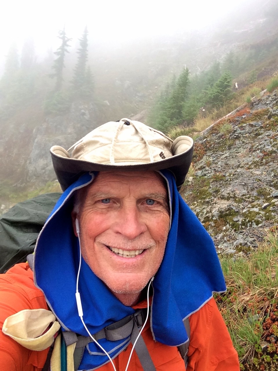
I knew it was going to rain all day so I decided to stay put through Wednesday with plans to head back to Mattole by hiking up the Spanish Ridge Trail over to the Cooksie Spur Trail on Thursday. This was a nice campsite and I was able to get out a few times during rain breaks. This video will give you an idea about how I spent Wednesday.
I was up before sunrise Thursday morning with my backpack ready to go, just needed to take down the tent. I was so happy that it had not been raining for a few hours and the tent was dry. Unfortunately all hell broke loose at sunrise. The rain and the wind hit what I would call typhoon force. My line holding my tent fly broke, my tent stakes were being uprooted, water was rushing in so I had to go. Taking down a tent in gale force winds is challenging but I captured everything, but somehow lost my reading glasses. Of course I was instantly soaked but my Marmot Gore-Tex jacket was taking care of me.

Climb to Spanish Ridge Trail
I decided to go straight up the side of Spanish Ridge and intersect with the trail which worked out fine thanks to the map I had with GPS location on my iPhone. The wind was blowing from the south so it was mostly going to be at my back.
My goal was to climb the 2400 foot vertical of the Spanish Ridge Trail and then take the Cooksie Spur Trail over to Cooksie Creek since I would need water.  Well halfway up the climb (see blue dot on map) I was realizing that this wind was a real problem. As it whipped up the slopes it must have gained even more power, so much so that I was barely able to stand up. Then I really got hit, actually blown off my feet, and I was a 250 lb object. I was totally exposed at this point, no trees or large rocks to shelter behind, so I laid face down next to a small rock that gave my head a little relief. I was pinned down about 45 minutes with the wind occasionally lifting me when it hit between my body and backpack. Oh yes, and the rain was as hard as you could imagine. So here I am face down trying not to be blown off the mountain and I’m getting cold. The night before I had listened to a chapter in Lawton Grinter’s book “I Hike” about his experience with hypothermia, so I knew that the shivering, loss of feeling in my hands and feet and the desire to burrow were typical of hypothermia. What was a bit fascinating from being in this predicament was getting a taste of what it may be like to face the real possibility of death so my conversation with God was with great urgency.
Of course the human spirit doesn’t just give up, I had to do something because my current situation was hopeless. I fought to stand which was really hard because my legs were not working as I would have liked. Something told me that I needed to climb out of this, however, I had no way of knowing what was ahead, but my GPS map at least assured me that I was on track. I walked with my back to the wind using my trekking poles as braces to counter the force and I made it to an area where a small cornice offered some relief from the heavy wind. At this point I knew I had to warm up so I pulled out a wool shirt to add a layer under my rain jacket. Buttoning that shirt with my cold fingers was far more challenging than I could have imagined. However, this accomplishment seemed to give me new motivation to press on at all costs. And pressing on was brutal. There were a few sections where the wind was at my back so I used it to essentially fly up the mountain, however, coming to a stop was never pretty. Then my backpack cover blew loose but was still attached to my backpack creating a spinnaker type sail that dragged me for 20 feet. In between my attempts to move forward I spent more time on my face trying to regroup. Overall it took me about 3 hours to travel about a mile through the really bad section of the ridge.

Beginning of Cooksie Ridge
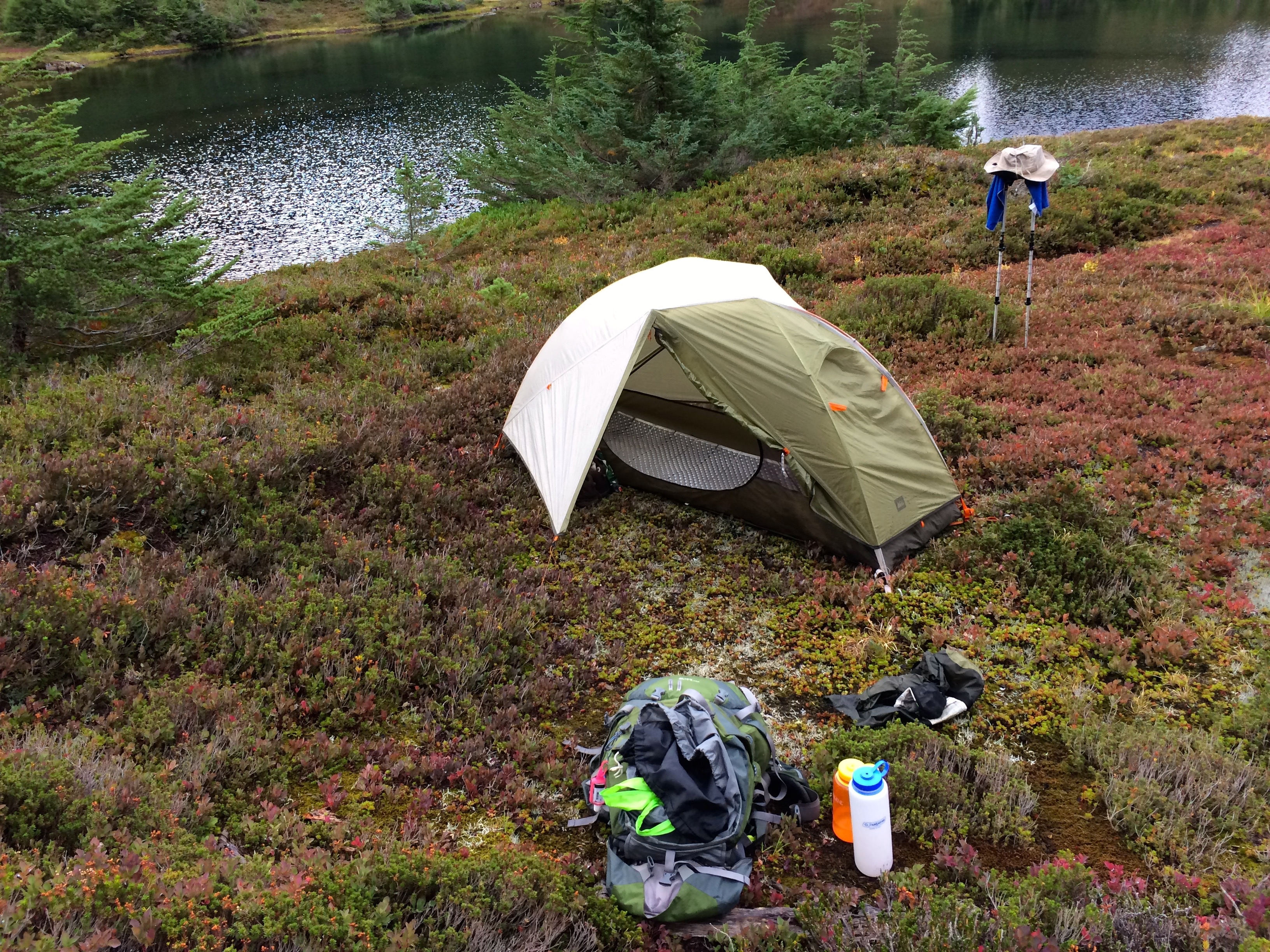
Of course I did finally make it to the top and when I got off the Spanish Ridge Trail and onto the much calmer Cooksie Spur Trail I was singing praise to God for allowing me to live. From the looks of the map I knew that the Cooksie Trail was also going to present an exposed ridgeline so I opted for the best tree sheltered spot to pitch my tent with the goal to get into my sleeping bag and warm up. That evening was not great but compared to the effort to get there it was wonderful. I was very content to make it through the night with just 13 ounces of water. I had dry clothes, mostly wool, so I did eventually warm up.


The forecast for Friday was sunshine which held true, so I set out with the need to get to Cooksie Creek for water. I also decided that I had had enough of the Lost Coast and I really wanted to hike back to my car with dreams of a good meal and warm bed. But the hike out Friday turned out to be a lot tougher than I expected. Thank God for my GPS map locator since finding the trail to the creek was rather confusing. For some reason I thought that the trail was going to follow the creek back to the coast, but as I kept examining my map I realized I must cross the creek and then climb 650 feet and another 2 miles just to get back to the coast.
 Well of course the creek was swollen from all the rain so crossing it created some anxiety trying to crawl over trees and fight the current. Unfortunately I lost my backpack rain cover as I was crawling over a log for part of the crossing. I was really bummed about the simple climb because my legs were dead tired, but the weather was great and the motivation to end this trip lifted my effort. This was a typical view as I returned to the coast.
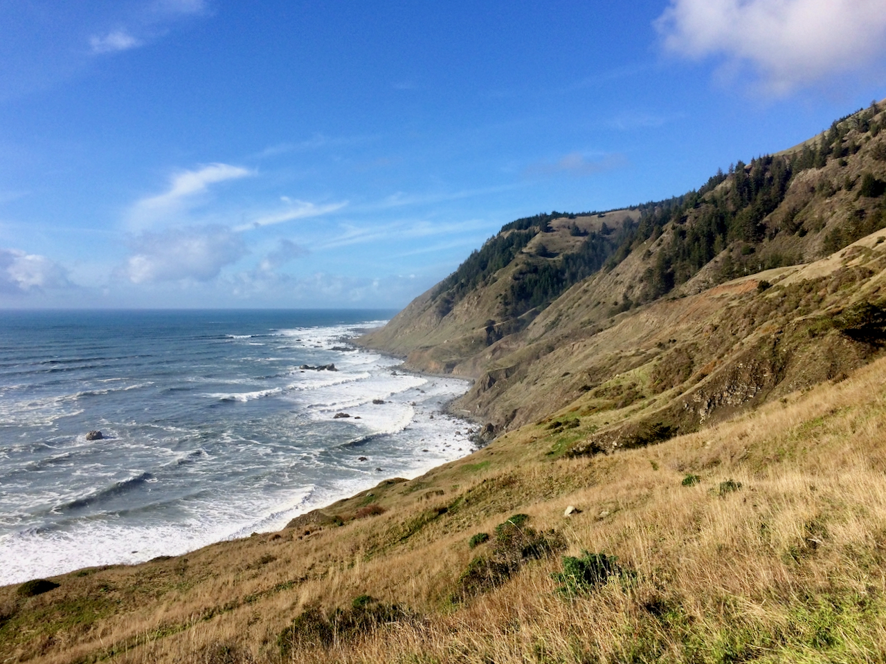 The first beach segment on this final coastal leg required navigating a few difficult points but it was at the (high) low tide. Surprisingly I ran into a single woman just entering this difficult stretch and it was an hour after low tide. I warned her that she might want to reconsider trying to make it to Spanish Flat, and I’m not sure what she decided. The rest of the hike out was not dangerous but it was exhausting.

Walking on loose sand with tired legs was tough, but the motivation was strong and the sunset was beautiful.
When I finally got to my car at sundown (long day) I was met with yet another disappointment. I noticed that my gas cover was ripped open and then I noticed that all of my windshield wiper blades had been stolen. This was just so rude. Luckily I intentionally had less than half a tank which probably meant they didn’t get any gas. However, if it had been raining that would have been one dangerous drive back to Ferndale. I did get to Ferndale and I had possibly the greatest NY Strip Steak ever and a much needed warm bed.
Note: I returned 4 years later in February of 2020 to Conquer the Lost Coast Trail
I visited the LCT again in February of 2021 and have plans to return again in February of 2022.
I was able to reenact my 2015 route in 2022 with perfect weather. Here is the comparison

Stevens Pass to Snoqualmie Pass
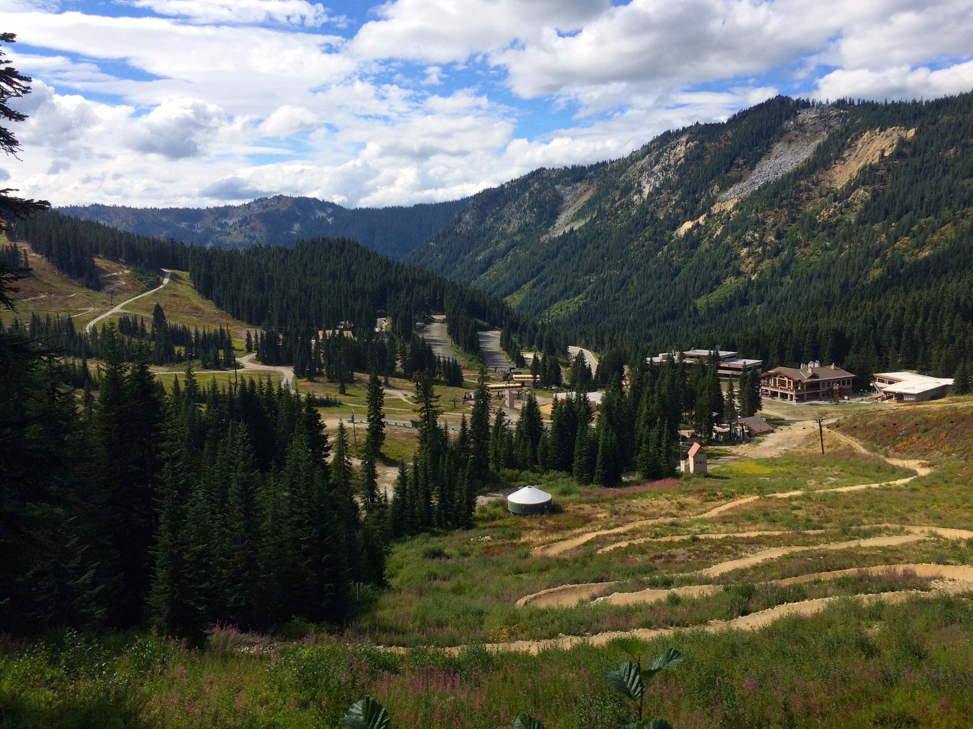
Stevens Pass Ski Area
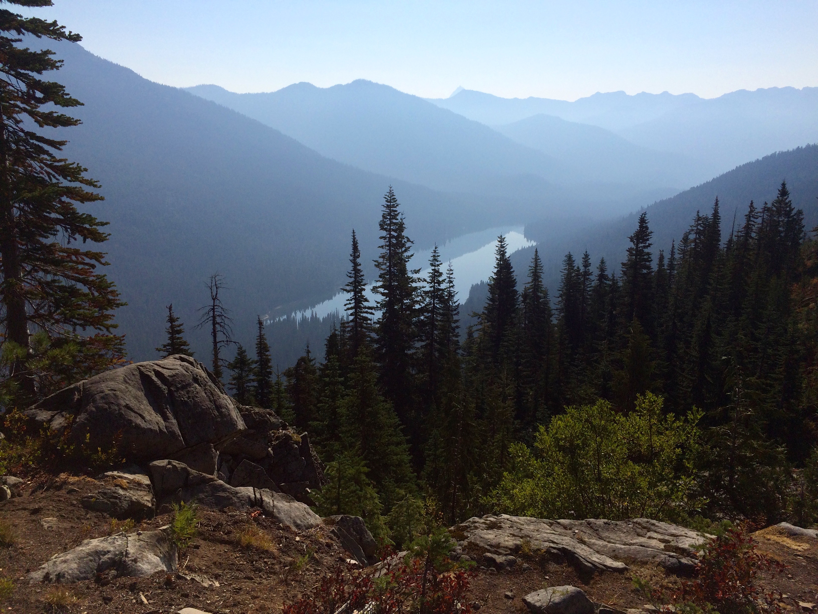
I backpacked the Stevens Pass to Snoqualmie Pass, PCT Washington Segment J from Aug. 8-16, 2015. It is 71 miles and over 18,000 vertical. This trip on the heals of my Spider Gap Buck Creek loop was challenging in many ways, most of which was related to heat, lack of water, lots of vertical and smokey conditions. Overall though it is a very dramatic PCT segment complete with very rugged and beautiful terrain.

Campsite in Berries
Starting off at the Stevens Pass Ski area was kind of cool thinking about how I might ski those runs that I was hiking. I was also treated to an abundance of huckleberry and blueberries for the first couple of days.

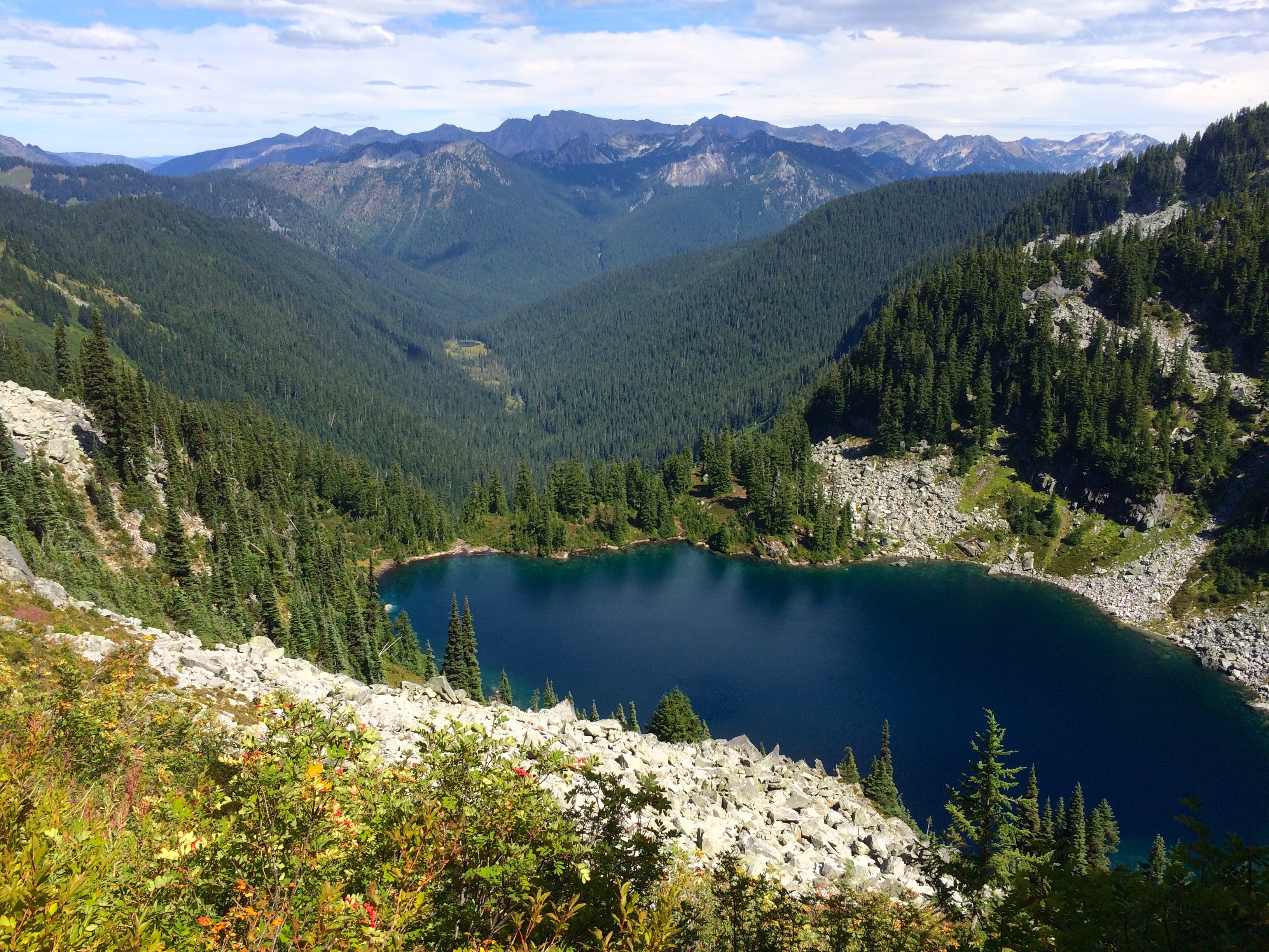
Mig Lake
My second day I had my sights set for a campsite on top of a mountain but along the way I passed many lakes of which I think the most beautiful was Mig Lake.
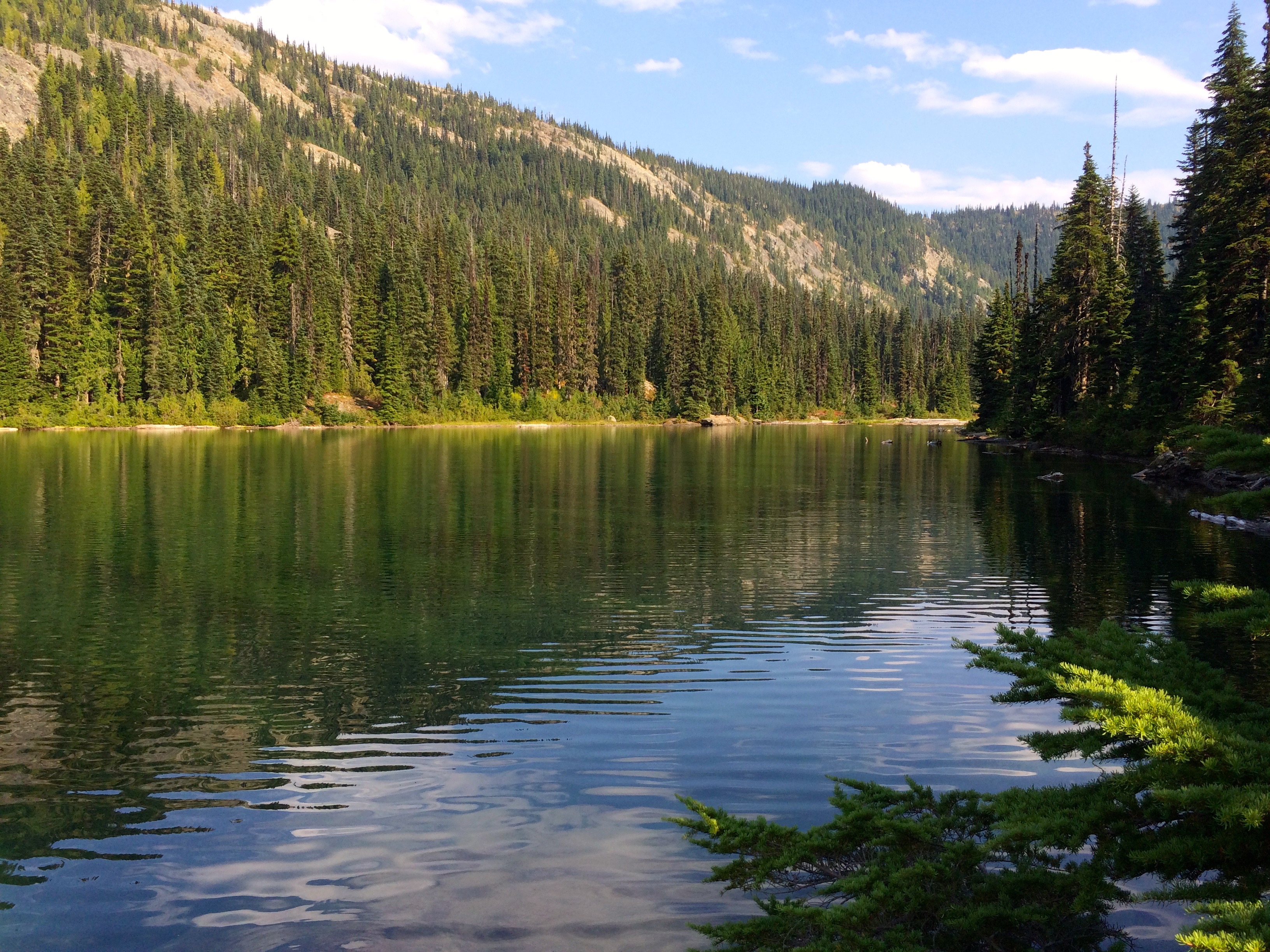
Trap Lake
At my mountain top campsite at PCT 2450 which was after a typical 3000 ft vertical climb day I had Trap Lake behind me and a beautiful sunset waiting ahead of me. One of the best campsites I have chosen.

Sunset from Mountain Top Campsite
The following day I planned on camping at Deception Lake, however,

Jets over the Wilderness
I was not that impressed with the options and I knew it would end up being crowed with the many through hikers now hitting this part of Washington. I pressed on and found a great campsite just south of Deception Creek at PCT 2442. The photo showing the jet exhaust trail represents the many jets that you hear flying over this area out of Seattle. You never see the military jets which fly lower and louder.

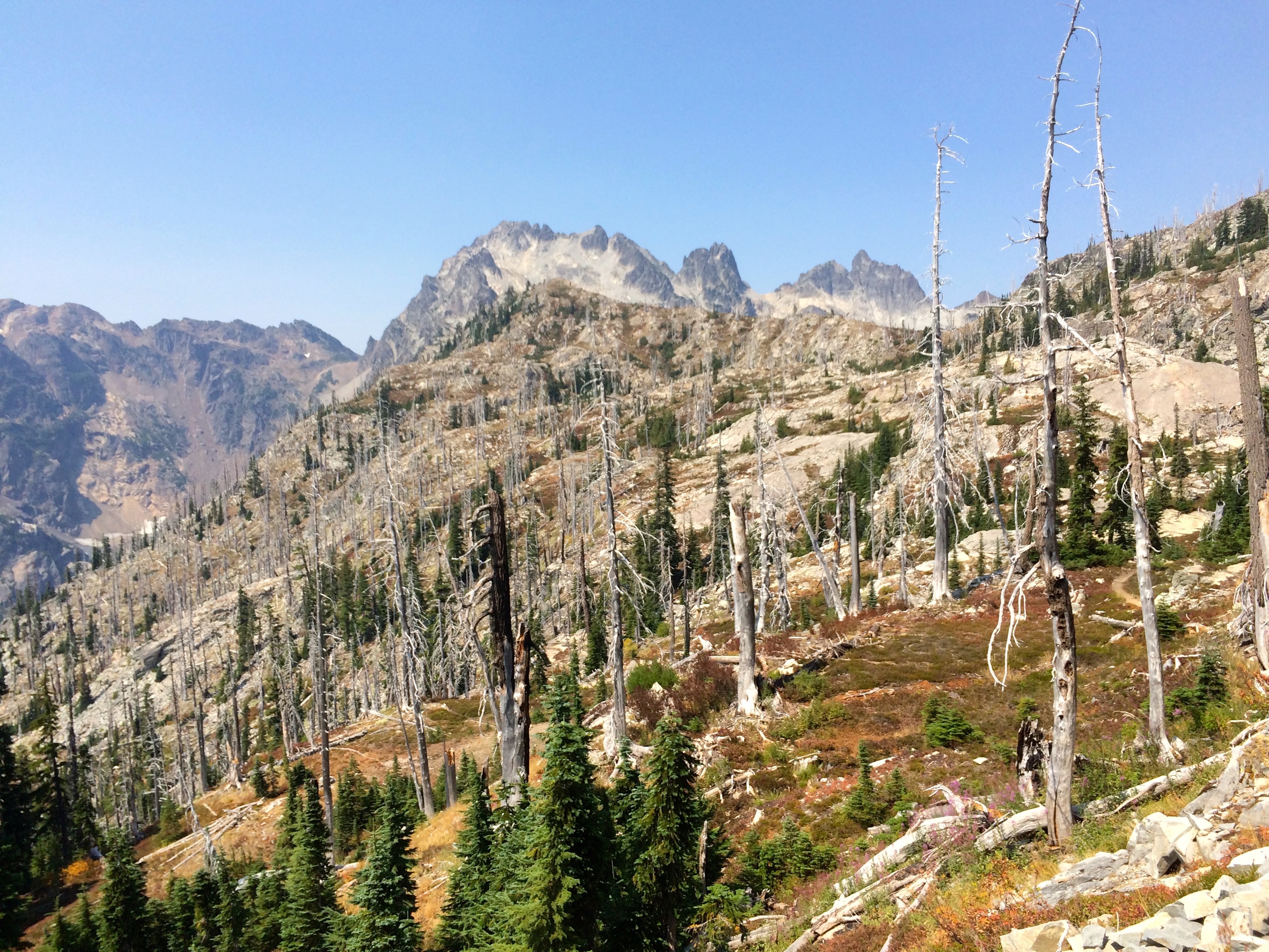
Cathedral Rock
The next day I climbed past the Cathedral Rock area but overall I took it easy and ended up at Deep Lake which offered a great site for a swim. Deep Lake still had water flow but it was low and the lake was warming up.
Deep Lake
I knew that I had a tough high vertical day coming up so I also took it a bit easy the following day in preparation to climb over Escondido Pass. I knew that water was going to be an issue and when I realized that my Camelbak bladder had leaked I was a bit concerned.
Smoke Over Lake Waptus
I did find a trickle of a stream where I filled up a Nalgene liter but I would need more. This was a long and exposed segment that turned out to be on one of the hottest days along with a lot of smoke sneaking into the area from the Washington forest fires.
Escondido Pass
There are a couple of dead lakes on top but who wants to drink warm water. It turned out that I did not have enough water or energy which made for a very difficult day. Boy was I happy when I finally got to a cool stream over near Lemah Meadows. I setup camp as it was getting dark and I collapsed for a night’s sleep to recharge. I did experience an interesting event that night as I believe a large buck must have been startled by my tent which was fairly near the trail. This was at 1:30 am and this buck sounded like he raised up and pounded his hooves 3 times right next to my tent. Nothing I could do but just lay there. Or maybe it was just a very real dream.
I took it easy the next day in preparation for more climbing.
Weather Changing
My plan was to camp near the Park Lakes area which turned out to be as far as I could get before the rain set in.
Campsite during Storm
In all of my backpacking I have been extremely fortunate with respect to weather, rarely have I endured a serious rain. Well that all changed with a night of wind and rain which was sorely needed by the draught stricken mountains. I did choose a good campsite next to a lake on top of ground shrubs which made for good drainage for the night long rain. The video gives you an idea of how pleasant the night long rain was.
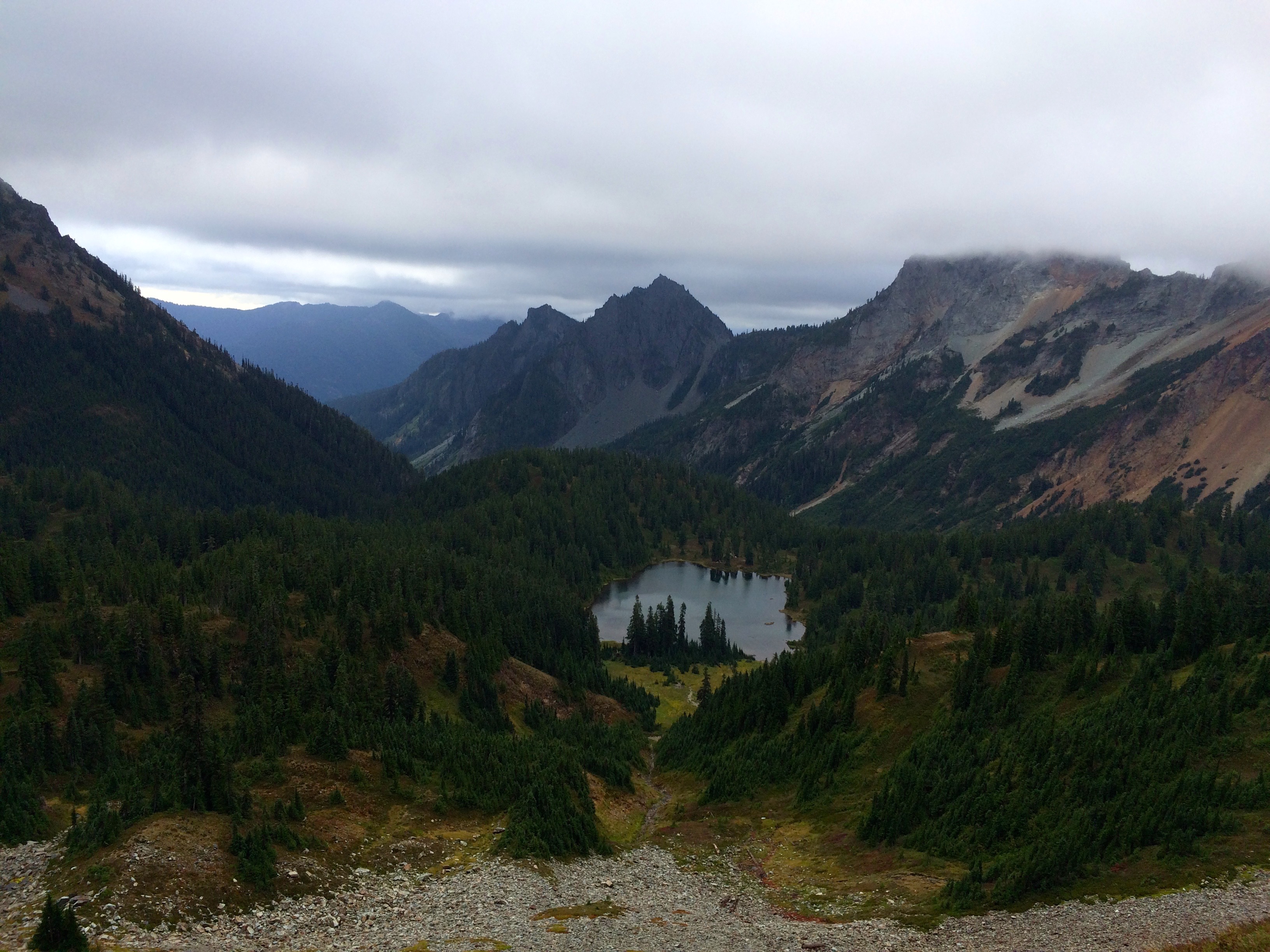
Park Lakes Area
The following day turned out to be a lot tougher then I expected, lots of up and downs, but the misty weather made for excellent hiking conditions.
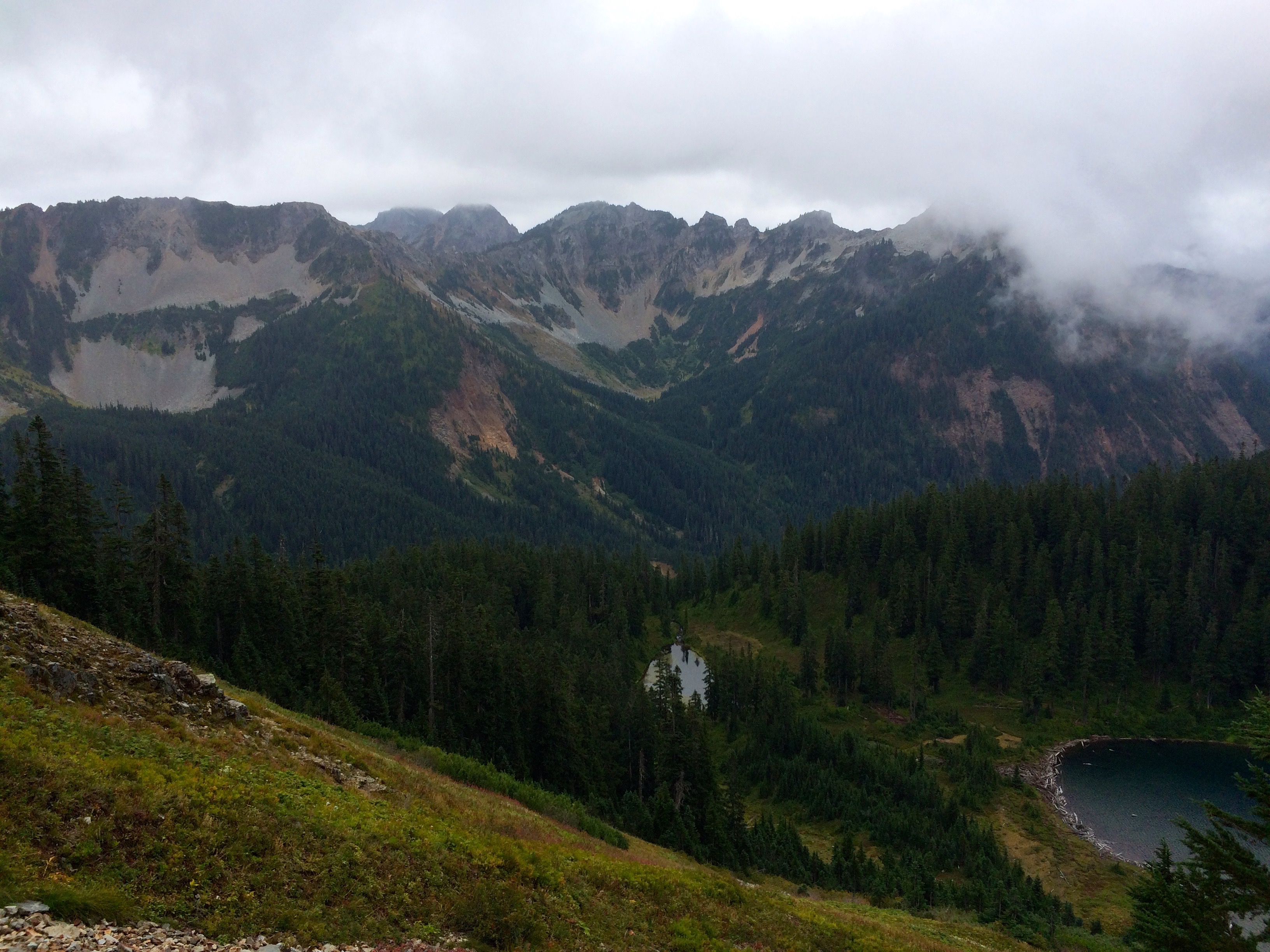
Above Alaska Lake
This is very scenic terrain and doing it in the clouds made for a unique day. Again my day stretched to the end of my energy just in time to make camp at Ridge Lake, just before it started raining again.
Hiking in the Clouds
Not so bad, just persistent. But this was my last night on the PCT since Snoqualmie Pass was over the next pass. Of course the sun came out just as I got on the trail. It would have been nice to have had the sun to dry some things out before heading out.

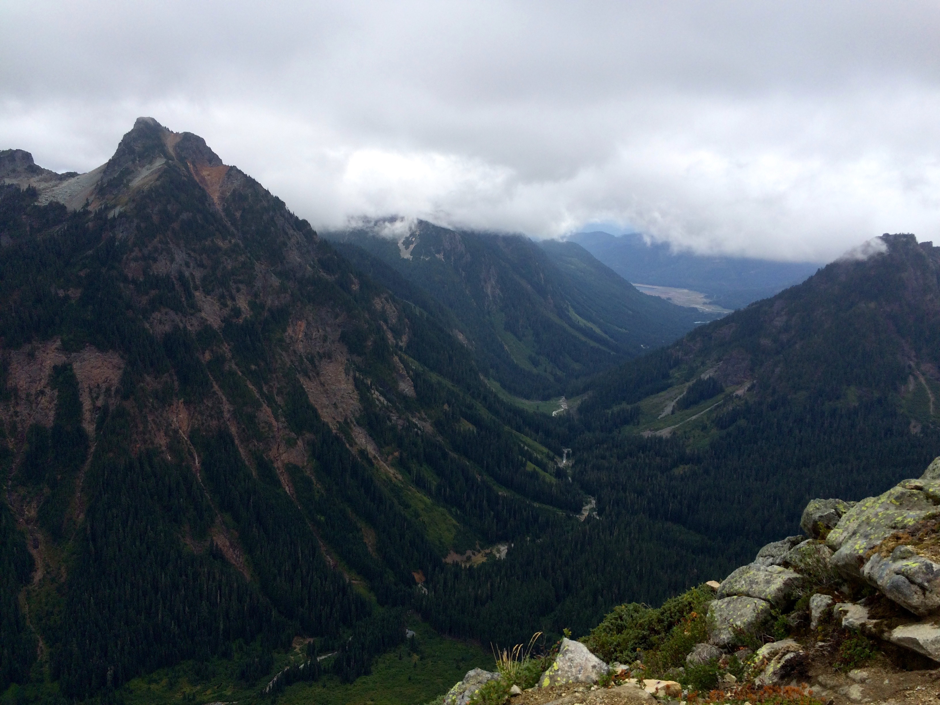
After the Storms
However, the rain brought crystal clear air for some of the most beautiful terrain left on the segment. This is a very popular day hike segment for the Seattle folks so I passed hundreds of them as I headed down to Snoqualmie Pass.
Then you see Mt. Rainier and you can get cell service. This all translated into a wonderful finish to this PCT segment. After getting my resupply at the Chevron Station and showering I enjoyed a few craft beers from the Dru Bru Brewery.


