
Raising a Backpacking Buddy
Puppy Brook is growing up and I took her on her first backpacking trip this week. She did great and I’ll share some of that in a bit. But any baby growing into adulthood is an incredible experience. Sure it is a lot of work but also a rewarding experience. Brook is our 3rd Australian Shepherd so it is interesting to compare but also helpful to know what the breed tends toward. An Aussie is primarily interested in serving her master which historically has meant herding their flocks of animals. So raising an Aussie does mean that you break them of that herding instinct especially with the neighborhood kids. Aussies will learn whatever you want them to, but their independence is also very important. Right now I am tempering Brook’s need to be the protector with the social requirement for her to be friendly. This is the critical artistry of parenting a pet.

Riding out a Thunderstorm
Our backpacking trip was a simple overnight on the Opal Creek Trail near the north fork of the Santiam River east of Salem, OR. This is an easy hike highlighted with typical Oregon majesty. Brook’s trail etiquette continued to be outstanding, but that is really built from her Aussie traits. I was really wondering about canine backpacking issues like staying on the trail, crossing narrow tree truck bridges and ignoring forest wildlife. And of course the critical test for how she would handle sleeping in the forest. An additional test of how she would handle a thunderstorm greeted us first as we barely got the tent setup before the storm hit. I was not real happy with how I had to rush the setup of the t ent, but it provided shelter in the nick of time. Brook immediately had to decide whether going into this tent was acceptable but quickly realized it was fairly cool hanging out with her master in such a confined space. This may have turned out to be the most valuable lesson most of us dog owners deal with. How does your dog deal with thunderstorms. Most of my previous dogs have gone berserk during a storm. However, during this storm Brook was so happy hanging out with me in the tent that she had no reason to fear the loud thunder. I may finally have a dog that can deal with thunderstorms. Awe yes, but then there will be the fireworks test someday soon.
The overall backpacking experience was perfect. Brook initially did not want to cross narrow log bridges. She was nervous about all bridges but if they had rails on both sides she could handle it. She does seem a bit reluctant to explore streams, I kept telling Brook that the best drink is from those babbling brooks. She did want to sleep in the tent but that worked out OK since she did not get overly dirty or wet. She would go out into the night for a drink and things but she did not waste much time staying away from the tent. In the morning she did get a bit spooked by all the birds serenading us, but that was quickly forgotten when she discovered how much fun it was to run up and down all the little trails around the campsite.
The major problem Brook is still dealing with is riding in a car. She does not prefer to do this, however, she does not have a choice in this matter. This trip was extremely valuable lesson for her, even with the throwing up in the car. She will be able to handle car travel, but I don’t think she will ever desire it.
April 30 I will be backpacking the Wild Rogue Loop in southern Oregon. Unfortunately Brook will not be accompanying me due to the presence of poison oak and ticks in the area.
Great Possibilities for my New CIO Role
I just finished up a visit to Western Washington University where I will be the Interim CIO for a year starting June 20th. I pleased to say that I am very excited about the prospects for the job and the university. Once I came out of the wilderness at the end of 2015 I decided I was ready to return to higher education and the opportunity that I selected was this unique role as an Interim CIO for one year. This all began thanks to a recommendation from an external review of the WWU Information Technology organization conducted by Marty Ringle, President of the Northwest Academic Computing Consortium, NWACC. One of the recommendations offered was to consider hiring an Interim CIO who would be able to work with the TBD new President exploring how WWU might want their Information Technology organization to be structured. Well I was one of the possible candidates and the stars aligned with respect to their believing in me and my ability to commit to this interim role.
Spending 2 days in Bellingham meeting most everyone who has a vested interest in who the new Interim CIO will be was more exhausting than a typical job interview. This was because we had dispensed with the possible and commenced to the real issues that we want to consider. Think about this opportunity. We joked about how I can blame everything on my predecessor CIO and how I have an exit strategy. Translated, that means we can actually place issues on the table with the freedom to actually address them. The reality is that my predecessor, who is retiring after an impressive career, has done a great job to set the stage for moving the IT organization forward. Everyone agrees that budget cuts after the 2008 downturn hit IT especially hard and it has taken a number of years to recover to the point now where they can focus on building rather than just surviving. Yes, I am really excited about the role I will be able to play in leading the Western Washington University Information Technology organization. WWU is a great university located in the beautiful Northwest near some fabulous backpacking opportunities, imagine that. But more important, it is a university where people want to be and that is why I am excited to be one of those people.
Introducing our New Aussie, Brook

Brook
At the end of my Timberline to Cascade Locks backpacking segment I was crushed by the news that my beloved dog, Abby, had died unexpectedly. Abby was 12+ and not able to backpack with me any longer, but losing her at a time when I was experiencing a dream that she should have been sharing with me was tough. My wife and I knew we would find a new dog when we felt the time was right. Well this post is dedicated to introducing you to our new dog, Brook, another Australian Shepard who is destined to be my new backpacking buddy.
Brook came from Gearhart Aussies on the Oregon Coast about a month and we have survived puppy training. Plenty of accidents have been cleaned up and not to much chewing damage has occurred.

Broncos Fan
There is a period of time with the new puppy where your lives are not yours. You have to cater to the needs of the puppy at the expense of your own desires. However, you know it is short-lived especially when dealing with the intelligence that comes with the Australian Shepard breed.
Brook is a Blue Merle Aussie with piecing blue eyes. Her color scheme is beautiful with perfect marking of the reddish fur. She has already shown her commitment to being a Broncos fan during last weekend’s AFC Championship. Now we will prepare for the Super Bowl.
We will also hit the trail soon to expose Brook to the discipline needed for backpacking. I like her disposition of displaying initial caution with strangers or unusual activity, however, she quickly evaluates the situation and reacts appropriately.
My wife works in a hospital and would like for Brook to possibly accompany her as a comfort dog for her patients. I think Brook will be perfect for this duty. But the primary job for Brook will be to provide companionship for us, function as a watchdog and allow us to love her unconditionally for the rest of her life. A Dog’s life is so tough.
Here is a video recap of the Gales Creek Hike in Tillamook State Forest.
Helping to Launch MacHub
I’m finished backpacking for a while so I have some time before I jump back into the IT world of higher education. This gives me the opportunity to volunteer full-time in support of a worthy non-profit that is based on selling donated items online so that the proceeds can go to a designated charity. It is called MacHub and it was all made possible because the successful online sales business, Swedemom, transitioned into this non-profit version. I had no idea that I would end up helping MacHub, it could be that God had His hand on this and maybe He is calling in a favor for saving my life on the Lost Coast Trail earlier this month.
There is no doubt that this MacHub venture is a great idea, but success will take some hard work and discipline. There are all kinds of charity selling models that work for the local demographics. But what if you had an option to get top value for your donations by selling it online to an international market. Of course this concept was made possible by the eBay online selling model, but anyone who has sold on eBay knows that it is not that simple. MacHub has been discovered rather quickly here in McMinnville, OR, which means that managing growth has already become a problem. MacHub benefits include more than just cash for charities, jobs for the homeless is also an outcome. But it is a business that must control expenses so that the realized proceeds for the Charity will justify the effort.
Success for MacHub does appear to be inevitable. The transition of assets from Swedemom and the use of their sophisticated database and sales processing software is invaluable. Combine that with a community that immediately rallied around the concept thanks to strong support from the local Newspaper, a small grant and a parent organization, Yamhill County Gospel Rescue Mission, YCGRM, plus dedicated people and you have a winning formula. And as my departed mentor, Bill Mitchell, used to advise, the goal only needs to be to “Do Good”.
What is really cool about this business model is that the donors can become partners. The simplest option is for a donor to just drop off items similar to the Goodwill model so that the proceeds can help cover the costs of the MacHub expenses. But a donor typically will designate the charity to receive the proceeds from the sale of their items, and they can get an account to actually check the status and validate the donation value for IRS purposes. Any organization can qualify to be a partner of varying levels based on the the amount of item preparation work they want to provide.
We are now working out the details for establishing an umbrella organization that will handle the administrative duties to ensure that the software continues to be developed and is maintained. The need for an umbrella non-profit is due to the interest by other organizations around the country wanting to start their own version of MacHub. We currently have a pilot version in Chicago that is more of a single charity supporting a large homeless shelter and one near St. Louis that is a community model like Mac Hub.

I Lost to the Lost Coast
Ready for the Lost Coast
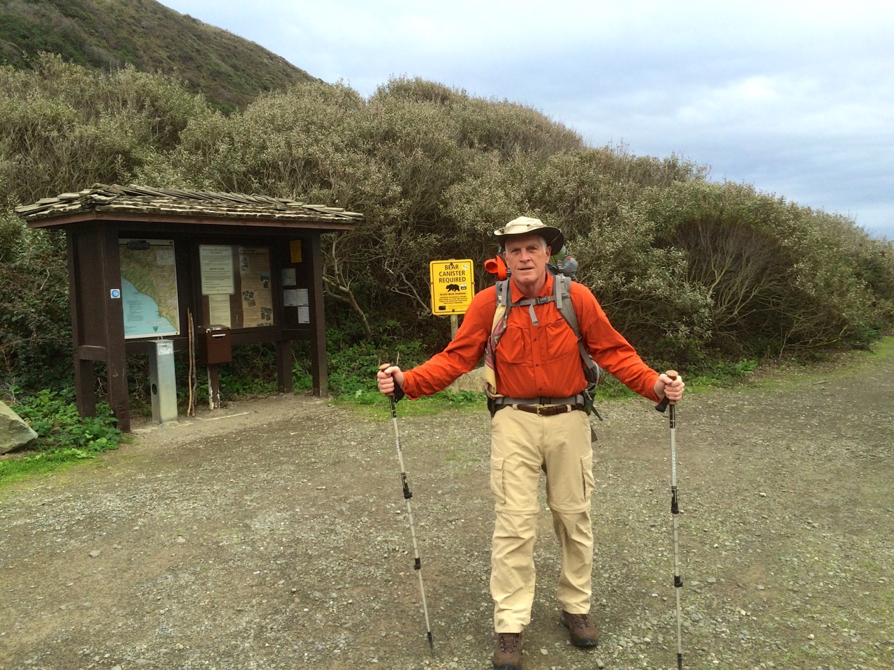
I headed into my Lost Coast Trail backpacking trip during the first week of December 2015 confident that I would accomplish my goal to hike from Mattole Trailhead to Shelter Cove and return. I knew it was going to rain a couple of days, but the forecast called for 10 mph winds. I also knew I had some bad timing for when the low tides occurred during the first part of the week. But I did not dig deep enough into this data to be properly prepared for what was ahead.
The drive down to northern California through the Redwoods was great, my car loves roads like the Redwood Highway. I visited the BLM office in Arcata first thing Monday morning to get my waterproof map, so with that map also on my iPhone equipped to use GPS, I was well prepared for navigation.
The low tide on Monday was not going to allow me to get past the first high tide hazard stretch so I had a leisurely hike past a herd of cattle to end up camping next to the Punta Gorda Lighthouse. It was a beautiful evening as I overlooked a beach full of seals.

Low tide on Tuesday was at 9:33 am at 3.2 feet, so I entered the beginning of this 4 mile stretch before 9:00 am. Based on most reports I had read this stretch was not going to be a problem even if you were a few hours on either side of low tide. Unfortunately, I did not consider the actual height of the low tide. The trek through this segment was tough even without navigating the dangerous rock points of which there are about 5 that are really challenging. Some you can climb up and over, but the rocks were really slippery probably due to the higher then normal waves preceding the approaching storm. So I worked my butt off hiking over the beds of football size boulders. As I neared the last few hazard spots it seemed like it was far more dangerous than it should have been.

Then the last point before Spanish Flat nearly did me in. It was a point where you had to go between a large rock as the waves were crashing, however, it was all under water. As I tried to see around the corner to determine what I was up against I caught a full face on wave that nearly pulled me into the ocean. At that point I couldn’t worry about waiting for the best wave timing so I jumped into waist deep water and made it around. I was soaked but relieved to have survived.

Spanish Flat
I stopped at Spanish Flat, put on dry clothes and checked the tide tables to discover that the low tides that I was experiencing were the highest low tides of the year. That explained things, but now I was concerned about the next day’s stretch of tide hazardous coast with another 3.2 foot low tide, not to mention my concern about coming back from Shelter Cove.


I decided to camp at a nice beach fortress just below Spanish Ridge. The winds were gaining strength which was good for drying out but it was also a bit foreboding knowing that rain was on the way. Yep, the rain started at sundown and the wind just kept getting stronger. It was time to reevaluate whether I should press on to Shelter Cove.
I knew it was going to rain all day so I decided to stay put through Wednesday with plans to head back to Mattole by hiking up the Spanish Ridge Trail over to the Cooksie Spur Trail on Thursday. This was a nice campsite and I was able to get out a few times during rain breaks. This video will give you an idea about how I spent Wednesday.
I was up before sunrise Thursday morning with my backpack ready to go, just needed to take down the tent. I was so happy that it had not been raining for a few hours and the tent was dry. Unfortunately all hell broke loose at sunrise. The rain and the wind hit what I would call typhoon force. My line holding my tent fly broke, my tent stakes were being uprooted, water was rushing in so I had to go. Taking down a tent in gale force winds is challenging but I captured everything, but somehow lost my reading glasses. Of course I was instantly soaked but my Marmot Gore-Tex jacket was taking care of me.

Climb to Spanish Ridge Trail
I decided to go straight up the side of Spanish Ridge and intersect with the trail which worked out fine thanks to the map I had with GPS location on my iPhone. The wind was blowing from the south so it was mostly going to be at my back.
My goal was to climb the 2400 foot vertical of the Spanish Ridge Trail and then take the Cooksie Spur Trail over to Cooksie Creek since I would need water.  Well halfway up the climb (see blue dot on map) I was realizing that this wind was a real problem. As it whipped up the slopes it must have gained even more power, so much so that I was barely able to stand up. Then I really got hit, actually blown off my feet, and I was a 250 lb object. I was totally exposed at this point, no trees or large rocks to shelter behind, so I laid face down next to a small rock that gave my head a little relief. I was pinned down about 45 minutes with the wind occasionally lifting me when it hit between my body and backpack. Oh yes, and the rain was as hard as you could imagine. So here I am face down trying not to be blown off the mountain and I’m getting cold. The night before I had listened to a chapter in Lawton Grinter’s book “I Hike” about his experience with hypothermia, so I knew that the shivering, loss of feeling in my hands and feet and the desire to burrow were typical of hypothermia. What was a bit fascinating from being in this predicament was getting a taste of what it may be like to face the real possibility of death so my conversation with God was with great urgency.
Of course the human spirit doesn’t just give up, I had to do something because my current situation was hopeless. I fought to stand which was really hard because my legs were not working as I would have liked. Something told me that I needed to climb out of this, however, I had no way of knowing what was ahead, but my GPS map at least assured me that I was on track. I walked with my back to the wind using my trekking poles as braces to counter the force and I made it to an area where a small cornice offered some relief from the heavy wind. At this point I knew I had to warm up so I pulled out a wool shirt to add a layer under my rain jacket. Buttoning that shirt with my cold fingers was far more challenging than I could have imagined. However, this accomplishment seemed to give me new motivation to press on at all costs. And pressing on was brutal. There were a few sections where the wind was at my back so I used it to essentially fly up the mountain, however, coming to a stop was never pretty. Then my backpack cover blew loose but was still attached to my backpack creating a spinnaker type sail that dragged me for 20 feet. In between my attempts to move forward I spent more time on my face trying to regroup. Overall it took me about 3 hours to travel about a mile through the really bad section of the ridge.

Beginning of Cooksie Ridge
Of course I did finally make it to the top and when I got off the Spanish Ridge Trail and onto the much calmer Cooksie Spur Trail I was singing praise to God for allowing me to live. From the looks of the map I knew that the Cooksie Trail was also going to present an exposed ridgeline so I opted for the best tree sheltered spot to pitch my tent with the goal to get into my sleeping bag and warm up. That evening was not great but compared to the effort to get there it was wonderful. I was very content to make it through the night with just 13 ounces of water. I had dry clothes, mostly wool, so I did eventually warm up.


The forecast for Friday was sunshine which held true, so I set out with the need to get to Cooksie Creek for water. I also decided that I had had enough of the Lost Coast and I really wanted to hike back to my car with dreams of a good meal and warm bed. But the hike out Friday turned out to be a lot tougher than I expected. Thank God for my GPS map locator since finding the trail to the creek was rather confusing. For some reason I thought that the trail was going to follow the creek back to the coast, but as I kept examining my map I realized I must cross the creek and then climb 650 feet and another 2 miles just to get back to the coast.
 Well of course the creek was swollen from all the rain so crossing it created some anxiety trying to crawl over trees and fight the current. Unfortunately I lost my backpack rain cover as I was crawling over a log for part of the crossing. I was really bummed about the simple climb because my legs were dead tired, but the weather was great and the motivation to end this trip lifted my effort. This was a typical view as I returned to the coast.
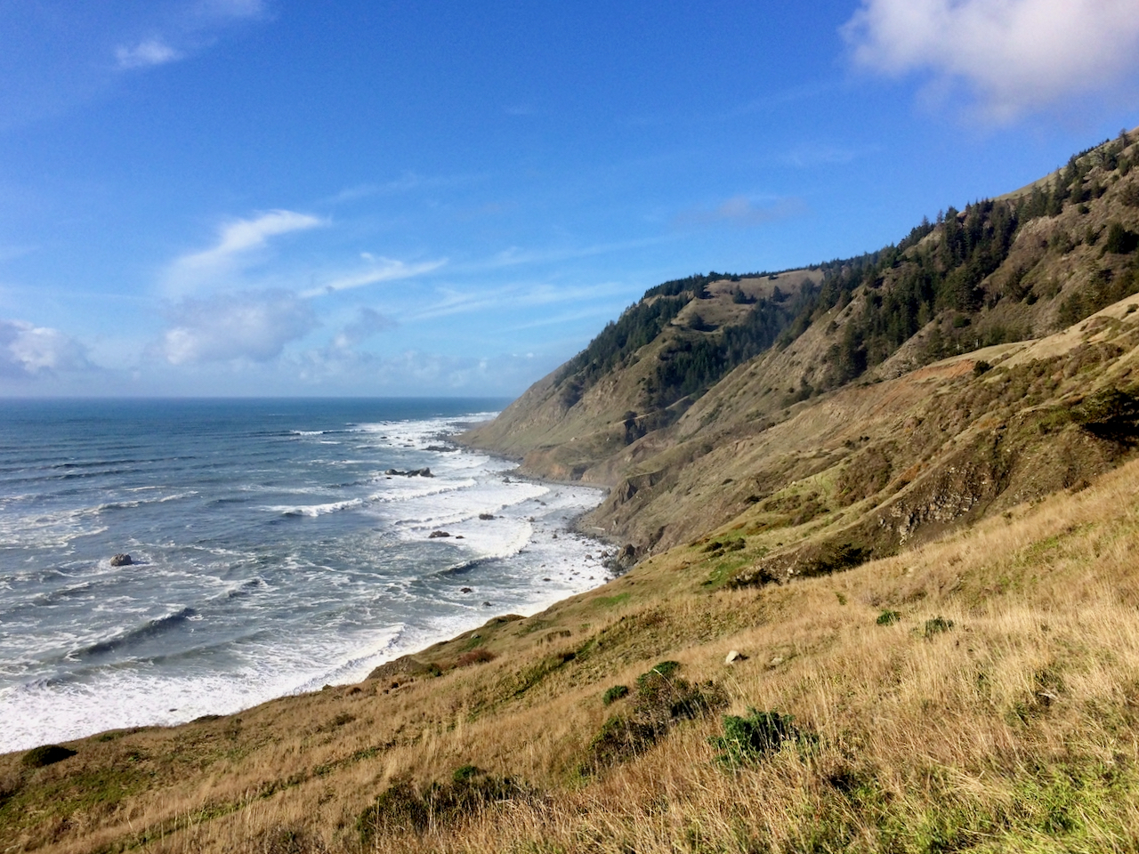 The first beach segment on this final coastal leg required navigating a few difficult points but it was at the (high) low tide. Surprisingly I ran into a single woman just entering this difficult stretch and it was an hour after low tide. I warned her that she might want to reconsider trying to make it to Spanish Flat, and I’m not sure what she decided. The rest of the hike out was not dangerous but it was exhausting.

Walking on loose sand with tired legs was tough, but the motivation was strong and the sunset was beautiful.
When I finally got to my car at sundown (long day) I was met with yet another disappointment. I noticed that my gas cover was ripped open and then I noticed that all of my windshield wiper blades had been stolen. This was just so rude. Luckily I intentionally had less than half a tank which probably meant they didn’t get any gas. However, if it had been raining that would have been one dangerous drive back to Ferndale. I did get to Ferndale and I had possibly the greatest NY Strip Steak ever and a much needed warm bed.
Note: I returned 4 years later in February of 2020 to Conquer the Lost Coast Trail
I visited the LCT again in February of 2021 and have plans to return again in February of 2022.
I was able to reenact my 2015 route in 2022 with perfect weather. Here is the comparison

Psyched to Backpack the Lost Coast Trail
I am so grateful that I live near an ocean which provides the type of climate buffering conducive for backpacking.  The “Lost Coast Trail” in the King Range National Conservation Area is just 8 hours to the south and offers an excellent challenge for a December trip. The Lost Coast Trail, LCT, North Section in the King Range offers the best beach access and is typically accomplished as a point to point with use 2 cars or a shuttle.

LCT PDF Map
I won’t be hiking the South section which is in Sinkyone Wilderness State Park. My plan is to do a loop where I hike from Mattole Beach to Shelter Cove and then return with various inland trail options.
The use of GPS with the PDF-Maps App will be extremely helpful. The app’s search routine is flakey but if you search for BLM you will see the North and South Lost Coast Trail Maps that are free for download. This tool was very helpful when I used it for the Cape Perpetua Scenic Area.
I am really looking forward to this trip partly because I just need to get back to the wilderness and partly because the trip plan offers so many options. The option to regroup in Shelter Cove if the weather has been brutal. And the choices for inland trails are numerous which could also be dictated by weather conditions. Elevations approach 4000 ft so I suppose snow could be in the equation at least for a short period of time. This trip also justified my purchase of a BearVault which is required for the LCT. I opted for the BV500 in anticipation for its use on the John Muir Trail in the future. Plus I like the fact that it will serve as a nice camp seat, unfortunately it adds weight.
I’m actually looking forward to the high possibility of rain, I feel like I have unfairly dodged the rain element and I think it would be a good test to have to deal with inclement weather. All part of the adventure. I also like the idea of doing this trail in the low tourist and bug season. Anyways, I am pumped. I will drive down on November 30th and hit the trail on the 1st of December.
Hopes and Fears for Xfinity WiFi
Have you experienced Xfinity WiFi? Maybe positive, maybe annoying, but if you touch it once you will need to deal with it. At first I saw this WiFi SSID named xfinitywifi as intriguing, I tried to connect not knowing my Comcast account info at the time and for a period there after I dealt with xfinitywifi popping up all the time, and it was persistent enough to really annoy me. Well I removed it from my WiFi list and forgot about it for a while, until my consulting activity uncovered a possible use for it. If you are not up-to-date on what Comcast’s Xfinity Public WiFi is all about I suggest you view this short video.
I am engaged as a CIO consultant for a large retirement community, CCRC. One of our goals is to improve their overall WiFi options throughout their community. This community offers bulk Comcast Cable TV and the residents get to upgrade to Internet service or premium channels if desired. This has worked out well for all involved. Now the CCRC is interested in expanding and improving their common area WiFi coverage both for business and for convenience. There are opportunities where a more pervasive WiFi coverage could facilitate business transactions such as Point-of-Sale or allow more effective monitoring of residents for health or access control reasons. However, institutions such as this are typically dealing with large rebar heavy cement buildings that are terrible for conducting a WiFi signal. We can deploy a solid WiFi infrastructure in the more open common areas, but wouldn’t it be nice if you could depend on connectivity anywhere in the community. Placing our own WiFi APs throughout the residential area does not make sense both financially or technically. But wait, we already have all of those buildings wired with coax carrying Comcast service.
In a multi-tennant installation Comcast basically carves out a few channels to be used for Internet delivery or maybe a public TV channel. This offers some potential for independent services, maybe your own Internet, but in the bigger scheme of things it is probably best to let Comcast do what they are good at. There in lies the opportunity to possibly leverage the xfinitywifi hotspots to enhance your overall local common area WiFi service. You can’t rebrand xfinitywifi to your own public SSID but you could help your community understand how to take advantage of it. So there in lies the good I see for xfinitywifi.

WiFi SSIDs on my iPhone
What about the concerns we might have for xfinitywifi? We are talking about a huge customer footprint that is now using residential WiFi modems to distribute public xfinitywifi hotspots. I live in a high density relatively high tech area near Portland, OR, and I can walk anywhere without losing connectivity to xfinitywifi. Of course I have implemented my own secure certificate on my iPhone with their Xfinity Secure App, but what about the normal Joe who has no desire to understand this Comcast Xfinity Wifi business venture. It is most definitely built upon a serious business plan to be a major player in public wifi access. And if this happens on the backs of their customers modems, is that OK? That is a much larger topic that I am sure Comcast is being extremely careful not to over step their bounds. I believe Xfinity Public WiFi is a good thing, but it will create issues. Everyone should be aware of adding a secure VPN type connection if you plan to use their xfinitywifi. And above all we will need to monitor Comcast to insure that they are not misusing their access to our connection information.

A Night in Paradise Park
It had been 3 weeks since I last escaped to the wilderness so I just had to take advantage of the two day good weather forecast.
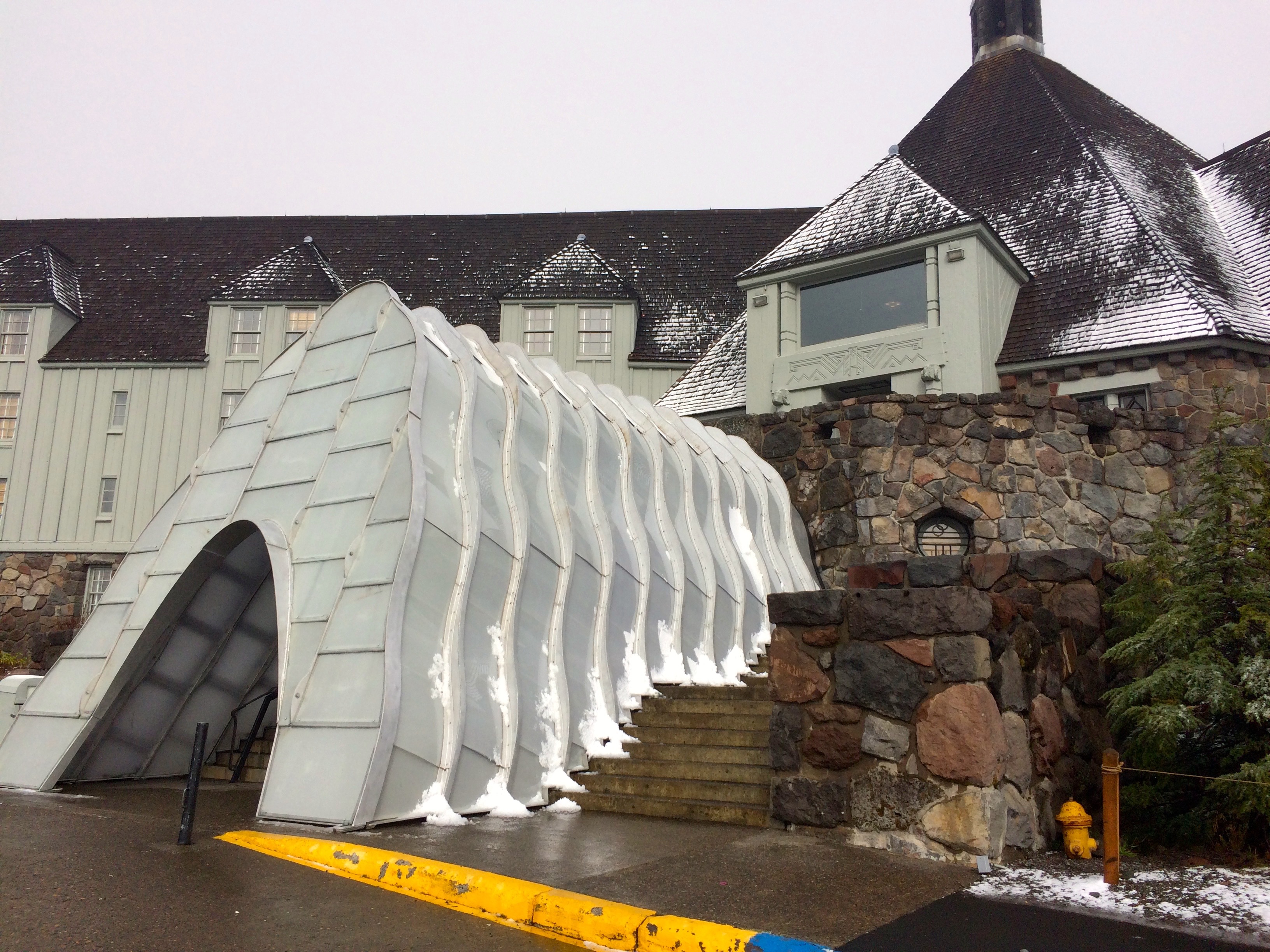
Timberline Ready for Winter
I initially tried to select another outing in the Tillamook State Forest since my last trip to Elk Mountain had been so rewarding, but something drew me to higher elevation. What about Mt. Hood, even if it may have gotten some fresh snow. Perfect, I had wanted to check out Paradise Park ever since my PCT segment that took me past the trail loop back in July. From Timberline Lodge it is about 5 miles to where I would want to camp. The Timberline webcams showed melting snow. The forecast called for a clear but cold night so let’s do it.
Cold Start
I packed my warmer bag and my perma-rest air mattress along with adequate warm cloths which turned out to provide sufficient comfort as the temperature may have hit a cold of 30 degrees. After a lunch buffet and IPA at Timberline I was off.
The typical day hike distance to the Zig Zag Canyon overlook and below offered a before and after shot showing just how much the weather changed from the trek in and next day return.


The trail takes you down to the bottom of the canyon and then you get to climb back up, but it went very well with a fresh body.
Autumn Color
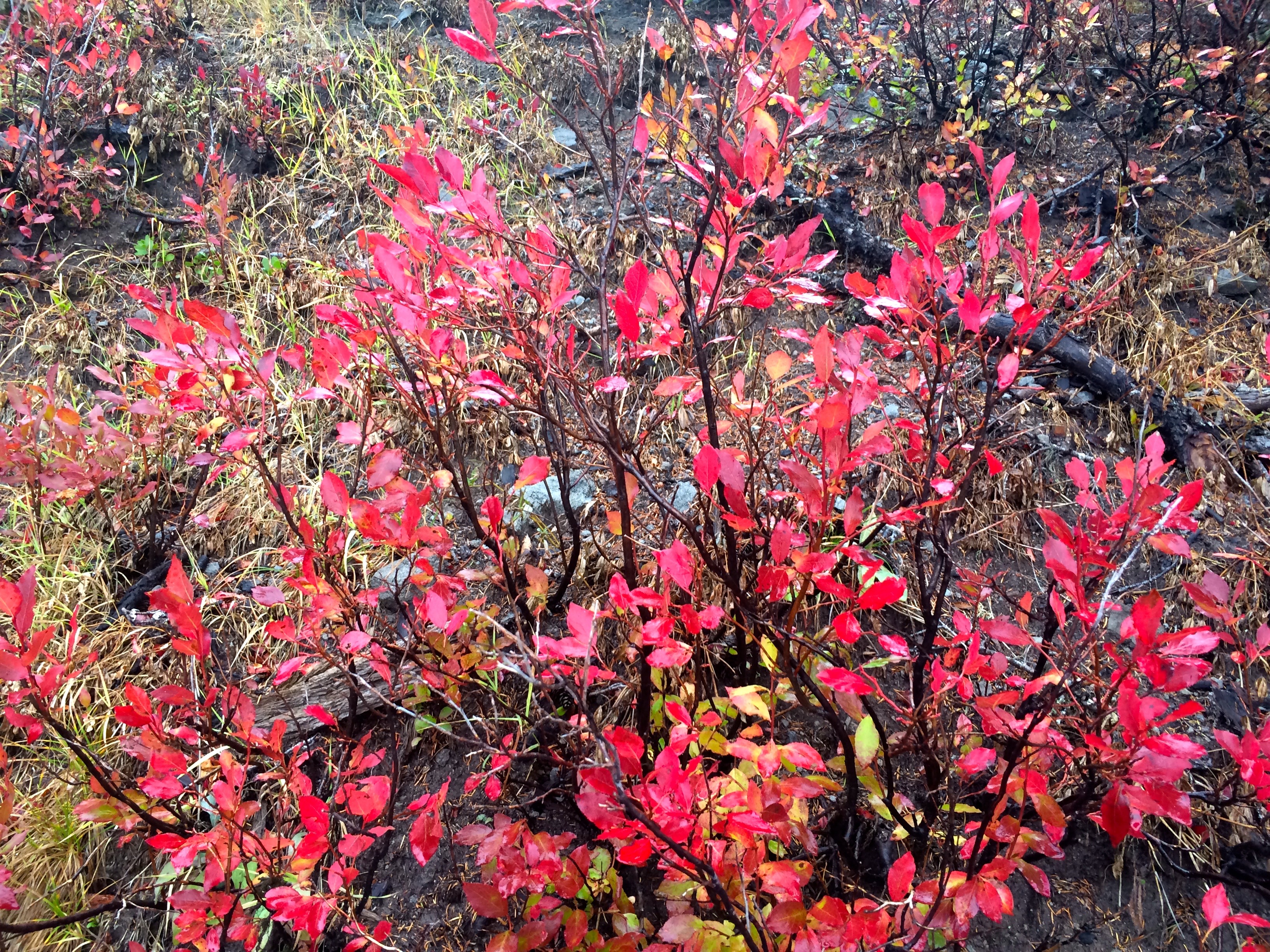
I was a little slower on the return trip as I was feeling some tired muscles. Hiking in late October does not provide the lush foliage but it was just as interesting seeing the mountain prepare for its winter blanket. I arrived at Paradise Park around 4:30 pm.

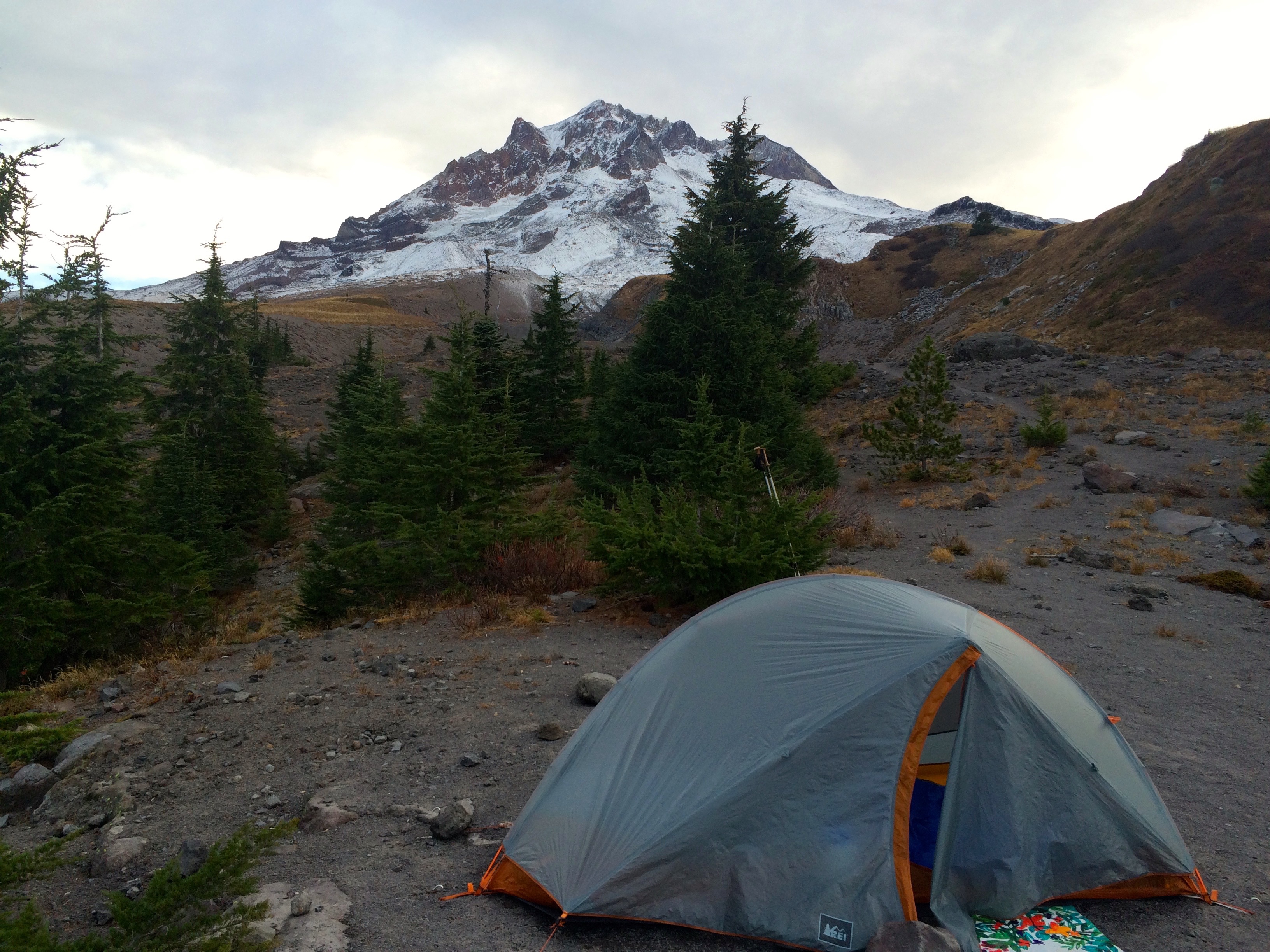
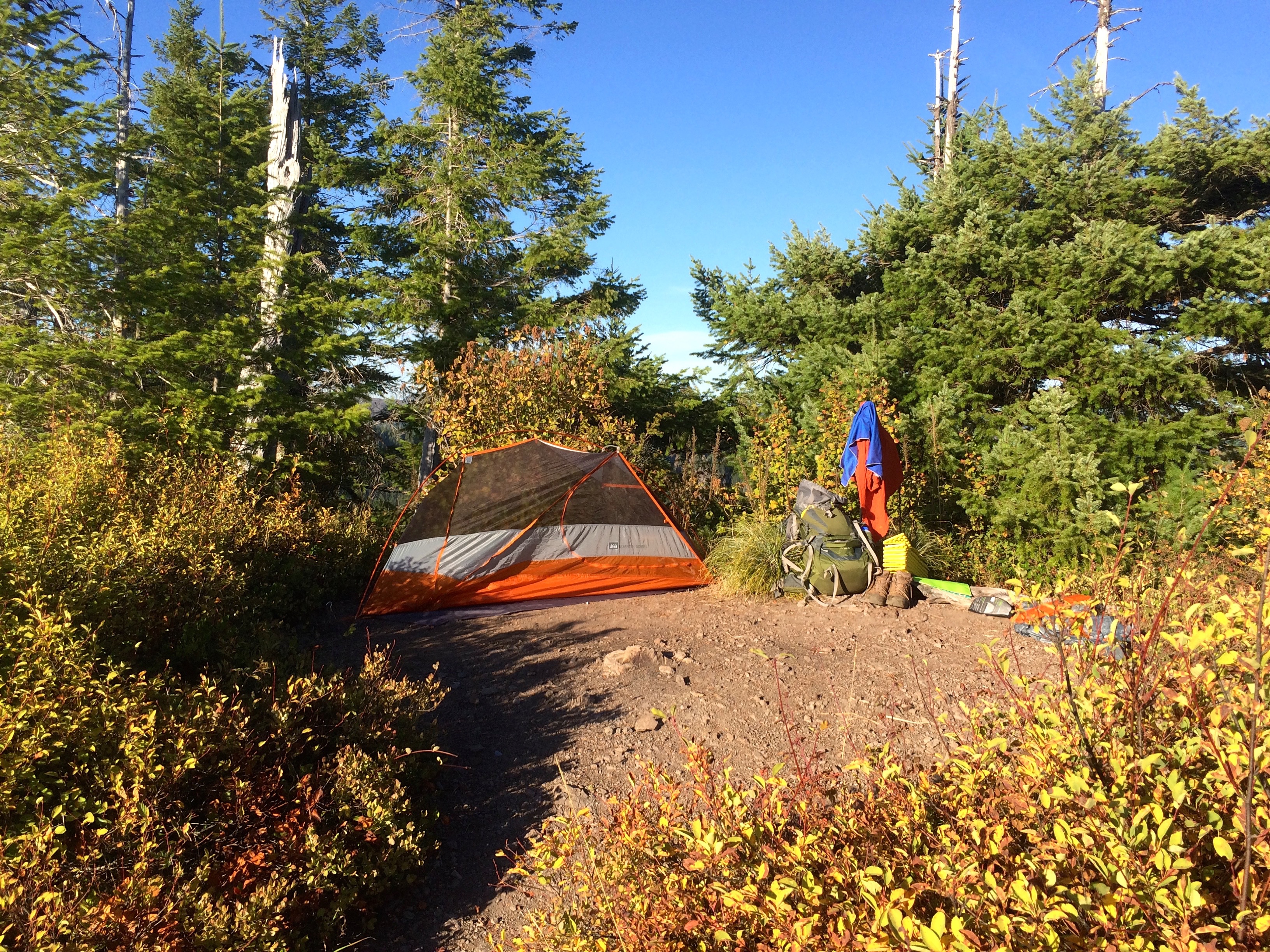
Setting Up Camp
I scouted the terrain quickly selecting a campsite with a view and accepting the consequences of a cold wind. The October evening was playing out way to fast. I had to enjoy the view but I also needed to setup camp.

Deer Family Visitors
Then a family of deer, 4 doe and a young buck strolled by. They stood near looking at me as if to say, “what are you doing here”.
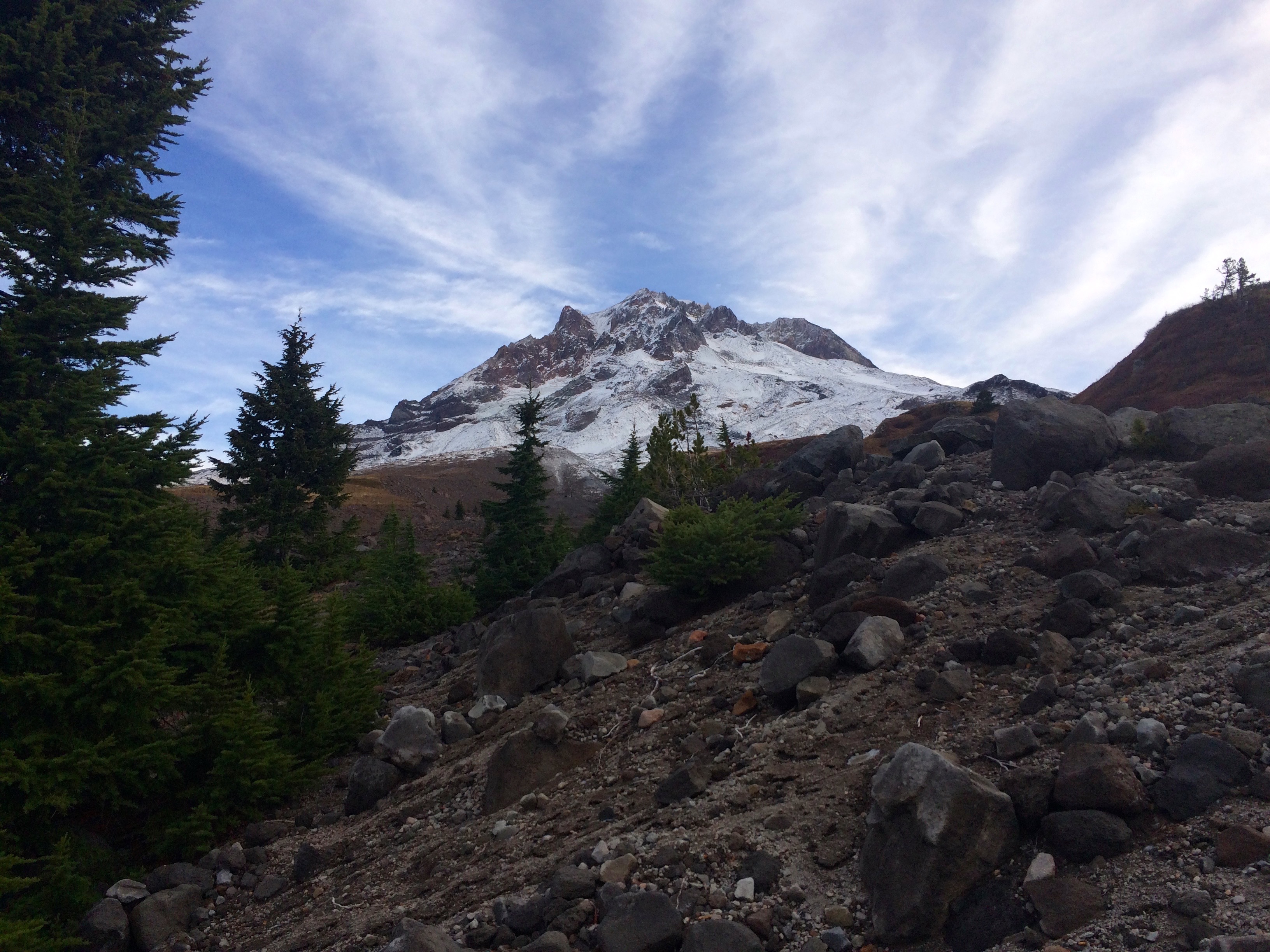
Back to the view, which was highlighted by the clouds opening to a valley exploding with sun rays. I had no idea what lay behind me as Mt. Hood was engulfed in a cloud. However, the hopes for a glorious sunset were high, but the temperature was dropping rapidly. The sunset did turn out to be unique but it was not photogenic due to the light sky above. The cold drove me into the tent where it seemed like I might be in for an uncomfortable evening.


It turned out to be just fine after I closed my air vents and put on a second pair of socks. It seemed like it was coldest at about 10 pm and then the wind shifted from the east. I wanted to enjoy the almost super moon rising over Mt. Hood but it was just too cold.
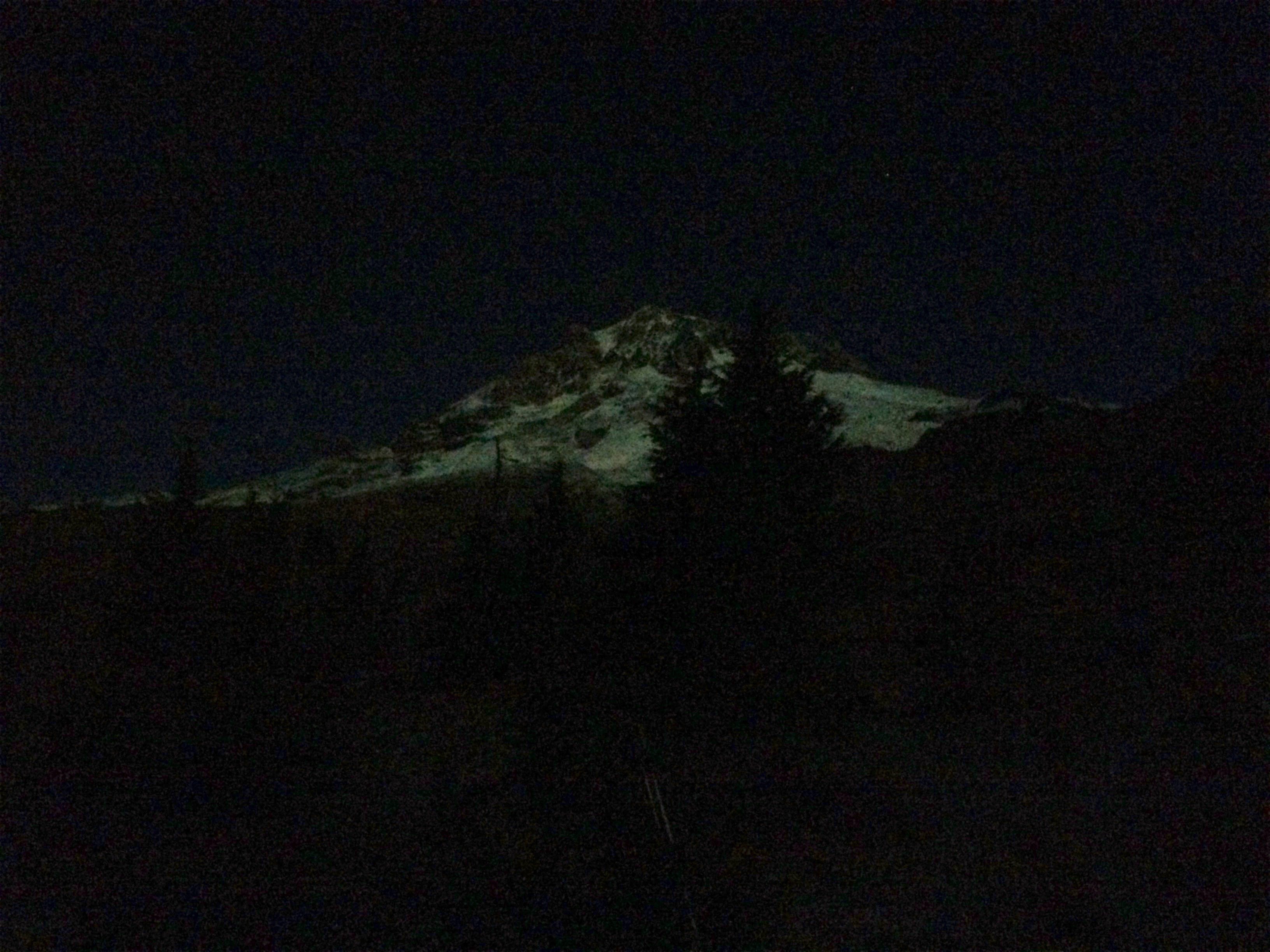
Mt Hood in Moonlight
When I got up around 3 am it was awesome, a bit warmer and the moonlight exposing a clear Mt. Hood was gorgeous.
Good Morning
Morning brought a reluctance to leave the warmth of the sleeping bag even though the sunrise potential with a clear Mt. Hood was high. I quickly took it in and then slept in until 8ish. The sun was quickly providing welcome warmth allowing for a pleasant coffee and hot chocolate wakeup.
Joys of JetBoil
I hung around most of the morning enjoying the view from Paradise.
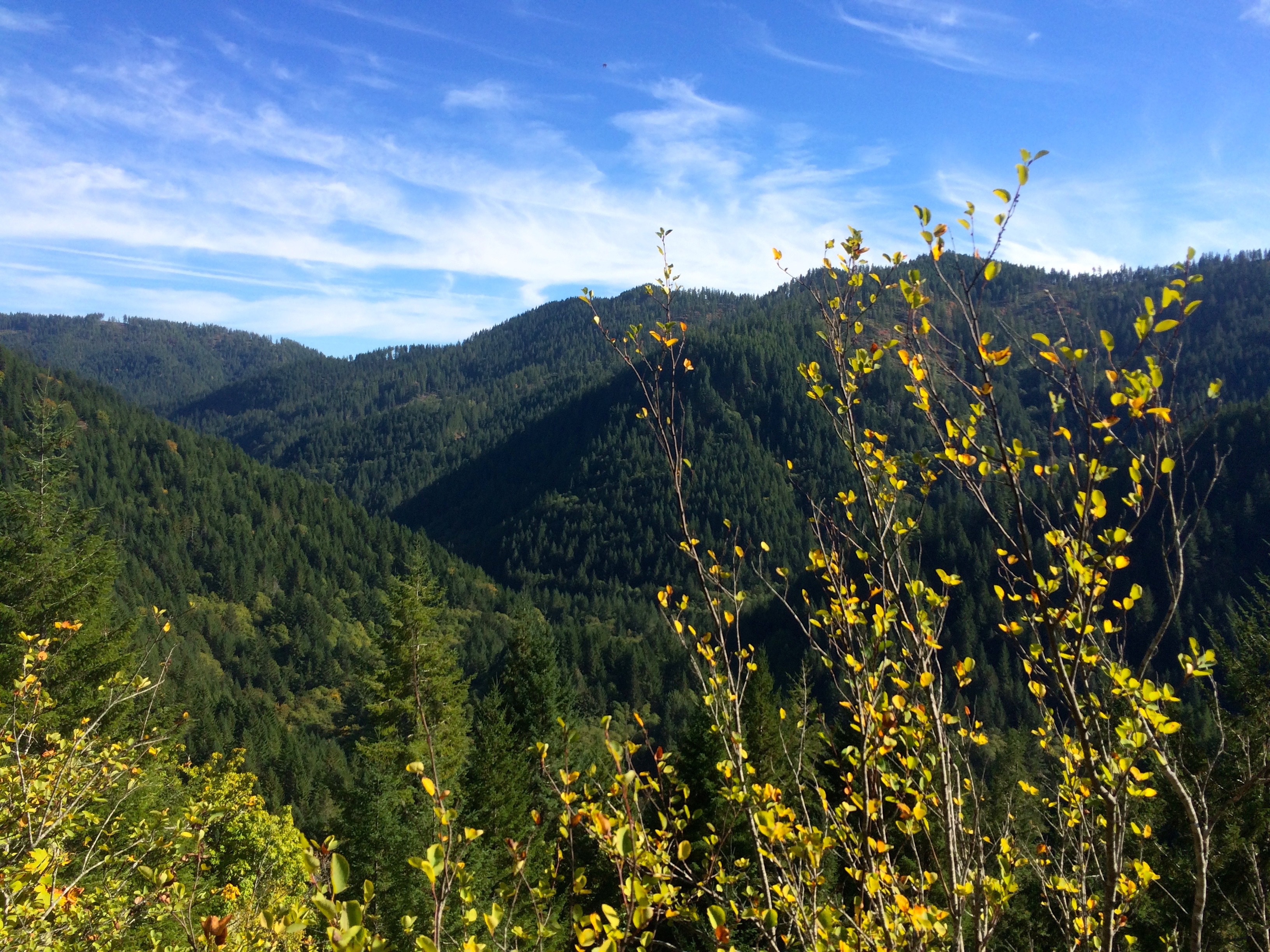
The hike back offered numerous views of Mt. Hood and Jefferson which I cherished via my many stops for rest.
Mt Hood’s Glory
The impulse backpacking escape turned out to be perfect.

Mt. Jefferson
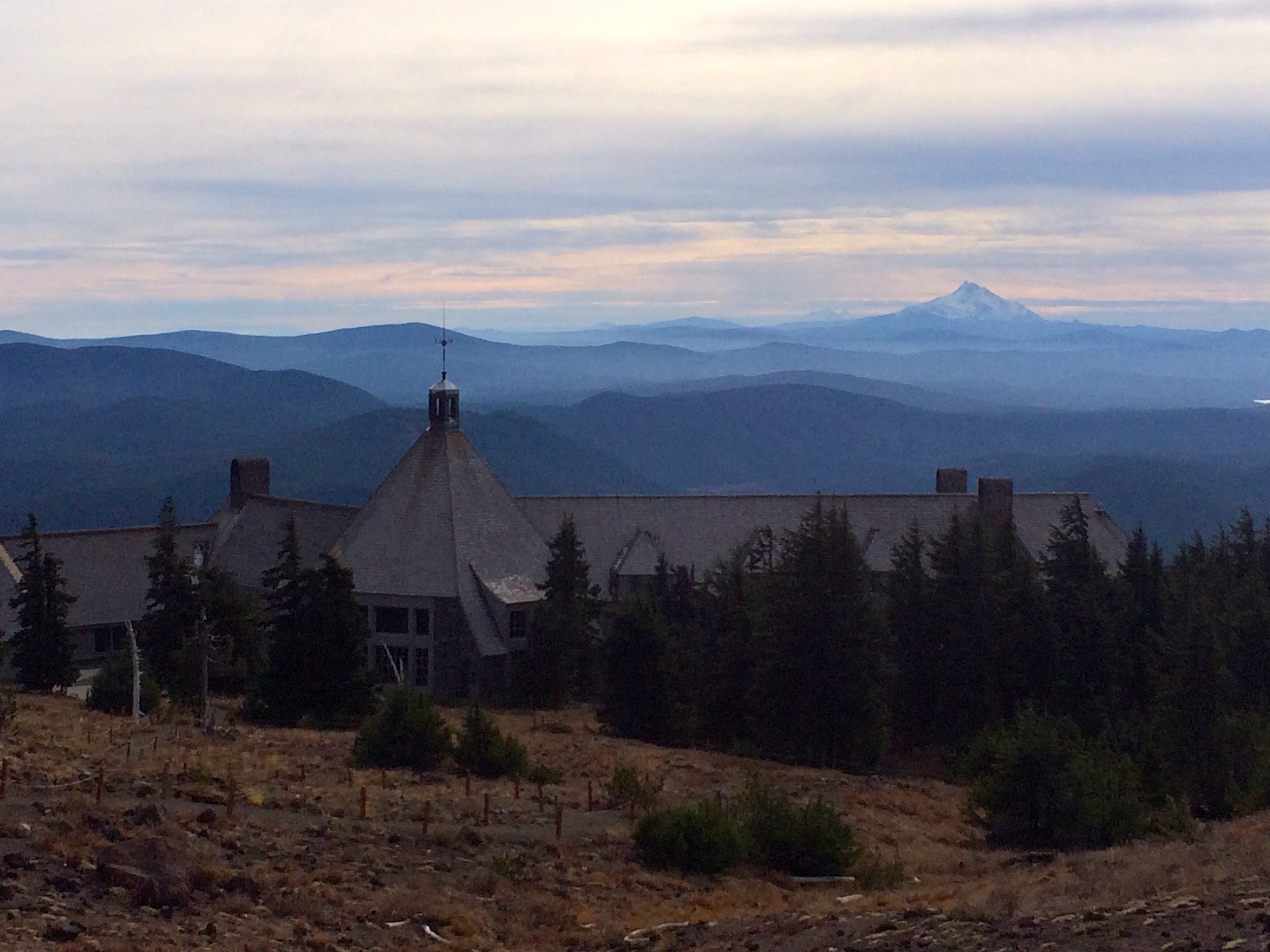
Return to Timberline Lodge
I am so grateful to be able to take advantage of God’s gift to us.

Mountain Top Experience
My backpacking choices just seem to get better and better. The weather October 5th was exceptional and I did not have any commitments for the start of the week so why not find a local backpacking trip. This one was stimulated when I stopped by the Tillamook State Forest Visitors Center and asked a forest ranger for a backpacking recommendation. I think the ranger knew I was serious because she gave me advice about trails that stated they were not for backpacking. Well the Elk and King Mountain summits caught my eye because they created a nice loop option for a day in day out quick trip.

Radically steep trail
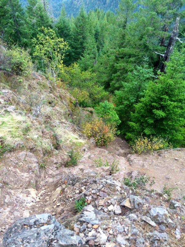
I chose Elk Mountain because it appeared to be a relatively short but challenging hike to the summit which I could pull off with an afternoon start. It was 1.5 miles and a 1900 ft climb, which of course had to translate into a steep trail. I found a blog post at crystaltrulove.wordpress.com that was valuable for helping me understand the false summit confusion, but even though I was warned of the difficulty of the steep trail, I assumed it would be a quick way to knock off 1900 ft.
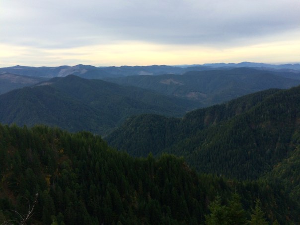
Views of Wilson River Valley along the Trail
Well that 1.5 miles felt more like 5 and it took me about 3 hours to summit. The recommendation that this is not a back-packable hike would be accurate. But Oh what a reward at the top.
This trail has been adopted by the Mazamas for which I applaud their work in helping to make this trail available.

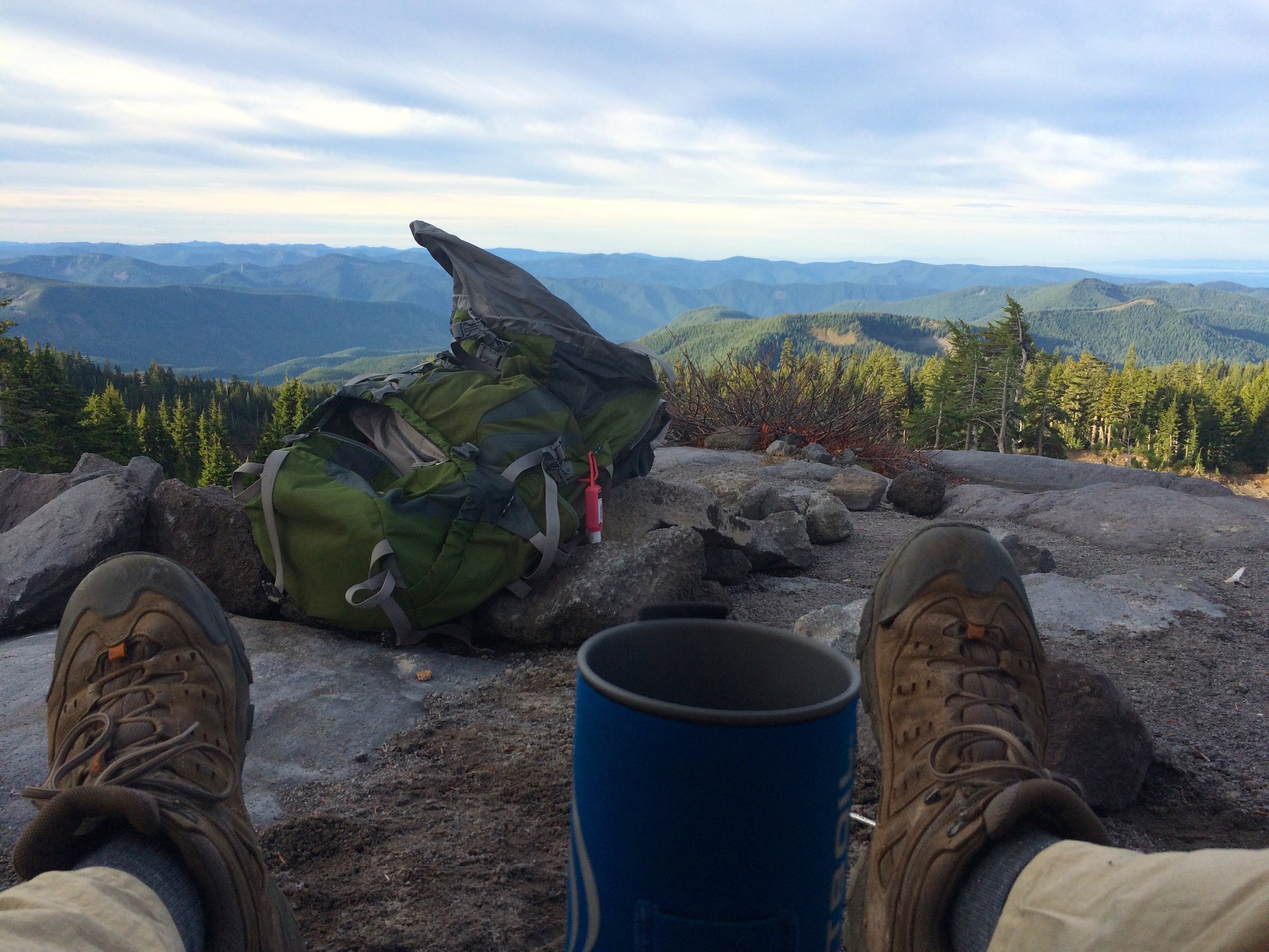
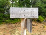
Summit Sign & Log Book
At the summit I signed the log book which the Mazamas have provided. This mountain top consisted of about 700 sq ft of land with maybe enough space for 20 people and one campsite.
Elk Mountain Summit Campsite
I had it all to myself and the evening was shaping up for a good sunset. This was too good to be true when you consider what would be the nicest front porch view you could have for an evening. Again, the weather was perfect with very little breeze so I setup camp and had dinner as I watched the sun set over King Mountain.
The gallery of photos below gives you a feel for the sunset and the coming prize of the starry night. There was no moon and you are far enough away from the Portland metro area lights to have excellent star viewing.


This was definitely a no fly on your tent night.
The experience got even better with the sunrise.


I jumped out of the sleeping bag to take photos and kept the camera close as I had my coffee.
I knew that the back side of Elk Mountain also offered up some radical vertical which is even more difficult going down, but it was not as extensive as the climb up.
-
- Decent to Elk Creek Trail
-
- Wilson River Valley
What did surprise me was the 2 mile segment to the Kings Mountain Trail that inserted more summit climbs and more awesome views of the valley. Another pleasant surprise was how beautiful the final 4.8 miles of the Elk Creek Trail turned out to be.

This was truly a Mountain Top Experience.

Sleep by a Mountain
Mt Jefferson from Whitewater Trail
When you have discovered the joy of being one with nature the call to return to the wilderness if often heard. I may not have time to put together week long outings, but a few days away sure does recharge the battery. On labor day I shared a great Oregon coast hike from Arch Cape to Cape Falcon in the Oswald West State Park just south of Cannon Beach.
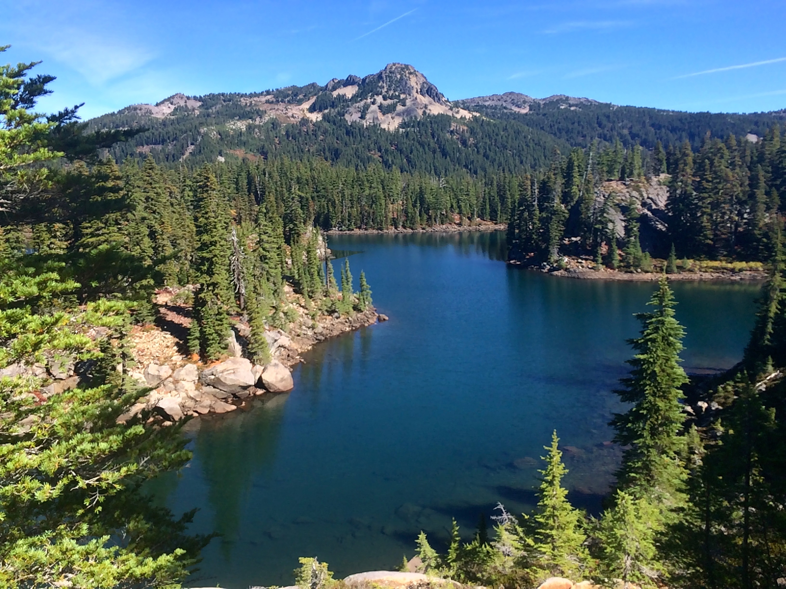
Bays Lake
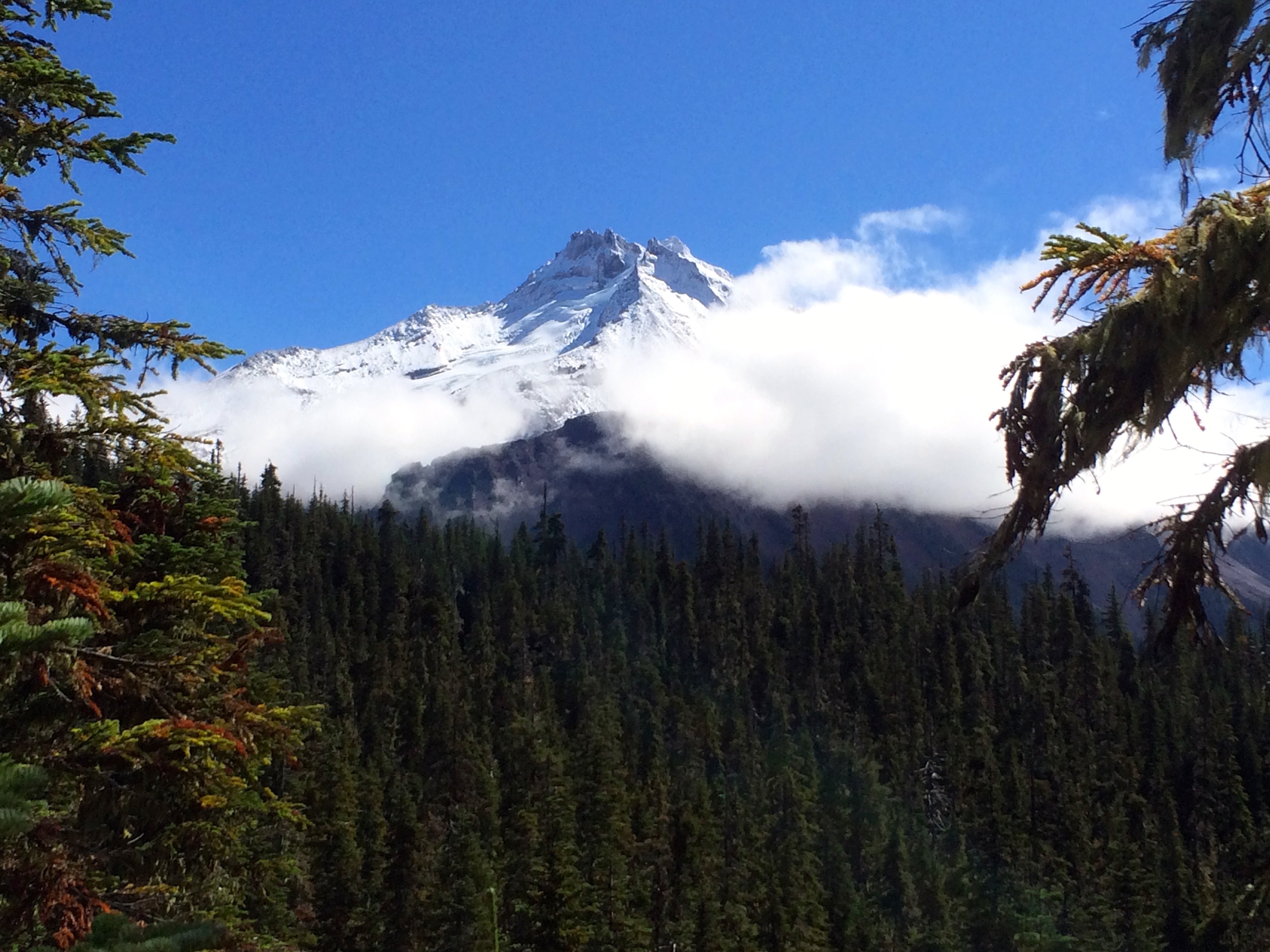
The last 2 days, September 18-19, 2015, I visited the Mt Jefferson Wilderness Area for a night next to a mountain. The weather in Oregon is beginning to feel like Autumn is just around the corner, so a beautiful weekend of heat and sun called for a jaunt up to Mt. Jefferson. This area of the Cascades is extremely popular which will dictate a reservation only option starting next year for campsites near the many lakes.
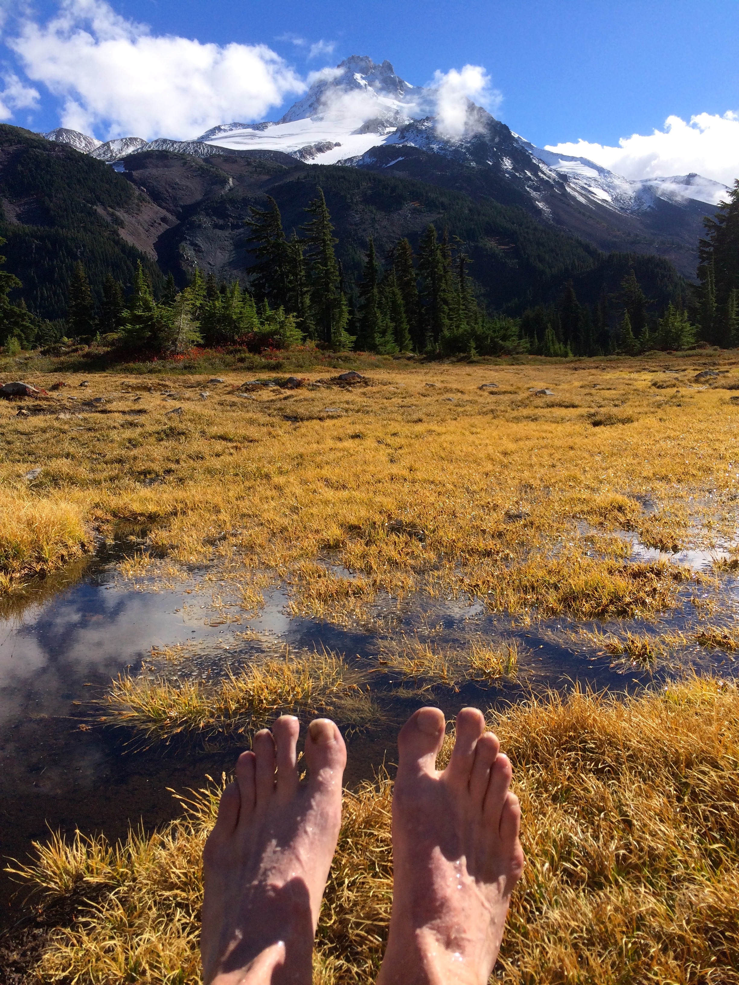
Relaxing
So with the motivation of choosing the best campsite available I took advantage of the beautiful weather and an early Friday start to backpack into Jefferson Park. The area had received a lot of rain which turned out to be an added bonus as the moisture seemed to spark life into the mostly brown vegetation, not to mention clearing the air for spectacular views of Mt. Jefferson. It appeared that all of the little ponds and wetland area was filled up with the recent rain and thanks to the warm sunny day which heated up the ponds offering me an enjoyable spot to soak my feet. I parked at the Whitewater Trailhead for the 6 mile and 2100 vertical hike which was just perfect for my old body which was in ready for the exercise. I think I may need to do a trip like this at least every few weeks to keep that healthy feeling.
Russell Lake
I ended up camping at the east end of Russell Lake which offered some privacy and an excellent view of Jefferson. Since I was essentially at the furthest campsite in the Jefferson Park area I had to respond to a number of groups who came all that way only to realize that all the campsites were taken.
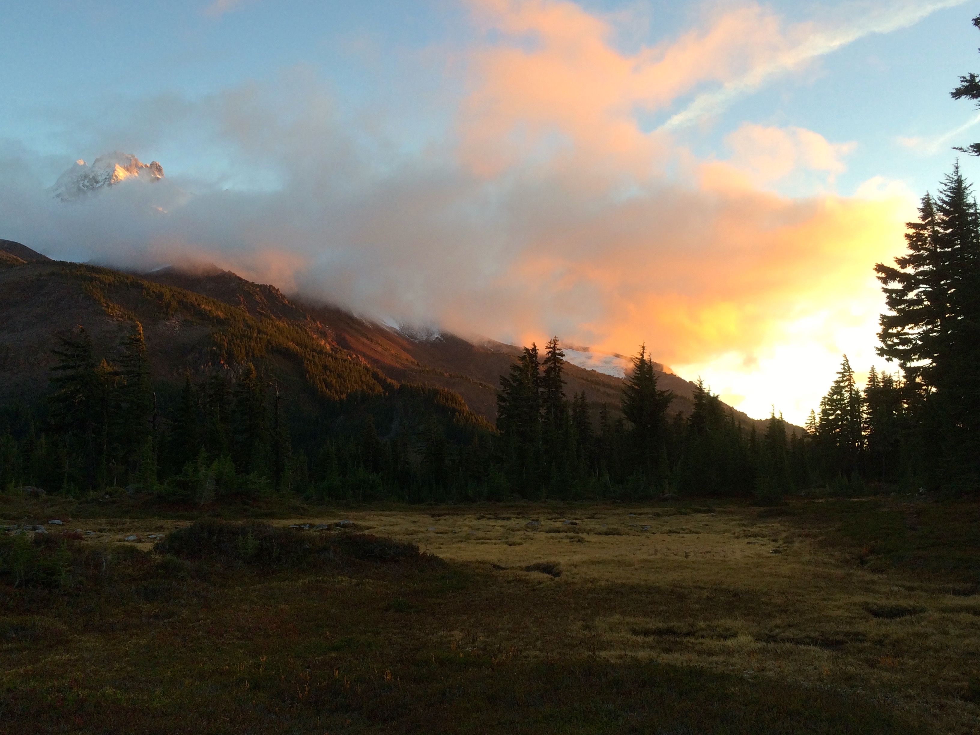
Sunset next to a Mountain
The sun dropped quickly as did the temperatures but with it came some intriguing sunset cloud formations around Mt. Jefferson. Of course I took about a hundred photos to end up selecting this one of the sunset with the half exposed mountain. When conditions are optimal one should always consider sleeping next to a mountain. It was a cold night though, had to totally zip up the mummy sleeping bag.

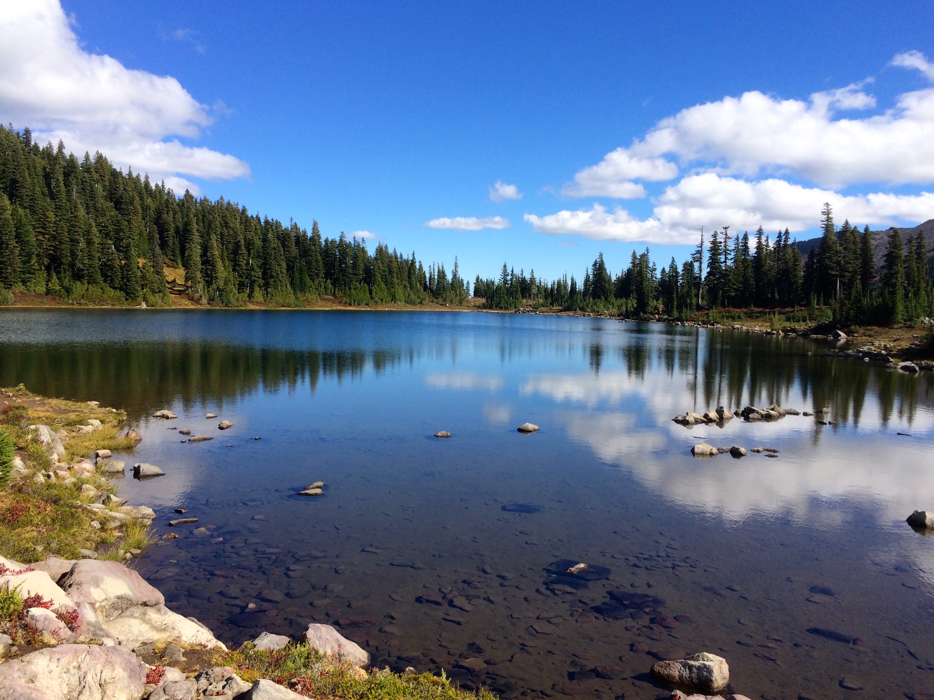
Campsite on Russell Lake
The humid air made for heavy dew but the early rays of sun quickly warmed everything up and dried out the tent.
The return to the car made for an easy mostly downhill hike in which I took the opportunity to checkout all of the lakes in the Jefferson Park area. I figured if I was going to have to make a reservation for a campsite I wanted to know what they all looked like. The final shot of Mt. Jefferson was as good as it gets.
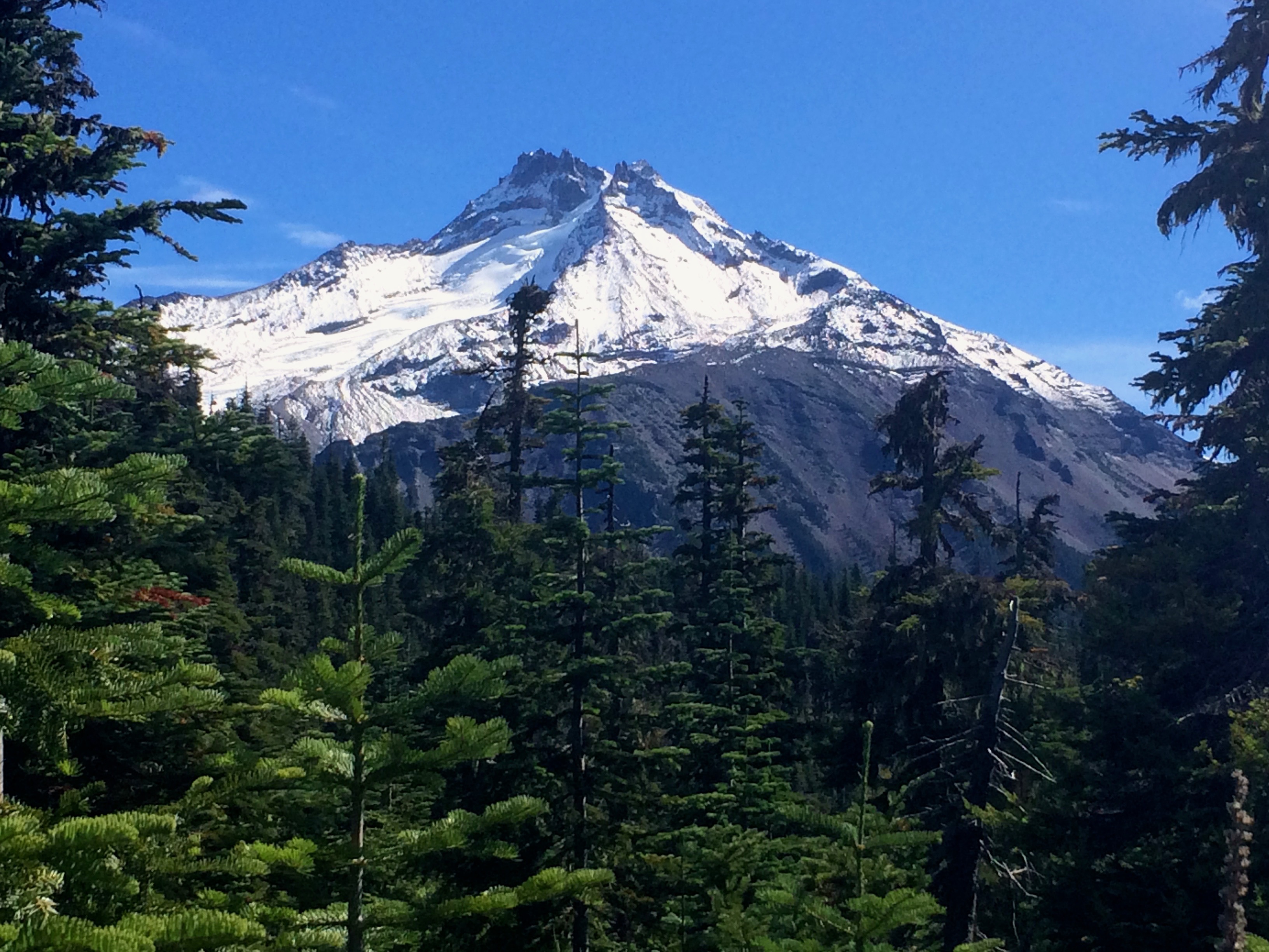
Classic Shot of Mt Jefferson


