Category Archives: Backpacking

Stevens Pass to Snoqualmie Pass
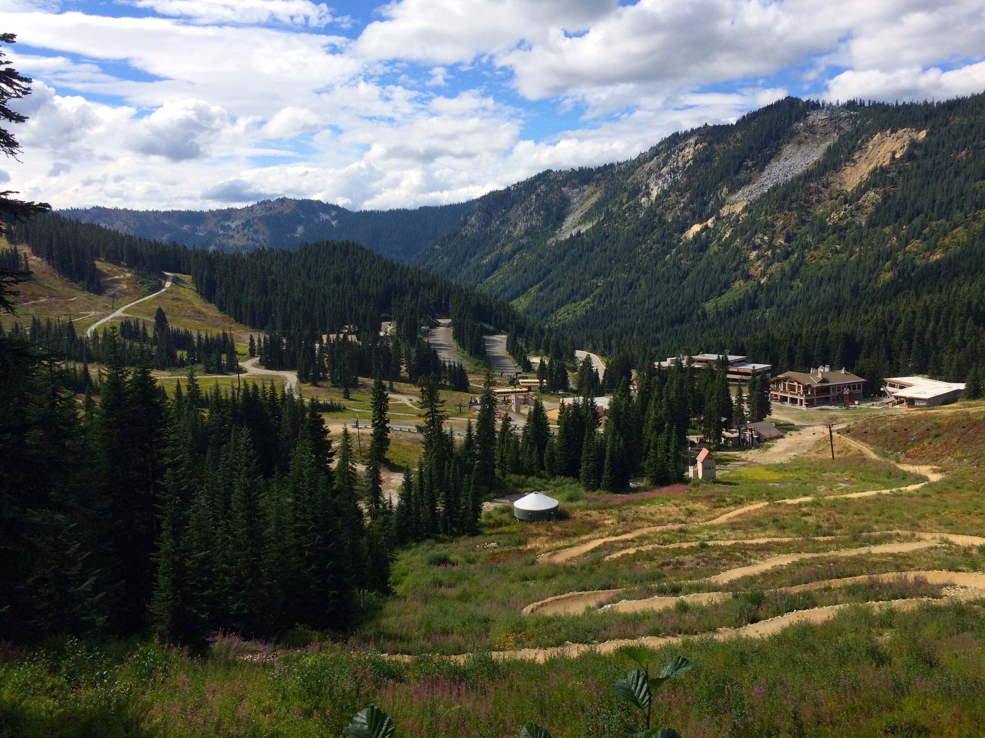
Stevens Pass Ski Area
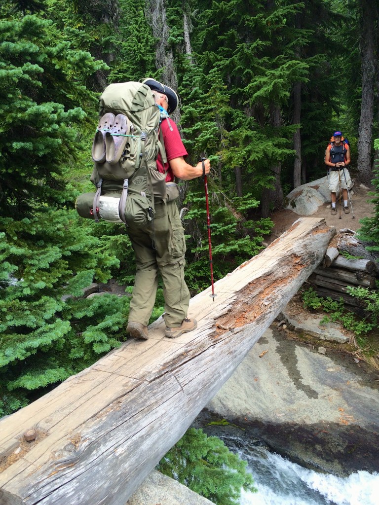
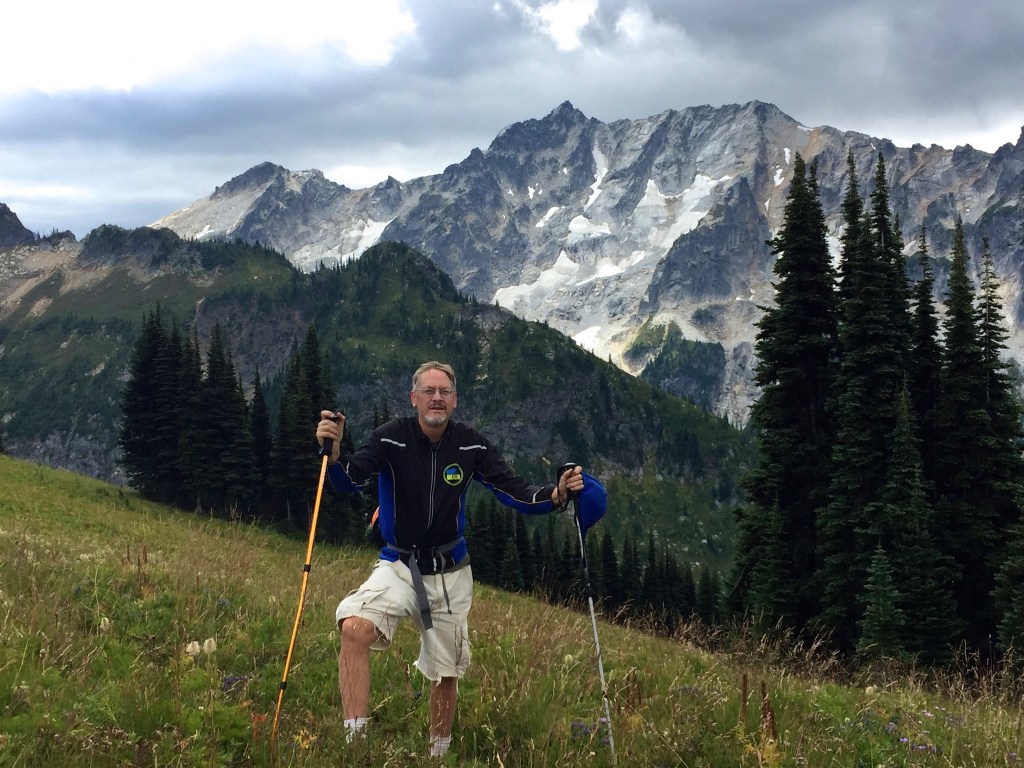
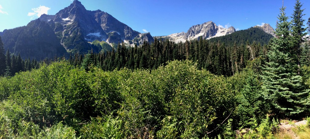
I backpacked the Stevens Pass to Snoqualmie Pass, PCT Washington Segment J from Aug. 8-16, 2015. It is 71 miles and over 18,000 vertical. This trip on the heals of my Spider Gap Buck Creek loop was challenging in many ways, most of which was related to heat, lack of water, lots of vertical and smokey conditions. Overall though it is a very dramatic PCT segment complete with very rugged and beautiful terrain.

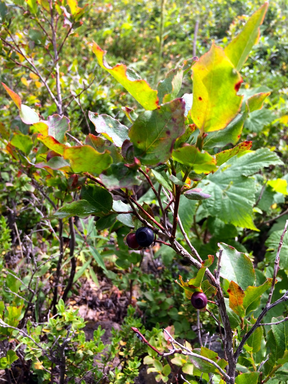
Campsite in Berries
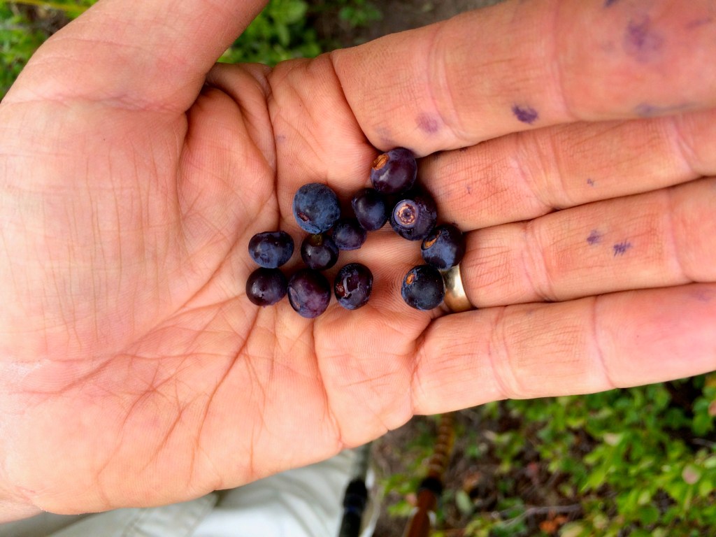
Starting off at the Stevens Pass Ski area was kind of cool thinking about how I might ski those runs that I was hiking. I was also treated to an abundance of huckleberry and blueberries for the first couple of days.

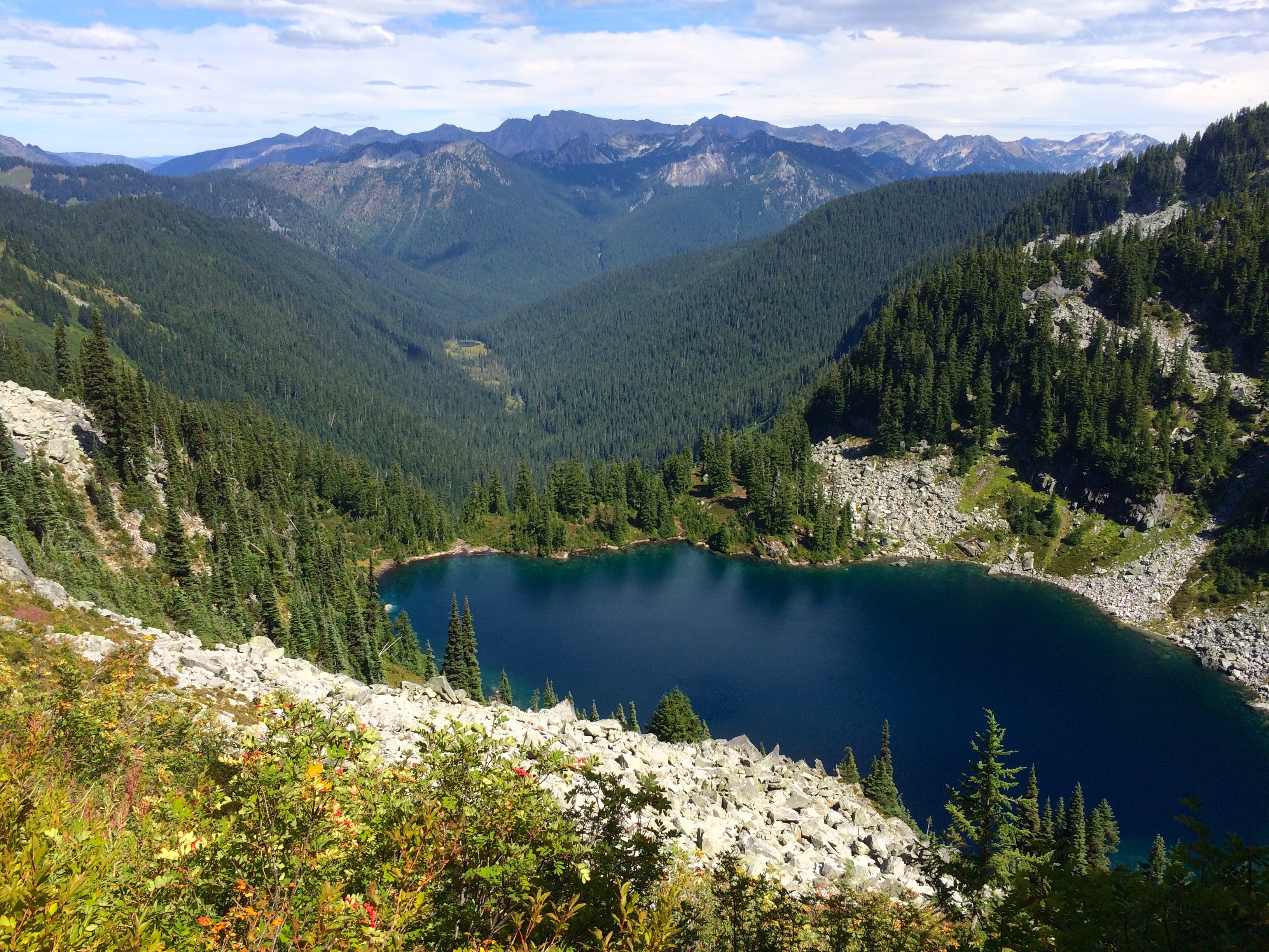
Mig Lake
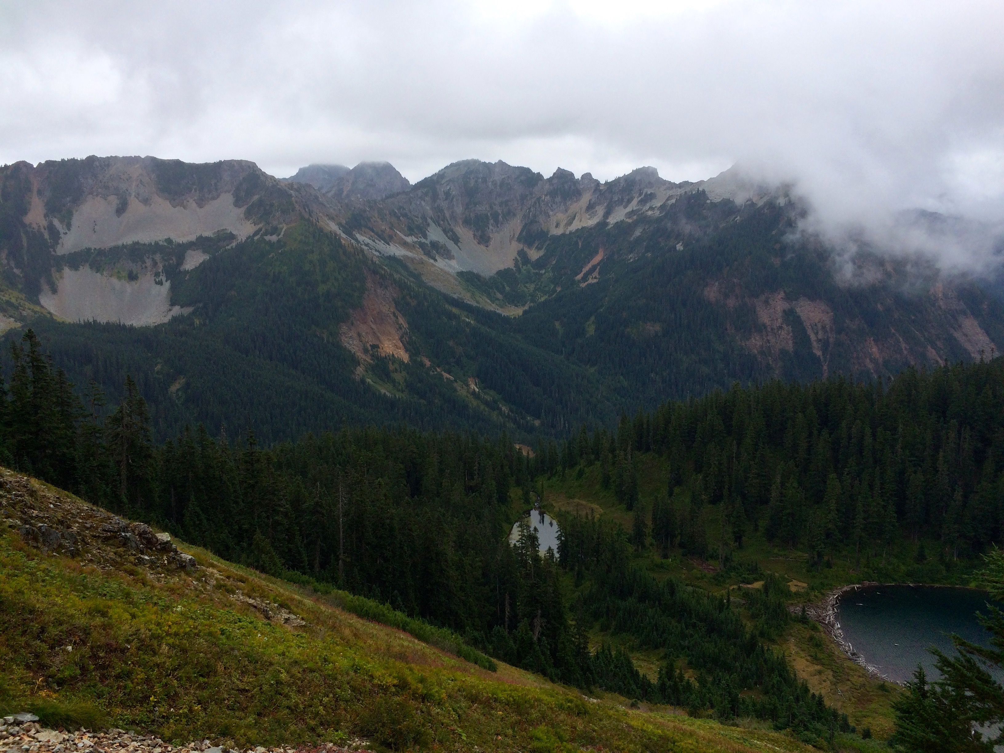
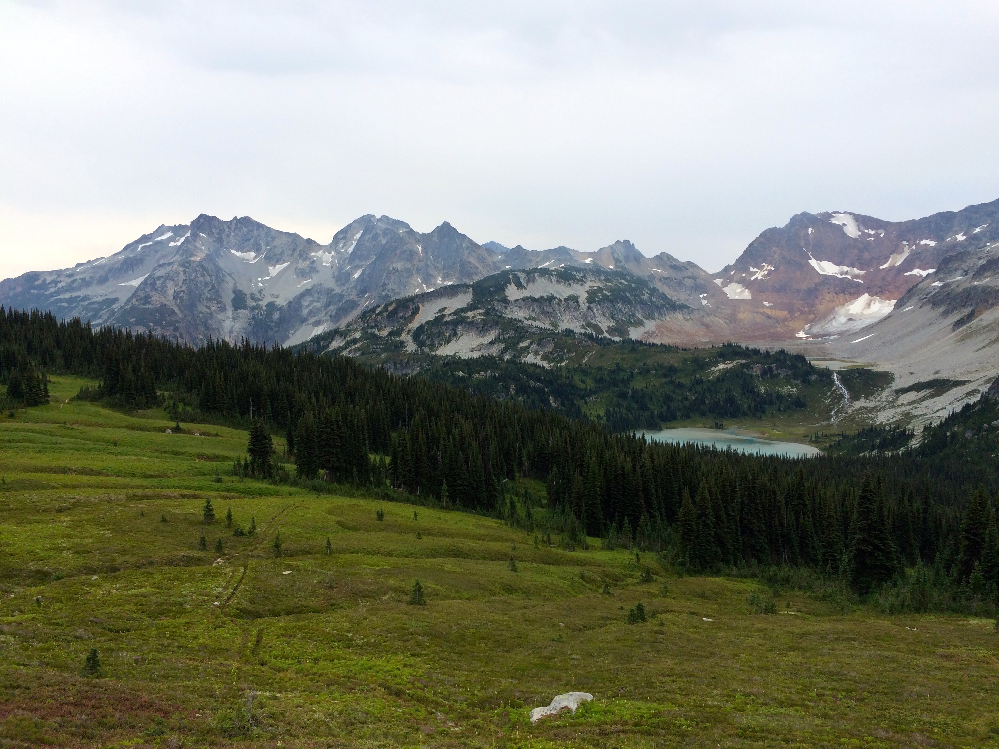
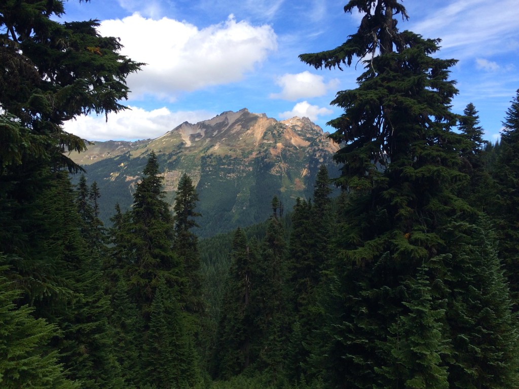
My second day I had my sights set for a campsite on top of a mountain but along the way I passed many lakes of which I think the most beautiful was Mig Lake.
Trap Lake
At my mountain top campsite at PCT 2450 which was after a typical 3000 ft vertical climb day I had Trap Lake behind me and a beautiful sunset waiting ahead of me. One of the best campsites I have chosen.

Sunset from Mountain Top Campsite
The following day I planned on camping at Deception Lake, however,

Jets over the Wilderness
I was not that impressed with the options and I knew it would end up being crowed with the many through hikers now hitting this part of Washington. I pressed on and found a great campsite just south of Deception Creek at PCT 2442. The photo showing the jet exhaust trail represents the many jets that you hear flying over this area out of Seattle. You never see the military jets which fly lower and louder.

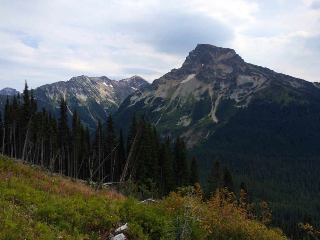
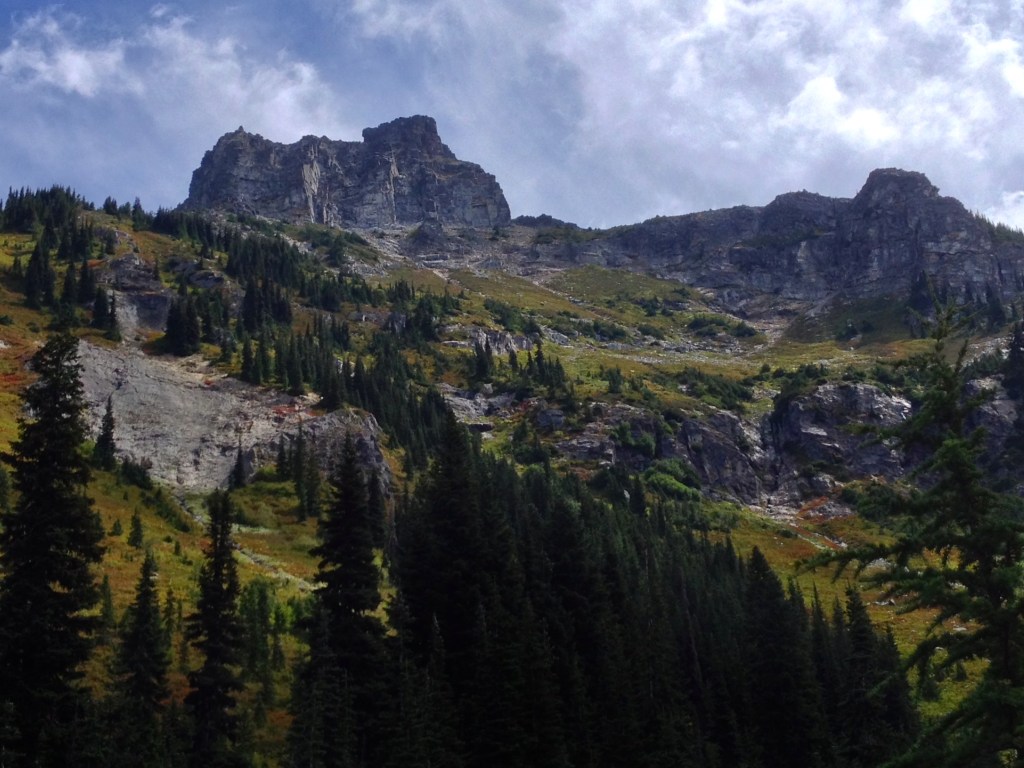
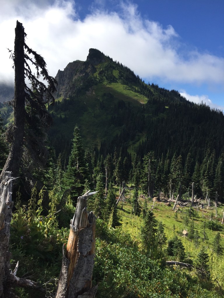
Cathedral Rock
The next day I climbed past the Cathedral Rock area but overall I took it easy and ended up at Deep Lake which offered a great site for a swim. Deep Lake still had water flow but it was low and the lake was warming up.
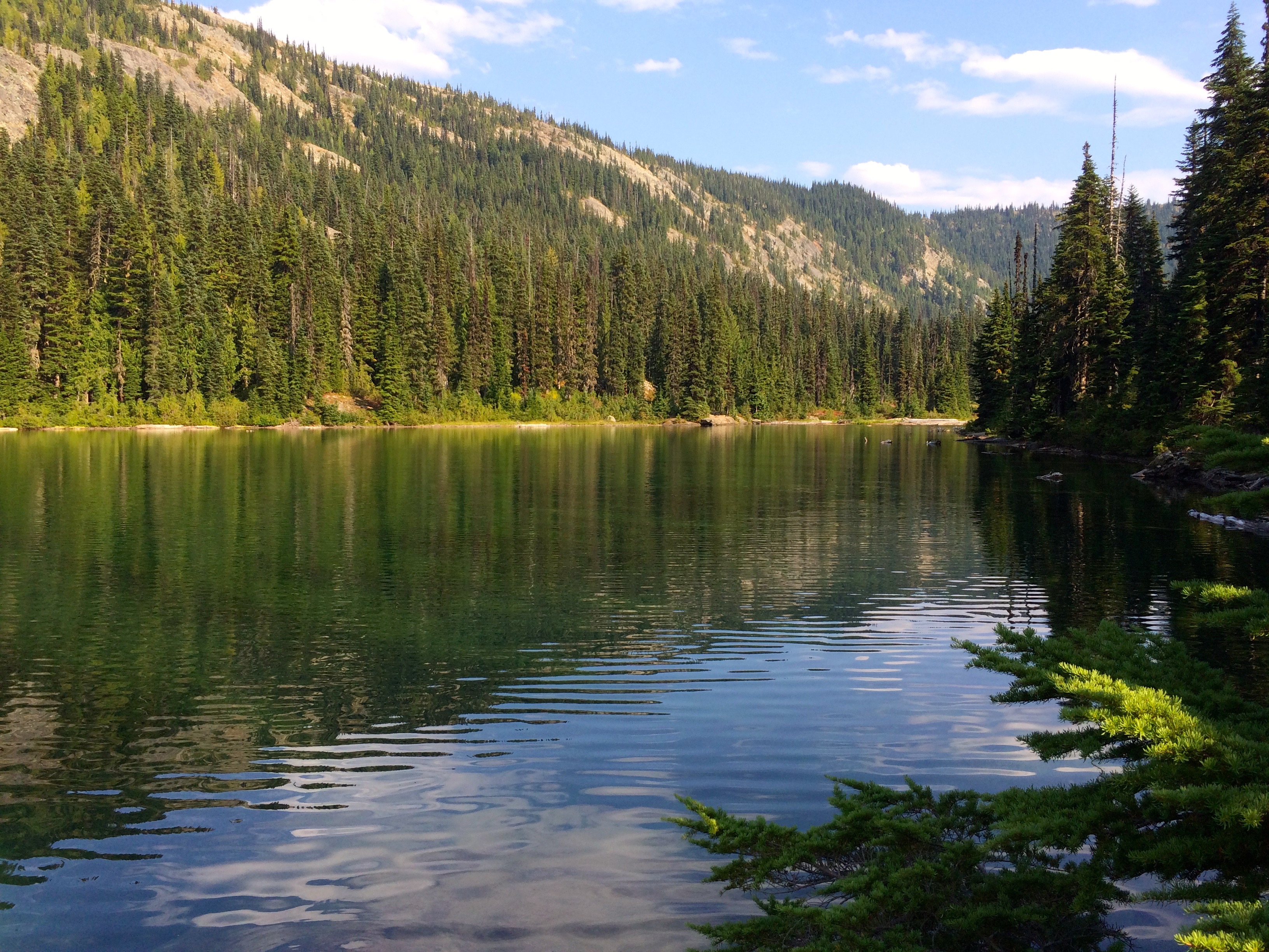
Deep Lake
I knew that I had a tough high vertical day coming up so I also took it a bit easy the following day in preparation to climb over Escondido Pass. I knew that water was going to be an issue and when I realized that my Camelbak bladder had leaked I was a bit concerned.
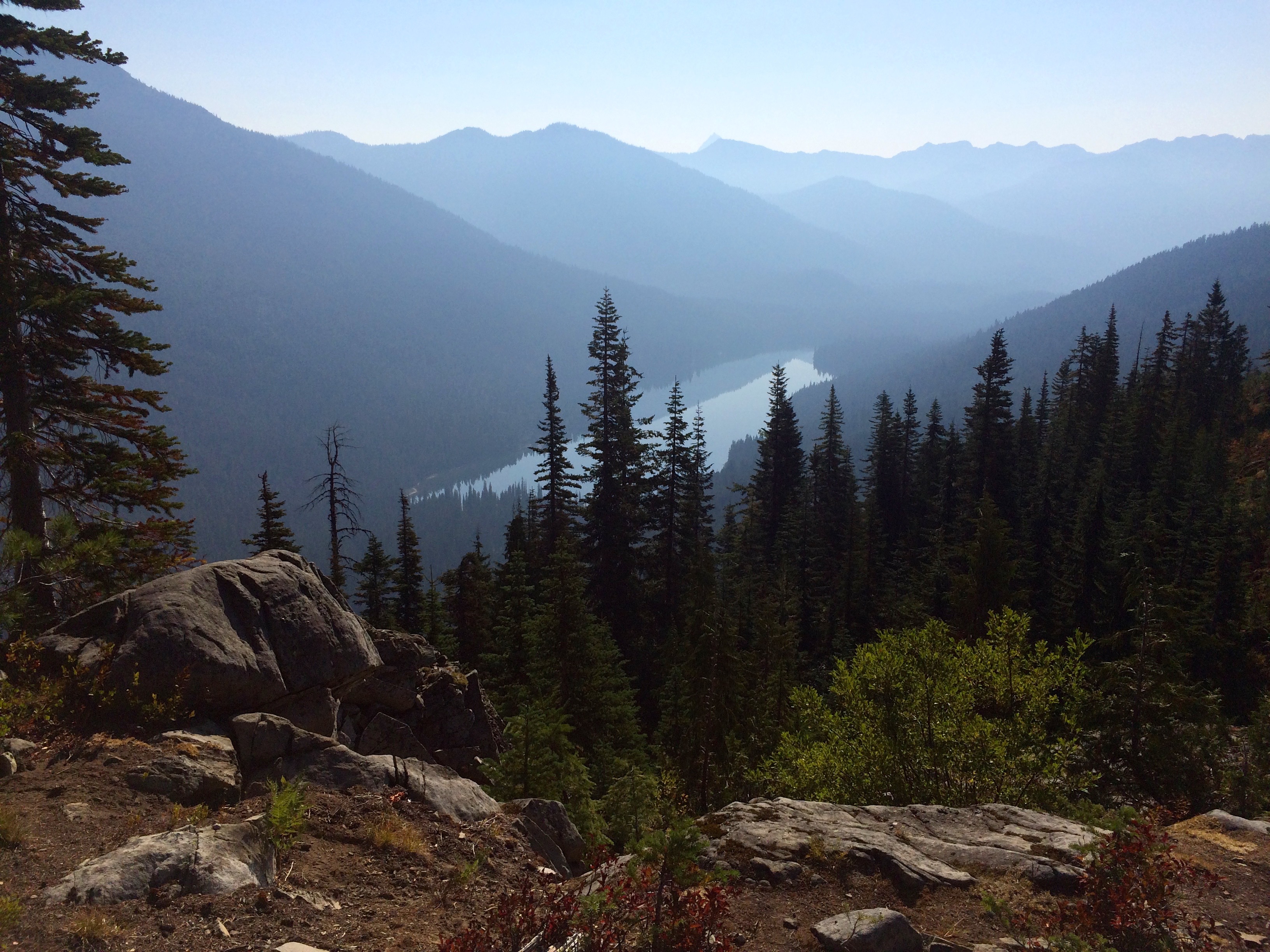
Smoke Over Lake Waptus
I did find a trickle of a stream where I filled up a Nalgene liter but I would need more. This was a long and exposed segment that turned out to be on one of the hottest days along with a lot of smoke sneaking into the area from the Washington forest fires.
Escondido Pass
There are a couple of dead lakes on top but who wants to drink warm water. It turned out that I did not have enough water or energy which made for a very difficult day. Boy was I happy when I finally got to a cool stream over near Lemah Meadows. I setup camp as it was getting dark and I collapsed for a night’s sleep to recharge. I did experience an interesting event that night as I believe a large buck must have been startled by my tent which was fairly near the trail. This was at 1:30 am and this buck sounded like he raised up and pounded his hooves 3 times right next to my tent. Nothing I could do but just lay there. Or maybe it was just a very real dream.
I took it easy the next day in preparation for more climbing.
Weather Changing
My plan was to camp near the Park Lakes area which turned out to be as far as I could get before the rain set in.
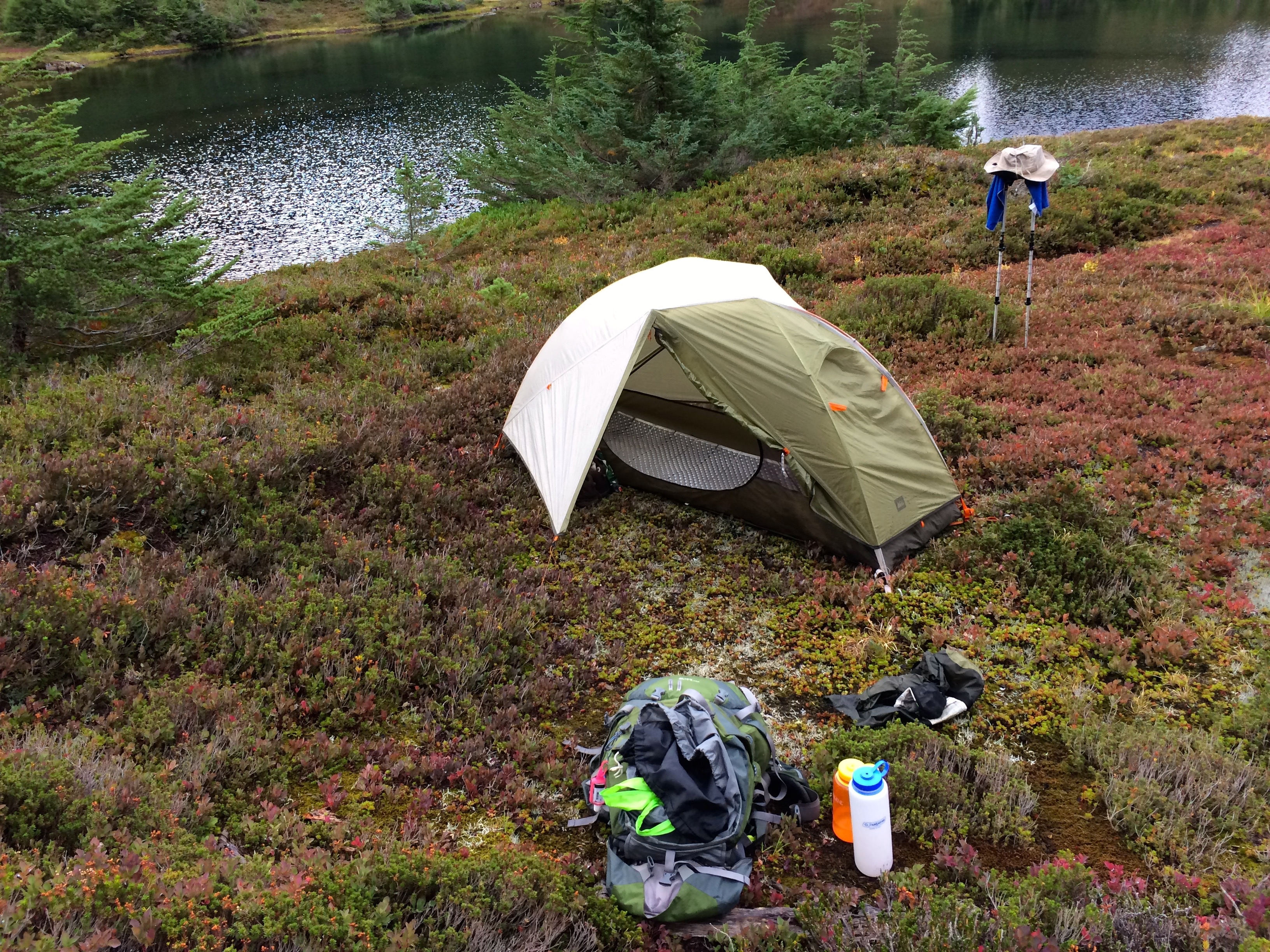
Campsite during Storm
In all of my backpacking I have been extremely fortunate with respect to weather, rarely have I endured a serious rain. Well that all changed with a night of wind and rain which was sorely needed by the draught stricken mountains. I did choose a good campsite next to a lake on top of ground shrubs which made for good drainage for the night long rain. The video gives you an idea of how pleasant the night long rain was.
Park Lakes Area
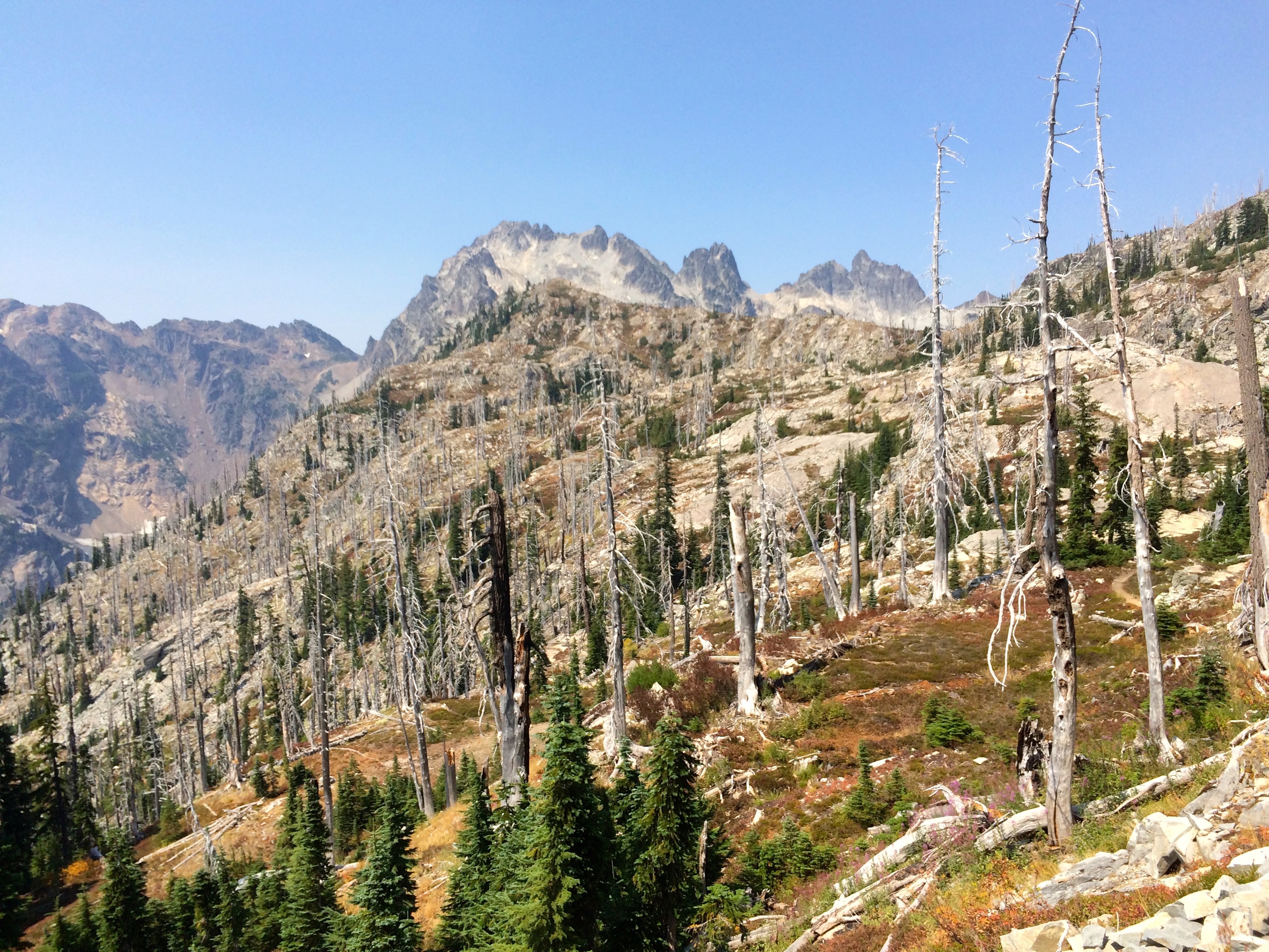
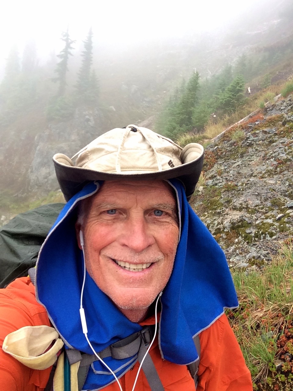
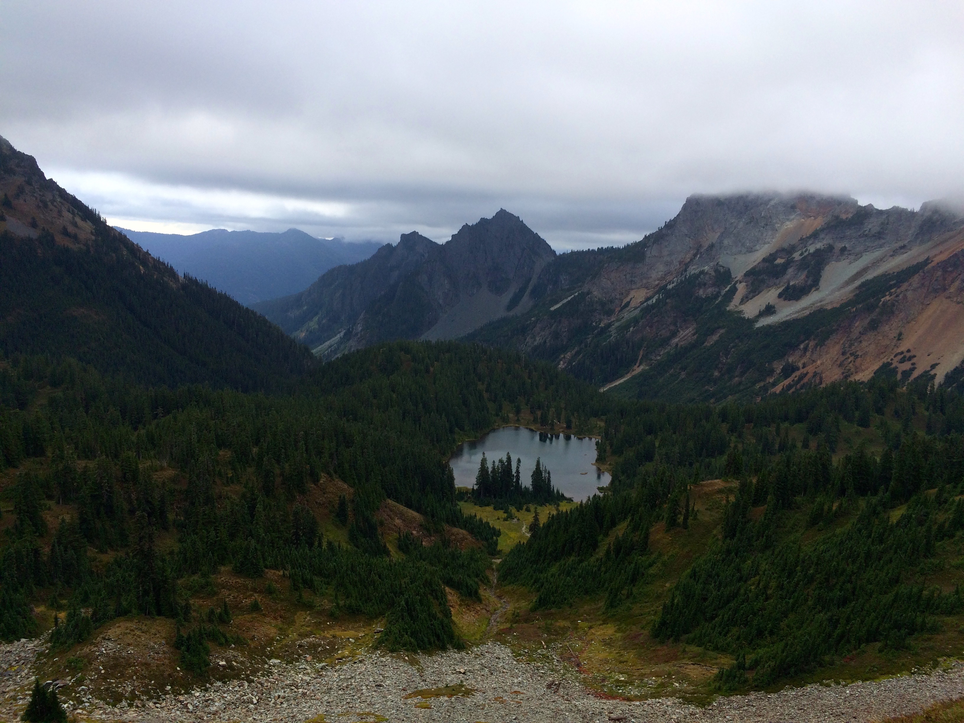
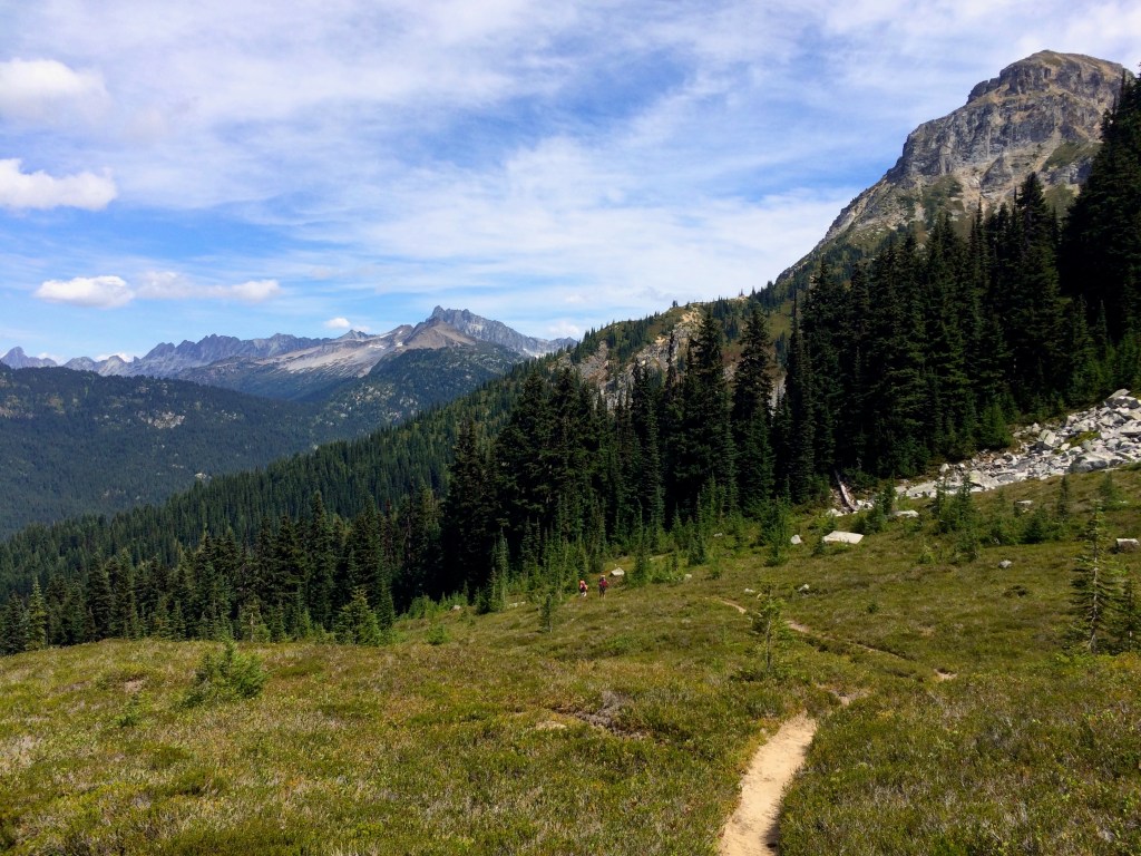
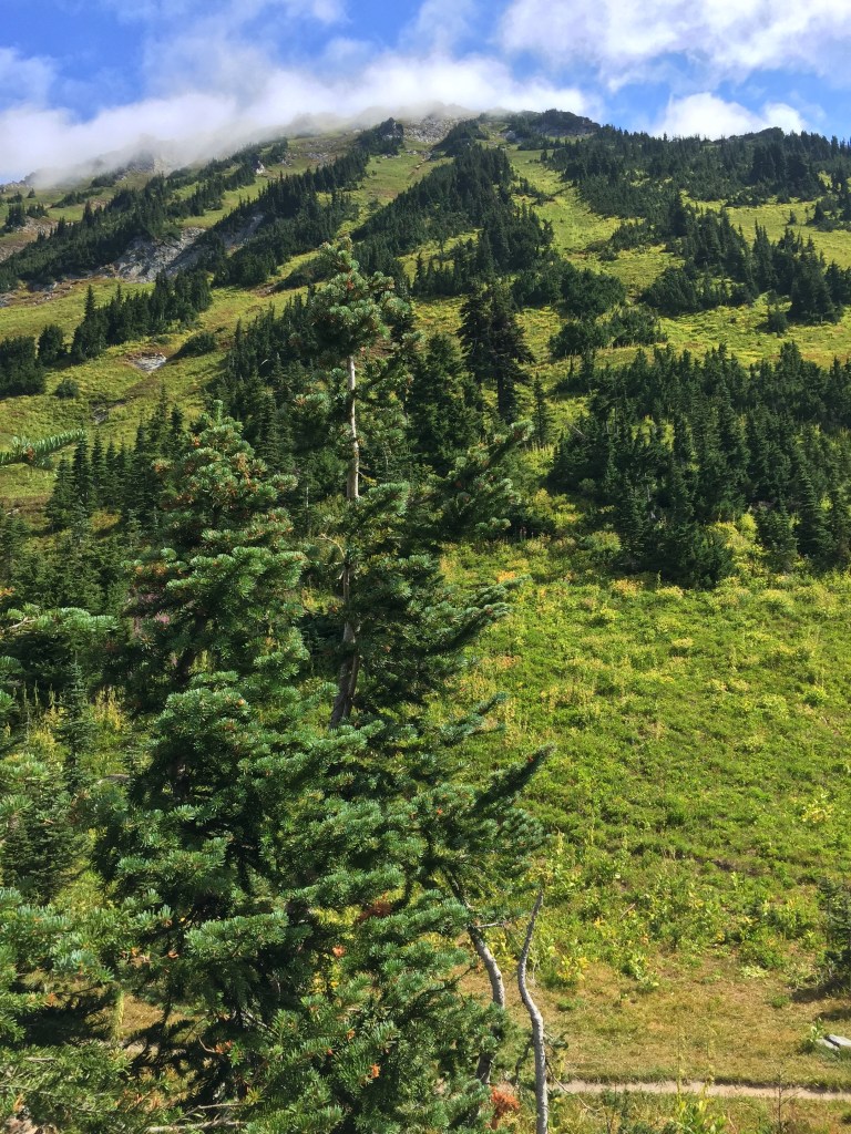
The following day turned out to be a lot tougher then I expected, lots of up and downs, but the misty weather made for excellent hiking conditions.
Above Alaska Lake
This is very scenic terrain and doing it in the clouds made for a unique day. Again my day stretched to the end of my energy just in time to make camp at Ridge Lake, just before it started raining again.
Hiking in the Clouds
Not so bad, just persistent. But this was my last night on the PCT since Snoqualmie Pass was over the next pass. Of course the sun came out just as I got on the trail. It would have been nice to have had the sun to dry some things out before heading out.

After the Storms
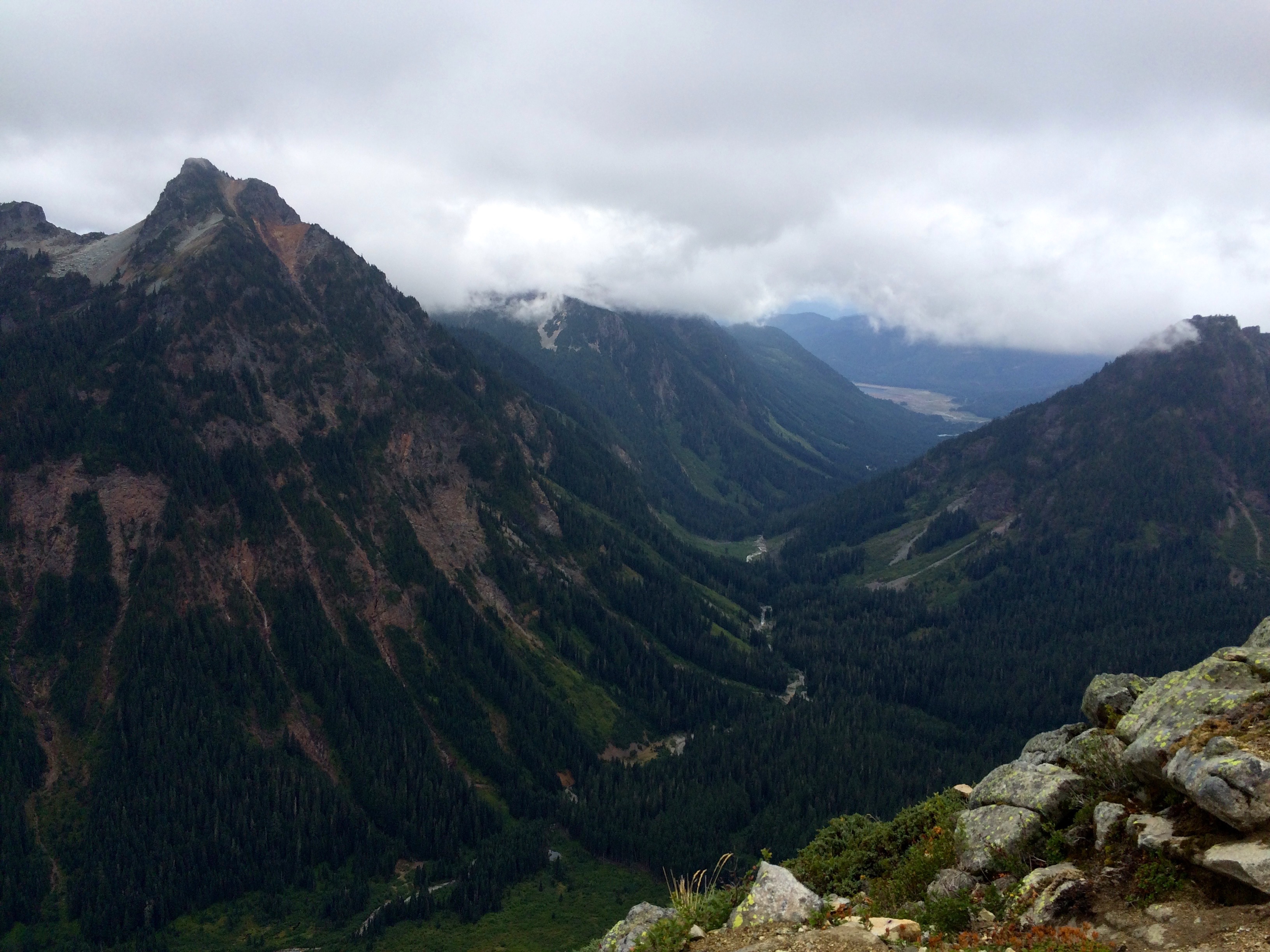
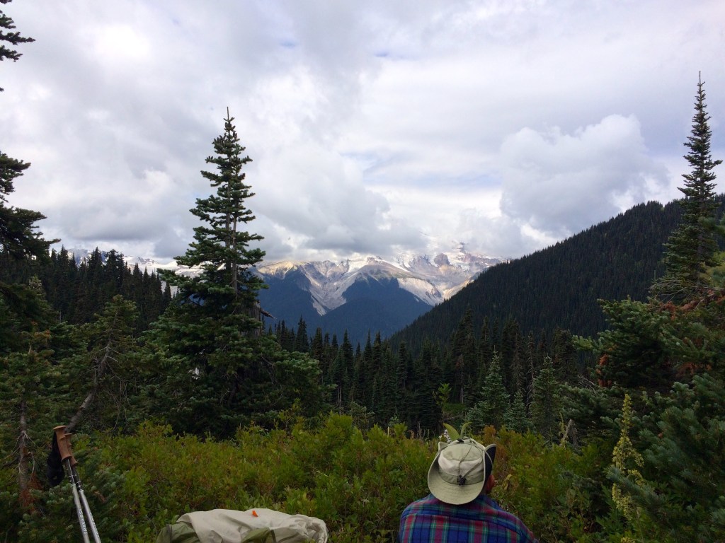
However, the rain brought crystal clear air for some of the most beautiful terrain left on the segment. This is a very popular day hike segment for the Seattle folks so I passed hundreds of them as I headed down to Snoqualmie Pass.
Then you see Mt. Rainier and you can get cell service. This all translated into a wonderful finish to this PCT segment. After getting my resupply at the Chevron Station and showering I enjoyed a few craft beers from the Dru Bru Brewery.


Spider Gap Buck Creek Loop

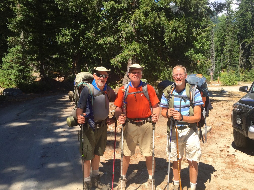
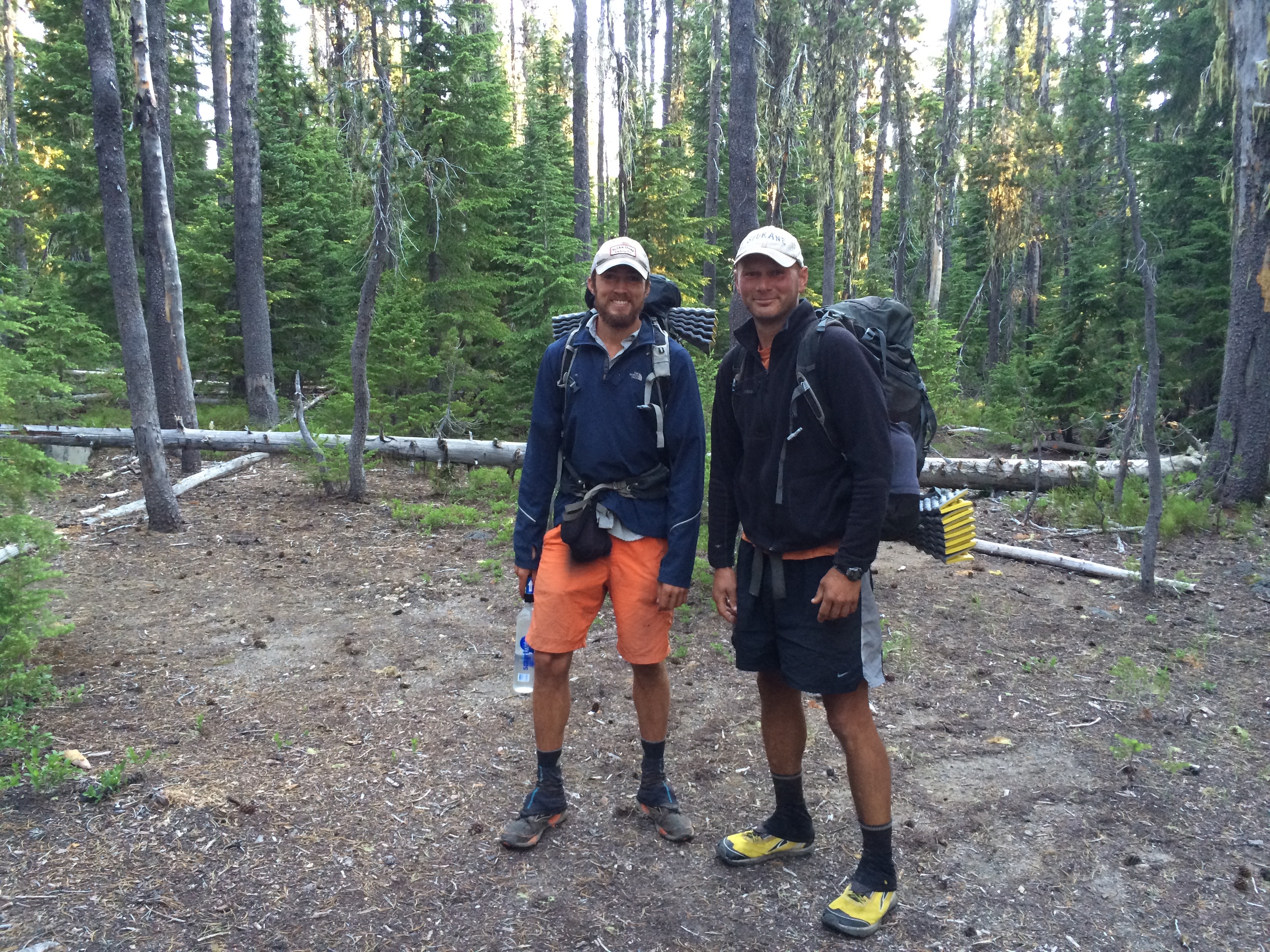
I am sorry for being a bit late on posting about our Spider Gap Buck Creek Loop trip, Aug 1-6. As expected this 36 mile loop with 8000′ vertical was amazing and lived up to our high expectations.
Every year I do a loop like this with friends and when we have asked other backpackers what they believe to be the best loop, Spider Gap Buck Creek tends to be the winner. And it is truly an awesome loop complete with incredible vistas, challenging climbs and unique topography.
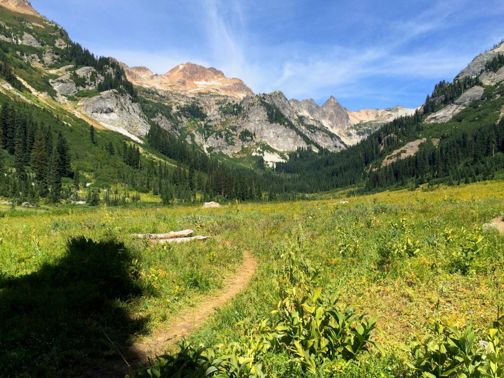
We decided to take the counterclockwise route beginning with the Spider Meadow Phelps Creek trail. The meadow was beautiful but it was obvious that we had missed the high flower point by a few weeks.
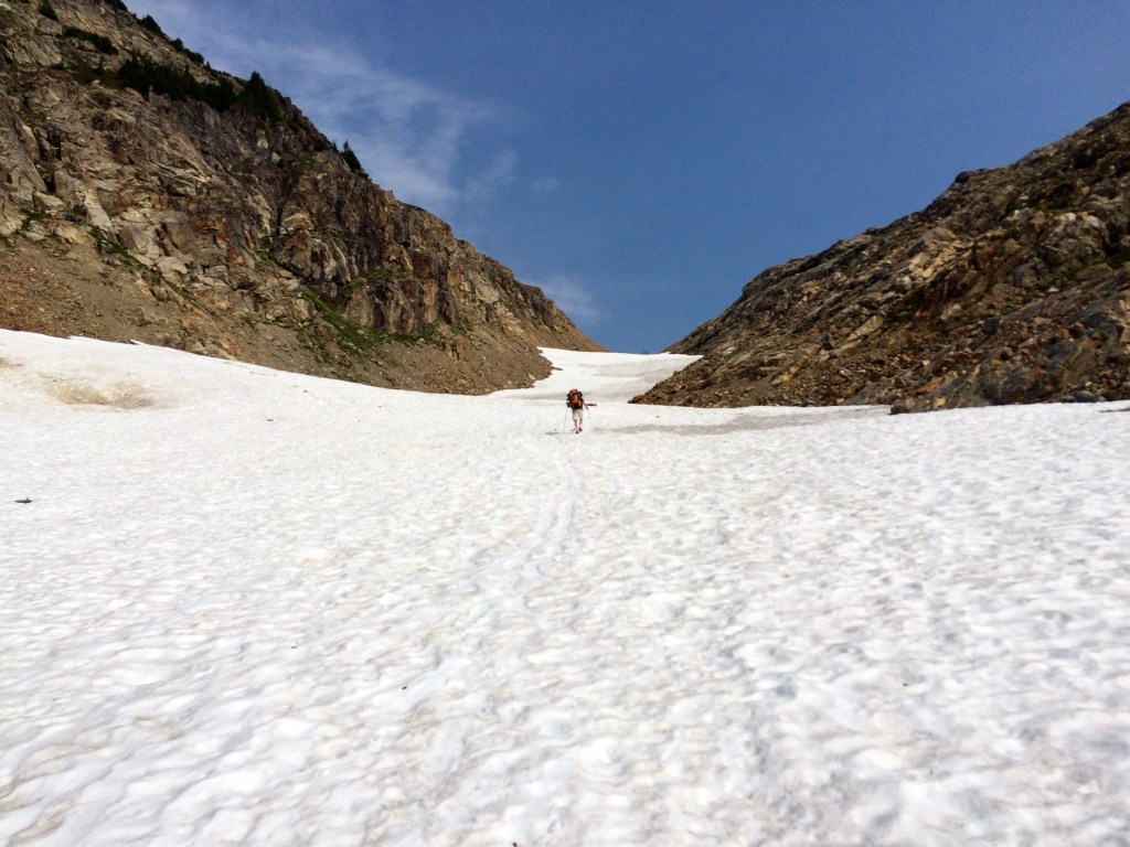
Taking it easy the first day we planned for the Spider Gap climb which is broken into an initial 1000 ft climb on a fairly rugged rock trail and then another 1000 ft climb on up the snow field. The reward at the top was worth the climb.
The view into the Lyman Lakes Valley and Glacier was highlighted by rugged terrain which turned out to offer up a bit of a scare to us. We made the mistake of assuming the trail to the east would eventually wind down to the valley. Wrong, so I advised that we backtrack and go down the snow field. Unfortunately, Bob, who hates to backtrack decided to take the short cut down the mountain slope. This was not communicated well and we ended up getting separated from Bob.

The outcome of this turned into a nervous search for Bob who did eventually turn up to relieve our fears after he had a bit of a hair raising descent down the side of the mountain ending up further down the valley. Our concern stemmed from the dangerous loose rock navigation that could easily result in a slide or a fall. But all was well and we settled in between the Lyman Lakes.

Old Backpakers 
Lyman Lakes Campsite
The following day took us over Cloudy Pass which lived up to its name. This is also about the time we began enjoying an over abundance of blueberries and huckleberries. We had a fun log stream crossing below Lyman Lakes. Again we kept losing Bob because he couldn’t resist stopping and eating the berries.

This is when we first saw the fires which have wreaked havoc with the PCT Trail closure. At this time the big fires over at Lake Chelan had not blown up yet. As we climbed over the pass we got to speak with many of the local Whistle Pig population.
This was also when we discovered that the detour to Stehekin was no longer an option for the PCT’ers. We went about half way to Image Lake and turned around figuring that the weather was not going to present us with enough reward. After talking to others who went over I think it was the right decision.
Fortress Mountain 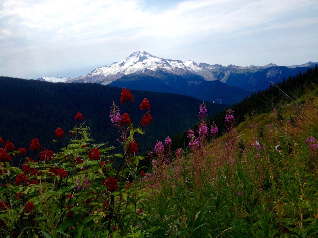
Glacier Peak

We had hoped to hike over to Image Lake which is a 2.4 miles. We went about a mile and decided we didn’t really need to go all the way. The views of Glacier Peak were excellent from where we were. (I did finally get to Image Lake and yes it is awesome) We camped across from Fortress Mountain. This was the Suiattle Pass Junction area where the PCT closure was spelled out.
We continued on with our loop up to Buck Creek Pass knowing that we would have time for a side hike. We setup camp at the top of the pass while the weather still looked good and we decided to do the Liberty Cap trail.

I highly recommend this route which offers fabulous views of Glacier Peak.
Well the weather started to change once we got up on Liberty Cap which caused us some concern but also offered beauty in the cloud formations.


We got back to camp just in time to avoid the rain.
The next morning it was still miserable on the pass but we could see that there was sun in the valley on our route back to the Trinity Trailhead. The annual backpacking loop trip with friends was again a great success, however, this year I was set to continue on for a few more weeks.
My original plan was to get my resupply and go from Stevens Pass to Canada, however, the fires forced a change to that strategy. So I decided to go from Stevens Pass to Snoqualmie Pass for my next segment.
Fires Force Reroute of My PCT Backpacking
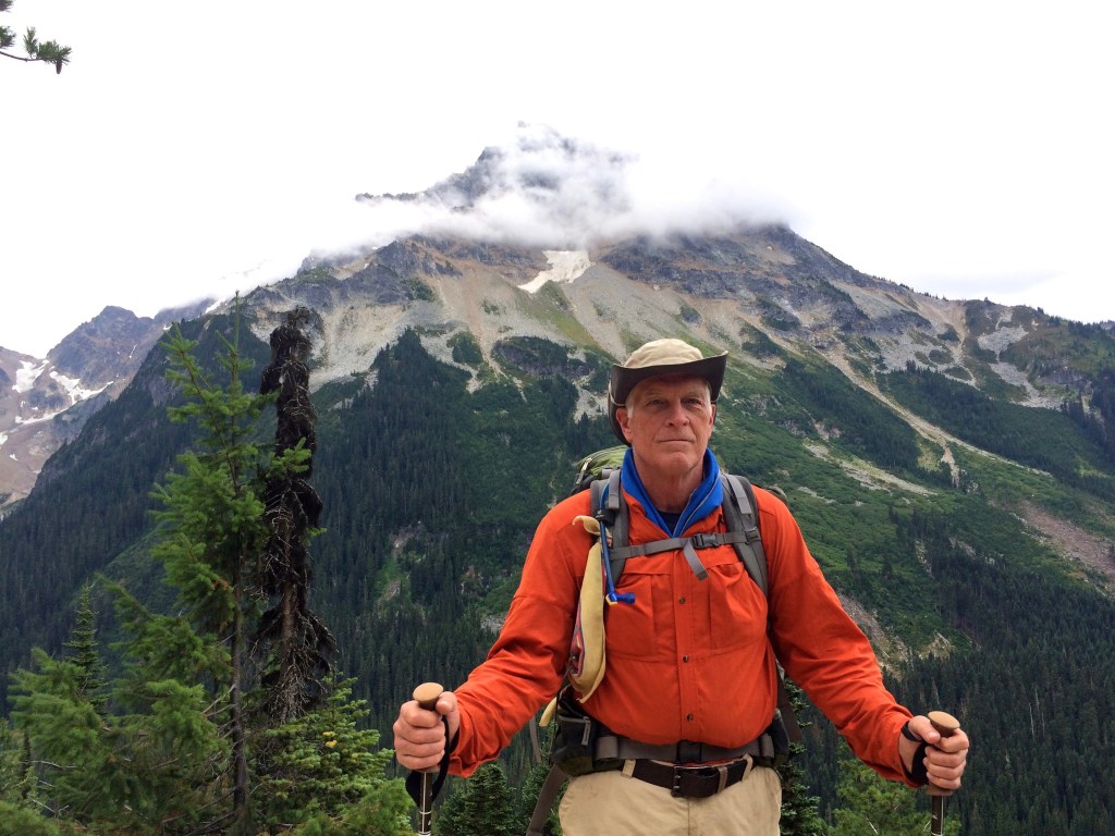
Heading South from Stevens Pass
The Spider Gap Buck Creek Loop backpacking trip was awesome.
The forest fires around Glacier Peak increased in number and size to prevent me from backpacking from Stevens Pass to Stehekim, so I have decided to go south from Stevens Pass instead. Starting Saturday August 8th I will head south from Stevens Pass to resupply at Snoqualmie Pass on I90. I will then go on to White Pass for a total of
I will provide trip report blog post when I return at the end of August.
The Stevens Pass to Snoqualmie segment was awesome and challenging. Lot’s of vertical plus some heat and rain. The view of Mt. Rainier was a welcome on a beautiful Sunday.

Mt. Rainier heading into Snoqualmie Pass
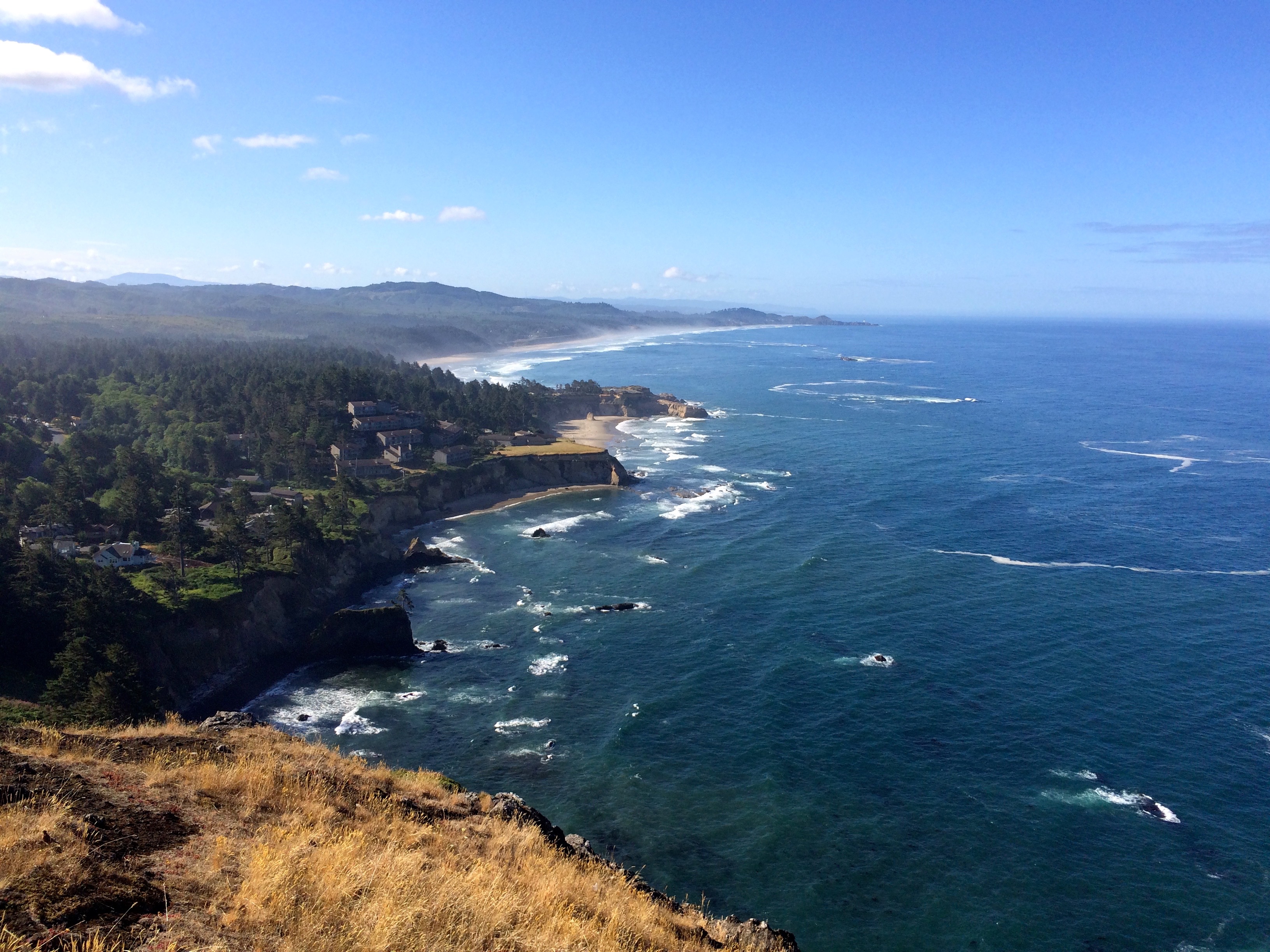
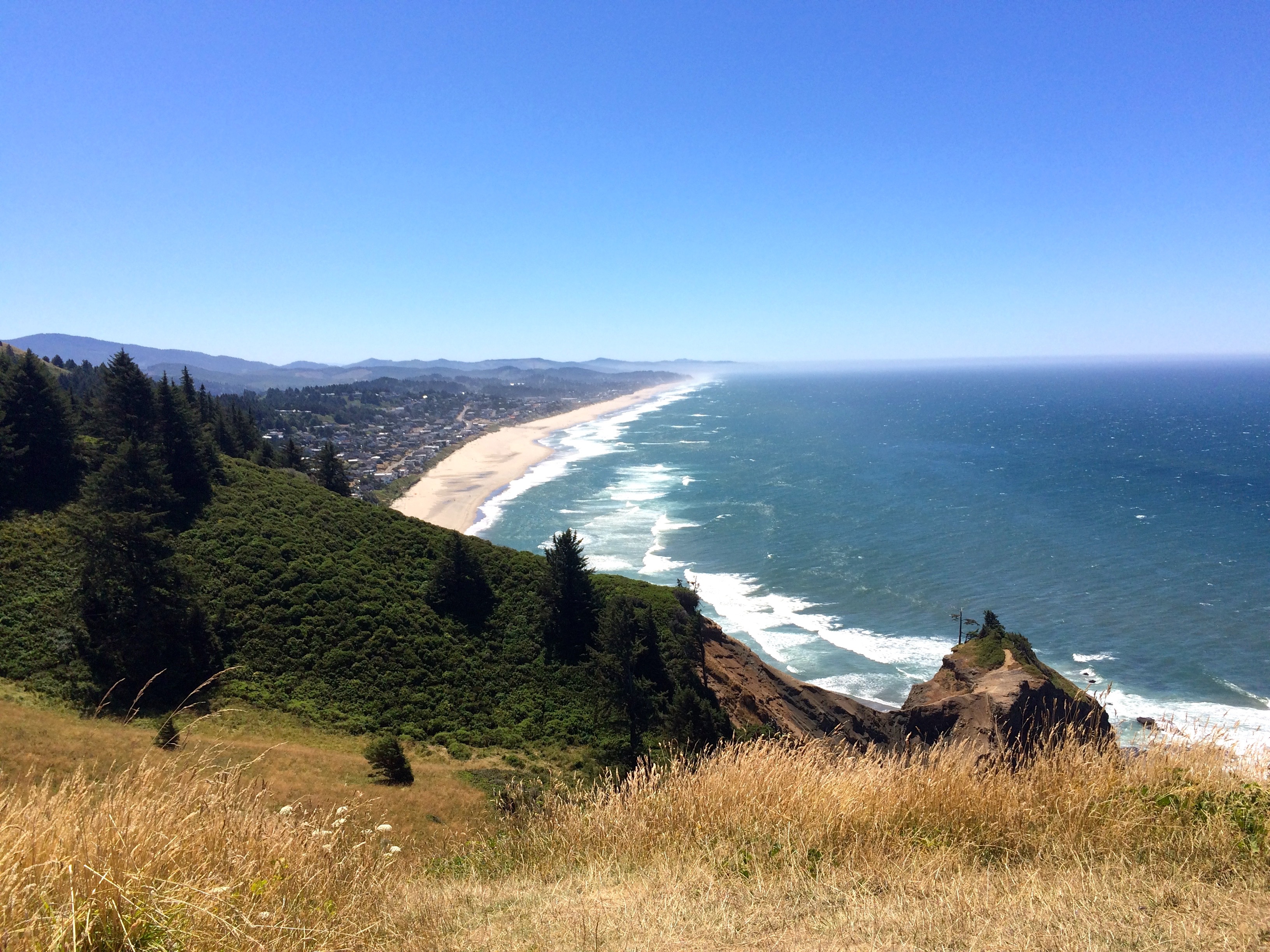
Oregon Central Coast

Proposal Rock in Neskowin, OR
I have been off the trail for 2 weeks and it seems like an eternity. I’m not sure if I just miss the wilderness or I am just overly pumped for the upcoming longer commitment. It was insightful to go through the planning steps for coordinating a month on the trail and sending off resupply boxes. I have an even greater respect for the PCT through hikers who figure this out for many months. But I am ready to go. The Spider Gap Buck Creek Loop with friends will be fabulous and then on to Canada on the PCT. Thankfully it appears the forest fires are under control.

North Neskowin Beach
In preparation for this next backpacking commitment I have been fortunate to spend about a week down at our townhouse in Neskowin. We have a 1/12 fractional share which is priceless (there may be a share for sale) The weather has been fabulous and the hiking opportunities around Neskowin are as good as it gets for the Oregon Coast. Let me give you a glimpse of my hiking preparation over the last 3 or 4 days.

View South from Cascade Head
Hiking the beach is always great exercise by way of distance and solitude. Rarely are there any other humans once you get a mile or so north of Neskowin. Hiking on Cascade Head should always be done either from above or below.
View from Cape Foulweather
My daughter motivated me to go for a longer hike so we opted for the trails behind Cape Pepetua scenic coastline. On the drive down we needed to stop at Cape Foulweather because the view is awesome. The Cape Perpetua coastline is considered the most beautiful in America and the hiking trails in the Siuslaw National Forest offer exposure to impressive old growth forests.

The Thumb
The unexpected hiking delight turned out to be the Thumb Trail which is a little known trail that starts at the end of Roads End in Lincoln City. A short hike with some serious technical climb to the Thumb but the view is second to none on the coast.

Cascade Head from Thumb
This discovery was extra special since it gave me a view of Cascade Head from the South.
Lincoln City from Thumb
This area is not really setup for serious traffic so please take care of this gem. The top of the Thumb is a bit dangerous especially with strong winds, it drops off on 3 sides.
Is this too good to be true?
August Backpacking Schedule
My backpacking schedule for August has been confirmed. August 1-7 I am doing Spider Gap Buck Creek Loop near Glacier Peak just Southeast of the PCT providing a great 44 mile loop rated difficult. I will do the loop with friends; Bob and Jeff.  Then I will get a ride over to Bellingham, WA, to visit friend John to resupply and prepare for my final solo PCT segment.
August 8th or 9th I will be dropped off at the PCT on Stevens Pass where I will head north to Manning Park Canada, about 200 miles. I will resupply in Stehekin, WA, which is a resort lodge at the North end of Lake Chelan. There are no communications (Phone, Internet) in Stehekin, so I believe I will be off the grid until I get to Canada. I’ll send a post card from Stehekin to let folks know my progress.

Dusk Proposal Rock
I should get back home by the end of August so that I can begin work with Willamette View. So what a great August it should be, about 250 miles of the most beautiful wilderness in America. Can’t wait to be on the trail again.
I will be mentally preparing for this adventure next week on the coast in Neskowin.

Timberline to Cascade Locks
My second Oregon PCT segment was excellent, the weather was what you would expect and the scenery was as good as it gets.

Abby
Unfortunately when it ended and I returned to the cellular world at the Eagle Creek Trailhead I found out that my beloved old backpacking canine companion, Abby, had died the night before. It was good that I had another 2.5 miles before I got to Cascade Locks, I needed the time to shed tears and reflect on our years together. I am so glad that we got to travel back to Oregon together. Australian Shepherds are incredible dogs and Abby was one of the best.
 Back to the Hood to Gorge review. My wife and I spent the night before I departed at Timberline Lodge. Weather was perfect as were the IPAs we consumed in the adirondack chairs observing Mt. Hood. We could see Mt. Jefferson to the South initially but the view faded away into a smoky haze from the fires in southern Oregon.

Early Views of Hood
I departed on July 9th in beautiful weather with no deadlines, just a destination. The PCT from Timberline takes you into the Paradise Park area which is all about majestic views of Mt. Hood. You feel very small underneath the mountain. An afternoon thunder storm brought needed moisture but also motivated me to seek a campsite. A heavy fog moved in which essentially equated to rain all night long.  The following day offered more amazing Paradise Park views. This is fairly rugged trail that skirts the many snow melt streams from Hood. The main goal was to have a relaxing lunch at Ramona Falls, however, crossing the headwaters of the Sandy river to get there always presents a challenge.

Sandy Crossing
So when I came out of the forest to greet the Sandy it was obvious that I was not crossing that high volume stream at this PCT designated trail point. When looking for a crossing you head upstream and look for perfectly positioned rocks or hopefully a log assisted crossing.
Mt. Hood from Sandy
I found the log/stick crossing that had been thrown together, and although it was a bit scary it turned out to be more then adequate. The reward for the challenging stream crossing is a glorious view of Mt. Hood.

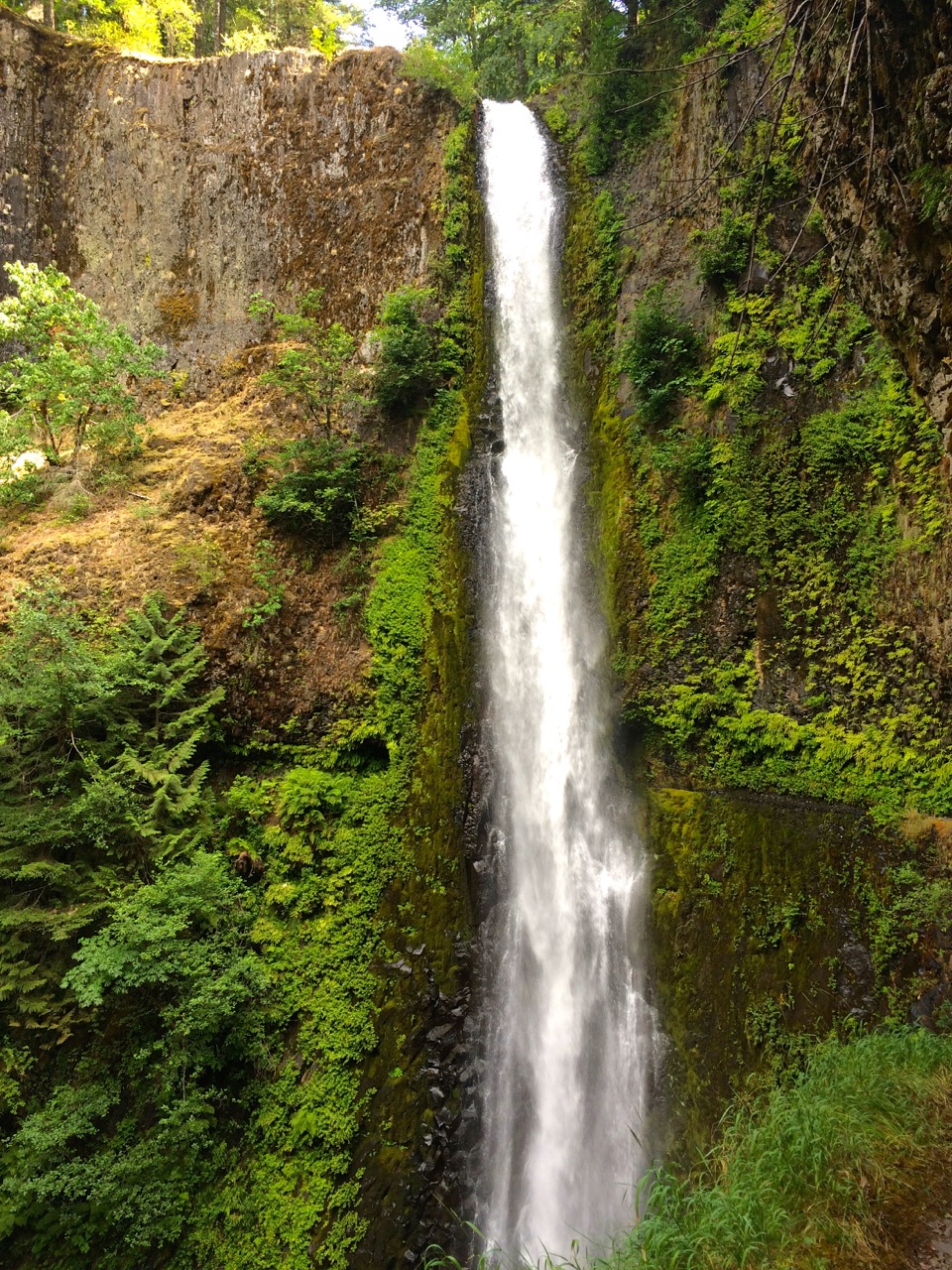
Ramona Falls
Then on to the ultimate reward of Ramona Falls and I was not disappointed. The sunlight through the trees creates unique highlights of this cascading waterfall.
I needed to put in a few more miles so taking the PCT Ramona Falls alternate trail to the Muddy Fork Junction was a perfect climax to my second day.  However, crossing fast flowing stream on a couple of logs was interesting. But more interesting to watch were a couple of endurance runners cross the stream on foot.
The next day, Saturday, was a bit dreary weather wise, but that was OK since it kept down the day hiker population. It was a tough day for distance and vertical, 10 miles of 3000 ft up and about 1500 down. When I passed Lolo Pass I was thinking about putting a long sleeve shirt on which made me wonder about the 4 teenagers who were heading up to Bald Mtn. in shorts and tank tops.

Mt. Hood and Lost Lake from Buck Peak
Sunday ushered in a lifting fog which made for an eerie beautiful trail. The body felt good as I was knocking off more vertical before the inevitable drop. I had passed Devil’s Pulpit and Preachers Peak so I was in the mood for a wilderness church setting. About 10:00 am I noticed a side trail which lead to Buck Peak. The trail was OK but narrow and overgrown enough to mean that condensation from the vegetation was going to be soaking. But I sensed its call and a half mile up I was rewarded with His majestic throne’s view of Mt. Hood and Lost Lake. The church service was excellent.
Ripe Huckelberries
The trail began the inevitable elevation decline to the gorge and with it came an abundance of ripe berries. I had a wonderful afternoon taking my time enjoying the spectacular view of the Eagle Creek canyon and eating plenty of ripe Huckleberries. After arriving at the Indian Springs abandoned campground I opted to continue on another 3 miles to Wahtum Lake. Definitely the right call as the lake campsite was beautiful and the trail there and then on to rejoin the Eagle Creek alternate PCT trail was a more gradual vertical decline complete with beautiful lush waterfall strewn scenery. Oh yes, and plenty of Thimbleberries, a tasty relative of the raspberry.
Tunnel Falls
I knew I was in for a treat from the Eagle Creek canyon trail but little did I know how amazing it would be. My daughter and I hiked up this trail about 10 years ago but stopped short of the really great landmarks.  So the ultimate goal is Tunnel Falls, which totally lives up to the hype. Actually the entire Eagle Creek Trail is awesome with many serious waterfalls, good swimming holes, precarious cliff carved trail and great campsites. But Tunnel Falls, Wow.
I knew that my trip would end the next day so I kept looking for the ultimate campsite, but I was getting tired.

Last Night Campsite
Thankfully I kept seeking a better site and ended up with a primo campsite just below 4-Mile Bridge next to this 30+ foot waterfall, Skoonichuk Falls. But it made for a perfect last night on the trail where I was spared the heartbreak of knowing what was happening at the time with my dog, Abby.

Bridge of The Gods
The final day took me past High Bridge and Punchbowl Falls, plus greeting about a hundred, mostly day hikers, many with the goal to make it the 6 miles to Tunnel Falls. After receiving the news about Abby I hiked the Columbia River Highway State Trail up to Cascade Locks which provides a very nice view of Bridge of The Gods over to Washington. My wife and daughter were at the PCT Trailhead park by the bridge waiting for me. It was a gorgeous day for a burger and beer as we mourned the loss of our family dog.
Backpacking Lessons Learned
My first segment on the PCT taught me a lot, but the most important was that you cannot beat the heat. My goal was Willamette Pass to McKenzie Pass, about 80 miles in 9 days. I aborted after 6 days and about 50 miles after 2 days of 90+ degree heat with thunderstorm humidity did me in. The other lesson taken away was to keep your destination schedule open, since you never know what will affect that schedule.
OK, now for a quick update on what I did accomplish. Remember, I am 61 years old, healthy, but not really in great shape and I have been living at low altitude.
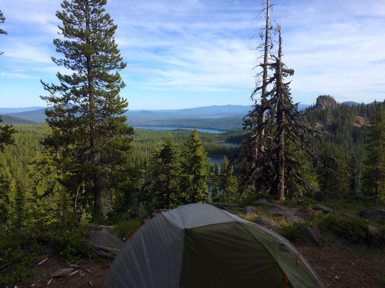
First Campsite Overlooking Rosary Lakes
I started off in the afternoon figuring I just needed to get a few miles under my belt to loosen up. I ended up going 5 miles and climbing 1200 vertical to end up at a fabulous overlook campsite. I felt great and was so pumped to be transitioning into this new wilderness mindset.
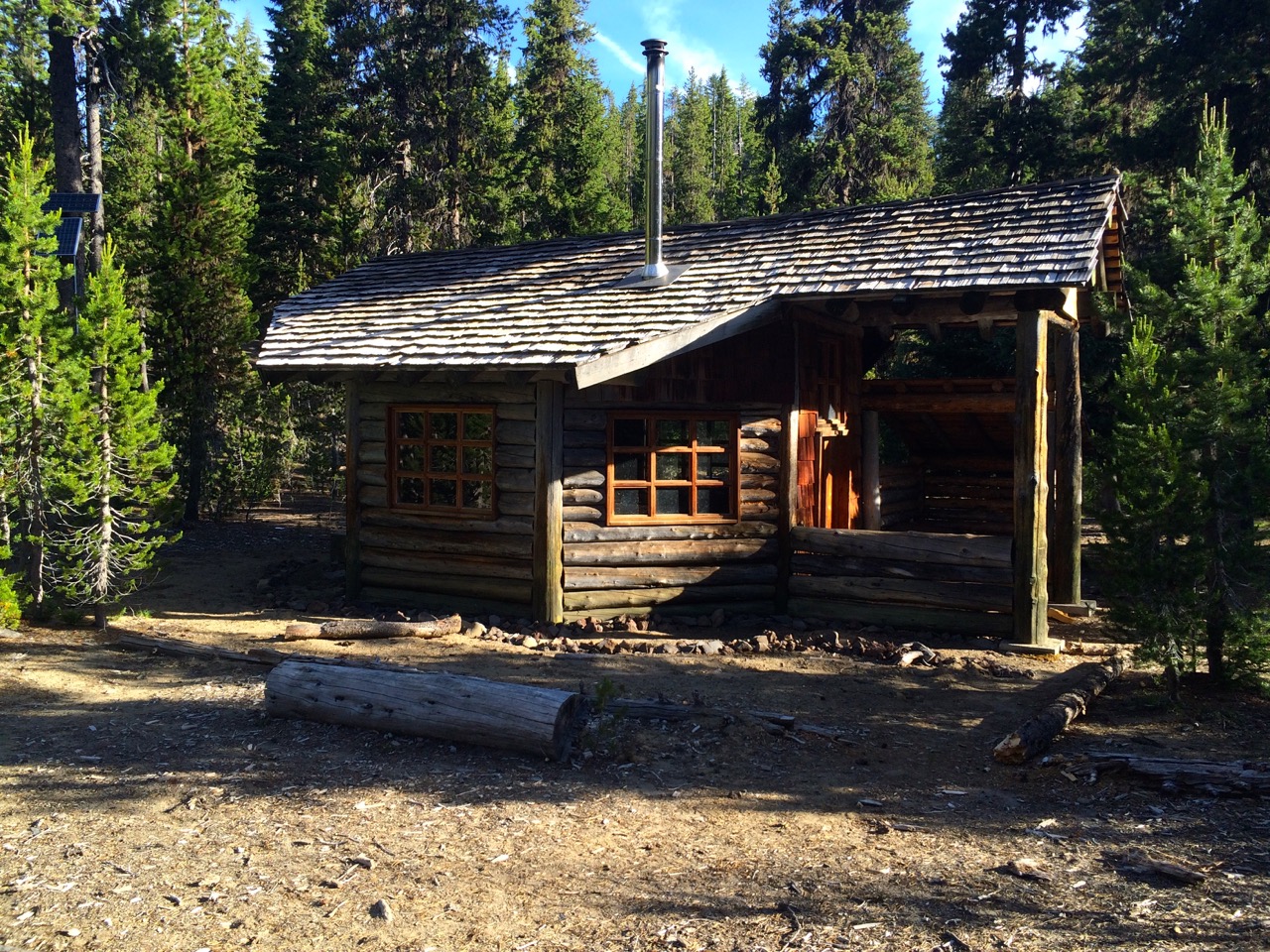
Winter Ski Cabin
The second day I enjoyed the comfort of a really nice winter ski cabin to escape the mosquitos and reorganize a bit. I determined that I would camp at the top of the next climb which meant I had to pack more water which I secured at Bobby Lake. I put in 9 miles and more good vertical and the body was responding well. Also to my surprise I had cellular service (maybe from Waldo Lake), although sporadic, but it did allow me to let the world know I was doing OK.
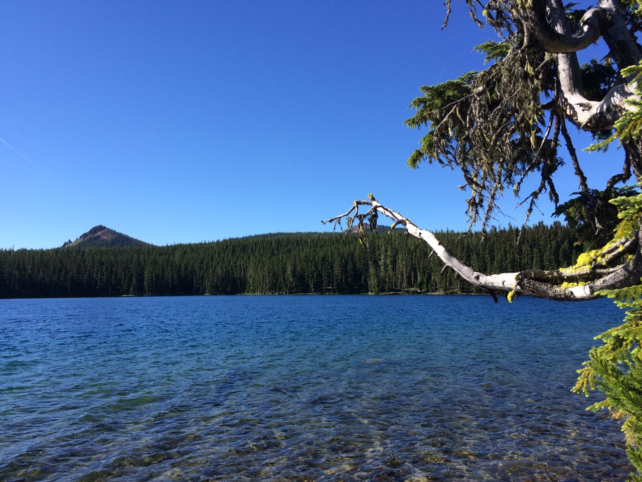
Carlton Lake
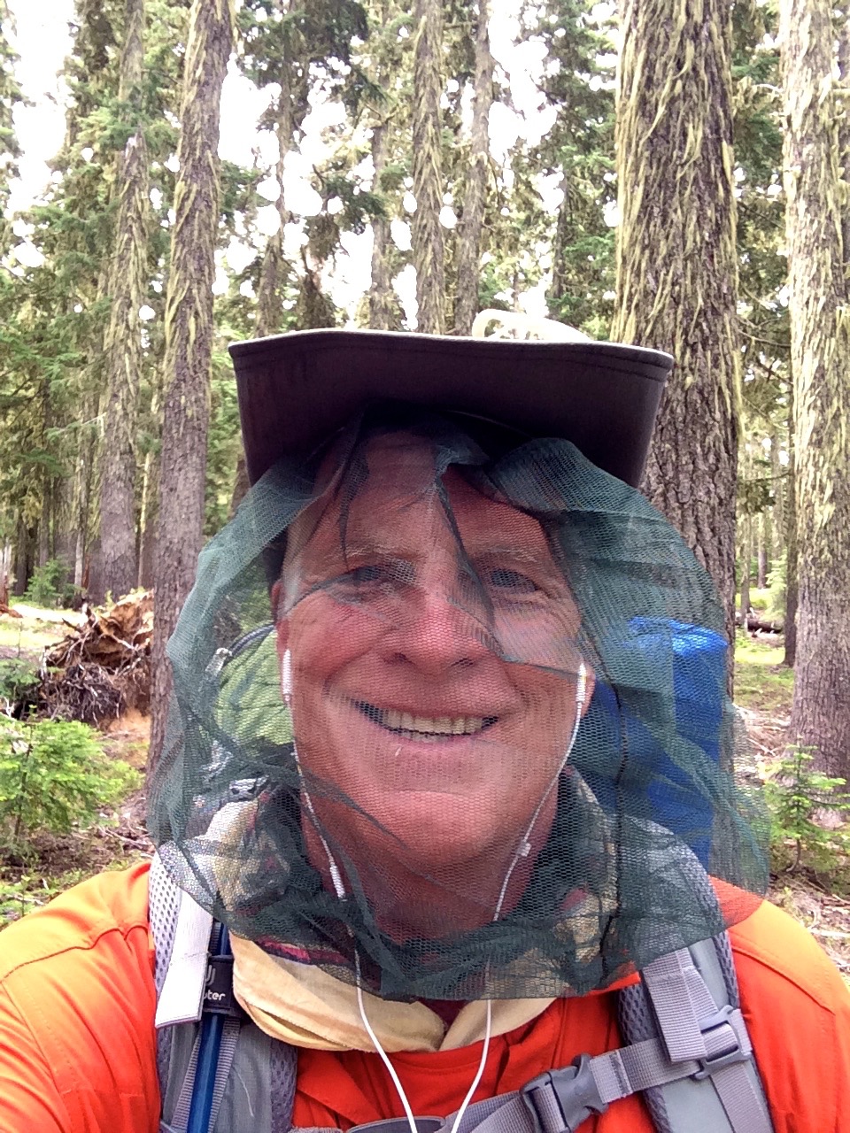
Mosquito Survival Net
The third day felt good, I get up early to take advantage of early morning coolness which allows you to wear longs sleeves to combat the mosquitos, but that is nothing new, just inconvenient.
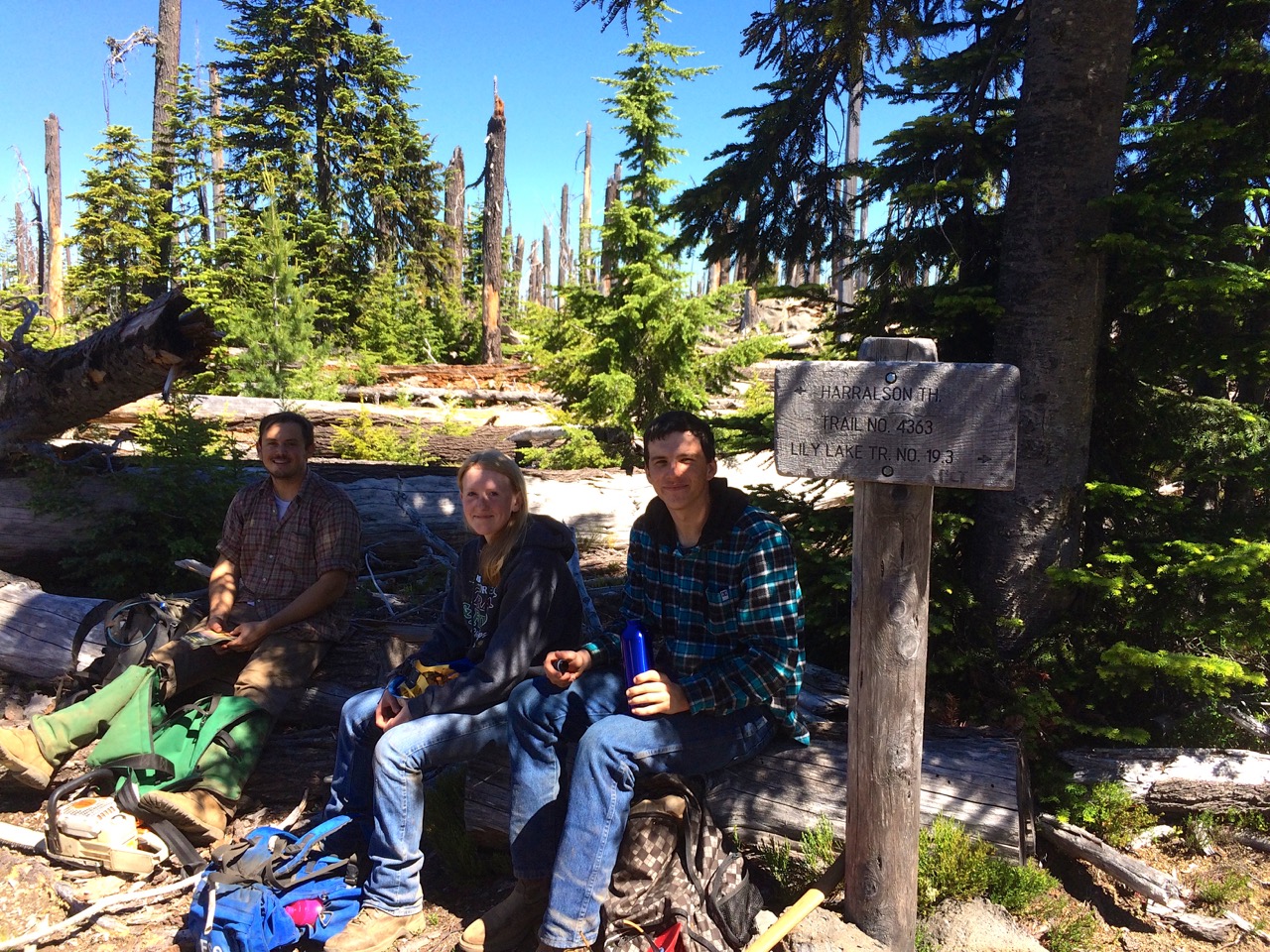
Trail Maintenance Team
I knocked off a number of miles and stopped at Carlton Lake to filter water and cleanup a bit. The mosquitos were getting worse and the breeze off the lake was a a welcome relief.
I was feeling good so a set a goal of another 9 mile day to get to Taylor Lake. Along the way I thanked a trail maintenance team for the work they do and travelled through maybe a 10 year old fire area.
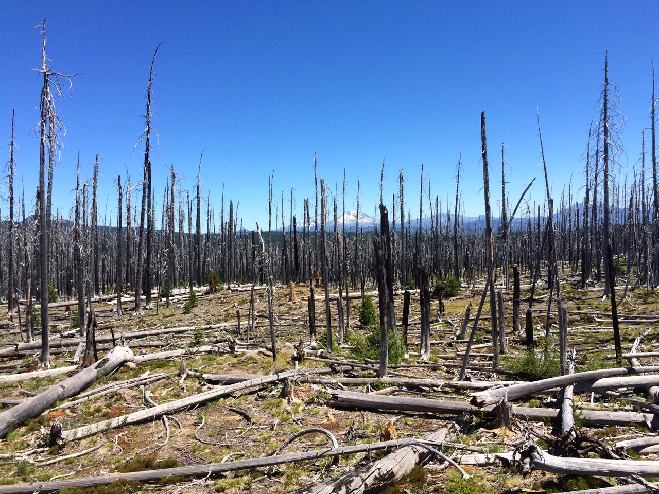
Fire Burn Area
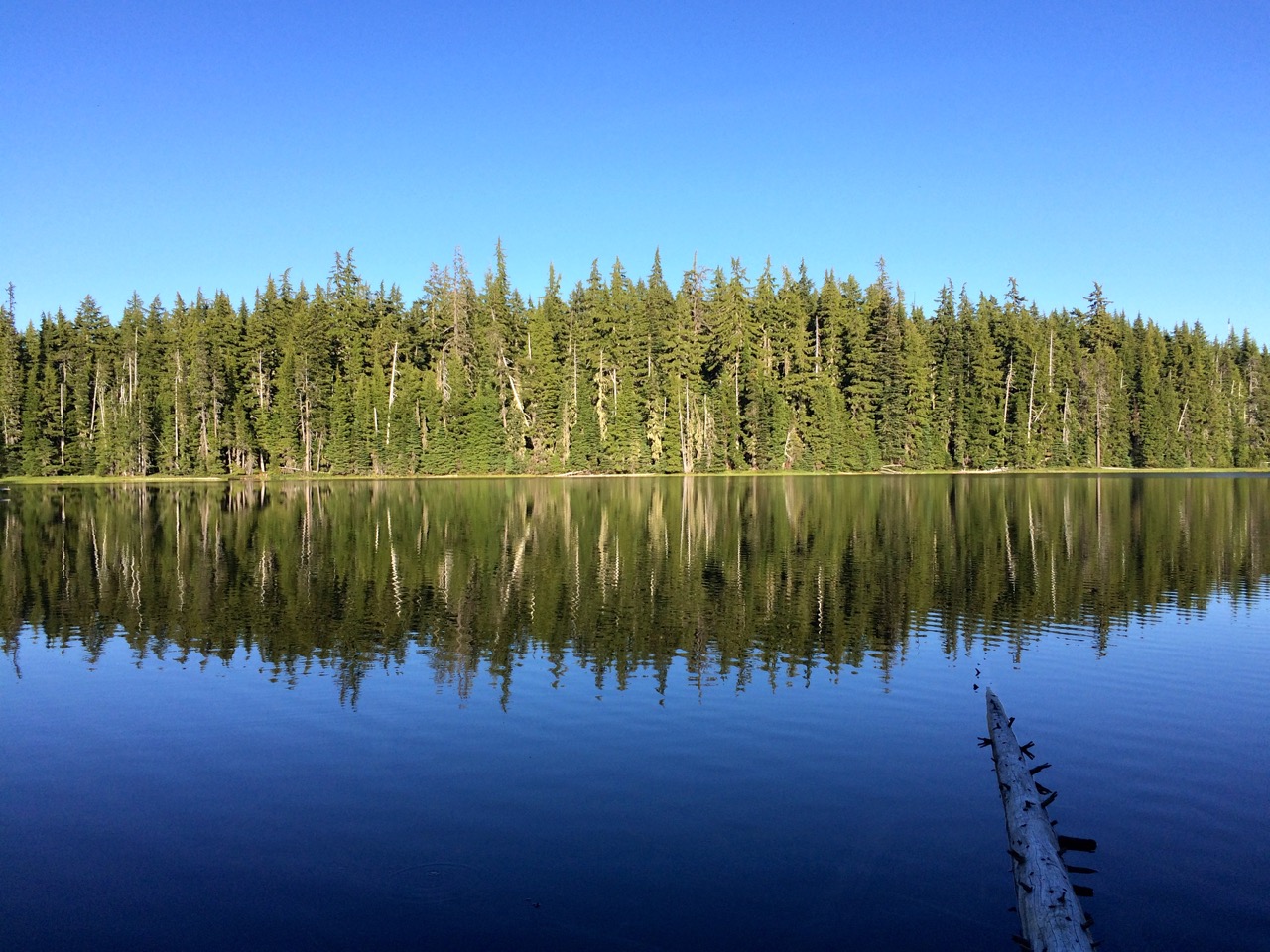
Peaceful Taylor Lake
I got to my campsite early afternoon and took advantage of relaxing by Taylor Lake enjoying the mosquito less breeze. This was the first time I realized I had pushed my body to about max, but I could tell that I was able to refresh it with rest.
Around dinner time I was joined by a couple of PCT through hikers, trail names: Ranger and Bubba Gump, which made for good conversation as I compared my PCT adventure to theirs. They may have been one of the first through hikers to reach this far north, however, they skipped the Sierras to avoid the late winter storm.
Ranger and Bubba Gump
They did plan to return to do the JMT.
Next day I watched the young buck through hikers leave me in the dust I again felt strong and very satisfied with how my body was responding. However, the temperature was rising and all was about to change. I pushed myself this day for 10 miles and ended up at a campsite totally depleted of energy as the heat was taking a toll on me that I still believed I could plow through. That night we had a thunderstorm which did little to reduce the temperature but it did raise the humidity. The overcast morning made for a warmer and more intense mosquito start to the day. After my initial few miles of enthusiastic trekking my body started rebelling. I was sweating a lot which I think I was replenishing with liquids, but the heat toll was greater then that. I had hoped to put in 12 miles and make it to Elk Lake Resort. However, as my body began to fail, symptoms of heat exhaustion setting in, I made the decision to stop at Dumbbell lake only half way but my only good camp option.
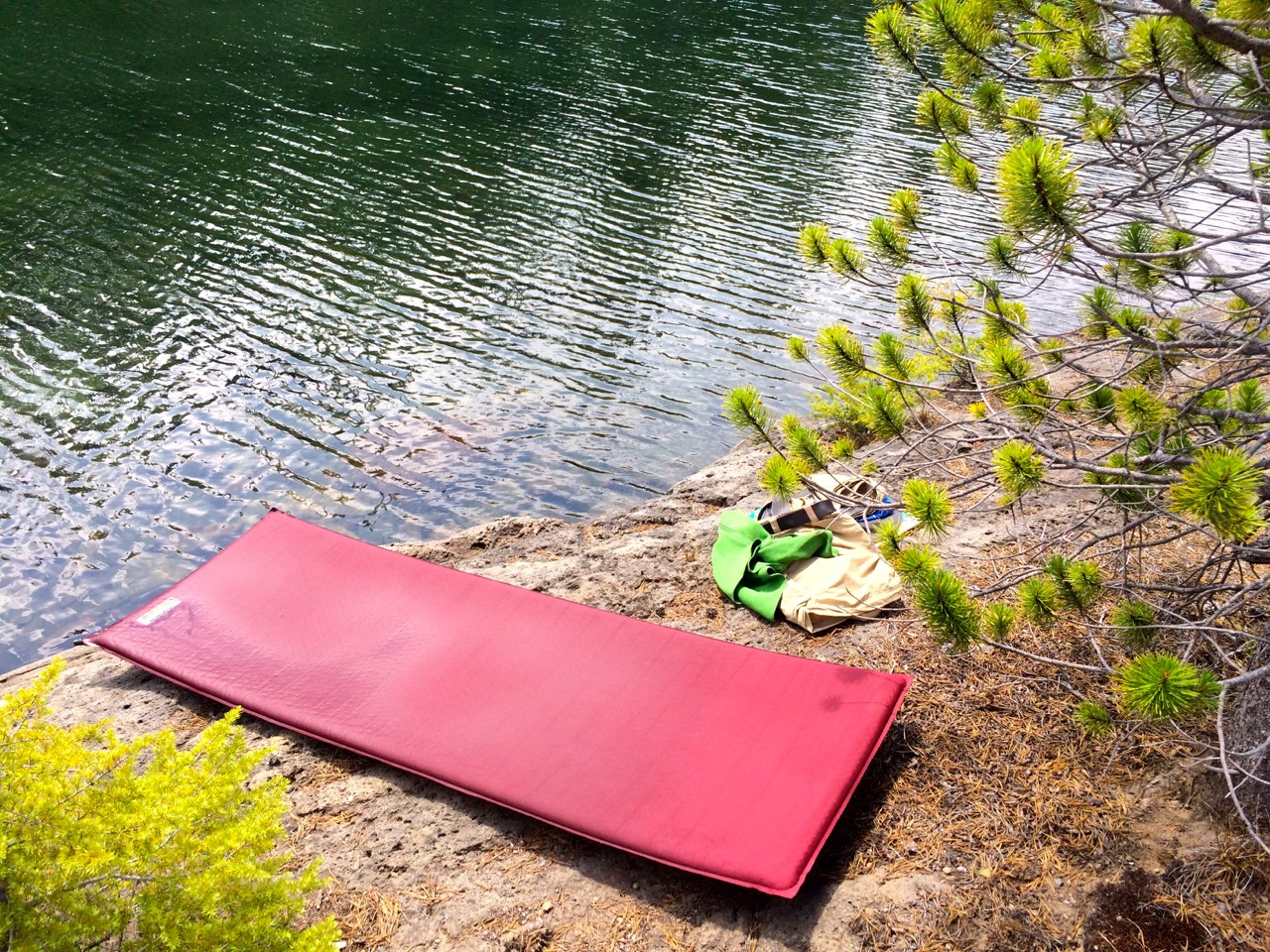
Therma Rest Float
Anyways, wisdom was setting in and I knew I had to back off due to the heat and this lake looked ideal for the swimming potential. So I made camp before noon and focused the afternoon on body recovery. Floating around the lake on my Therma Rest Pad provided a wonderful way to cool down and great relaxation. However, I was now challenged to make my designated destination pickup at Lava Lake Trailhead. Unfortunately, it was still hot and more storm clouds added to the humidity.
The only remaining option which would allow me to complete the planned segment would be to put in 10 miles and summit Koosah Mountain with a difficult 1200 vertical or bailout with a 6 mile mostly downhill trail to Elk Lake Resort.

End of my Trail
Well about 4 miles into the effort it was obvious that heat exhaustion was not going to allow me to accomplish the needed goal so Elk Lake it was.
Actually aborting in this way made for a fairly interesting adventure in figuring out how to get home. I hitchhiked from Elk Lake, something I have not done for 40 years. The couple that gave me a ride dropped me off at the Cascade Lake Brewery in Bend, OR. I was able to connect with an old GEOAID colleague who gave me a bed for the night. Then I took a bus shuttle to Gresham, OR, where I caught the MAX light rail train to Hillsboro. All in all, it was a wonderful first phase of the adventure. Backpacking is tough, but the rewards of experiencing God’s earthly beauty justify the effort. I’m ready to hit the trail again in a week after this heat wave subsides.
Backpacking Tomorrow – Yes
The backpack is loaded and I am ready to go. Tomorrow I will kickoff my first segment at Willamette Pass on highway 58 just East of Eugene, OR, where I will head north on the Pacific Crest Trail for 75 miles to McKenzie Pass. This is actually Halfmile’s Oregon Section E Map, by the way, I’m excited to try out the Halfmile PCT iPhone GPS App. This segment will take me through the 3 Sisters Wilderness area and should be a good warmup. I am giving myself 8 days which should not be difficult even by not being in backpacking shape. This is a great trip with plenty of lakes, moderate vertical changes, some lava fields, lots of beautiful mountains and hopefully plenty of wildflowers with limited mosquitos.
My pack fully loaded including max water is 41 pounds. A little heavy but I know that I can cut out 3 or 4 pounds of water for the first half of the segment. I might need all of the water plus an additional water bag toward the end depending on the availability of stream water. The food weighs about 7 pounds and will only get lighter as it is consumed. Heat is going to be a concern. Temperatures on the trail will reach close to 90 on many of the days. The heat will allow me to use a lightweight sleeping bag and go light on cloths but hiking will need to be done early in the day with siestas for the afternoon.
I believe I have taken care of all the backpacking prep. REI was heavily utilized to provide me with the most efficient backpack and gear possible. Mentally I and totally psyched, I mean I can’t wait to immerse myself into the wilderness. My friends and family are concerned that I am going alone and they have pushed hard for me to consider a satellite phone or beacon. But no, I am not worried about this segment, by PCT backpacking challenge, this will be pretty easy. Sure I may injure myself but I will survive, there will be other hikers who will hear my whistle for help.

Should be my campsite on Day 6 – South Sister
The greater challenge that I have transitioned through is mental acceptance that I am actually doing this. Thoughts of shouldn’t I be working or what about other professional opportunities that have crept into my head, but I think I have them cleared away. Yes I am going to take a few days in-between the next segment to launch my consulting career with Willamette View, but everything has worked out to make me believe that I am truly supposed to be doing this. I do believe that there is some greater understanding that I will gain from it.
I don’t know what that might be but I can’t wait to reevaluate life after coming out of the wilderness in a few months. I know that what ever I will do, I will do it better for having this experience. I love that confidence that I know God has planted in me.
NW Drought Backpacker Concerns
I am winding down my CIO career in Higher Ed so my thoughts wander more frequently to my next career of backpacking. It does appear that it will be a co-career with continued involvement with leading technological change in various industries, but backpacking is the immediate driver.
This brings me to the subject of this post which is the drought in the West.  The headlines have been informing us for a few years now how serious this drought is especially in California. But those headlines focus on identifiable concerns such as the supply of drinking water or irrigation of our nation’s richest agricultural region. This last year has been extremely significant for the drought due to the lack of snow pack in the Sierra or Cascade mountain ranges. Now this starts to get my attention because backpackers need water and water is heavy to carry.
I only plan on backpacking in Oregon and Washington this year which normally would not present a water concern, however, snowpack in the Cascades is at amazingly low. Washington’s governor just declared a drought emergency referencing snowpack at 16% of normal. From what I see the snowpack is better in northern Washington but the rest of the Northwest is in trouble. Not for drinking water but for some agricultural and higher threat for forest fires, but most important backpacking. My real concern is for Oregon which does not have as many lakes in the mountains as are in Washington. I hope to backpack through Crater lake in early July which normally would be a great challenge since it is rare to be able to get into Crater lake before July. Today there is no snow there, Crater Lake Webcam. The good news for that segment is that I can refill water in crater lake, but the challenge will be how much water I will need to carry to get to the next lake.
I want to do the PCT from Willamette pass to Mt. Jefferson which would take me through the Sisters. There are a few lakes but typically you count on snow melt streams. In fact I have backpacked in the east side of the Sisters knowing that the streams would only be running in late afternoon when the temperatures heated up. But many of those streams will be dry so I will be very grateful to trip reports from other hikers to help plan the water resupply strategy. I rely heavily on the many member reports on http://www.oregonhikers.org along with data from http://www.pcta.org and with high hopes for how Halfmile’s iPhone app will help guide me.
Washington will be better thanks to more lakes but it could mean missing exceptional flowers and it will cause different concerns about wildlife. My highlight segment for this year will be Spider Gap- Buck Creek Pass Loop in NC Washington. Good news is that the snow pack is much closer to normal in the north so our first week of August trip should be awesome.
Into the Wild
I have resigned as CIO of Missouri University of Science & Technology with an exit date planned for the end of May. I will be Returning to Oregon thanks to my wife’s new employment there. For the last few months I dabbled with other CIO opportunities but I’m not sure my heart was totally into it. I kept telling myself I would still consider trying to change higher education but I am really thankful that higher education is not quite ready for change. You see, I have the option to take some time off and make some dreams come true.  For the second half of this year I hope to spend significant time backpacking the Pacific Crest Trail in Oregon and Washington.
I will use this blog to expand more upon my career transition and the new adventures awaiting me in the wilderness. I may very well return to Higher Education someday but for now it will be Higher Elevation.


