Blog Archives

Devils Dome Loop – Clockwise
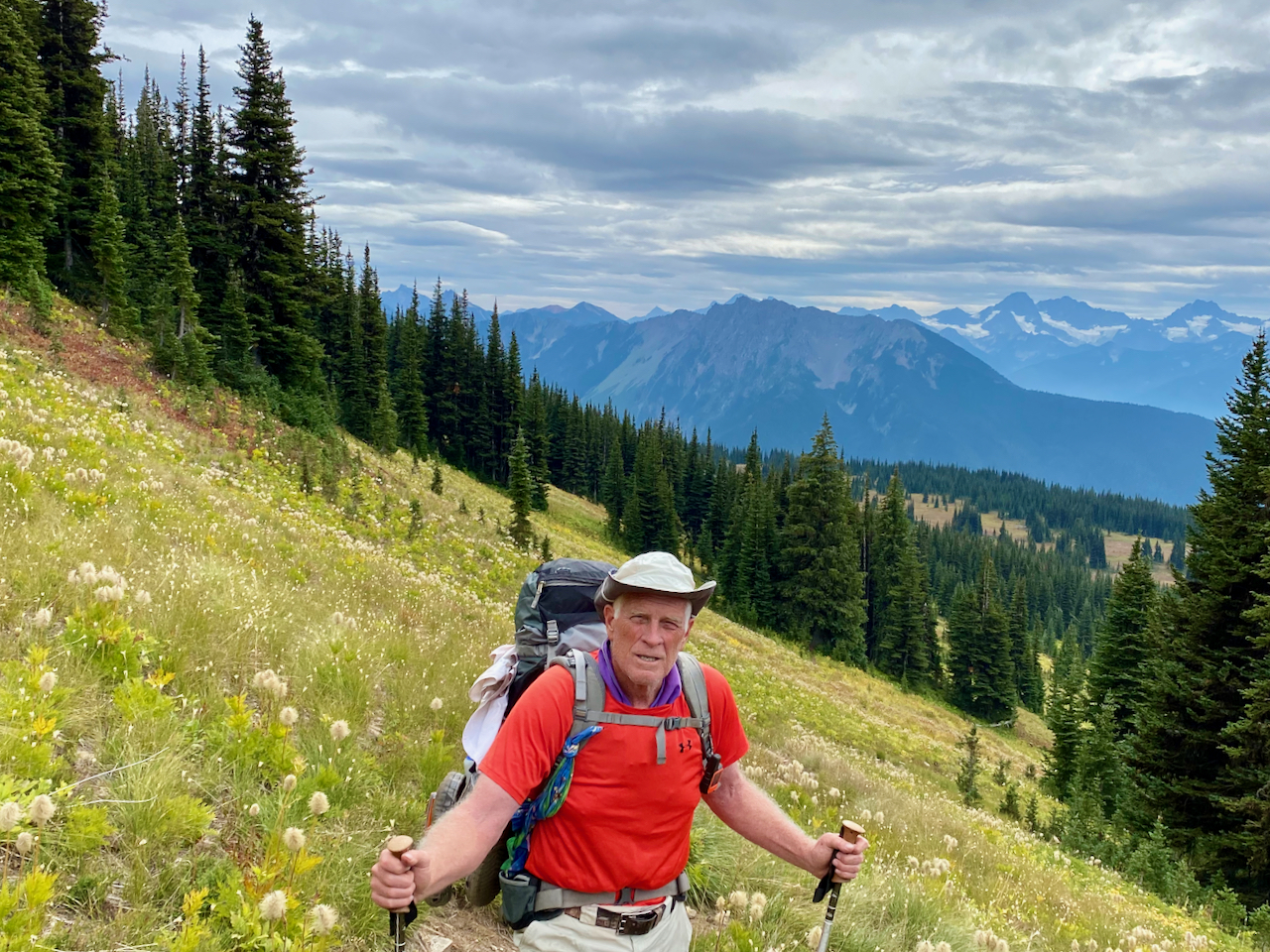
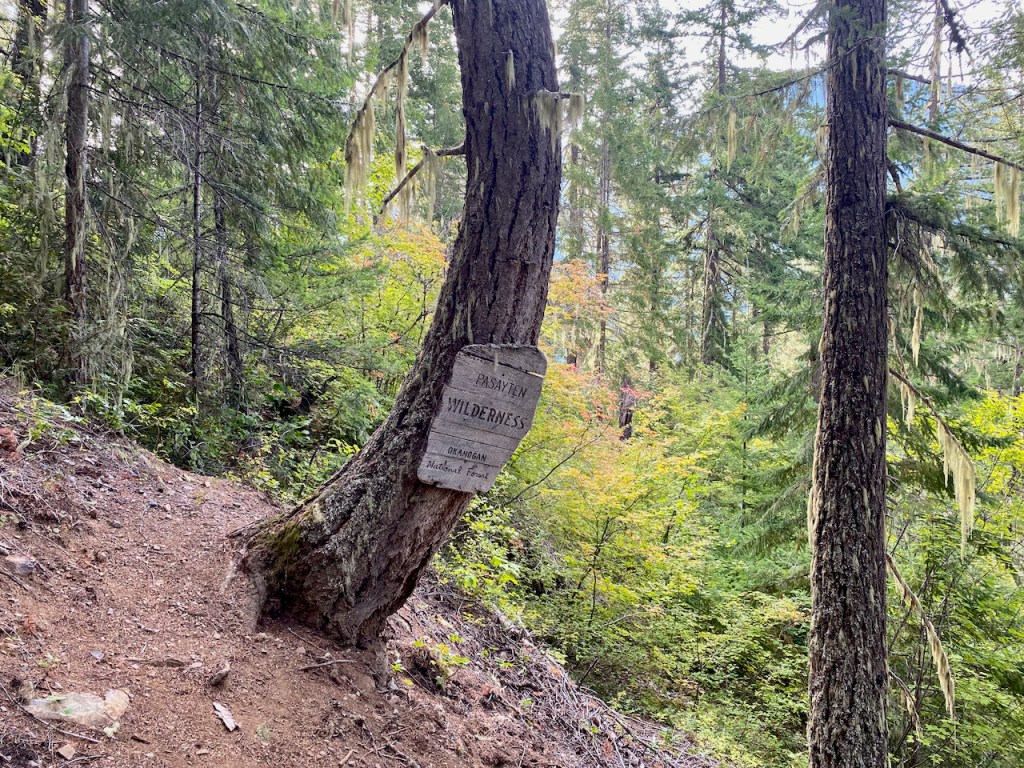
I love multi-day backpacking loop treks and the Devils Dome Loop in the North Cascades turned out to be a jewel. I was a bit surprised to come across it only finding a few trip reports. The distance and vertical are very similar to the Timberline Trail but the the effort was far greater.
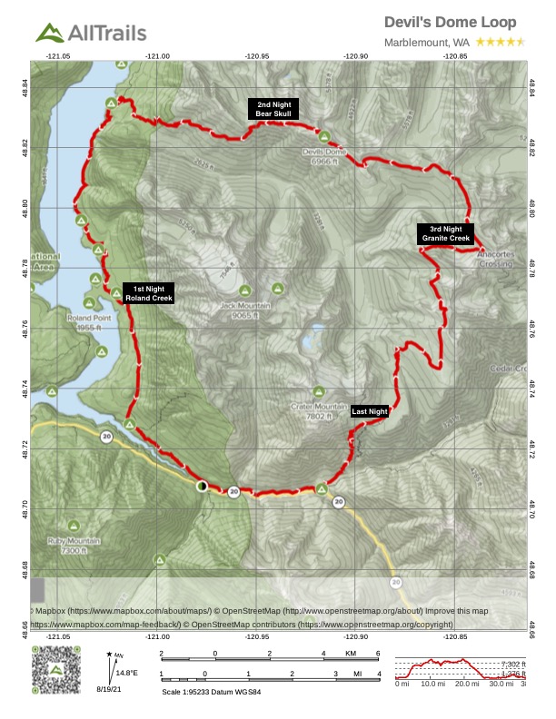
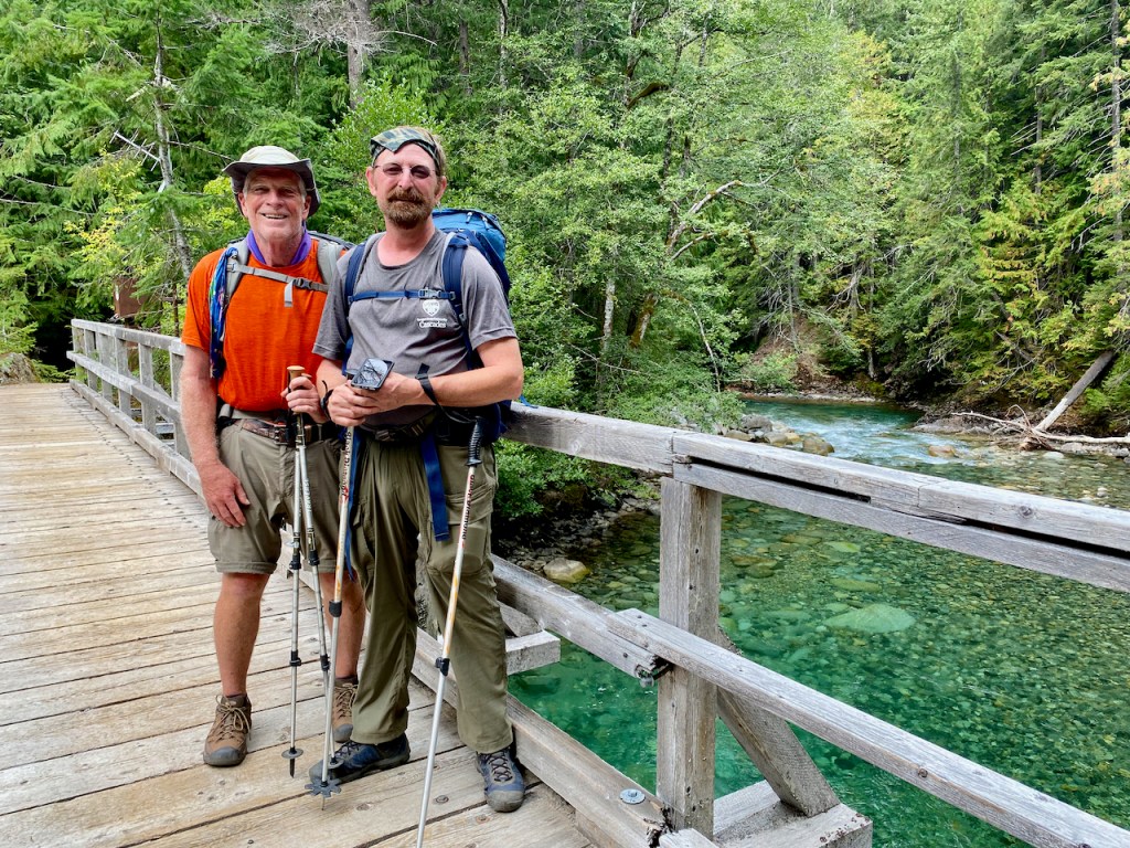
Most people approach the loop counterclockwise since the initial 4000′ climb is more moderate thanks to switchbacks. But I opted for the clockwise route to coordinate better with the North Cascades National Park permitting for the first night. My common backpacking partner, Bryce, was going to be challenged with getting there at a reasonable time on September 1st, so I opted for a campsite halfway along the East Bank Trail at Roland Creek. We did not hit the trail until 7 PM, so night hiking was required. One issue worth mentioning, especially when searching for your campsite in the dark, was that the campsite shows up on the typical topo maps as being south of the creek when, in fact, it is north of the creek. But it did turn out to be a good site for setting up in the dark.
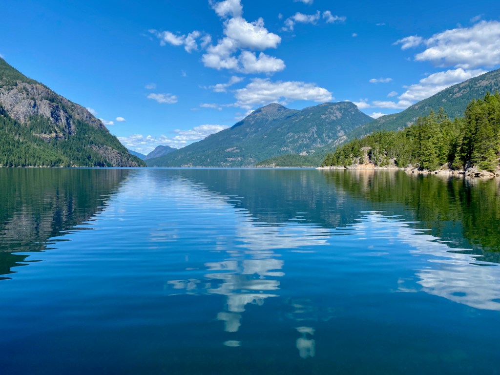
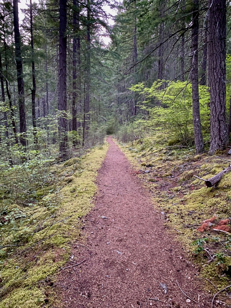
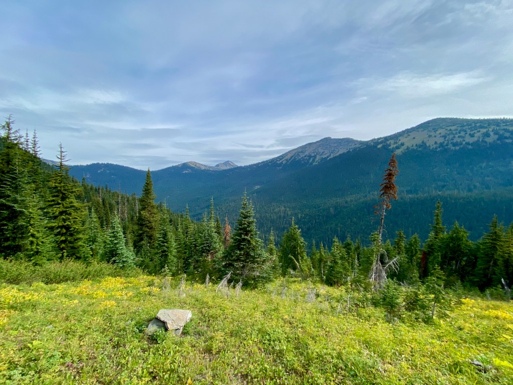
We hiked about 6 miles to Devils Creek Landing on Ross Lake, where we had lunch and a rest before the big climb. The climb to Devils Dome, or at a minimum Bear Skull Cabin, was going to be the make or break for my body, which is why I had been putting in extra vertical training in recent weeks. Water is an issue, and the most dependable source supposedly would be found at Bear Skull Cabin, 4000′ up. We were told that there was a stream at about 3000′, so we only carried 2 quarts, which was adequate for our perfect cool weather climb.

However, 4000′ mostly straight up does kick your butt. Bryce and I slogged along and finally reached the cabin after a 6-hour climb. I believe I got all that I could from my body on this climb, so my training turned out to be totally justified. Now I understood why this loop is not more heavily traveled. The climb from the other direction is probably easier due to water and switchbacks, but 4000′ is a tough climb, especially for an old backpacker. We did have a nice campsite just off trail toward the cabin. The night was totally clear, with magnificent stars that I was too tired to enjoy.


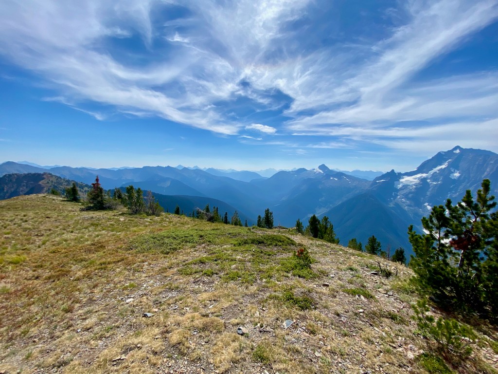
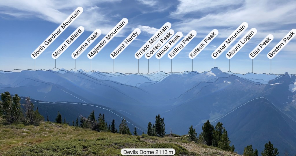

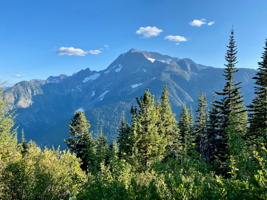
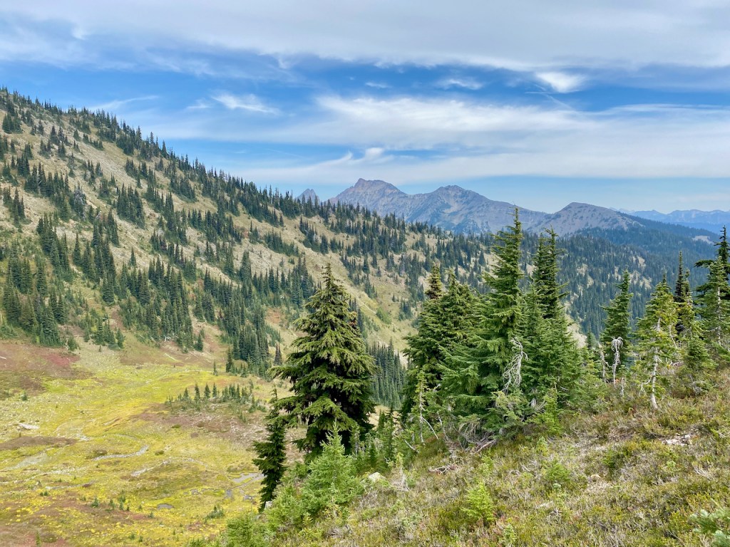
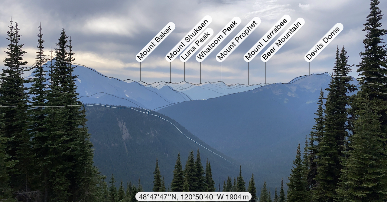
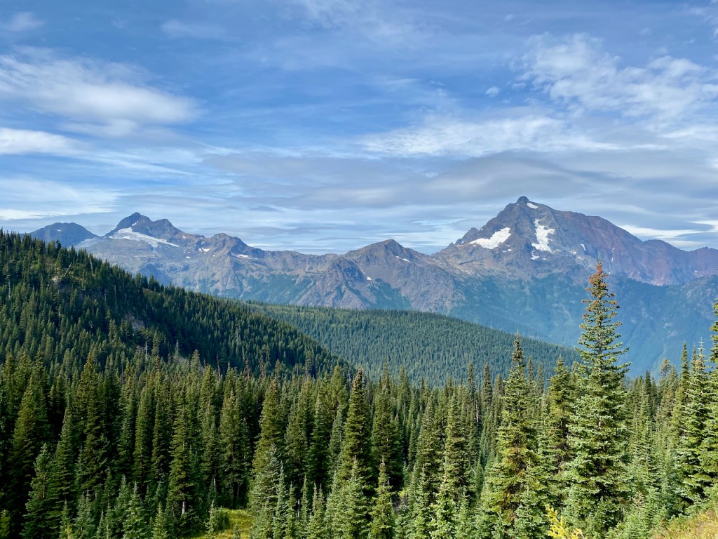
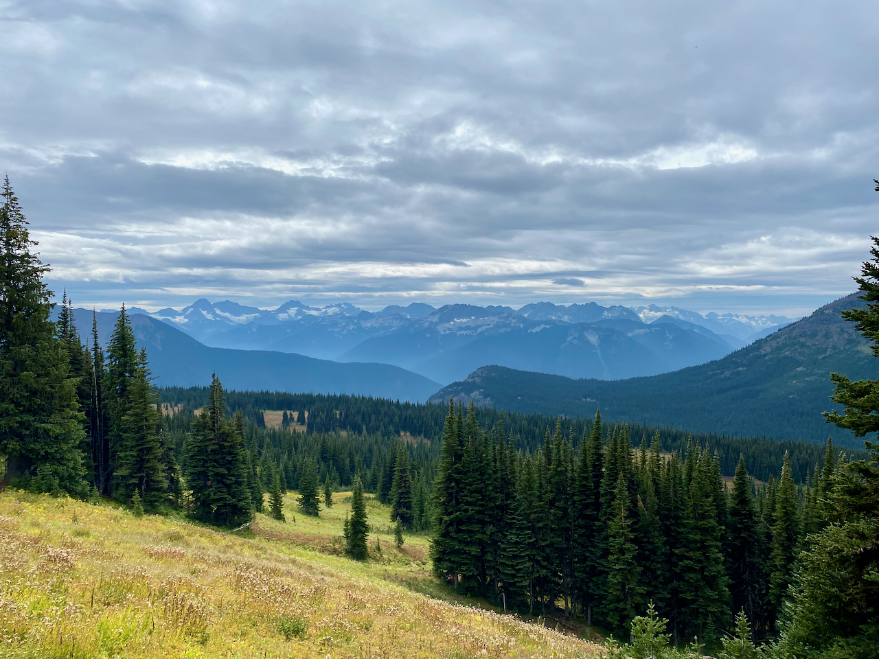
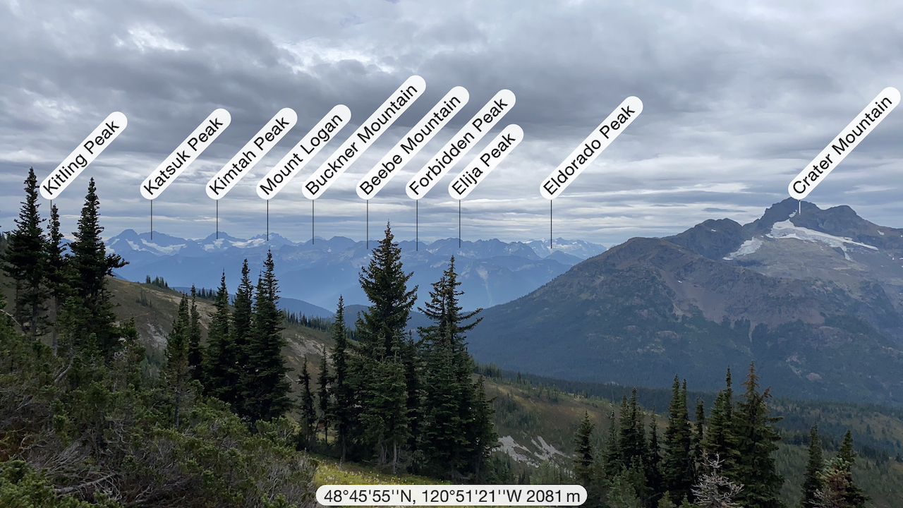
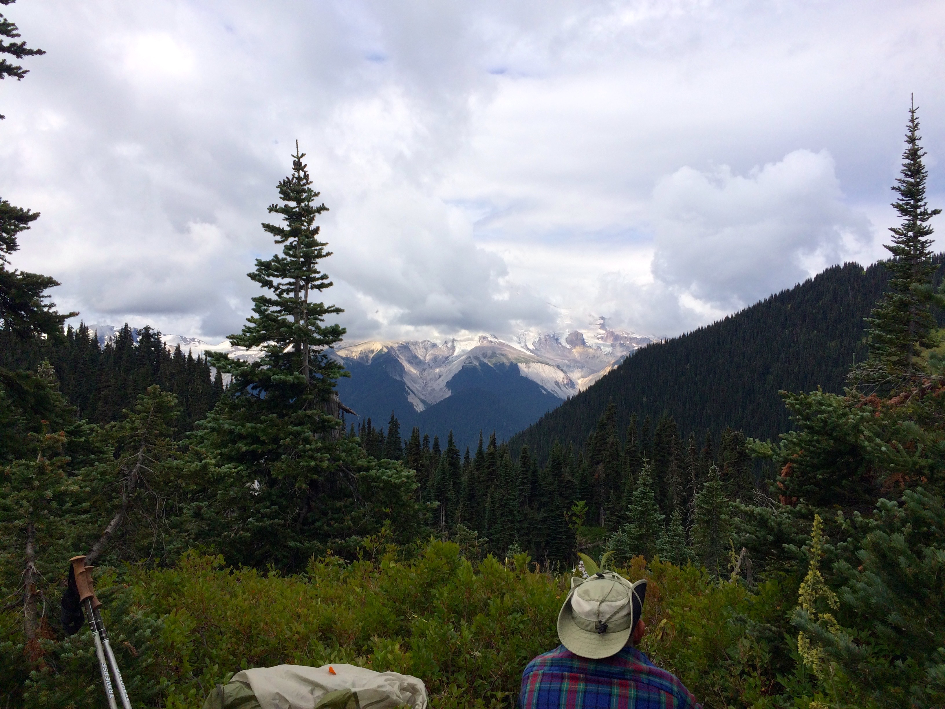
The next day required another 1000′ climb up to Devils Dome which lived up to the hype for a fabulous 360 view of the North Cascades looking into Canada. The day was clear with some cloud cover moving in later, temperature at about 60 and no wind. This was as good as it could get.
Up till now we were also sharing the trail with the Pacific Northwest Trail, PNT, but that would end as we approached Devils Pass. Supposedly there is water on this 6 mile stretch but I don’t remember seeing any.
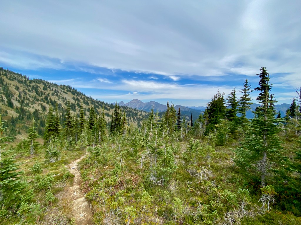
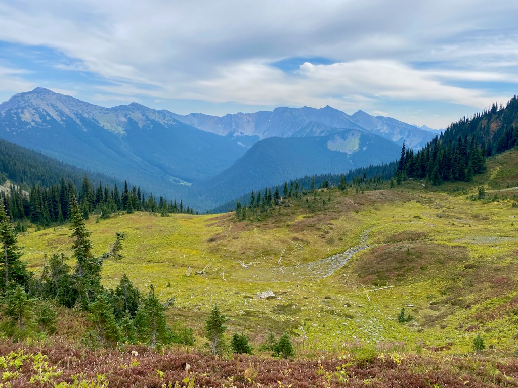
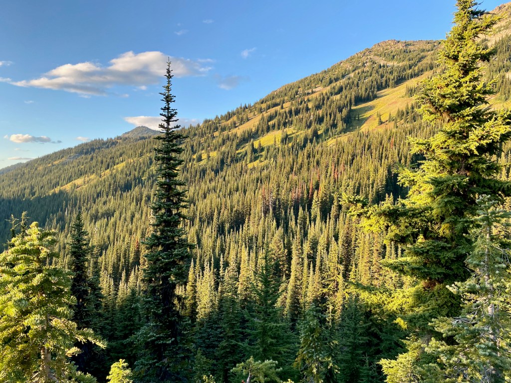
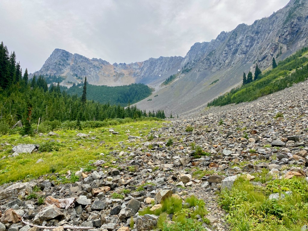
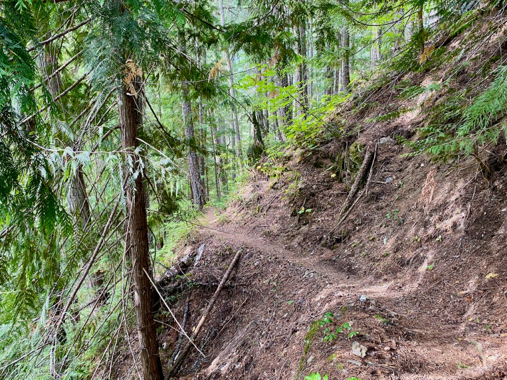
We were carrying enough water to make it to Granite Creek, which turned out to be our choice for a campsite after about an eight mile day. The trail over to Granite Creek was one of the most pleasant and beautiful stretches of hiking that I have ever experienced.


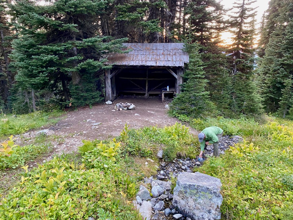
However, more campsite information would have been helpful. On the north side, there is a campsite about a quarter mile up a steep trail from the stream. We opted to go to the creek, assuming there would be campsites. Well, we only found one campsite barely large enough for two tents, which was just south of the creek as you enter the trees. This worked out fine since there were hardly any other backpackers on this loop. And we did keep commenting on this lack of traffic, especially on the long Labor Day Weekend. I guess the high vertical entry price to this loop keeps the crowds away.

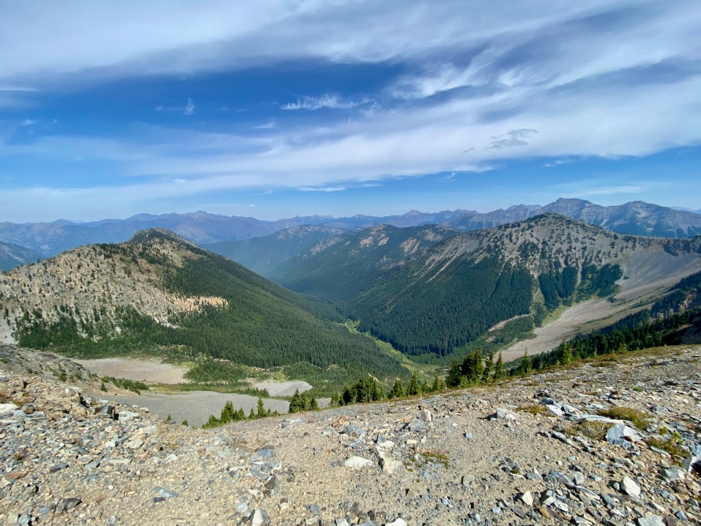
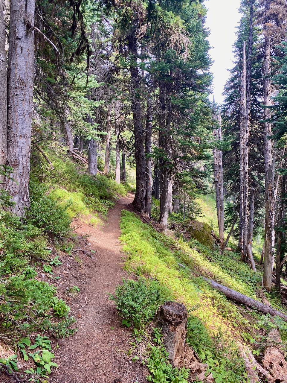
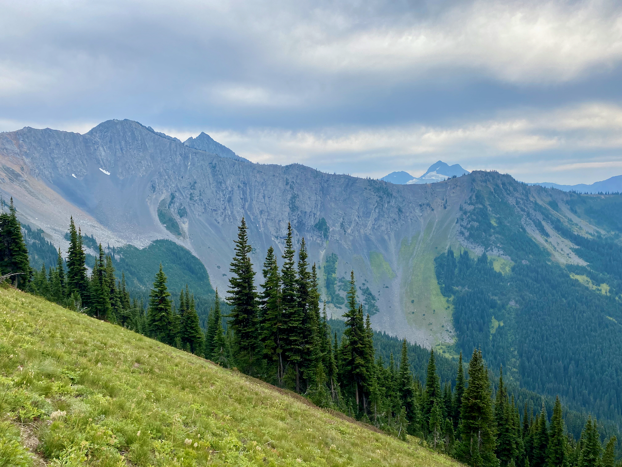
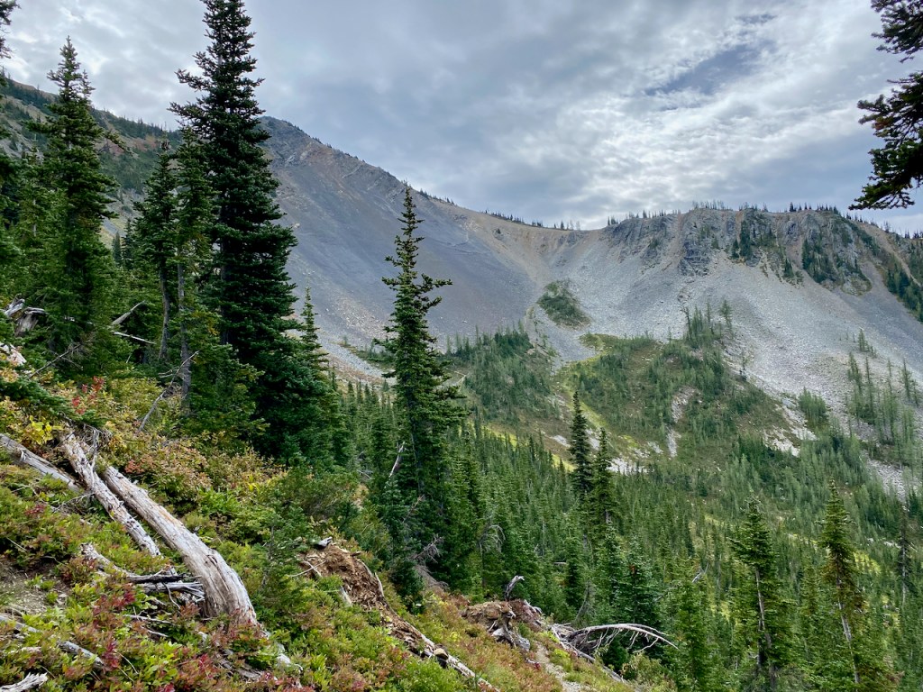
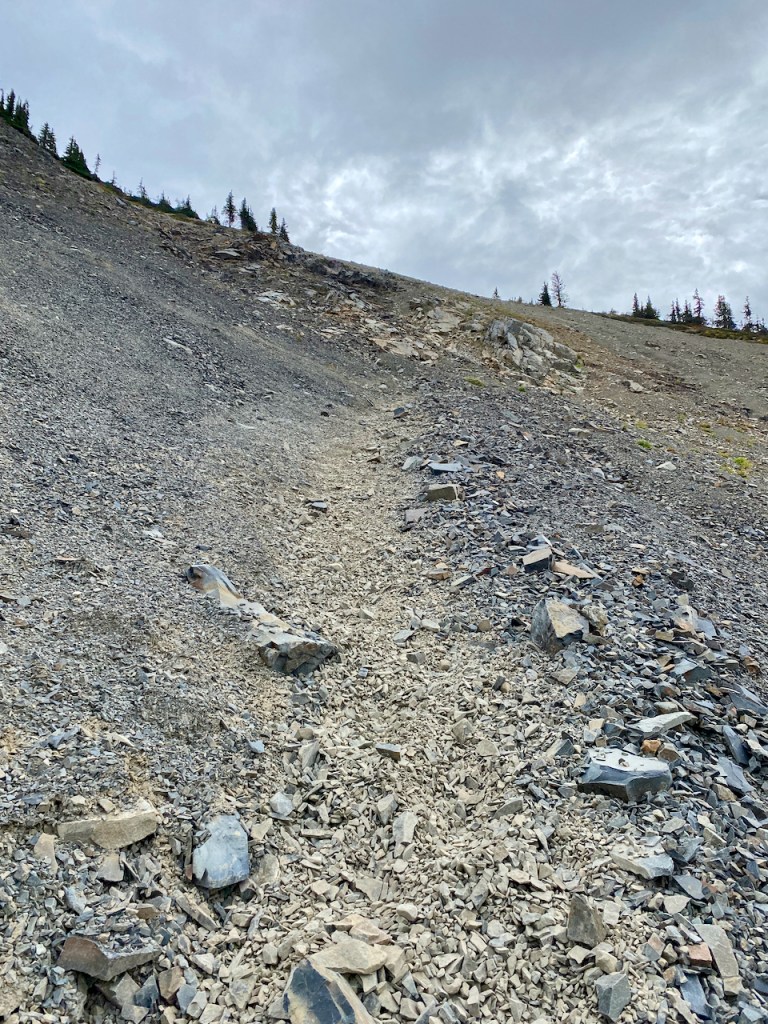
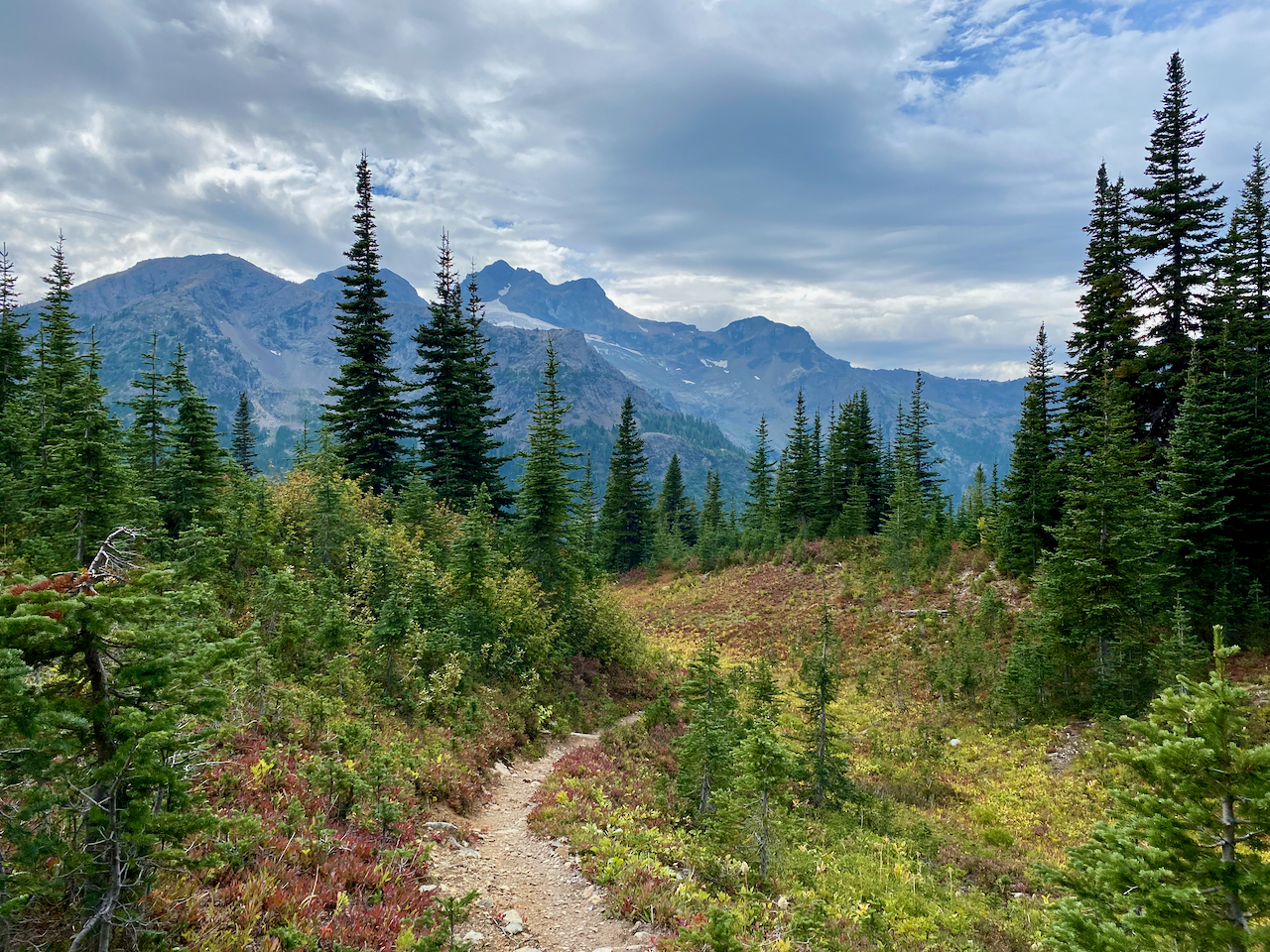
Leaving Granite Creek hits you with a couple of tough 700+ ft climbs, the second being switchbacks up a fairly steep scree field.


These climbs were tough with legs that were worn out from the previous climb but were encouraged by fantastic views of Crater and Jack Mountain over beautiful valleys. The last climb was a bit precarious as you had to climb up a scree field with a few long switchbacks but also with a few really steep slippery sections. I think that I would rather be climbing here rather then descending.
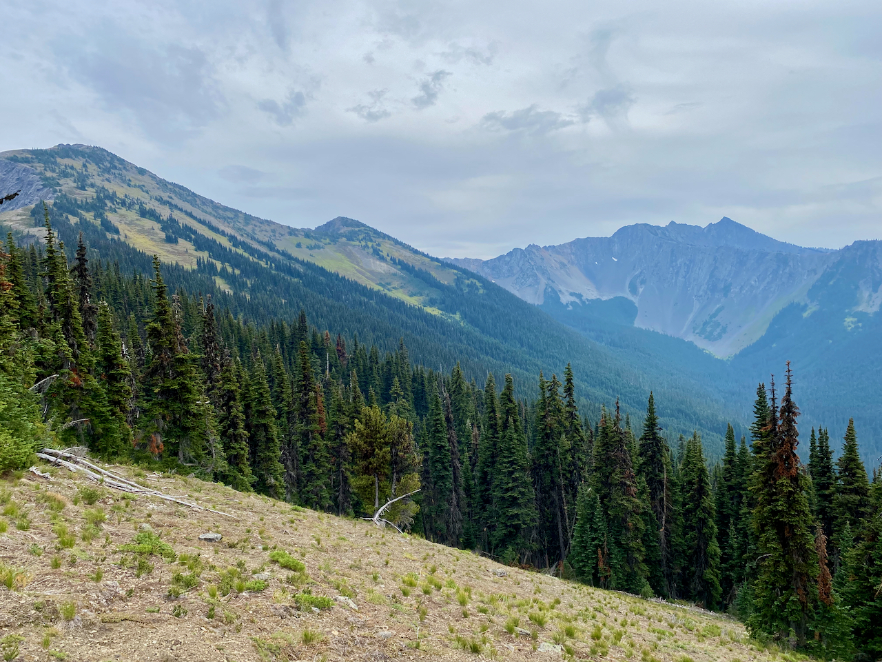
We were again putting in about an 8 mile day planning to camp just before the final descent down to the Devils Park Trail which would take us back to our East Bank Trailhead parking lot.


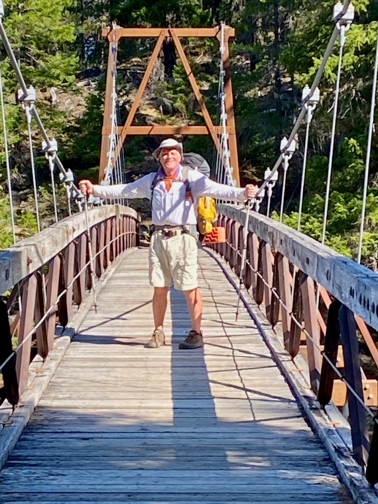
We were again surprised that campsites were not more plentiful except for 2 to 3 miles up from the start of the descent. There was only one good campsite before the descent and it was fairly large but taken. Luckily the people there had scouted the area and found a hidden campsite a short distance behind theirs which turned out to be perfect for Bryce and I. The last day required us to descend down to Canyon Creek which was rather easy considering the number of switchbacks. This video captures my gratitude.
The long descent to the canyon floor.
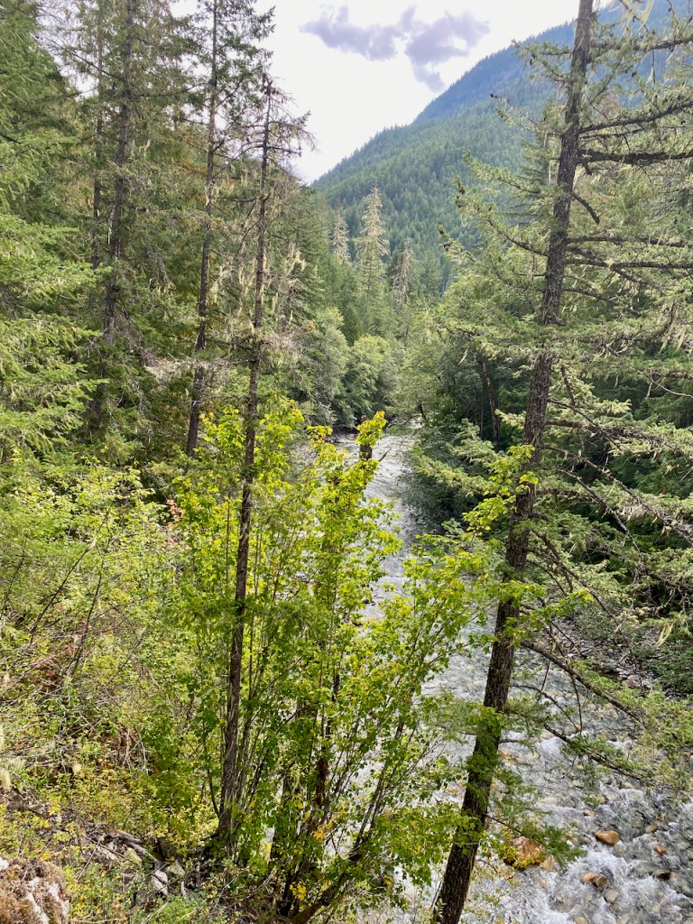
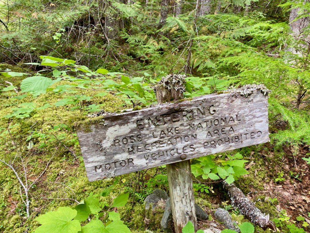
At the crossing area over to the the Trailhead there is no longer a bridge, however, the stream ford is not to difficult. Plus there is a landslide just west of this crossing which forces you to ford the stream just to get around the landslide and back to the Devils Park Trail. Now you get to finish up the trek with a gentle 3+ mile hike along the stream.


Bryce and I agreed that the Devils Dome Loop is a special one, however, we would classify it as more technical or difficult. Our bodies were totally spent but it “Hurt So Good”. My advice, I originally planned to camp at Devils Creek on the 1st or second night to set up better for the long climb up to Devils Dome. One bummer for the trek was finding that thieves had stolen Bryce’s Catalytic Converter off his Toyota 4Runner.

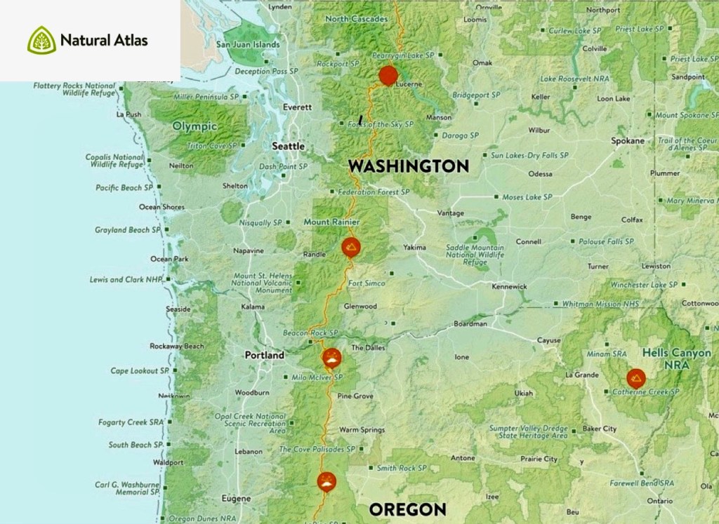
Great PNW Multi-day Backpacking Loops
I have been putting together an annual multi-day backpacking loop trek for my friends for the last 8 years. The goal was to find a 4 or 5 day trek of moderate difficulty based on a loop to simplify travel logistics.
The first trek was through the Sisters Wilderness in 2011 and during each trek we would ask other backpackers what they thought was another great loop option. This advice truly led us to discover and confirm the finest multi-day backpacking loop treks in the Pacific Northwest. Since I have answered this question for other backpackers through the years I decided to create post to highlight these loop treks. The order presented is based on the order in which I discovered these treks. Please feel free to share your similar favorite loops.
Three Sisters Wilderness
Husband Peak coming down Separation Creek
There is a 50 mile loop that encircles the 3 Sister Peaks, however, I selected an approximate 35 mile route that starts from the Lava Lake Trailhead and cuts through between the Middle and South Sister peaks. This was my first multi-day trek for which I named the post “No Pain No Gain“, reflective of efforts and rewards of backpacking. The route adhered to the 4 to 5 day goal while adding the challenge of being up close to the Sisters. I would recommend the clockwise route with attention paid to water availability on the first day. Camp Lake through to the Chambers Lakes typically presents the challenge of climbing through snow but you need to experience the view from up there. You have to time this trek to allow for the snow crossing while also taking in a maximum floral display without too many bugs. The east section which is the PCT takes you through lush forests into lava fields. Passing through the restricted Obsidian area is not a problem, however, you want to time your climb over Opie Dilldock pass during the cool part of the day. The Mattieu Lakes near the start and finish offer good rest options. You could also consider doing this loop from the Pole Creek Trailhead.
Eagle Cap Wilderness

Glacier Lake – Eagle Cap
The Eagle Cap Wilderness was enticing, however, piecing together a loop was not as obvious. I settled on using the Two Pan Trailhead to enter via the Minam Lake Trail and returning via the East Fork Lostine Trail while taking in all of the options provided by the Lakes Basin area. This loop requires crossing the 8548′ Carper pass to settle around Mirror or Moccasin Lakes. Here you have the option of expanding the loop up and over Glacier pass through Horseshoe Lake to Douglas Lake. Or you could just base from the basin area and do a few day hikes to fill your trek. Either way you must experience Glacier Lake. The lakes here are deep and can provide some good fishing. You come out completing the loop via the East Fork Lostine Trail with a shrinking awesome view of Eagle Cap.
Goat Rocks Wilderness

Valley below Goat Lake
Goat Rocks should end up on everyones list, however, with that popularity come the weekend crowds. The loop option is fairly defined with a starting point at the Berry Patch or Snowgrass Flats Trailheads. It could be treated as a 2 day loop, which is why you include spur hikes north & south on the PCT. Whether you go up Snowgrass or Goat Ridge Trails you will be doing the bulk of the climb and you typically will deal with the worst of the mosquitos and black flies. I like the Snowgrass Trail to the Bypass Trail over to the PCT. Once on the PCT portion of Goat Rocks you have access to Cispus Pass south or Old Snowy north which is worthy of a few nights. Then head over to the Lilly Basin Trail which takes you to the Goat Lake area. The lake is generally iced over, however, the campsite options around there provide an awesome view of the valley and Mt Adams. You may want to hike up to Hawkeye Point and you should be treated to herds of mountain goats above Goat Lake. Your hike out via the Goat Ridge Trail is essentially downhill.
Spider Gap Buck Creek Loop
The Glacier Peak Wilderness provides a classic 36 mile backpacking loop that takes you up a glacier to Spider Gap past the Lyman Lakes then over Cloudy and Suiattle Pass by Fortress Mountain and over to Buck Creek Pass and Liberty Cap. This trek is probably the most true loop and it may be the most challenging especially getting up to Spider Gap. You start at the Phelps Creek Trailhead and head up the Phelps Creek Trail as far as you can in preparation for the climb up the Spider Gap Glacier. Camping near the Lyman Lakes sets you up for the next climb to Cloudy Pass and then around to Suiattle Pass where you get your first glimpse of Glacier Peak. If time and energy allow you should consider including a visit to Image Lake along Miners Ridge. As you work your way around to Buck Creek Pass, Glacier Peak is positioned prominently to the west. Find a campsite with a view of Glacier and take a hike over to Liberty Cap. The final hike out is relatively easy from there.
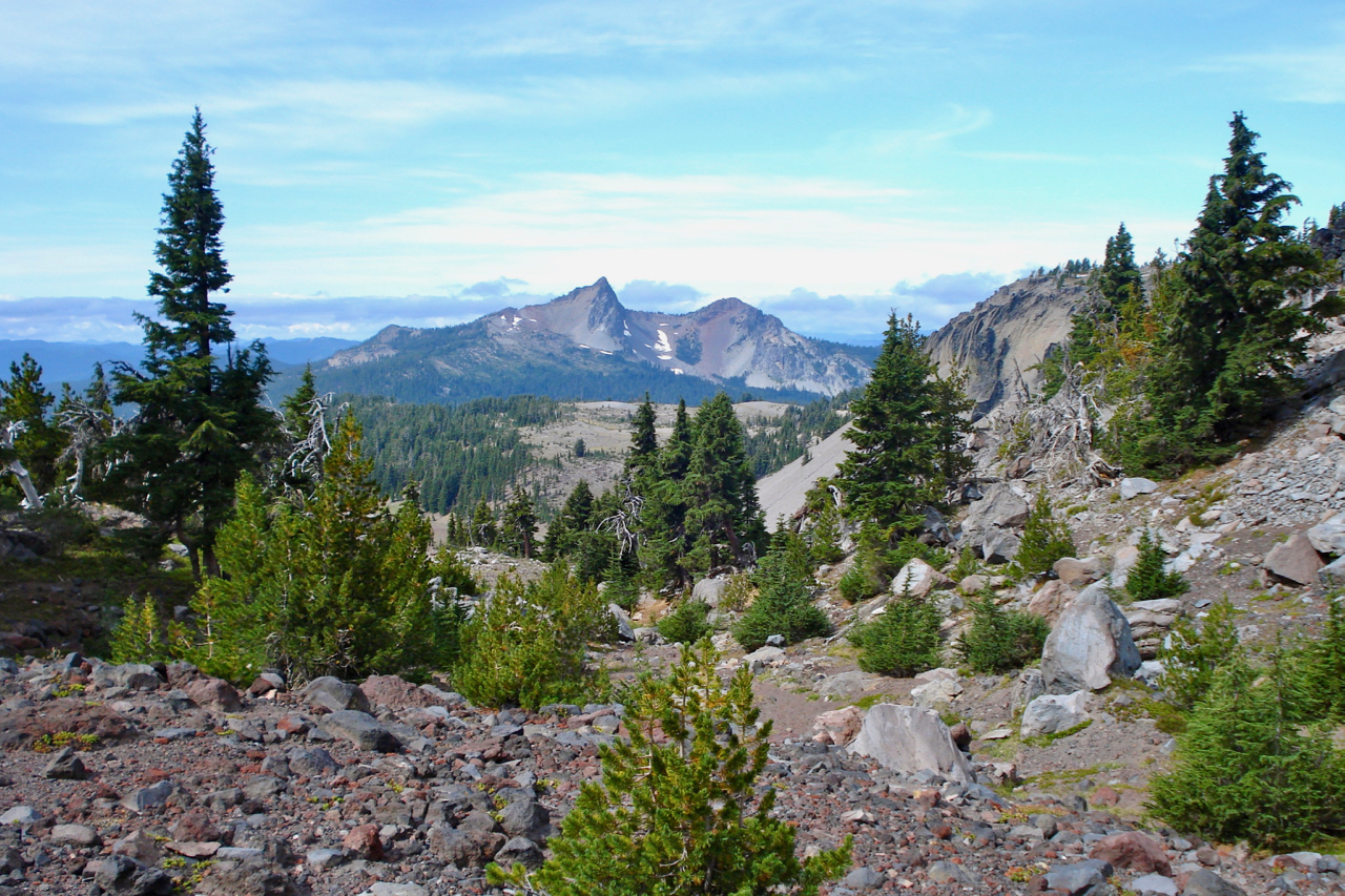
Timberline Trail Around Mt Hood

Mt Hood
This is a great loop trail around Mt. Hood with views many other mountains. I have decided to do this loop every year because it is so perfect and it provides me with a gauge for my overall health. The TT is approximately 40 miles with a number of potentially challenging stream crossings. The elevation low point is near Ramona Falls at about 3300′ with a high point on the east side at 7350′. There are many choices for a starting point with the most common being at Timberline Lodge. Clockwise is the more common route from the lodge on the PCT which takes you by the Zig Zag Canyon where you should consider detouring up to Paradise Park for an evening. Crossing the Sandy river may be the most challenging before you take in Ramona Falls. The PCT offers you a couple of options, I like the one up toward Yocum Ridge over to Bald Mountain before you head up the Timberline Trail toward McNeil Point. On the north side you cross through some old burns but the beauty is everywhere. Once past the Cloud Cap TH you climb to above tree-line typically crossing many snow fields. Copper Spur is a side trip option and then you work your way down to Gnarl Ridge. All of this area is arid and treeless. Cross Newton creek, pass some waterfalls and head through Mt Hood Meadows Ski Area. The final push is to cross the White River and then climb back up to Timberline Lodge. This final climb can be challenging due to the sandy trail and exposure.
My Annual Timberline Trail Trip Reports: 2017 2018 2019 2020 2021
I hope these backpacking loops help you find that perfect trek.
A recent loop that I have just completed does deserve mention, however, it is more difficult than my top 5. It is the Devils Dome Loop in the North Cascades of Washington.
I will also throw in another option which is partially a loop, The Wild Rouge Loop diverges from the primary Rouge River Trail up to Hanging Rock.
I am moving to Grand Junction, CO, where I have targeted the Four Pass Loop in the Maroon Bells – Snowmass Wilderness to potentially replace my Timberline Trail Loop Annual Trek.


