The West Coast Trail – Vancouver Island, BC
I finished off my 2 month backpacking adventure by choosing to leave the hot, dry, smokey Pacific Crest Trail to take on the infamous West Coast Trail on Vancouver Island, BC.

Start of WCT at Pachena Bay
This was totally a spur of the moment decision to go for this unique backpacking destination. I only knew about this trail because my wife found it listed in a top backpacking destinations of the world listing in response to my frustrations with the PCT conditions. Most who take on this trip will get their permits early in the year and plan for months. I had a day to replace my REI tent and schedule a few important things like ferry and bus reservations. I actually got the date wrong for the ferry but all worked out without a hitch, I even stayed at the Ocean Island backpackers hostel in Victoria, BC, the night before. On August 21st I road the 5+ hour bumpy bus ride to Pachena Bay Trailhead and got the last walk on permit available. This was just meant to happen with the added bonus of perfect weather.
After a required orientation session put on by the Canadian Parks Service I set out via the beach trailhead for a 12K destination of the Michigan Creek Campsite.
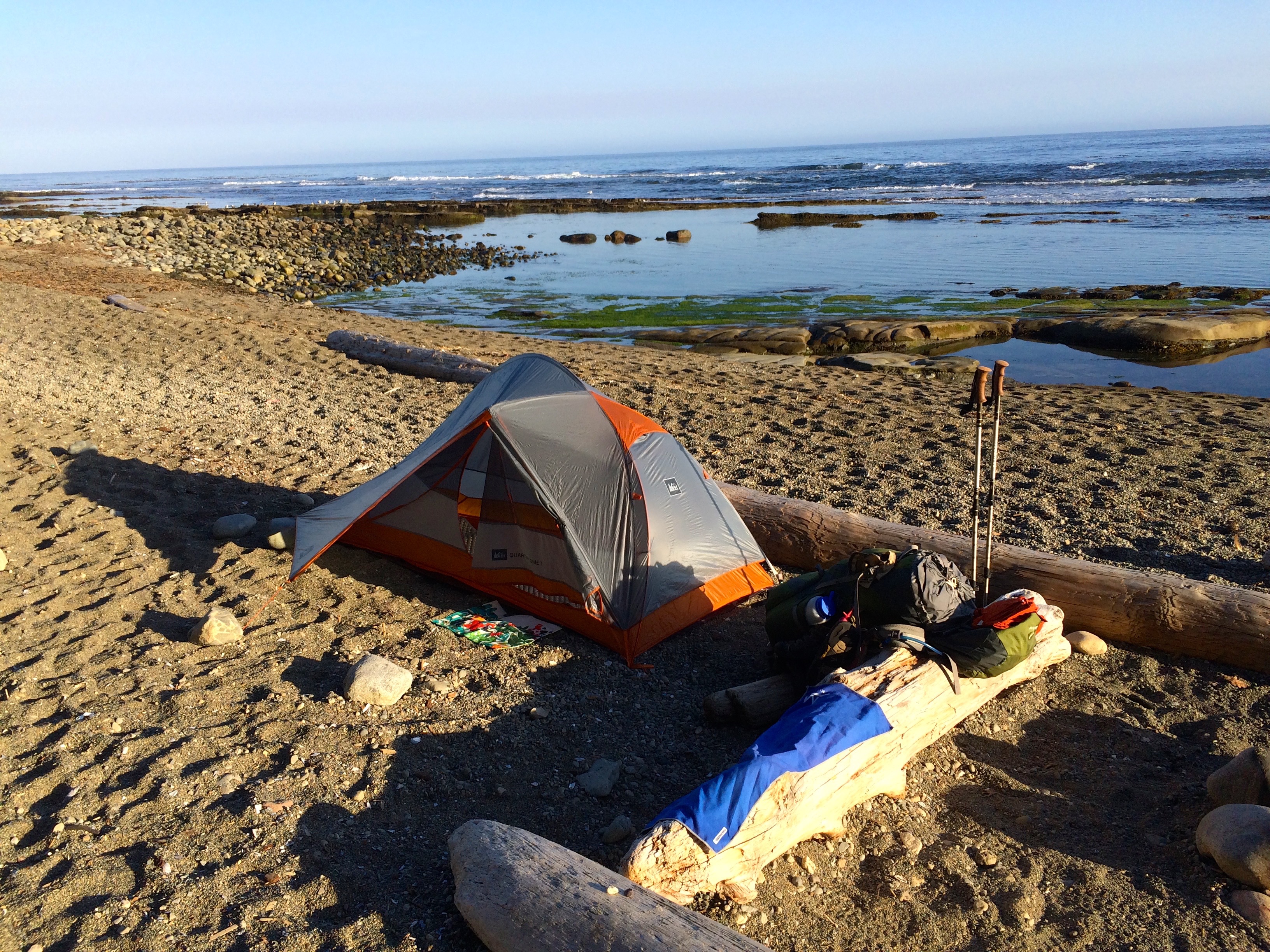
Michigan Creek Campsite
You are provided an excellent waterproof trail map which I quickly realized steered you to designated camping areas which typically had a bear vault for food and a composting outhouse. I went along with this option the first night but there after I tried to camp by myself on the beach whenever possible. I wasn’t being anti-social, I just am not used to that type of control. The West Coast Trail is much more geared to groups which is really important for the motivation and teamwork needed to complete the trail successfully. I did get to know many, typically Canadians and Europeans who were on the same trail schedule as I was. The West Coast Trail is considered an accomplishment of a lifetime for the many casual backpackers who attempt it. As a solo older hiker I was a bit of an anomaly.
The first day’s 12K segment was relatively easy in comparison to the previous PCT segments I had been on. But it was a different kind of difficult in that the trail presented so many situations of risk. I slipped, stumbled and fell far more times on this trail then all of my miles on mountain trails.
Fear Of Heights was Not an Option
You had to overcome any fear of heights that you might have, ladders, log bridges, pulley cable cars and boulder hopping.
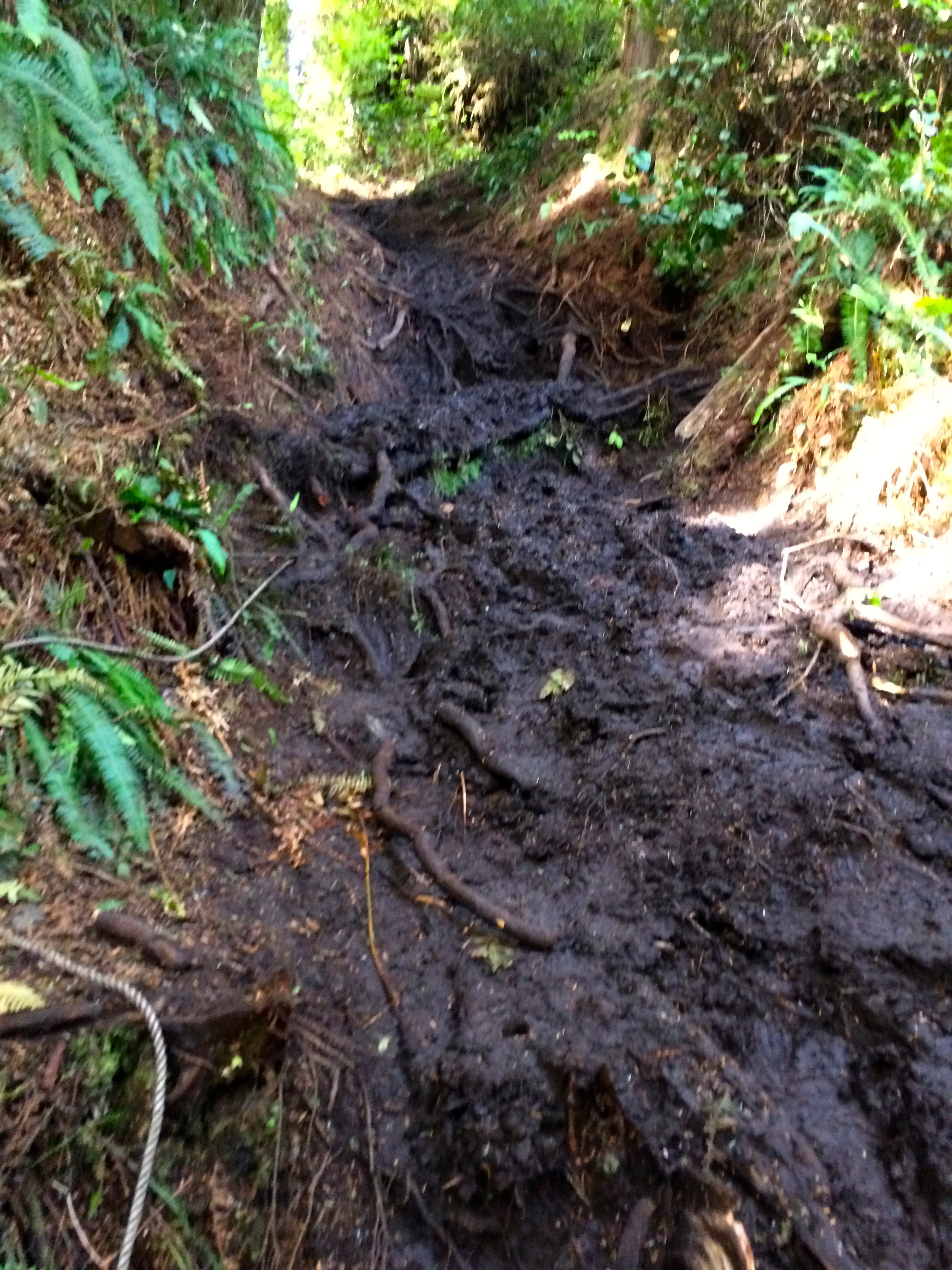
Mud and Roots
I did have to use my first aid kit a few times. I mentioned slippery, mud is a big part of the trail, however, I again benefitted from the period of dry weather, so I believe the typical muddy root infested climbs were tame compared to how they might have been in a normal wet environment. I never had to use my gaiters.
Sea Lions with Whale spouting
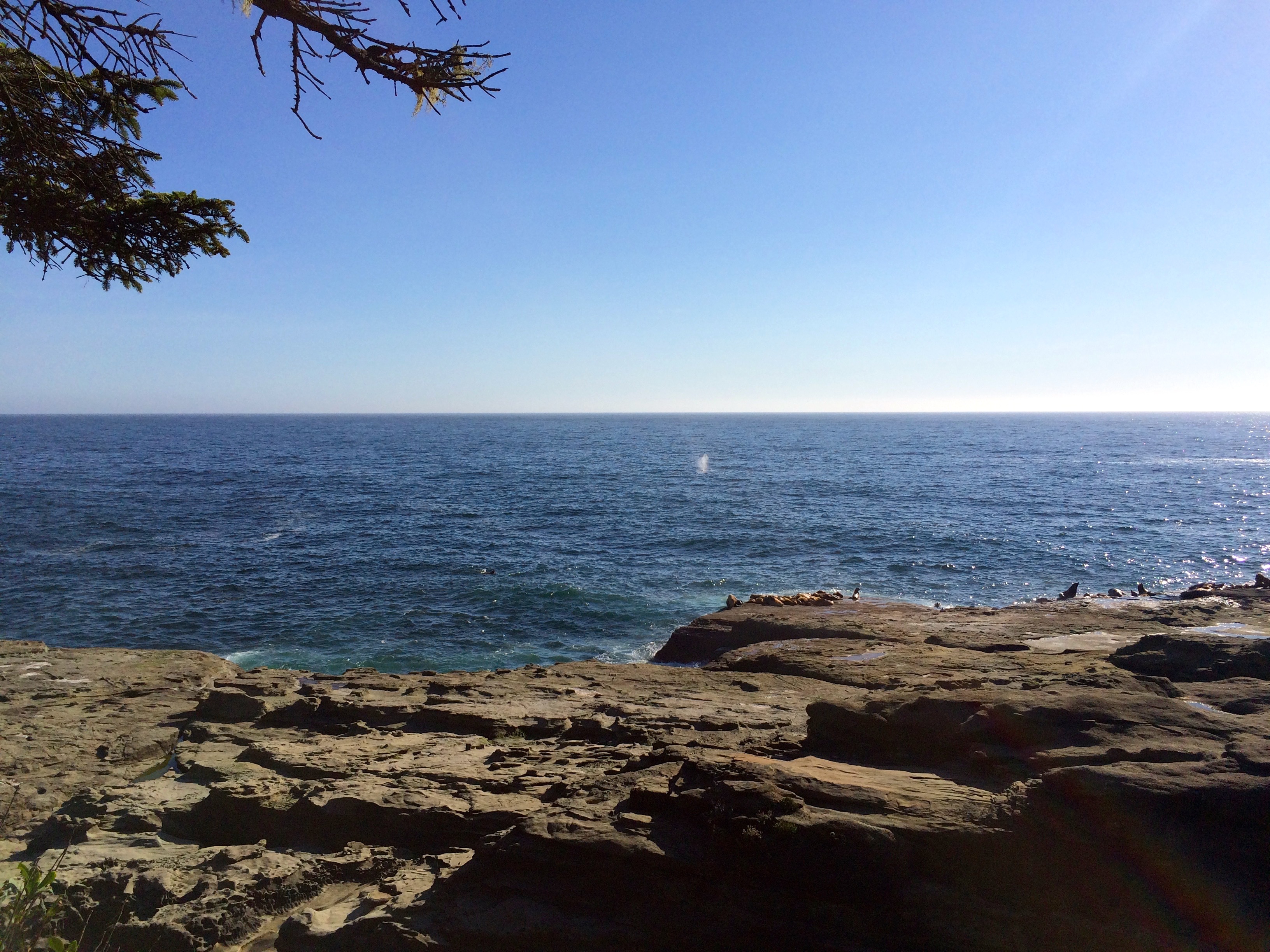
Wild life on the trail consisted mostly of sea life. There were a couple a great Sea Lion viewing sites and you saw whales every day. Also lots of sea gulls and on the trail a fair number of small snakes. I was a bit disappointed that I did not get to experience a bear sighting, I intentionally hiked on the trail as quietly as possible, however, many of the hikers had bells on their packs.
If you have ever enjoyed coastal beauty you can relate to what became the norm for me on the this trail. Hundreds of photo worthy views of spectacular coastline. This would have been the trip for a better camera, however, you would probably break it in one of your falls.
Typical Coastline Views


My second night I searched for a private beach campsite which I found just past the Klanawa River.


You are advised not to camp outside of the designated camp areas, but the chance to camp on a secluded beach with a fire was worth ignoring the advice. I did hang my food from a tree not so much for fear of bears but in case I was questioned about camping alone on the beach.
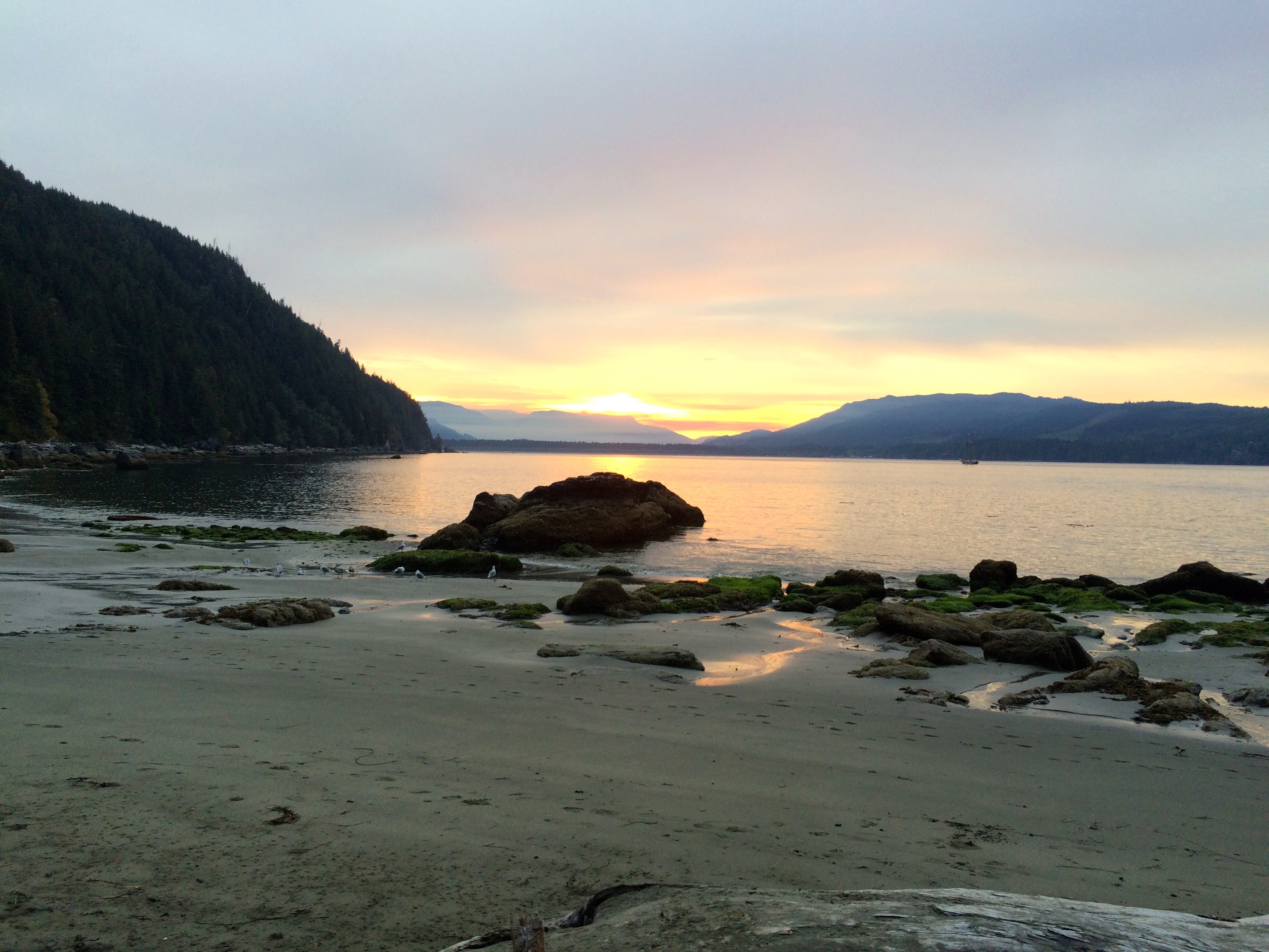
I think that night alone on a wilderness beach with the fire, sunset and moon was one of the most amazing experiences I have ever had.
The third day required a long stretch of trail to just get to the next campsite option. Since I camped a few kilometers prior to the popular Tsusiat Falls, my day was even longer.
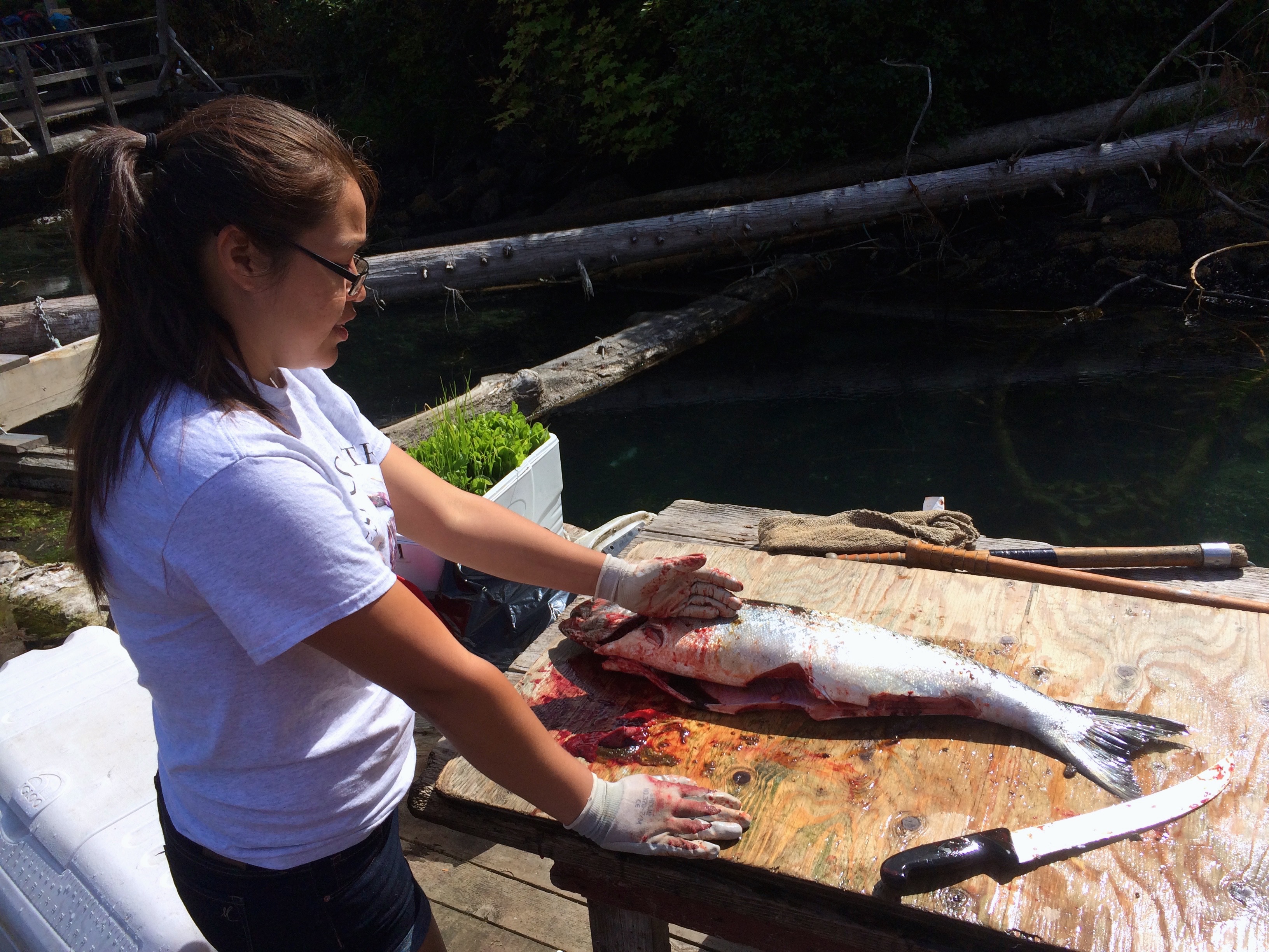
Fresh Salmon Lunch
The reward though was a fish or crab lunch at the Nitinat Narrows. The native Indians provide a ferry service which conveniently takes you to their outdoor cafe on the water for a selection of Halibut, Salmon or Crab. Oh yes, and beer.
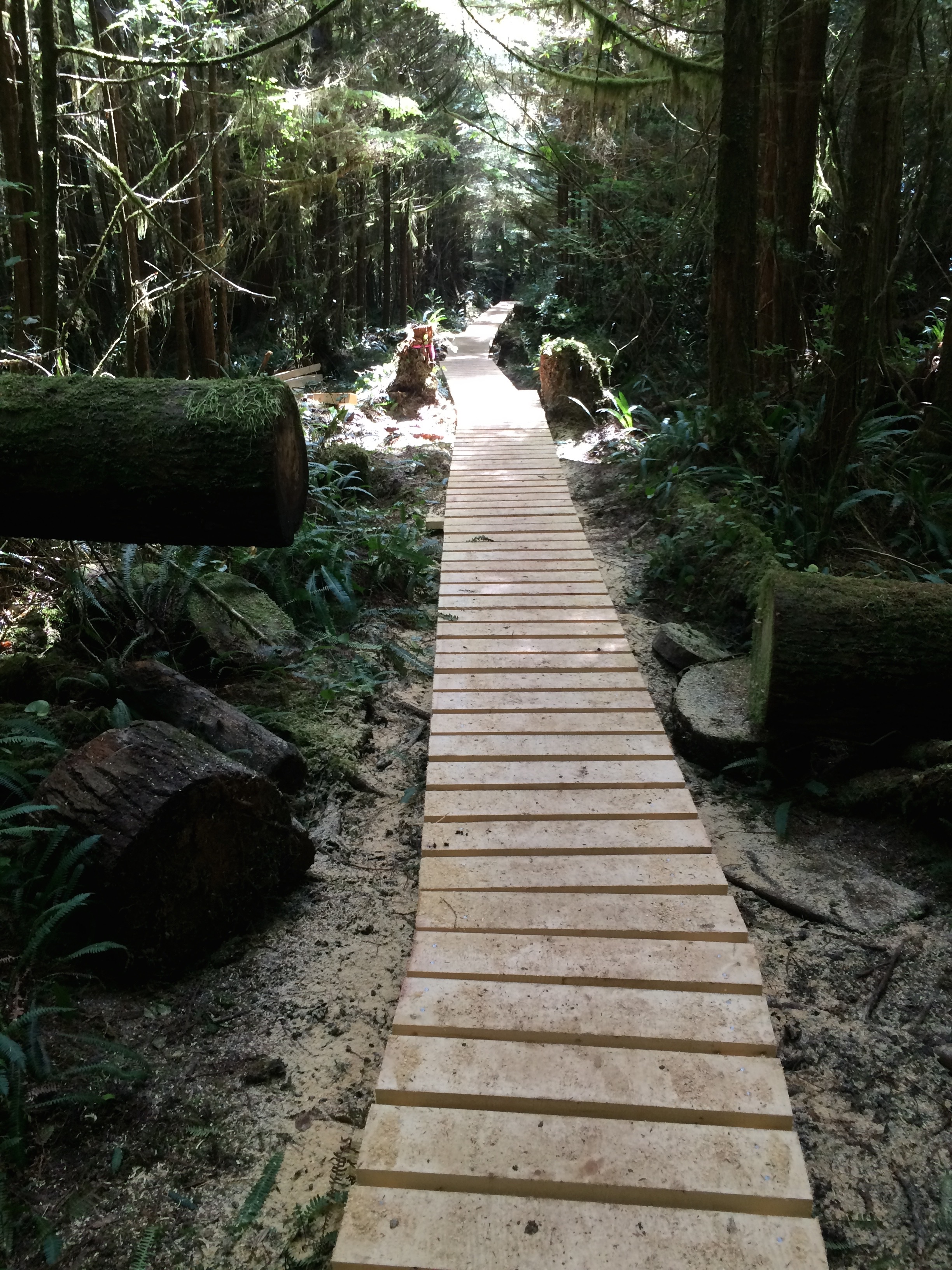
New Boardwalk
I opted for the Salmon but only had one beer since I still had 10K to hike to the Cribs Creek campsites. Thankfully that 10K stretch included a lot of boardwalk which you came to highly appreciate.
I was halfway done with the trail but you are fore warned that the northern segment is easier then the southern which was still ahead of me.
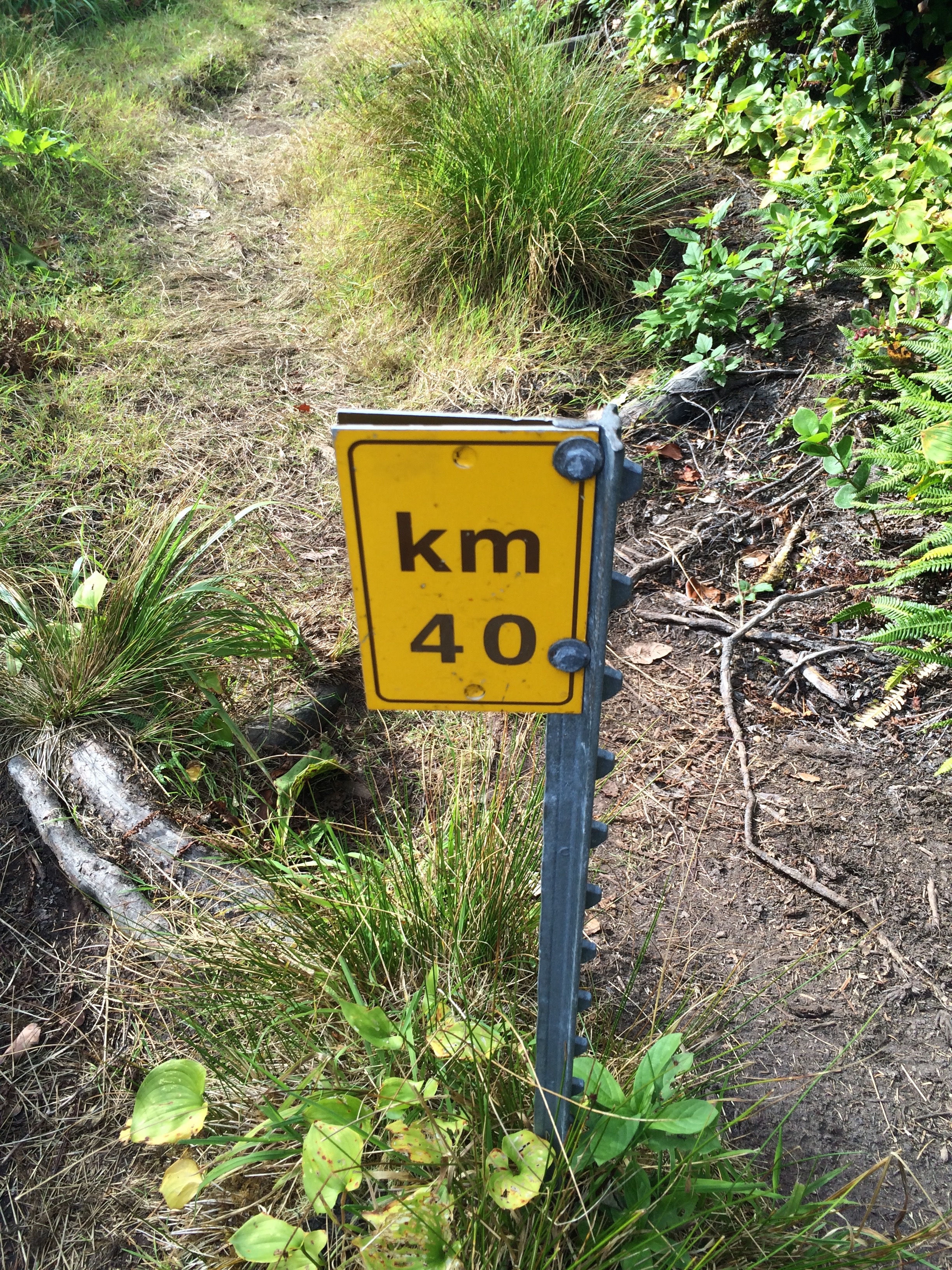
Trail Kilometers
The trail did provide a nice feature of Kilometer markers. Typically you could do 3K per hour on good trail but only 1K on the difficult sections.
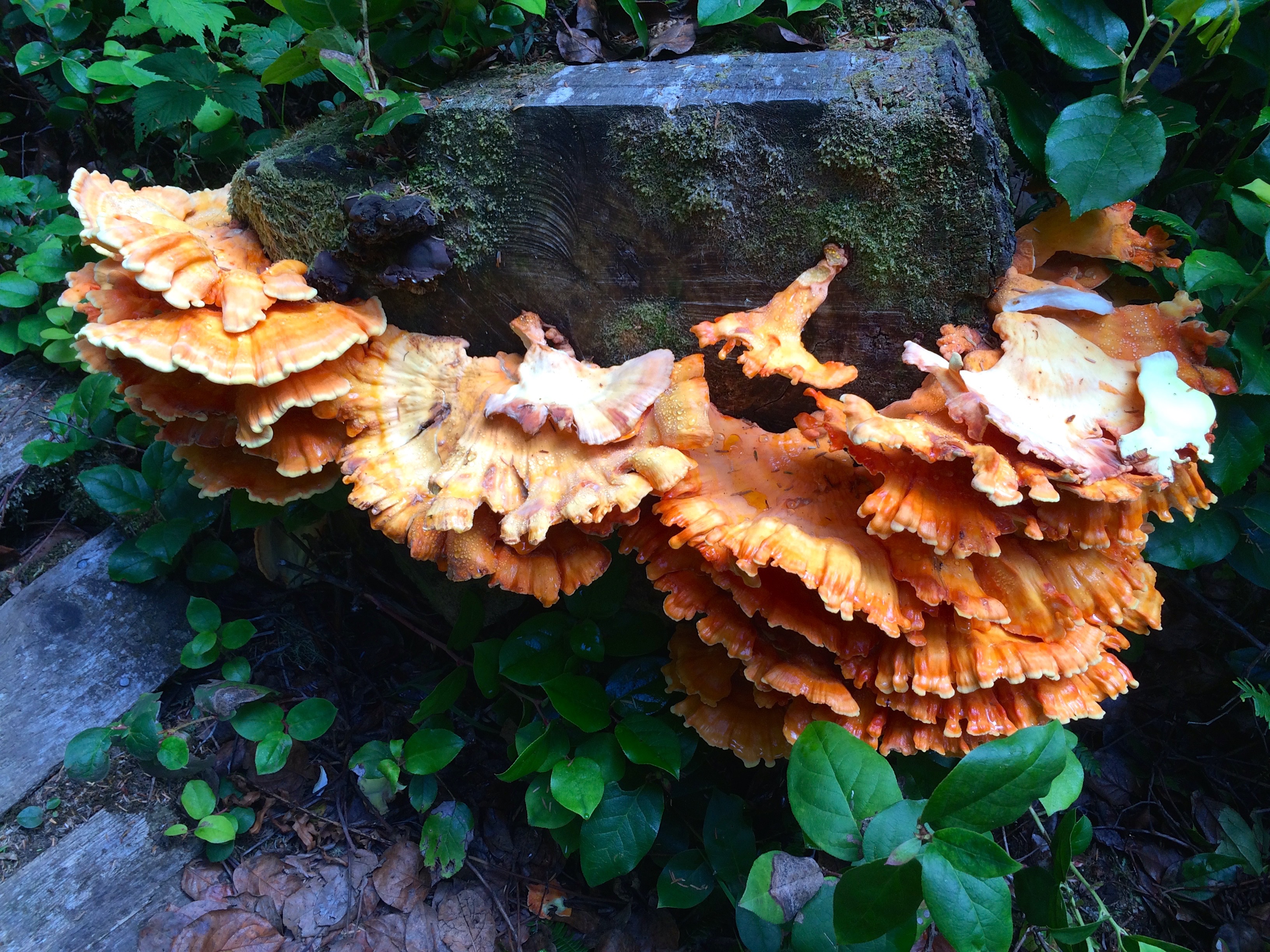
Colorful Mushrooms
There were not many flowers on the trail, however, they would have been absorbed by the overabundance of vegetation. There were some interesting mushrooms though.
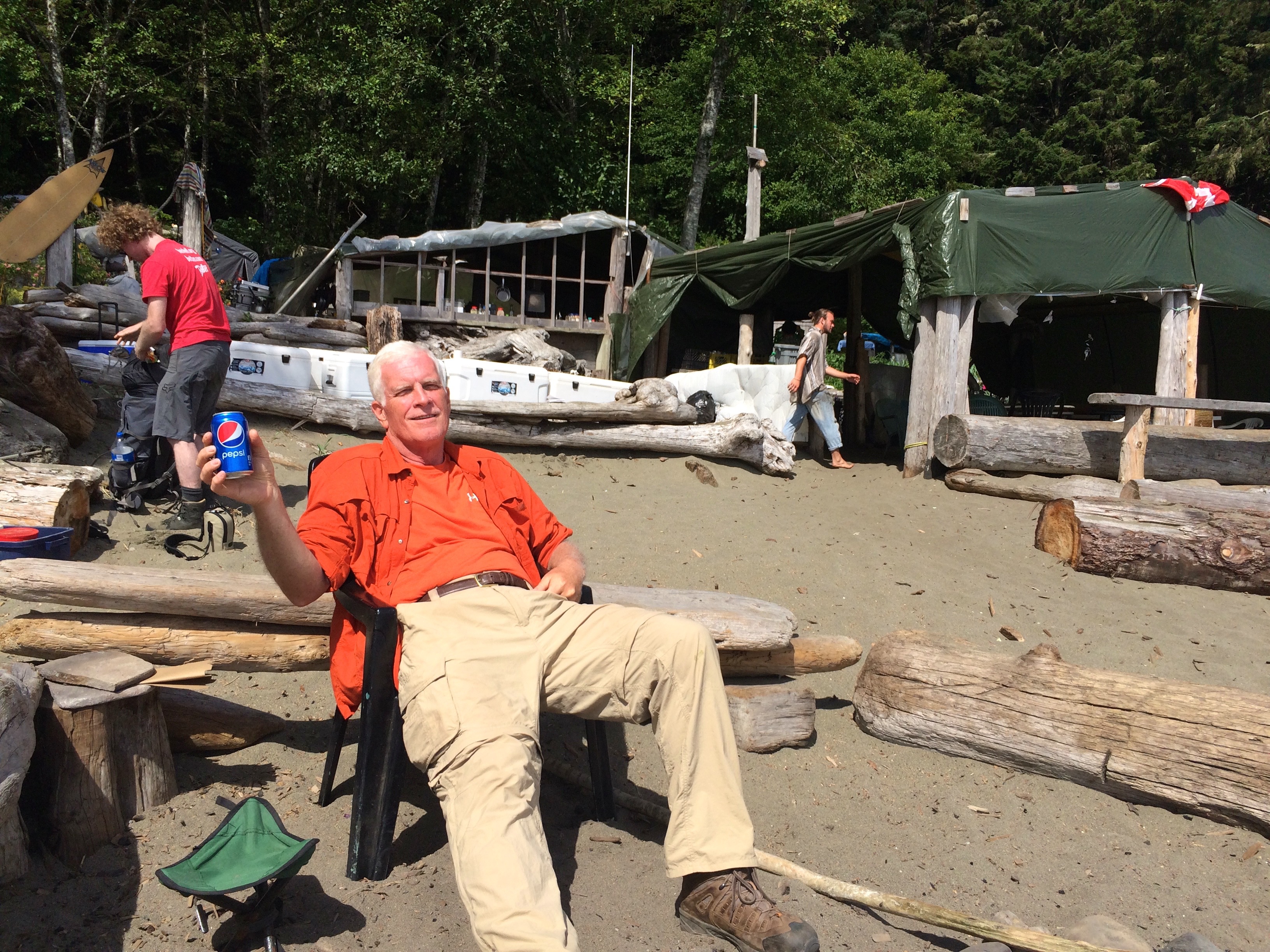
Relaxing at Chez Monique’s
The following day presented another cafe option known as Chez Monique’, a burger tent on the beach. This was too good to be true, a great burger with beer. Well since I put in such a long day prior and I was not on a strict schedule I decided to camp nearby and take the afternoon off with a burger and a number of tallboy brews. My photo shows that I also tempered the beer with some Pepsi. It was a fascinating day of conversations. The guy in the photo with the red shirt was giving a presentation in Vancouver on the Functional programming language GHCJS Haskell. And Monique was an assembly language programmer back in the fifties.


I was able to stumble back to my tent for a really good night’s sleep.
I spent the next night at Walbran Creek with about 40 others. I decided to be social and it was good. I did help a young lady with a foot blister problem understand that moleskin is intended to replace or cover your skin. She was putting it on at night and taking it off to hike??? Walbran did offer the nicest swimming hole but it had accumulated a bit too much seagull droppings for me.
The next day’s trail along the beach offered some of the most beautiful views yet.


My goal for the next day was to seek out another private beach campsite and I had hopes for an option before I got to Owen Point which requires a very low tide to navigate through the caves. Low tide was early in the morning so I hoped to be close to hit it the next day.
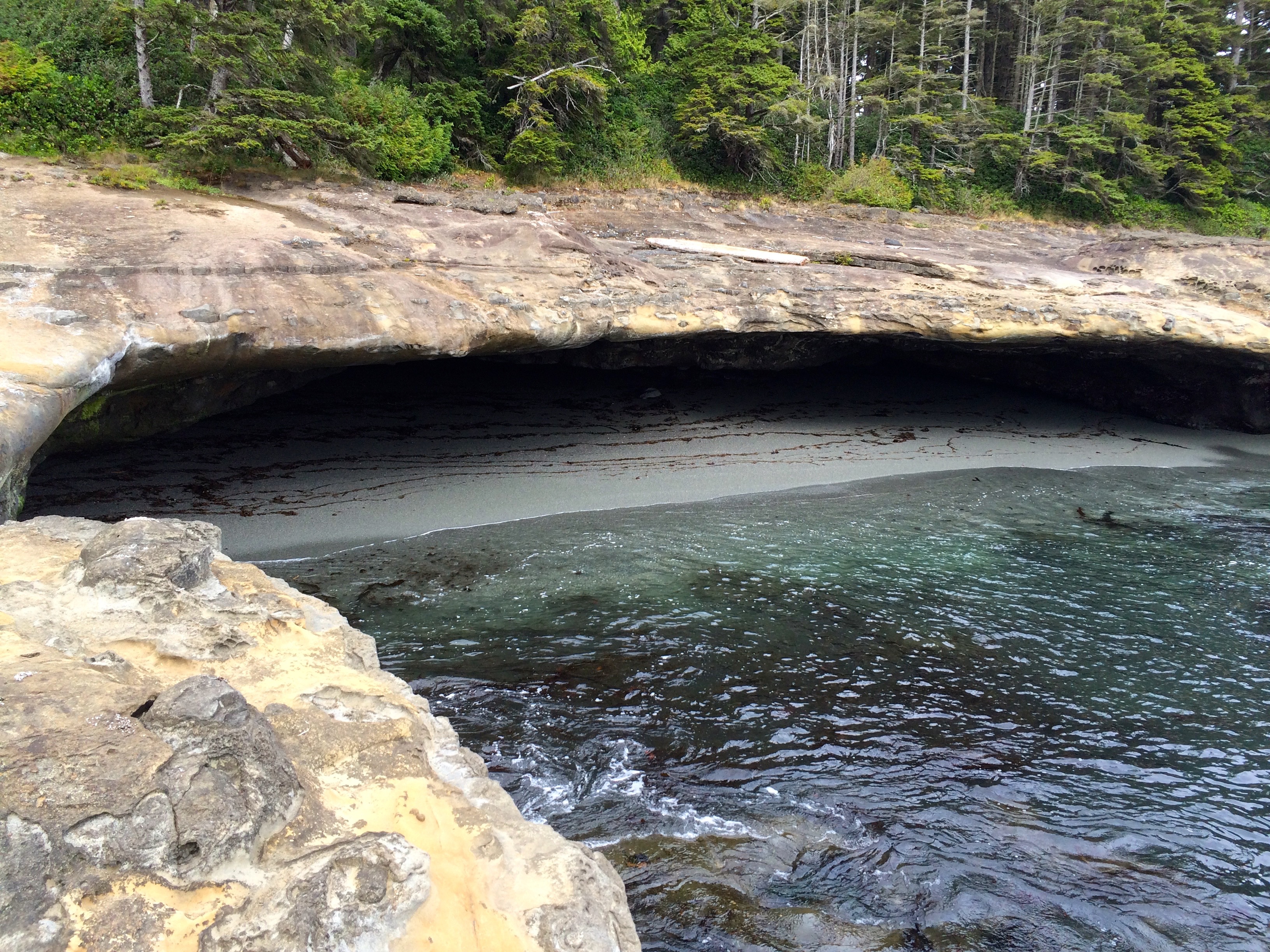
Beach Before Owen Point
Well I entered the beach trail a few kilometers before Owen Pt. but could not find a suitable campsite.
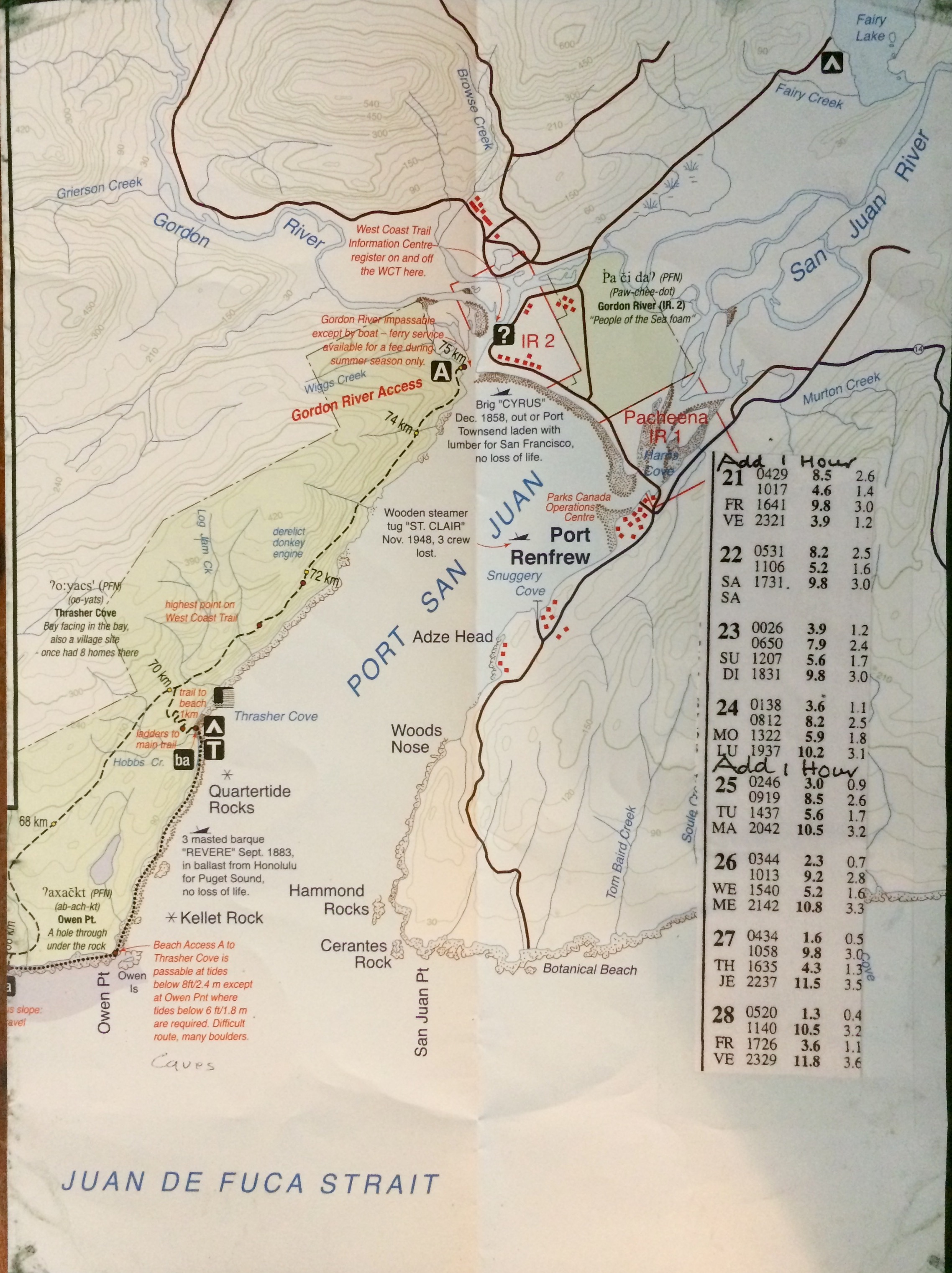
Owen Point Section of Map
So I ended up at Owen Point around 4:30 pm which was close to low tide, plus there were others who had been waiting there for the tide to recede. At this point I had to get past the caves but that meant I would have to navigate the dreaded boulder field for the next 3K to get to the Thrasher Campsite. I made it around Owen Point but not without partially falling into the ocean and getting my boots soaked.


I did save my backpack by giving up some skin off my elbows.
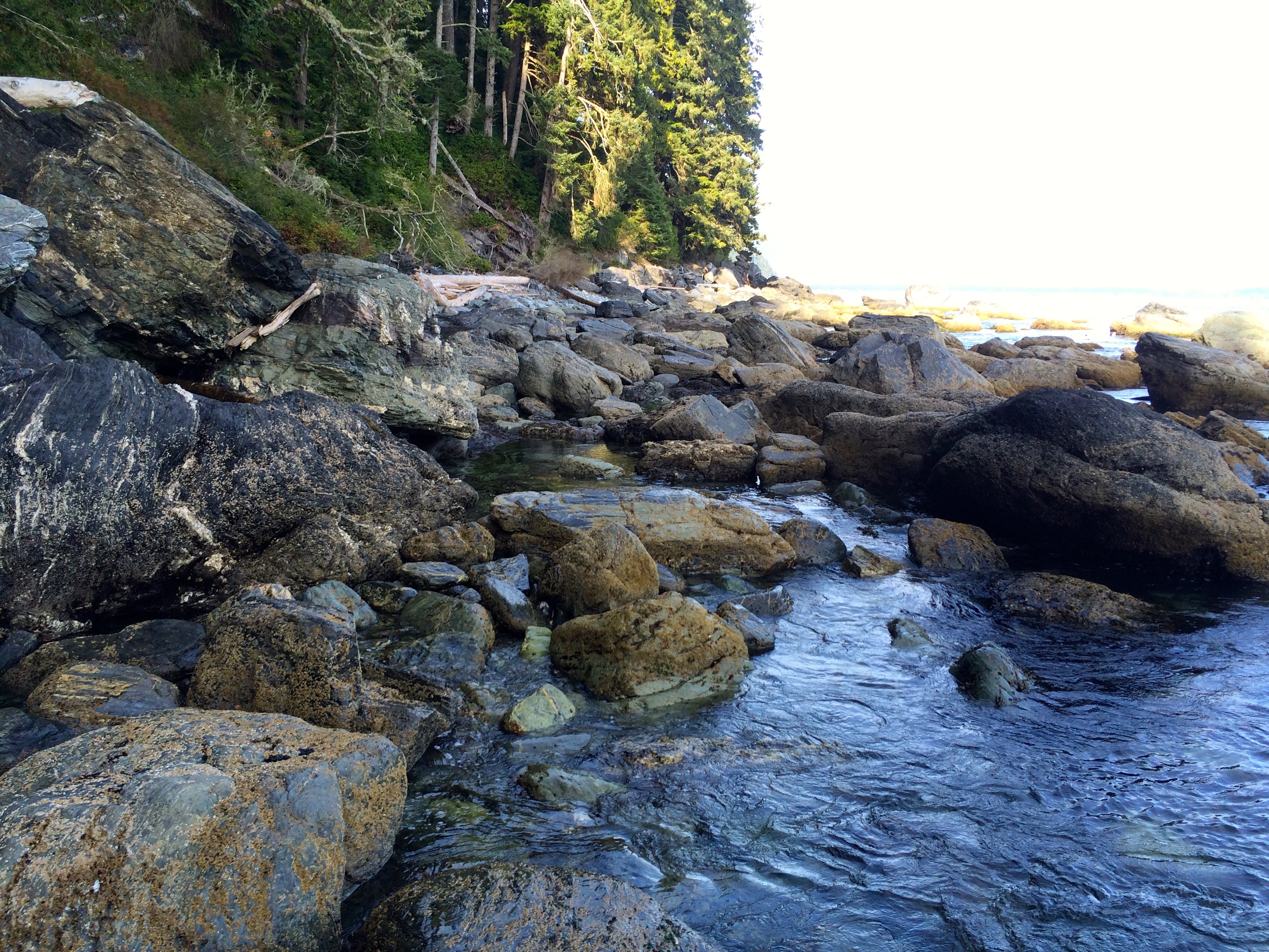
Boulder Beach
I mentioned the boulder field, Wow, navigating this section of beach over massive boulders at the end of a tiring day may be one of my most impressive physical accomplishments. I actually traversed them rather quickly, maybe I was just amazed that I was doing such a crazy thing. All I remember is that when in doubt about the path take the high road. Sometimes you ended up climbing over trees and boulders 2 stories high. Jumping down to boulders with a backpack did take a toll on my thighs, but I recovered quickly.
Once I got to Thrasher beach campsite I was faced with a crowded selection of real estate.
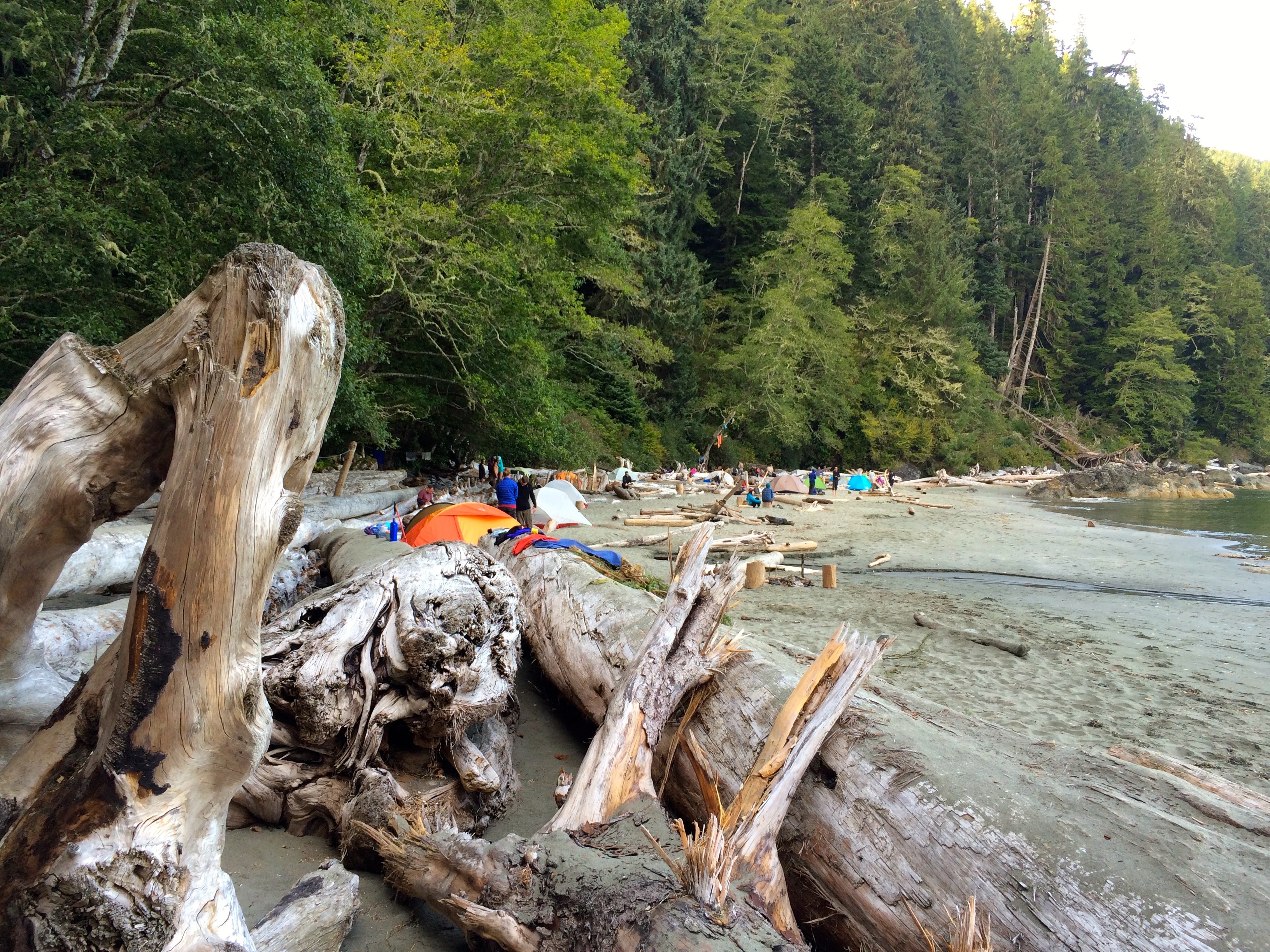
Thrasher Campsite
Prime locations were on high ground since we were expecting a higher than normal tide to hit around 11:00 pm. I chose a spot on on a level that did present some risk, but I had large trees that would protect me from waves. As it turned out most everyone stayed up to make sure that we did not get washed away. All part of the adventure.
Sunrise over Port San Juan
The next morning brought a beautiful sunrise and less dew then typical so all was set for the final hike out to Port Renfrew. The last section was only 5K but it was a tough go with many root climbs, ladders and mud. I was excited to complete the trail but also sad for it to be over. The entire week I was blessed with perfect weather. Those starting the trail that day, August 27th, were in for many days of heavy rain.
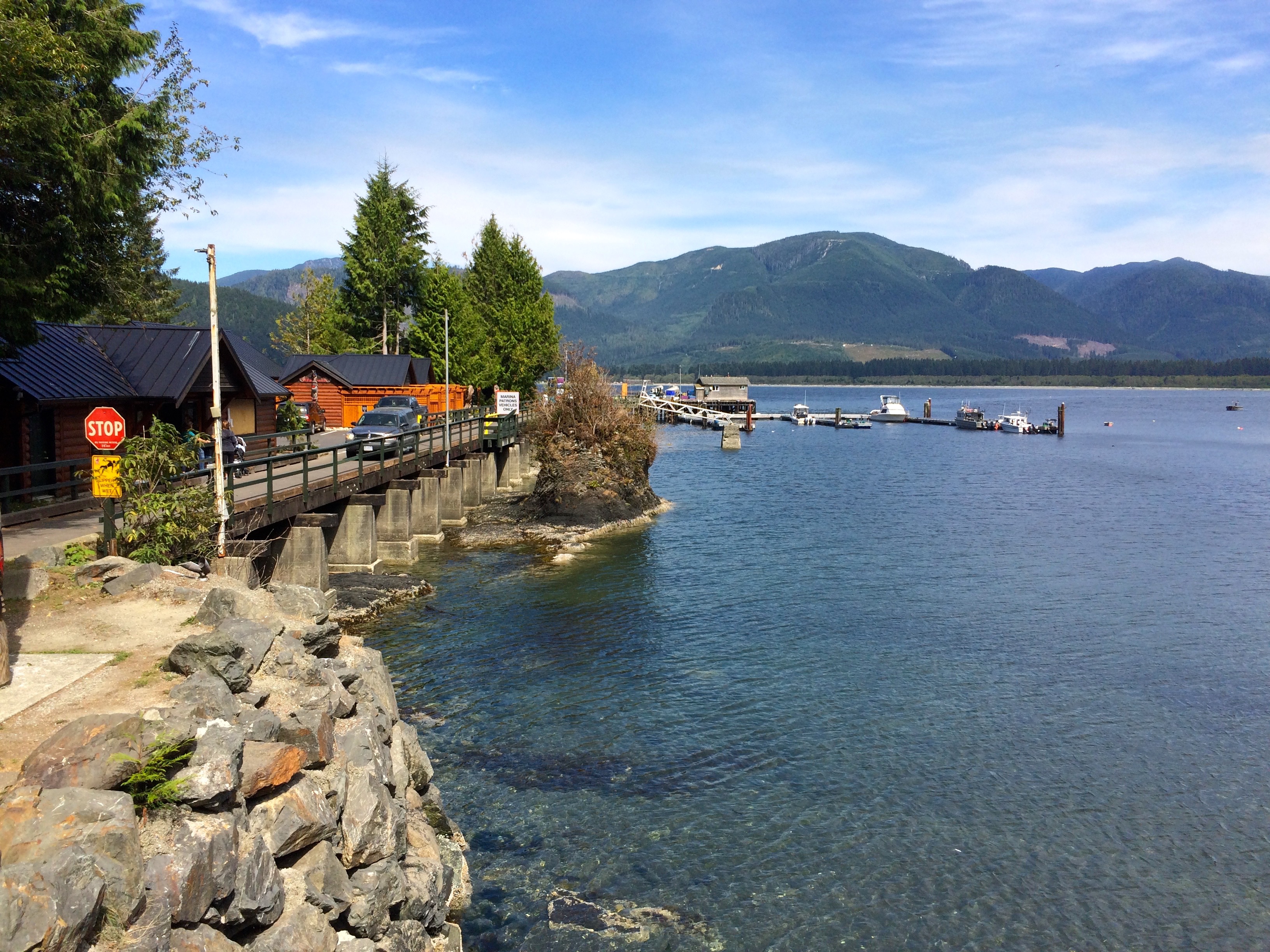
Port Renfrew
I opted for a quick shower at the campground before going into Port Renfrew where I had halibut fish and chips. Excellent.
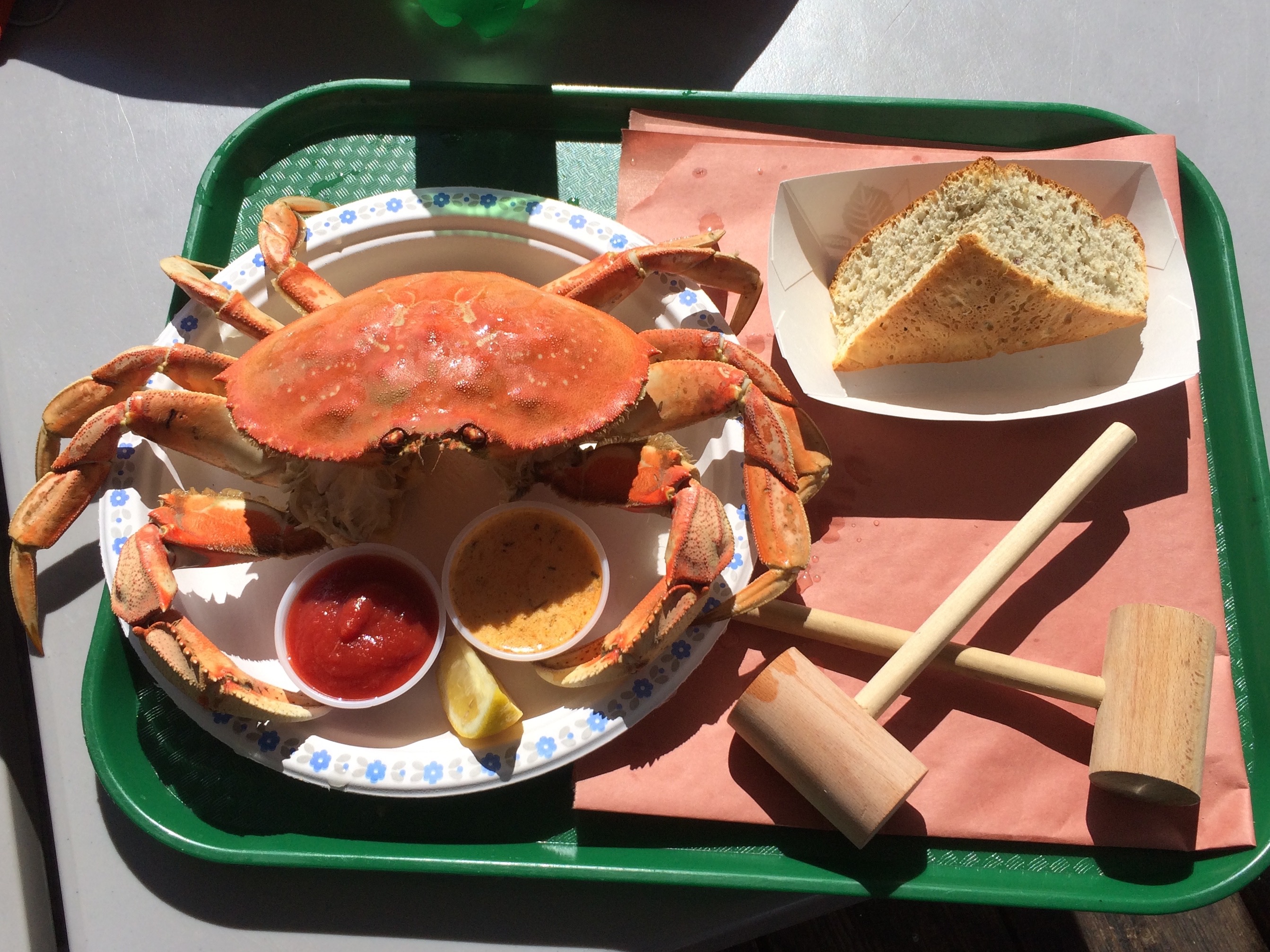
Dungeness Crab Lunch
The bus got me back to Victoria by 8:00 pm, I got a hotel, then enjoyed some sight seeing in Victoria the next morning with a lunch of Dungeness Crab at Fisherman’s Wharf before catching the ferry back to the U.S.
What an amazing couple of months of backpacking and what a fantastic finish with the West Coast Trail, Hike of a Lifetime.
Posted on August 30, 2015, in Backpacking, Wilderness and tagged backpacking, Canada, Pachena Bay, Port Renfrew, Vancouver Island, West Coast Trail. Bookmark the permalink. 7 Comments.


Greg,
What an amazing trip. Thanks for all the pictures but more thanks for the excellent written narrative. I miss our days of golf but am envious of your days on the trial.
Happy Hiking,
Joseph
LikeLike
Impressive adventure Greg! Nicely done and certainly inspirational for me. Thanks for sharing.
LikeLike
Awesome thing you did Little Brother! So proud of you and happy that you got all that natural psychic gold from the experience.
LikeLiked by 1 person
Excellent post. I will be going through some of these issues as well..
LikeLike
Pingback: The North Olympic Coast | Higher Elevation Tech Talk
Pingback: Publishing a Photo Book | The Adventure Continues
Pingback: The North Olympic Coast | The Adventure Continues